Ah, tech rock. We'll roll over a small       drop, turn left and plunge down a steep narrow ramp, swing right, then pivot left and try       to squeeze the bike through the "pedal scratcher" slot in       the middle of the photo.
Ah, tech rock. We'll roll over a small drop, turn left and plunge down a steep narrow ramp, swing right, then pivot left and try to squeeze the bike through the "pedal scratcher" slot in the middle of the photo.
Zen Trail

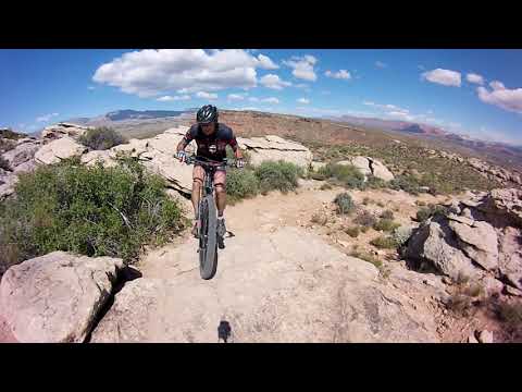
The Zen trail is probably the most technical ride in the St. George area. It's also one of the most famous and most-beloved. It has quite a few little rock tricks that challenge the rider. I recommend Zen for advanced riders, or for very experienced intermediates with a good attitude and a sense of adventure. (It doesn't take that long to walk your bike through a spot that spooks you.) But realize: this is a strenuous ride that requires power and skill.

Initial photos and review of Zen by Bruce on January 12, 2008, with the latest update November 5, 2025.

The original Zen loop changed in 2025 with the development of a subdivision at the northern end of the riding area. The trailhead has been moved to the south (see below). A section of easy-cruising singletrack at the northeast corner was replaced by a longer and more-technical section that closes the loop.
Northbound on the lower side of Zen as we drop into a       wash above the new subdivision.
Northbound on the lower side of Zen as we drop into a wash above the new subdivision.
Climbing through nugget sandstone as we exit a wash       on the newer FTNC segment of the Zen loop.
Climbing through nugget sandstone as we exit a wash on the newer FTNC segment of the Zen loop.

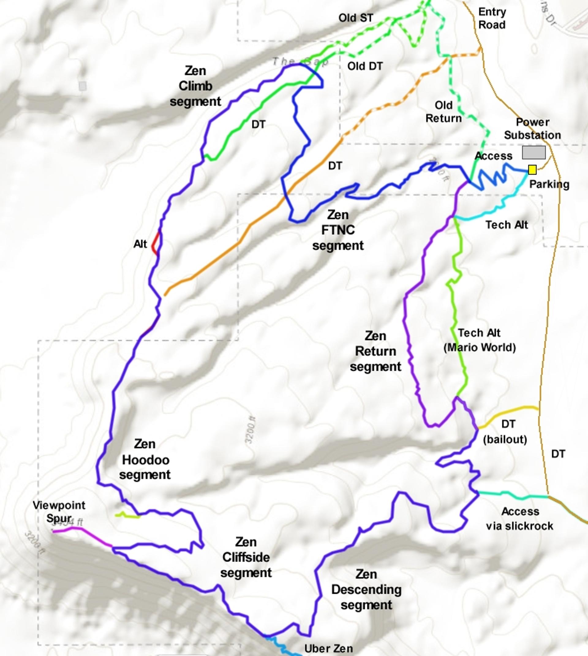
The trail starts at 2700 feet in the bottom of the valley, with an access trail from parking near the power substation. (The substation road runs south from the road to the Bearclaw Poppy trailhead.) Top elevation is 3450. The trail can usually be done year-round, weather permitting.

As mentioned, the ride is quite strenuous. There'll be about 1100 feet of climbing if you do the full loop ride. The loop itself is 6 miles, for a ride of 6.6 miles including the connector trail. Exhausted riders have no bail-out options until they near the end at mile 5, where they can roll out to the dirt road to cut a mile of technical riding.
Bruce finishes The Dip, a tricky down-and-back-up feature. Photo by Gene Poncele...
Bruce finishes The Dip -- also known as The Bathtub -- a tricky down-and-back-up feature. Photo by Gene Poncelet, February 2011.
Jackie waits for the bike to start rolling again, as the trail threads through h...
Jackie waits for the bike to start rolling again, as the trail threads through hoodoos.

The Zen Trail offers many different experiences. Done counterclockwise, there's fairly stiff climbing on the lower and northern sides of the loop. Nice aerobic workout. There are the technical challenges as you enter areas of pillow-shaped sandstone and hoodoos. There's the eye candy. The rock monoliths are so visually interesting, it's hard to keep your eye on the trail. Scenery? There are expansive vistas. Want variety? One minute you power along snaking desert singletrack and the next you're route-picking over slabs of rock.

Trailhead and access
Arriving at the new parking area.
Power substation trailhead

From Dixie Drive in St George's Green Valley area, turn onto Canyon View Drive. At the top, veer to your right onto the dirt road. Now veer a bit left to a smaller road that turns and drops off the hill, turning to the left as it does so. Keep left at the bottom, and stay to the left as you pass the road to the Bearclaw Poppy trailhead. Continue south for 1/2 mile. As you pass the power substation, look a bit to the right and spot the parking zone for the Zen trail. The singletrack begins on the uphill side of the parking zone.

Be sure to take the northbound trail (heading to your right). The smaller trail to the south, coming out of a wash, is a technical alternate route that's best done downhill.

Climbing toward the Zen loop on       the power substation parking connector trail.
Climbing toward the Zen loop on the power substation parking connector trail.
Alternate access

You can intersect the Zen trail by pedaling from the power substation dirt road at two points further south. The first is at mile 1.2 from the Bearclaw trailhead access road (0.7 miles south of the power substation). Just after the road passes through a fence, the trail is on your right. It's 0.2 miles into the wash, where you'll encounter the eastbound trail turning north and climbing up a rock slope.

For the second access, go 1/2 mile further, then turn to the right and go 0.2 miles. Spot a path on your right, heading north. It will climb 0.4 miles up a ridge to meet the loop trail in a bare sandstone area. (Additional GPS tracks can be found in the Mega Zen area file.)

Power substation parking connector trail
Stranding on the connector trail as it ends. Looking       northwest.
Stranding on the connector trail as it ends. Looking northwest.
The parking connector is found at the upper right corner of the parking zone. This trail winds back and forth across the slope as it gains 100 vertical feet in 0.3 miles. When the trail hits an old doubletrack, veer a bit to the right as you go across onto singletrack. Don't go uphill.

The singletrack trail uphill to your left is the return path from upper Zen. This is where you'll arrive when you complete the loop.

The continuing Zen trail actually angles a bit downhill at this spot. The segment is designated FTNC on Strava.

Zen Loop from the power substation parking connector
Heading uphill to the west, where we'll turn to       descend east into the wash, then turn and begin climbing west again.
Heading uphill to the west, where we'll turn to descend east into the wash, then turn and begin climbing west again.
The FTNC section of Zen is new in fall 2025. It's an expert-level trail, twice as long as the old trail it replaces, and way more techy. The climbing is also pretty strenuous at times. For example, you'll climb 250 vertical feet in just the first 0.7 miles.
Overall, this section is 1.2 miles long. Because it descends into three major washes -- and climbs back up the other side -- your overall climbing will be 350 vertical feet. Add the 100 vertical on the connector trail, and you've done 450 feet of climbing over rough rock in 1.5 miles.

I failed clean three of the climbs on this section. Some of these uphills are pretty steep, with loose dirt alternating with rock barriers as you struggle up from the bottom of the wash.

A steep and loose turn as we drop into a wash.
Among the climbs I didn't clean...
One you reach the old Zen trail (where you'll veer to the left uphill), the climbing continues. You'll gain almost 600 feet of elevation over the next 1.2 miles. This is the climbing segment of the Zen loop.

Once you reach the hoodoos near the top, things get more interesting! The hoodoo segment of Zen has a bit of up-and-down, but is fairly flat overall. The fun-to-work ratio is high here!

Around mile 2.9 from the substation trailhead, you'll spot trails running everywhere. Keep left and drop straight across the small valley, then climb the big rock to a shelf on the other side. There are interesting nooks and hideaways in the hoodoos here, and that's the reason for so many trails.
This ride is visually interesting. There are spacious vistas, colorful rock, pre...
This ride is visually interesting. There are spacious vistas, colorful rock, pretty cactus. Some of the rock shapes are so unusual they look like abstract sculpture.
Jason Sparks hits a ramp in January 2010. This is the same ramp seen in reverse ...
Jason Sparks hits a ramp in January 2010. This is the same ramp seen in reverse angle in the top photo.

Stop at the trail fork on the far side, drop the bike, and make a hard right. Walk about half-way around the little circle of cliffs, and you'll enter a deep grotto. Nice lunch spot on a hot day.

Around mile 3.2, you'll exit the hoodoos onto a hillside of sage brush and slab rock. Here you begin a switchbacked singletrack climb to the top of Bloomington Hill.

At the top, you can fork right and follow an out-and-back path to a viewpoint, or simply keep left as the trail follows the cliff edge. You're now on the cliffside segment of Zen. There are some easy view spots right along the trail. You can look south over the Roller Coaster section of the Bearclaw Poppy Trail. The town of Bloomington is on your left. Stucki Springs is way off to your right.

Jake Weber ducks under an overhang during a January 2010 ride by UtahMountainBik...
Jake Weber ducks under an overhang during a January 2010 ride by UtahMountainBiking.com Race Team members.
More typical trail. Around a rock, over a rock.

Shortly after the viewpoint, the trail will fork. You're now at mile 4 of the ride. The trail to the left (eastbound) is the continuation of the Zen loop. This will take you rapidly away from the cliffs.

The trail that continues straight at this trail fork will drop through a bowl and enter some high-expert tech riding and cliff-clinging exposures. This is the Uber Zen section of the Mega Zen ride (see below). We'll assume you forked left.

The downhill has plenty of adventure, yet the feel of the trail changes significantly here. Plenty of tech stuff, just not as tough. There are also stretches of high-speed cruising. Plunge on downhill.

As you get toward the valley floor, you'll pass a connector trail on a sandstone slope at mile 4.9 from the trailhead. The Zen loop trail curves around left to drop into a wash. The connector runs downhill to a dirt road.

Soon after you drop into the wash, before it opens onto the valley floor, head for the left side and hug the wash edge. Watch for a fence post and a trail on the left heading into a short side-branch of the wash. This is the return path. (Unless you're toasted and want to bail by riding out to the dirt road.) You're at mile 5.3.

Looking south, were high above the Roller Coaster section of the Bearclaw Poppy....
Looking south, we're high above the Roller Coaster section of the Bearclaw Poppy. In the distance, that's Bloomington.
Looking to the north, we see the Pine Valley Mountains over northwest St. George...
Looking to the north, we see the Pine Valley Mountains over northwest St. George.
The route will turn north and climb steeply up a rock slope. Once you're on the trail northbound, it should flow pretty well, but watch for spots where doubletracks cross and "fan fiction" trails leave and join. If you wind up in the valley, you missed something!

Just 1/10th mile from the wash, there's a subtle trail fork. The main Zen loop turns to the left and climbs a bit uphill. The trail on the right is an alternate route called Mario World on Strava. It will traverse the hill 0.5 miles before rejoining main Zen just before the Power Substation connector trail.

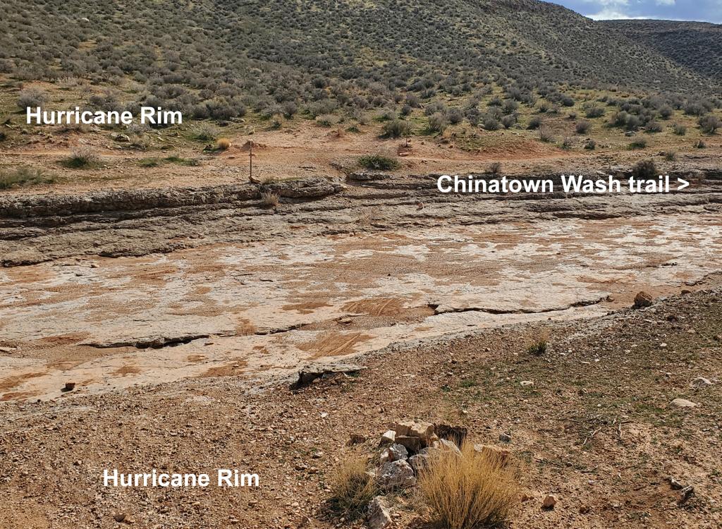
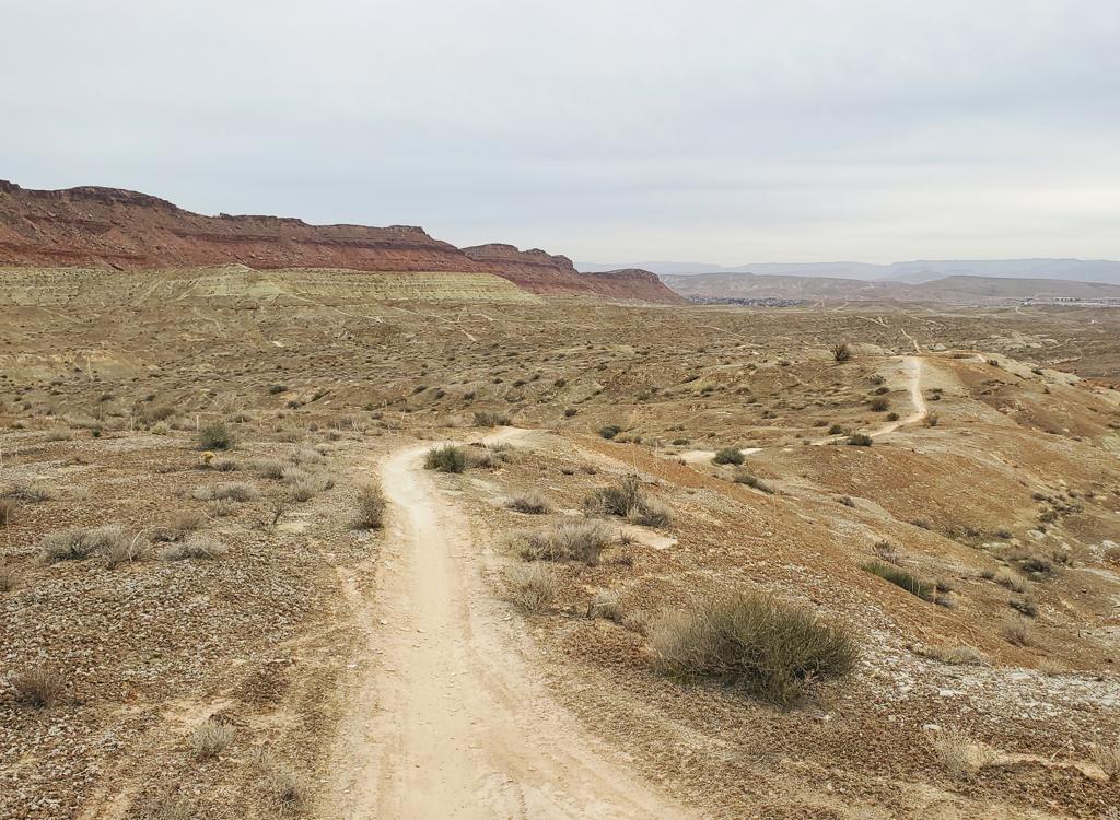
The initial north-to-south lower singletrack crosses some broad areas of open slickrock. To navigate, watch for bicycle tire tracks and small rockpiles. A couple of the spots make it fairly easy to blunder off-trail if you're not actively looking.

And when you reach the carsonite post where a singletrack and doubletrack cross (mile 6.3) you're back at the connector. Fork to the right to descend 0.3 miles to the trailhead.

Theres a fair amount of slickrock riding. Here on the lower mountain, the path o...
There's a fair amount of slickrock riding. Here on the lower mountain, the path of the trail is shown by the dots.

A ride on the Zen trail...

[Back to video list ]
View southeast on Mega Zen. Cliffs above, cliffs below.

About "Mega Zen"

The ride called Mega Zen is a double-black highly-technical alternate descent that adds considerable work and cliff exposure. It includes the Mega Zen trail and further descending through the trails known as Bloomington Rim, then a return via dirt road to lower Zen. This route is discussed on the Bloomington Hill trail page. It should only be done by true experts!

Getting there:  Exit southbound I-15 at the Dixie Drive exit and turn right. Head northwest about two miles on Dixie Drive. Turn left at Canyon View Drive, heading uphill toward the Green Valley Spa. (If you reach a "Green Valley Market" with gas pumps, you passed it. Turn around and backtrack.) Drive past the spa onto dirt at the end of the road. Turn right at the top of the mesa, then immediately veer left to drive down into the deep valley. The road will left turn to aim south. Now keep left at the road fork with the Bearclaw Poppy access road to continue south on the power substation access road. Go south for 1/2 mile. As you pass the power substation, look a bit to the right and spot the parking zone for the Zen trail. The singletrack begins on the right and uphill side of the parking zone, heading northbound.