

with Rattle and Hum downhill trail
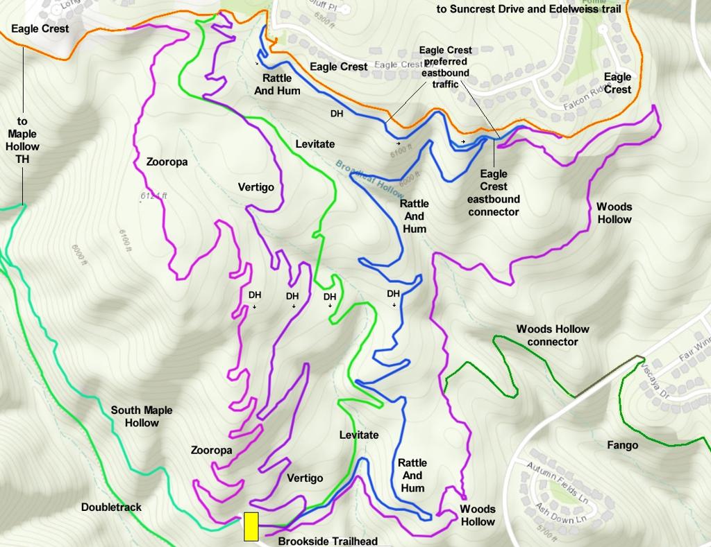
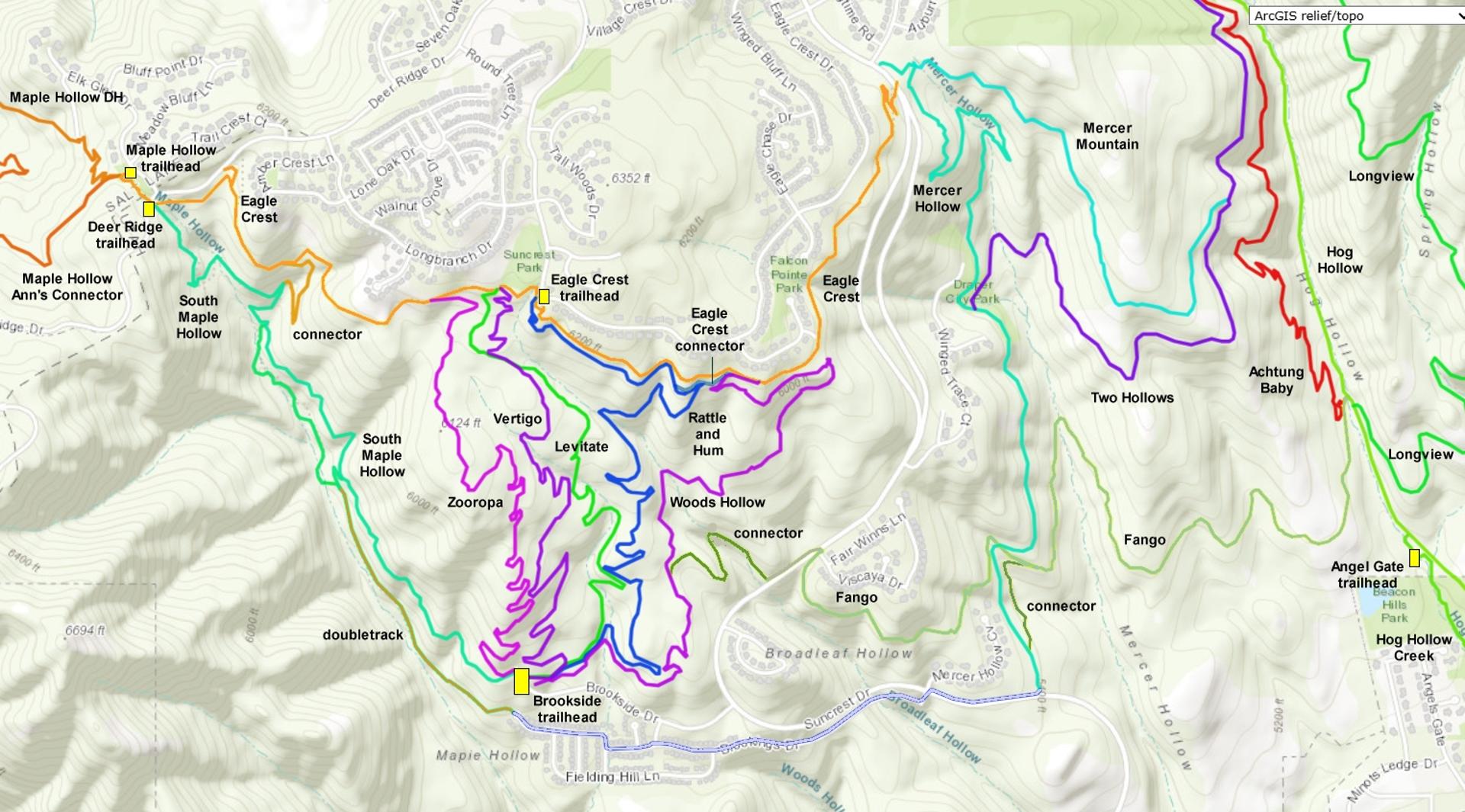
Woods Hollow is an easy 1.8-mile two-way trail that joins the Brookside trailhead (and the bottom of the Zooropa, Vertigo, Levitate and Rattle and Hum downhill-only trails) to the Eagle Crest trail near the top of Traverse Mountain. It is also the route to a short connector trail to the Fango trail, from which you can hit the Mercer Hollow and Hog Hollow area.
Rattle and Hum is a 2-mile beginner-level downhill flow trail that begins at the Eagle Crest trailhead and ends at the Brookside trailhead on the Woods Hollow trail. (Until 2026, a shorter version of Rattle and Hum began on upper Woods Hollow. With the construction of upper Rattle and Hum from the Eagle Crest trailhead, that old connection has now been closed off. After climbing Woods Hollow, you'll need to pedal 1/2 mile west on Eagle Crest to reach the top of Rattle and Hum.)
The most frequent "customers" of Woods Hollow will be riders climbing up to Eagle Crest in order to ride downhill on one of the four downhill flow trails. As a route to the top, Woods Hollow is a slightly easier climb than South Maple Hollow. Beginners will enjoy Woods Hollow all by itself as an out-and-back, or as a loop with Rattle and Hum.
In 2026, rocks are breaking through the surface of Woods Hollow in multiple locations. It's now more of an early-intermediate climb. I no longer recommend Woods Hollow as a climbing route for brand-new beginners or unskilled kids. If you want to show them a good time, shuttle them to the top of Rattle and Hum and skip the bumpy climb.


Woods Hollow is 1.8 miles long (from the Brookside trailhead to the Eagle Crest trail) with 450 feet of elevation gain.
The Woods Hollow trail starts in South Maple Hollow, forking away from the combined Vertigo and Levitate trails about 100 yards before they hit the trailhead on Brookside Drive. As you head east from the trailhead area, keep to the right of the log fence to start uphill on Woods Hollow. The left fork is the return from Rattle and Hum (do not enter).
Around 0.4 miles from the trailhead, there's a short cutoff trail on your left that connects over to Rattle and Hum -- in case you're looking for a super-short loop. A second fork at mile 0.7 is the Fango connector trail on your right.


At Eagle Crest, riders can continue east to Suncrest Drive near the top of the Mercer Hollow trail. Or, you can do a hard left turn to go westbound toward the Eagle Crest trailhead. This section of Eagle Crest also climbs gently uphill.
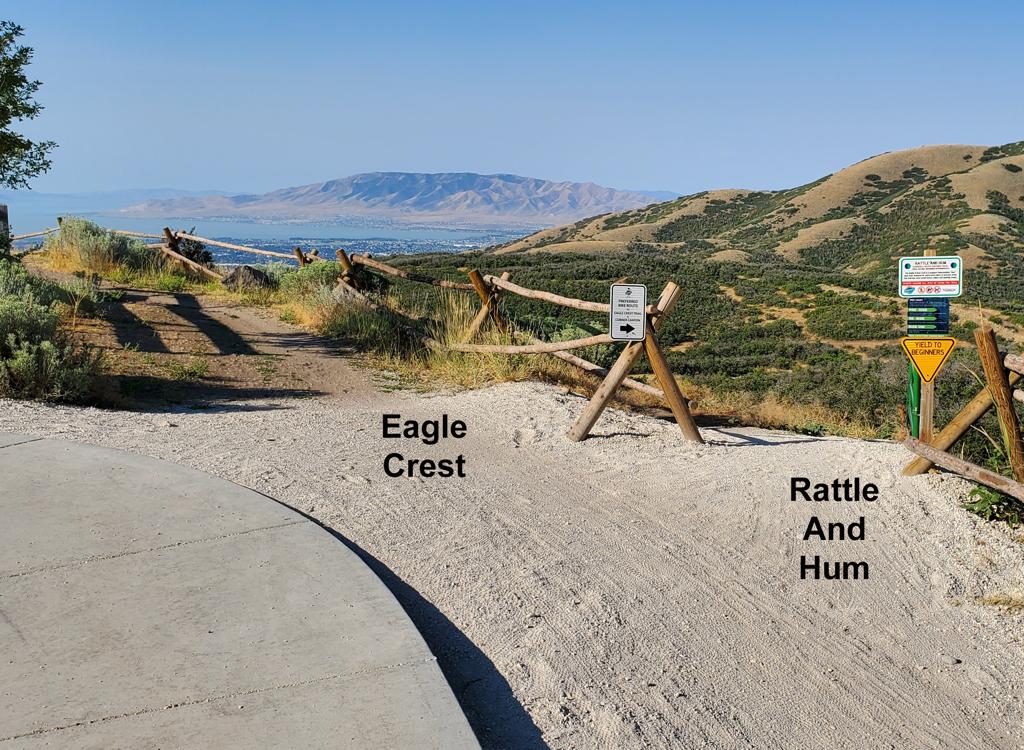
At the trailhead, Rattle and Hum will be a 180-degree turn. If you continue straight past Rattle And Hum for around 50 feet, make a 90-degree left turn to continue west on Eagle Crest. Just past the trailhead are drop-ins to Vertigo, then Levitate, then Zooropa. These trails are downhill-only.
A loop that descends Vertigo will be exactly 4.0 miles with 550 vertical feet of climbing. A loop with Rattle and Hum is easier technically at 4.4 miles, also with 550 feet of climbing. Beginner and early-intermediate riders may find a single lap to be enough. Experts will crank around again and again.


Rattle and Hum is a 2-mile downhill flow trail that begins at the Eagle Crest trailhead and ends on lower Woods Hollow at the Brookside trailhead. There's 500 feet of elevation loss over the length of the trail, with a gentle and fairly constant slope.
If you arrived by climbing Woods Hollow and 1/2 mile of Eagle Crest, you'll find Rattle and Hum on your downhill left just as Eagle Crest reaches the trailhead. It's a 180-degree turn to reverse direction onto Rattle and Hum.
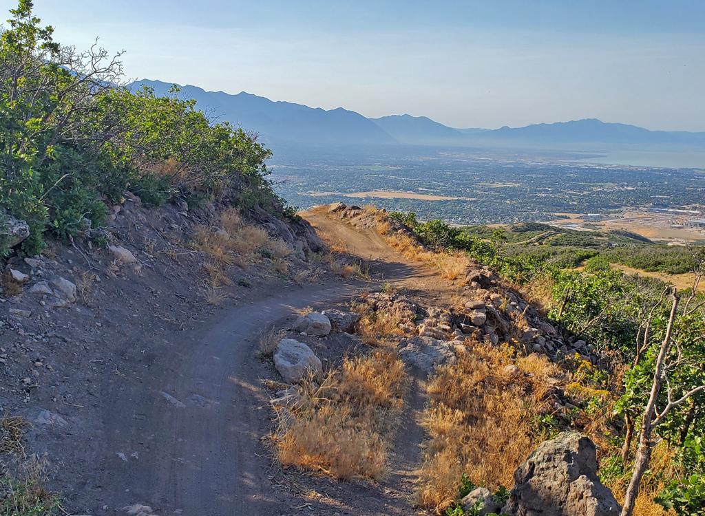
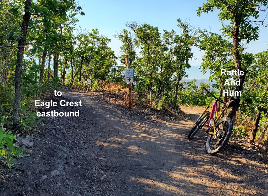
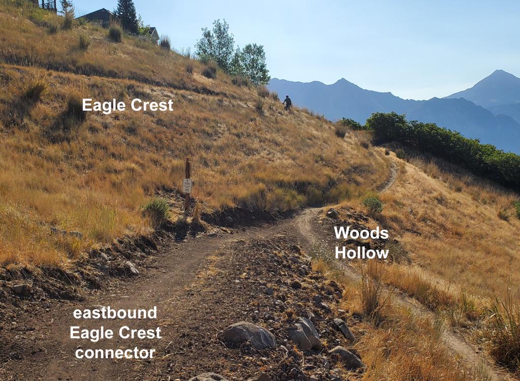
As the new section approaches Woods Hollow, there's a connector trail on your right (see below). This is for eastbound riders who are using upper Rattle and Hum as a preferred alternative to Eagle Crest. The connector joins upper Woods Hollow, then eastbound Eagle Crest.
Keep to the right and soon you'll be on the older portion of Rattle and Hum.
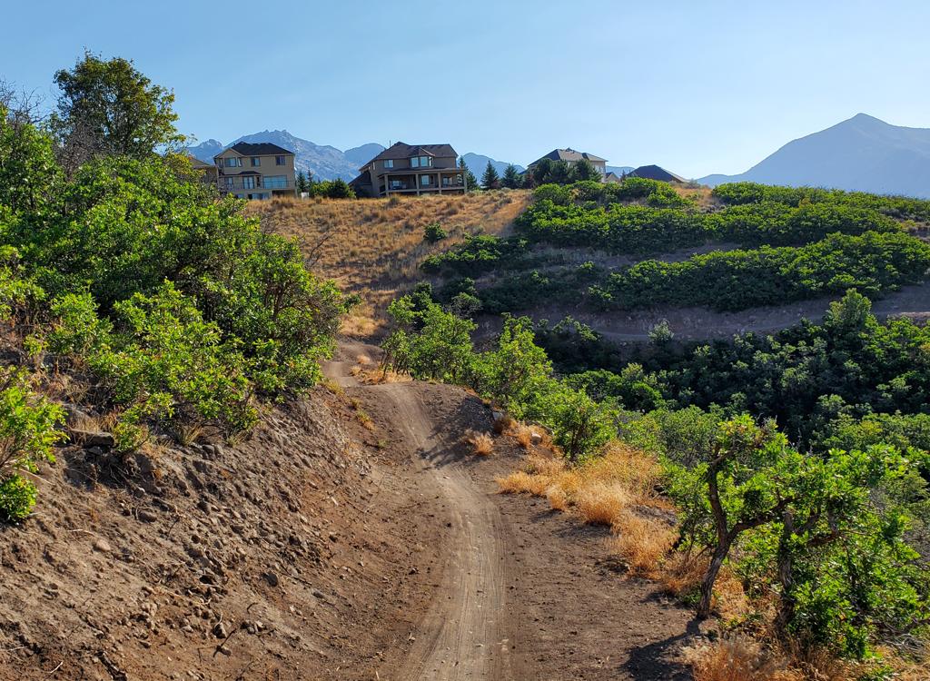


The rest of Rattle and Hum is downhill and slightly to the right.

Woods Hollow and Rattle and Hum are a very nice additions to Draper's trail system. They provide a much-needed beginner option for the south side of Traverse Mountain. Although Woods Hollow is not as scenic as South Maple Hollow, it's an easier climb -- and although it's slightly longer it's probably faster for most riders. Rattle and Hum is a good choice for true beginner mountain bikers.
0.0 Find spur on north side of Brookside Drive
N40 27.695 W111 50.157
50 feet to Vertigo/Levitate, then fork R
1.7 Hard L on Eagle Crest
N40 28.201 W111 49.700
2.2 Curve around trailhead parking
N40 28.317 W111 50.164
N40 28.353 W111 50.250
3.9 Join Levitate
N40 27.740 W111 50.113
4.0 L for another climb
N40 27.716 W111 50.145
Straight for Brookside Drive
From Utah County, get on the Timpanogos Highway. At the Lehi-Highland border, go north on Highland Blvd at the big stop light east of Smiths. This will become Suncrest Drive as it enters Draper. Climb to the stop sign at the top of the hill.
Deer Ridge (Maple Hollow) trailhead: At the stop sign in Suncrest, get on Deer Ridge Drive (right turn from SLC, straight from Utah Co). Go 0.9 miles. Just before the road crosses a bridge, turn right onto Elk Glen Drive and immediately turn left to park at the small picnic area.
Brookside Drive Trailhead (South Maple Hollow): Brookside Drive turns to the west off Suncrest Drive, just uphill from the Maple Hollow subdivision. This is about a mile uphill from Utah Valley. Drive past the homes and uphill to the end of the road. The South Maple Hollow trail is on the west side of the road. It will take you uphill, where you can connect to the Eagle Crest trail then continue east to Vertigo.
Top of Mercer Hollow: There is some roadside parking off Suncrest Drive near the top of the trail, on the east side of the road 1/2 mile downhill from the four-way stop in Suncrest. But there are some cautions. In 2016 this is an active construction area, so be sure you're not in an access-point or work zone!
Bottom of Mercer Hollow: There's room for 3 or 4 cars at the bottom of the doubletrack portion of Mercer Hollow on Suncrest Drive.
Single-page riding guide
Higher-res satellite map for printing: View map
Lodging, camping, shops: Links to southern SLC resources
Click
for Corner Canyon area trails
overview page
Most recently updated 2026


