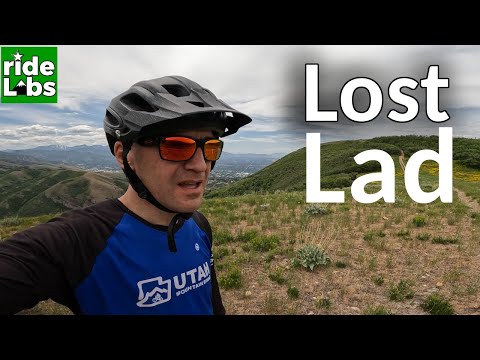
View over the Eaglewood golf course from early in the clockwise trip around the Wild Rose Loop. Photos and description from a ride by Bruce on October 9, 2012 with an update for the new BST on July 12, 2022.
Wild Rose TrailsThe Wild Rose area lies in steep foothills above the North
Salt Lake bench. There's a short-but-sweet singletrack loop suitable for
early-intermediate riders and a short DH (downhill, bikes-only) trail
for
techies. And there are connectors to the upper ridgeline trail, for adventuresome
riders only. Wild Rose also provides an access point to the
Bonneville
Shoreline Trail
to Hidden Lake or
North Canyon
higher on
the mountain.
You can pedal to the Wild Rose system using the lower Wild Rose Trail, or use lower Wild Rose as a bailout downhill after riding. See the Lower Wild Rose trail page for details.
Trailheads and Connections
Wild Rose trailheadThe trailhead is at 5150 feet of elevation, already 900 feet
above the valley floor. You can ride singletrack directly from the asphalt
extension
of the lower
Bonneville Shoreline Trail
on
Eaglepoint Drive, or drive to the Wild Rose Trailhead Park on Sky Crest
Lane to start 1/10 mile further up the trail.
You can also pedal to the trailhead from the US-89 area using the Lower Wild Rose trail.

This is the trailhead park as we pedal into the parking lot. The easiest access to the trail is singletrack by the toilet on the left, at the uphill end of the parking area. You can also catch the trail at the upper end of the grass area.

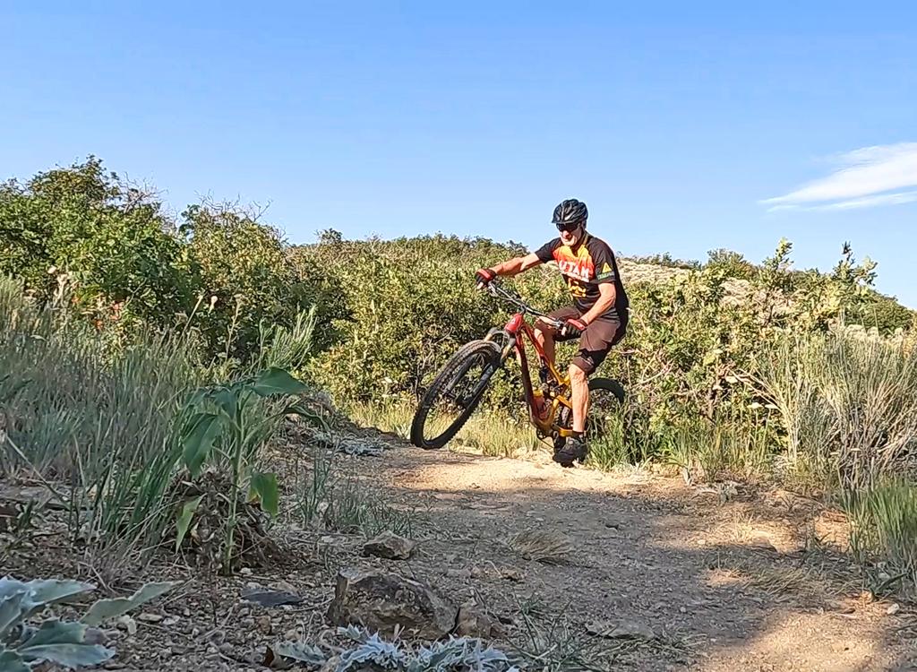
Typical trail view as we ride through maple forest. Smooth broad track with a steady pitch.
Here are the three access points to the trail:
(1) Where the (paved) BST crosses Eaglepoint Drive, singletrack heads
uphill in a grove of maples about 100 feet north of Sky Crest Lane. Keep
L at the next two forks.
(2) From trailhead parking, go north (left) on singletrack past the kiosk
and toilet. Fork R uphill when you hit the main trail.
(3) Go uphill on the paved path through the park. At the uphill end,
find the trail that doesn't end in a picnic table. Keep R when you hit the
main trail and head uphill.
Connecting via the Bonneville Shoreline from Hidden Lake or North CanyonYou can connect to the Wild Rose trail from the north via the Bonneville
Shoreline Trail. It's 8 miles from the trail fork of the BST with the North Canyon trail to
the Viewpoint Trail just a bit above the bench/view. A much shorter option is the Summerwood trailhead, where you can climb one mile on the Hidden Lake trail then gently descend 4 miles of BST to the Viewpoint trail.
Once you reach the Viewpoint
trail, descend from the BST to reach the main Wild Rose loop. Note that at this time (2024) there's no connection to the upper BST from the south, as the BST dead-ends shortly after crossing the Viewpoint trail.

Handlebar view on the Bonneville Shoreline as we ride toward Wild Rose.
Main event: The Wild Rose Loop
The main biking loop is the Wild Rose Trail. When done from the Ensign
Peak
BST
(and with a short side-trip to Sunset Point) it's only 2.4 miles. My
recommended ride: start in City Creek and take the BST five miles north
to
Wild Rose, do the loop as your finale, then head back.
The trail splits into the Wild Rose Loop at 0.3 miles from Eaglepoint Drive. The loop can be
done in either direction. My ride description goes clockwise.

Riding past the end of the DH trail.

The main fork of the Wild Rose Loop. Straight for clockwise; right for a counterclockwise loop or for a quick trip to the top of the DH trail.
The trail climbs 400 vertical feet to a top altitude of 5500. It's a fairly sustained 8% climb
to the top of the loop. The track is broad and smooth, and for a new trail
it's already very
well-packed. Strong beginners can do the Wild Rose loop but should stay
away from the DH or
viewpoint trails.
As the trail climbs around steep mountainsides, you'll be riding in maple forest. There are
frequent breakout views north to Bountiful and west over the southern
edge of the Great Salt
Lake.

Climbing uphill. The mountainsides are steep, but the slope of the trail is gentle. Middle-ring climbing.

Trail spur to Sunset Point.
About a mile up the hill, you'll reach the fork to Sunset Point. Head west (left) on the top
of the little fingerling ridge. Stop to take in the views. As the name
suggests, this spot
is popular for watching the sun go down.
At the viewpoint, you're only about 150 feet above the uphill trail, but you won't see it below
you in the maples.
After reconnecting to the main loop, you'll reach the fork to the east viewpoints at mile 1.3.
There's trail construction going on (2012), so this spot will change.
There are ribbons in
the brush indicating it will connect to Wild Rose a bit further west in
the future.

View north over the golf course toward the Bountiful LDS temple.

High point of the loop. Straight ahead intersects the viewpoint trail in 300 feet. Right continues the loop.
If you head to the viewpoint trail, expect some adversity. See the description below. For now,
let's keep to the right on Wild Rose. You've just passed the ride's highest
point.
A little further along Wild Rose at mile 1.5, you'll come to another trail fork. The trail
to your left splits about 50 feet later into the DH trail (downhill-only)
and the Chukkar Loop
trail which is feet-only (no bikes). For now, go right on Wild Rose.
Keep left as the Shortcut Trail joins 0.2 miles later. In 200 feet, the Wild Rose trail hits
the gully and pops up sharply to join the DH trail for 30 feet. (Caution!)
Now keep straight
as the DH trail falls away to your right.
I think this crossing needs a little sight-line work. The specific danger is someone speeding
downhill on Wild Rose -- and looking left for oncoming DHers -- running
into a climber on Wild
Rose who was hidden by the maples. Be careful.

Finishing the Wild Rose loop.

Looking back up the Wild Rose trail. This direction provides the fastest way of getting to the top of the DH.
The trail will come to a confusing 5-way at 1.9 miles. The single carsonite post (Oct 2012)
will have you scratching your head. Just turn hard right to stay on Wild
Rose -- the rightmost
of the four possible trails. (Note: Straight and leftward uphill is Chukkar
-- No Bikes. 90
degrees right climbs to the ridge viewpoint. Right-right drops down a
DH-only connector to
the main DH trail. Rightest-right is Wild Rose. I think this intersection
needs more, and more-clear,
signage.)
Cross the DH trail again. To complete the loop, pass the Shortcut (stay straight). Recommendation:
If you're heading back uphill to do the DH, go left on the Shortcut, rather
than completing
the loop. The end of the loop is only a tiny bit further down the trail
(across the pipeline
corridor). At mile 2.1, you're back at the trail fork where you started
the loop. Head downhill
if you're done or climb back uphill for more fun.
At mile 1.5 going clockwise on the loop above, fork left off Wild Rose. Then immediately keep
right to enter the DH. (Left is Chukkar, a no-bikes loop.)
For the shortest route to the DH trail from the
BST
, fork
to the right as the Wild Rose loop begins at 0.3 miles. Then turn left
on the Shortcut. Turn left again when you rejoin Wild Rose.
Fork hard right at the top at mile 0.7 from the BST, and you're on the
way
down the DH.

Start of the DH.

Bumps on the DH trail. Not too steep or tough except at the corners.
The DH trail winds downhill, spreading its 200 vertical feet over 0.5 miles. Typically there
will be a traverse with occasional tabletop jumps, then a very tight turn
with high berm.
In October 2012, the turns are still very sloppy and loose. Stay high and fast, up on the berm
if possible. A slower turn in the trail's middle requires good surfing
skills as you wallow
in deep dust and cobble. Intermediates will want to wait until next year
when the trail firms
up before trying the DH.
The DH route crosses Wild Rose twice. There are trail crossing warnings. Slow down as you approach.
The first crossing is actually a "join and drop off." When the trail system
is crowded, there's
high "idiot potential" here. And newbies may be parked in the riding line
of the conjoined
trail, trying to figure out where to go. Dial it back and watch out.

Of the four trails you see below you, the second one down is Wild Rose heading towards its intersection with the DH. The others are the DH trail itself.

Looking back up the trail at a log drop as we play in the ravine near the bottom.
At the bottom of the DH, it drops onto the stem of the Wild Rose trail with your bike aiming
downhill. If you want another go, do a 180. You can loop back up via the
Shortcut in only 0.4
miles. See the by-the-mile description below.
The western (lower) DH route starts at the 5-way intersection. It's the trail immediately to
the right of the Viewpoint Trail. This fun route will swoop back and forth
through the ravine
as it descends, crossing the upper DH trail on the way before joining
it.

Handlebar view down the lower DH.
There are two trails leading up to the high ridgeline. The one on the east forks off the Wild
Rose loop at mile 1.3 when riding clockwise.
The western viewpoint trail starts at the 5-way at mile 1.9 clockwise -- or at mile 0.5 from
the BST if riding counterclockwise on Wild Rose.

Fresh trail cut on the east viewpoint trail. Narrow track but nice riding for this first 1/4 mile.

Looking west. The blue on the right is the southern arm of the Great Salt Lake.
East: For the east trail, fork uphill at the top of the ridge
(this route will change as new trail is cut). 300
feet up the hill, you'll intersect 1/4 mile of narrow new trail-cut heading
left. Shortly after passing a spur going left, the
trail gets primitive with encroaching maples and deadfall (2012). Then comes a
long and ugly 0.3-mile hike-a-bike section before you hit the cruising on
the ridgeline. It's 350 vertical; 20% slope; and it seems to go on
forever. You are hereby warned.
At the ridgeline, head west (right) to the first view. Backtrack and pass the trail fork to
go southeast on the ridge. There's a mile of nice cruising ahead. When
you hit a doubletrack
area, turn left and join DT heading east toward the big knoll. That's
your viewpoint. (Alternate:
At the DT, keep southbound and drop across the valley to DT heading over
the rise. This DT
eventually drops steeply down to the Bonneville Shoreline Trail near the
radio tower north
of
Ensign
Peak
)
The doubletrack heading west-northwest can connect you to the gas line and thereby to the west
viewpoint trail, but it can also take you downhill and get you thoroughly
lost. Know before
you go. Few riders do this route. Don't plan to follow tire tracks.

View north toward Bountiful, Woods Cross, Farmington...

Looking south toward the Salt Lake Valley as we approach the City Creek viewpoint.
West: The western viewpoint trail starts at the five-way
intersection. If you're on Wild Rose, it's the trail across the gully that
climbs uphill while traversing the slope, 90 degrees to your right. The
trail that goes uphill in the gully is Chukkar, a no-bikes.
After 0.3 miles, you reach a sorta-viewpoint.
Non-adventurous types should say ooh ah and turn back here. If you
continue, you'll be pushing your bike. The first hike is coming right up.
At mile 0.4, the Bonneville Shoreline Trail (BST) crosses. (There are three levels of BST in
this area: the doubletrack on the upper mountain; the mid-elevation BST
toward North Canyon;
and the lower
BST
near the bottom of Wild Rose.) At this time (July 2022) the BST to the right ends after 100
yards. To the left, it's 8 miles of nice riding to North Canyon.

Looking east on the BST shortly after leaving the Viewpoint Trail.

The knoll is our turnaround, where we have a look into City Creek Canyon. (No bikes are allowed off-road in upper City Creek; don't follow any primitive trails downhill.)
If you're headed further uphill on the Viewpoint Trail, cross the gas line at mile 0.5 to stay
on ST. Then rejoin the gas line at 0.7 and push your bike uphill. There
will be some cruising
up on top, but right now you've got a brutal half-mile ahead. Stay on
the ridgeline and join
doubletrack. A fork in the doubletrack means you're near the east viewpoint
trail. If you keep
left and head east, you'll hit the doubletrack at the end of the eastern
viewpoint trail. If
you can find the east viewpoint singletrack -- not easy in 2012 without
GPS -- you can complete
a loop.
There's also hiker-only trail called the Chukkar* Loop. While it's clearly marked on the east
end, you might accidentally blunder onto the west end where the 5-way
trail intersection is
confusing. Be aware that it's there. Watch the trail description and check
the signs carefully.
Hopefully, the signage at the 5-way will improve soon. The signs at every
other trail fork
are excellent. *The chukkar is a robin-sized game bird that looks like
a midget grouse. Not
worth the price of a shotgun shell, if you ask me.
Wild Rose Loop, clockwise from BST:
0.0 Leave paved BST on Eaglepointe Dr
East uphill on ST
N40 49.625 W111 53.842
0.1 Keep straight (L)
(R = to BR and parking)
N40 49.583 W111 53.766
0.2 Keep L and uphill
Connectors to park on
R
N40 49.546 W111 53.733
0.3 Keep L (R = DH return)
N40 49.528 W111 53.698
100 feet, then L again
(R = return from loop)
N40 49.532 W111 53.683
1.1 Go L to Sunset Point
N40 49.629 W111 53.512
1.15 View N40 49.632 W111 53.571
1.2 Straight (L) to continue loop
N40 49.634 W111 53.513
1.3 Fork R (L = to ridgeline views)
N40 49.587 W111 53.418
1.4 (Keep R, flagged for new trail on L)
1.5 Fork R (L = to DH)
N40 49.522 W111 53.482
1.7 Fork L (R = shortcut)
N40 49.481 W111 53.562
1.75 Join DH (from L)
N40 49.476 W111 53.517
30 ft then keep L as
DH
leaves on R
1.9 Hard R at 5-way
N40 49.351 W111 53.556
(Straight L = Chukkar
No Bikes)
Soft R across gully =
ridge
viewpoints
Soft R then R = alt DH
2.0 DH crosses!
N40 49.466 W111 53.610
100 ft, then keep L
(R = shortcut uphill)
N40 49.479 W111 53.618
2.1 L on main trail
N40 49.532 W111 53.683
2.2 At Park, keep R
N40 49.546 W111 53.733
2.3 Keep straight (L = to BR)
N40 49.583 W111 53.766
2.4 Back at BST
Wild Rose mini-DH loop:
0.0 From mile 0.3 of Wild Rose above
(Bottom of DH N40 49.528 W111
53.698)
Uphill on Wild Rose 60 ft
R at fork N40 49.532
W111 53.683
0.1 L on Shortcut N40 49.479 W111 53.618
0.2 L on Wild Rose (counterclockwise)
N40 49.481 W111 53.562
0.4 Fork hard R N40 49.522 W111 53.482
50 ft, then keep R (L
=
Chukkar, no bikes)
N40 49.511 W111 53.480
0.6 Join Wild Rose
N40 49.466 W111 53.610
(Caution! uphill bikes and
hikers!)
30 ft, then drop R on DH
N40 49.472 W111 53.522
0.9 Cross Wild Rose
N40 49.467 W111 53.609
50 ft then alt DH joins on
L
1.0 Bottom of DH on Wild Rose
East viewpoint trail, notes:
2012 -- will change as new
trail is cut...
0.0 From mile 1.3 of Wild Rose Loop
N40 49.587 W111 53.419
Straight (L) up ridge 300 ft
L at new trail-cut
N40 49.555 W111 53.391
0.3 Spur on L, fork R
N40 49.510 W111 53.171
(L = views, quick drop to
streets)
0.5 Primitive: deadfall and encroaching trees
0.6 Gets steep, push-a-bike
0.7 Ugly push-a-bike for 1/4 mile
0.9 Ridgeline, R to view
N40 49.276 W111 52.911
1.0 View, backtrack
N40 49.310 W111 53.002
1.1 Keep straight (R) at ridge fork
1.7 Fork at N40 48.965 W111 52.498
Note gas line connects to west
viewpoints
Option 1:
straight
to
DT and up next knoll 2.0
N40 48.793
W111 52.533
(DT drops
to
Ensign Peak)
Option 2:
L and join
DT
to east knoll 2.4
N40 49.285
W111 51.953
Option 3:
West to gas
line and loop via west viewpoint trail
West viewpoint trail, notes:
0.0 From mile 1.9 of Wild Rose above
N40 49.354 W111 53.554
90-degree R at 5-way
(L = Chukkar, no bikes)
(hard R = Wild Rose down)
0.3 Views on ridge N40 49.380 W111 53.657
Done vs continue straight
First push-a-bike
0.5 Cross gas line to ST
N40 49.233 W111 53.607
0.7 Join gas line, R steep
uphill
N40 49.125 W111 53.408
Join eastbound DT when
you can
1.6 Flat area, forking DT
Veer slightly left on
DT
Don't go downhill w gas
line, stay L
Option: return by East
viewpoint trail
On
the
ridgeline NE of DT fork:
Leaves
DT
uphill at
N40 48.901 W111 52.499
Cairn
at
N40 48.965 W111 52.498
(2012
hard to find, suggest GPS)

Closeup of Wild Rose system
Getting there, via Wild Rose Park:
On I-15 northbound, take exit 312 (US-89). Just after the exit at the
first stop light, turn right on Eagle Ridge Drive. Keep on Eagle Ridge
(straight) at the roundabout. Climb the hill for about two miles. Watch
for Eaglepoint Drive on the right at N40 49.803 W111 53.771. (If you reach
the golf course, you just missed it.) Drive 0.2 miles on Eaglepoint and
turn left uphill on Sky Crest Lane. The parking lot is at the end of the
road. From parking, find the singletrack on the left just below the
bathroom. It connects to the uphill trail. Alternately, you can take
sidewalk up through the park and find the uphill trail at the top of the
grass, among several picnic-table spurs.
Getting there, via BST: From the
City
Creek TH in Salt Lake City, pedal across the mountain, keeping R on
the BST at the Ensign Peak fork at mile 2.3. Descend to the bench
northbound. At Tunnel Springs Park (mile 5.0), cross the street and
continue north on paved trail on the left side of the street. When the
asphault ends in cement sidewalk (just after you pass Sky Crest Lane on
your right) at 5.4, cross the street on the crosswalk. The Wild Rose trail
is just a few feet away. The dirt ST N40 49.623 W111 53.840 heading uphill
in the maples is it.
From North Canyon, take the BST west
from the North Canyon trail.

Wider area view