Bob (left) and Brian look out over the White Rim. Photo October 23, 2001 by Bruce Argyle.
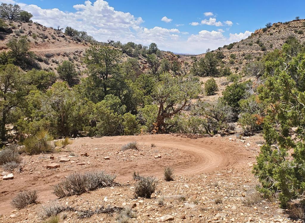
White RimThe White Rim Trail is Utah's ultimate multi-day party trail. The trail is a 103-mile loop
on jeep road through Canyonlands National Park. Technically, this trail
is fairly easy. But
the length (and a few stiff climbs) means you need to be in good condition
to do the whole
thing.
The major climbs add up to 4000 vertical feet, but an altimeter or GPS unit that records every
little up-and-down will give you about 6000 feet total. Most riders spend
3 or 4 days to ride
this trail, spending the night at campgrounds. (Two days = Monster. One
day = Lunatic.) You'll
need a support vehicle for food, water, camping gear, and bike parts.
(Even though there's
little dangerous stuff, the length of this trail -- combined with sand
-- means there's a good
chance you'll need some on-trail repair.)
Campgrounds are spaced every few miles. (Waiting time for some camp sites is around ONE YEAR.
You must obtain a permit from the National Park Service to ride this trail,
and reserve your
campsites well in advance of your ride.) Bring cooking gear. Open fires
are prohibited.

Brian cooks up a bit of breakfast. Note the winter clothing. In fall and spring, nights are bitter cold in the desert.

Bruce stands on the White Rim sandstone, looking out over spires of the Permian Period's Organ Rock formation, a deep-red shale with layers of sandstone.
Bring clothing, shoes, and a hat for hanging out around camp, and for those little side trips.
Prepare for weather of both extremes! At night, you'll need a thick coat.
In October, we went
from full powder-ski clothing (34 degrees) to sweating in a sleeveless
mesh jersey within one
hour! You'll want insect repellant, sunblock, a tent, and warm sleeping
gear.
There are bathrooms at each campground. If you have an "emergency" between toilets, you're
expected to pack it with you. Because this trail is in Canyonlands National
Park, biking off-trail
is prohibited. This isn't a ride to test your rock-hopping prowess. It's
a buddy cruise with
your pals.

Brian rides through the shales of the Moenkopi formation (the layered chocolate brown in mid-photo), looking up to the multicolored slopes of the Chinle, then the tall cliffs and spires of the Wingate sandstone. These formations date from the Triassic Period.

Bruce prepares to drop over a ledge in a slot canyon. Photo by Brian.
You can ride the trail either direction. Most bikers ride clockwise, from the Schafer Trail
around to the Green River. This direction tends to be a little nicer,
because it puts most
of the sand on the downhill slopes. There are four big hills with over
1000 feet elevation
gain, but you get to do one of them downhill as you drop into the canyon
on the first day.
A three-day trip gives you one major climb each day.
In hot weather, it's very difficult to carry enough water to survive. (Some solo riders carry
cash to buy water from campers, others pre-stash water and food with touring companies. Heading
into the loop without a plan isn't smart.)
Some riders will tackle this loop in one day. Be prepared
for an insanely difficult ride. Unless you're an experienced endurance
rider, don't even think about one-day without a support vehicle.
Fido note: Pets are prohibited
in Canyonland's back
country!

Brian cruises. The cliffs above the trail are Wingate sandstone capped with Kayenta. The skirts are Chinle, then Moenkopi formations. Most of the ride is on a table-top formed of the White Rim sandstone, with the dark red-brown Organ Rock shale and sandstone dropping down to the river.
One-day White Rim,
self-supported; one rider's experience:
April 9, 2005. Riding clockwise through periodic storms, wind direction rotating
so the entire
ride was against the wind, wind-speed up to 20 mph. Average riding speed
11.4
mph, riding time 9 hours, total on-trail time 10 hours with 1/2-hour break
at top of Murphy's Hogback, 2 brief sightseeing stops. Total hike-a-bike
=
3 feet on the upside of the sandy wash along Green River -- had to
reposition the bike to restart. Fluids 120 oz (100 oz Gatorade in Camelbak,
20 oz H2O bottle), GU gel-packs 12, energy bars 2 (total calories consumed
on-trail 2000). Packing first-aid kit, spare tube, tool kit, cold-weather
clothing (used jacket twice -- rainstorm, snowstorm with temperature down
to 37 degrees). A great ride. -- Bruce

Bob and Brian sit on the cliff-edge of White Rim sandstone while taking in lunch.
To get a permit to stay overnight,
contact:
Canyonlands National Park
Attn: Reservations
2282 Resource Blvd
Moab, UT 84532
Include: number of vehicles, number of people, dates and campsites
requested (list alternate dates and campsites if possible). In 2001, the
non-refundable fee was $30 for the reservation. Call 435-259-4351 for
information. You'll have to pay additional entry fees when you arrive.
Side trips and stop-and-gawk opportunities abound. Some of the more famous include the Colorado
Overlook, Musselman Arch, Lathrop Canyon (bike 1 mile), White Crack (bike
1 mile, hike 1/3
mile to canyons overlook), Murphy's Trail, Whilehite Trail (and the slot
canyon opposite it),
and the Syncline Valley Trail. Before entering any dirt road, check for
a "no-bikes" symbol.
Most side trails prohibit bikes.
 wait for sun...")
Brian and Bob (the tiny white dot near the right edge of the tower) wait for sundown at the White Crack campground, between the Green and Colorado Rivers.

Bruce poses with his bike on top of Musselman Arch. Although carrying your bike out onto the arch for a photo is OK, it's not legal (or smart) to ride across the arch.
For alternate rides, you can connect to Moab through the Colorado River valley by taking dirt
roads that branch off the Shafer trail below the switchbacks, or off the
paved Dead Horse Point
road.

Layout of the White Rim ride
Getting there: Eastbound on I-70, turn at the Moab
exit onto US-191. About 20 miles later, turn right on U-313 towards
Canyonlands. Pay the entry fee ($30 in 2024) at the gate and proceed a
couple of miles to the Island-in-the-Sky Visitor's Center. Register here.
Now backtrack to your point of departure. The parking area off U-313,
and at the top of the Horsethief Trail, are popular areas to leave a
vehicle. Most riders go clockwise, dropping down the Shafer Trail the
first day, then climbing up the Horsethief Trail on the last day.


 wait for sun...")