![View up the canyon on the lower portion of the trail. Original review and photos... View up the canyon on the lower portion of the trail. Original review and photos...](http://cdn1.utahmountainbiking.com/trails/images/pics-trails/SnowBsn-Wheeler05.jpg)
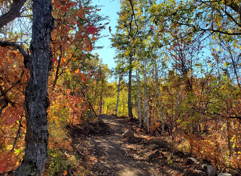
The Wheeler Creek Trail is a popular trail close to Ogden. It's 5.3 miles long, with 1300 vertical of total climbing. The trail melts out in mid spring. It can be ridden by late April to early May, and in virtually any weather. The upper section becomes snow-free by early June.
The first section is easy for beginners; the upper trail is intermediate in technical requirement. The lower portion of the trail is also very popular with hikers and dogs, so wild downhilling is strongly discouraged.
![Sample of the upper part of the Wheeler Creek trail as we gain elevation. Sample of the upper part of the Wheeler Creek trail as we gain elevation.](http://cdn1.utahmountainbiking.com/trails/images/pics-trails/SnowBsn-Wheeler01.jpg)
![The Art Nord trailhead, as seen from the East Fork trail. Note the ratio of hors... The Art Nord trailhead, as seen from the East Fork trail. Note the ratio of hors...](http://cdn1.utahmountainbiking.com/trails/images/pics-trails/SnowBsn-Wheeler03.jpg)
A bit of history: The lower portion of the trail -- the part along Wheeler Creek in the canyon -- used to be called the Wheeler Trail. Meantime, the upper three miles was called the Maples Trail because it ended at the (now abandoned) Maples Campground. Grizzled old riders and locals may still use these names.
![Approaching the Art Nord trailhead near the top of the first trail section of th... Approaching the Art Nord trailhead near the top of the first trail section of th...](http://cdn1.utahmountainbiking.com/trails/images/pics-trails/b-wheel2.jpg)
![Heres the fork for Icebox. The two routes go on opposite sides of the hill strai... Heres the fork for Icebox. The two routes go on opposite sides of the hill strai...](http://cdn1.utahmountainbiking.com/trails/images/pics-trails/SnowBsn-Icebox01.jpg)
Icebox Canyon is a fun singletrack for upper-intermediate or better riders. There are some steep spots, and a bit of loose rock near the top. There are also some sections with fairly large embedded boulders.
![Icebox Canyon is filled with tall trees and is substantially cooler than Wheeler... Icebox Canyon is filled with tall trees and is substantially cooler than Wheeler...](http://cdn1.utahmountainbiking.com/trails/images/pics-trails/SnowBsn-Icebox03.jpg)
![Narrow bridge across the creek in Icebox Canyon. Narrow bridge across the creek in Icebox Canyon.](http://cdn1.utahmountainbiking.com/trails/images/pics-trails/SnowBsn-Icebox04.jpg)
![Looking toward Ogden Canyon on Wheeler, just downhill from Art Nord. Looking toward Ogden Canyon on Wheeler, just downhill from Art Nord.](http://cdn1.utahmountainbiking.com/trails/images/pics-trails/SnowBsn-Wheeler04.jpg)
![The area between the upper Icebox fork and Middle Fork is 100% fall-line trail, ... The area between the upper Icebox fork and Middle Fork is 100% fall-line trail, ...](http://cdn1.utahmountainbiking.com/trails/images/pics-trails/SnowBsn-Wheeler06.jpg)
The second 3.6 miles is dirt singletrack through aspens, oak brush, and meadows. This section begins at the Art Nord Trailhead and ends on the doubletrack portion of the Ogden Canyon Overlook trail . There are some rocky loose sections at first, but if you hang on, the upper couple of miles are plush riding!
At mile 1.5, the Middle Fork trail forks uphill to the left. Keep straight.
![Bruce cranks through aspens on Wheeler Creek. Bruce cranks through aspens on Wheeler Creek.](http://cdn1.utahmountainbiking.com/trails/images/pics-trails/SardinePeak12.jpg)
![A meadow of mules ear flowers, now crisp from the summer sunshine. Were near the... A meadow of mules ear flowers, now crisp from the summer sunshine. Were near the...](http://cdn1.utahmountainbiking.com/trails/images/pics-trails/SnowBsn-Wheeler07.jpg)
At mile 3.6, the singletrack ends on dirt road. To the left is the Ogden Canyon Overlook trail; to the right the doubletrack goes 0.6 miles to Snowbasin parking and access to the Snowbasin (Maples/Needles/Green Pond) singletrack.
![Handlebar view of the western part of the trail. Handlebar view of the western part of the trail.](http://cdn1.utahmountainbiking.com/trails/images/pics-trails/SardinePeak13.jpg)
![Almost to Snowbasin. Almost to Snowbasin.](http://cdn1.utahmountainbiking.com/trails/images/pics-trails/SnowBsn-Wheeler02.jpg)
Green
Pond Loop.
12 miles, 1600 vertical. With Wheeler, 15 miles and 2100 vertical. Loops
up through Snowbasin.
East Fork Loop.
6 miles, 800 vertical. With Wheeler, 10 miles and 1300 vertical.
Mid-altitude ride.
Ogden Canyon Overlook.
5.4 miles, 900 vertical.
Sardine Peak.
12 miles, 1900 vertical.
![Map of the Wheeler Creek area Map of the Wheeler Creek area](http://cdn1.utahmountainbiking.com/trails/maps/Wheeler-LRes.jpg)
Art Nord: For Art Nord (recommended, bathrooms), keep straight (R) at the dam, then 2.7 miles later, turn R on U-226. Go another 3.6 miles and turn R into the Art Nord trailhead.
Snowbasin: From US-89, turn east to take I-84 up Weber Canyon. Take the Huntsville/Pineview exit and turn left under the freeway, then right to continue up the canyon. About a mile later, follow the signs to turn left towards Huntsville on U-167. At 6.8 miles after leaving I-84, turn left on U-226 and follow the road to the main resort. Go left to the big parking area. The dirt road behind the gate takes you to the trail.
One-page printable guide
GPS track files (right-click and "Save as..."):
Wheeler Creek only
Lariat Wheeler-EastFork-Green Pond around to Icebox
GPX area multi-track file
High-res area topo map for printing: View map
Lodging, camping, shops: Links to Ogden area resources