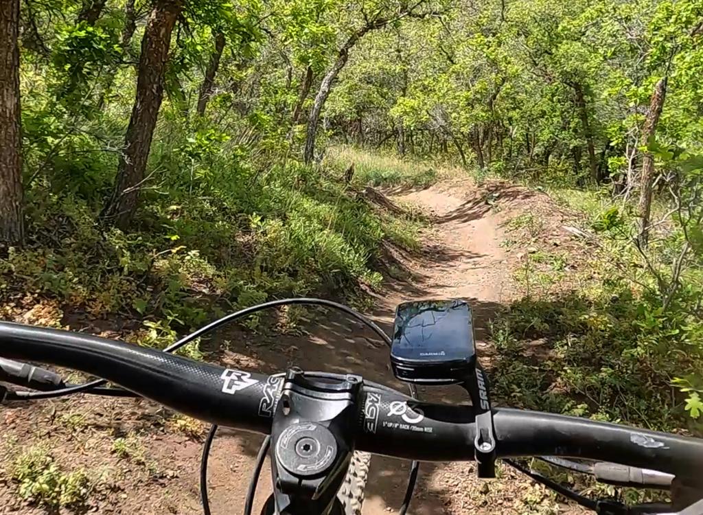
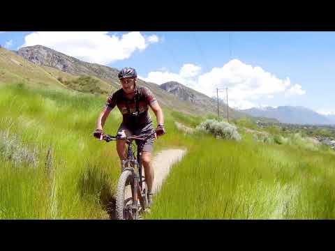
Little Rocky is enjoying a cruise around the Soft Rock loop. Original photos and ride description June 30, 2016 by Bruce. Latest update July 8, 2019.
Valley Vista Trail System
Soft Rock, Rose, Gamble, Fault Line and Cowley's Curse loops
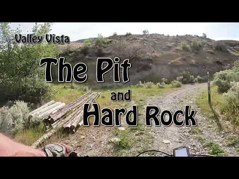
Foothill, Molly's, Cowley's Cure, Hard Rock and The Pit trailsThe Valley Vista trail system is in the foothills of Pleasant Grove between the Murdock Canal
Trail and the Bench Road. It's a network of interconnected loops for riders of all abilities,
completed in September 2016 with 6 miles of trail. Expansions in 2019 and 2021 added 5 more
miles of trail north of the original trail system.
Wade Spring trailhead in Pleasant GroveThe trails can be reached via the paved
Murdock
Canal Trail.
The closest trailhead to the main trails is Wade Spring, located on 1100
North at approximately 650 East. The trailhead includes bathroom, shaded
picnic area, and water. The trails most suitable for beginning riders
--
Soft Rock, Rose, and Gambel -- are just north of the Wade Springs trailhead.

Looking north near the trailhead entry.

Your target is the gap between the trees at the top of this little hill. Just veer to the right and head uphill on the doubletrack to the kiosk. We're riding north in this photo.
From Wade Springs, the trail system is reached by pedaling 0.2 miles north on the Murdock Canal
Trail. Veer right and gently uphill on a gravel doubletrack. A bit over
100 yards uphill, the
entry to the first singletrack loop Soft Rock is on your right and the
Foothill trail is straight
ahead.
Cedar Hills Canyon Road trailheadYou can also ride from the Canyon Road trailhead (located on the uphill side of Canyon Road
just south of where the Murdock Canal trail passes under the highway).
The connector to The
Pit loop is about 1/4 mile south of the trailhead, on the left side of
the Murdock Canal trail.
The Foothill singletrack trail is further down the Murdock Canal Trail at around mile 0.8,
about half-way between the two Murdock Canal trailheads. It winds quickly
uphill, then contours
the hill southbound until it reaches the trail kiosk at the bottom of
the Soft Rock loop.

The Cedar Hills Murdock Canal Trail trailhead, looking south.

Heading south on the doubletrack connector. Just ahead, we'll veer to the left uphill.
To reach The Pit loop, get onto the doubletrack just uphill from the paved trail. After about
100 yards on the gravel doubletrack fork uphill and ride toward the mountain.
At the base of
the slope, turn right (the left-hand trail is the one-way return of The
Pit).
Trail organization at Valley Vista

Just getting started. Bruce rides through the first turn on Soft Rock after leaving the trailhead kiosk.
The easiest trails are located on the lower slopes. In general, the trails are built as "stacked
loops" that ride one direction. On each loop, you can either continue
uphill by transferring
to the next-higher loop as you reach the loop's high point, or you can
roll on around and downhill
to complete the loop. Individual trails are described below.
I recommend that beginners start from the Wade Springs trailhead and ride the Soft Rock loop.
From Soft Rock, you can progress to the Rose loop, then the longer Gambel
loop. These loops
are "stacked" one above the other. Each loop is a bit larger than the
one just below it. See
the maps near the bottom of this page.

Hitting a turn on Rose as we climb through the trees of Valley Vista. The lower three loops are fairly heavily forested.

Climbing Cowley's Curse. Nice views up here.
Above the Gambel loop is Cowley's Curse, a larger intermediate-level loop. Cowley's is the
largest of the loops at 2.3 miles, and takes you all the way uphill to
the gravel Bench Road.
(From here, you can connect to Forest Service trails above the road such
as the Bonneville
Shoreline Trail. Or you can head north on the Bench Road to the newer
parts of the trail system.)
Near the top of Cowley's Curse, the Fault Line loop forks away to the south, then rejoins just
a few feet further up the hill. Cowley's traverses the hillside, then
descends back down to
the Gambel loop.
There are two alternate paths while descending Cowley's: the Viking Run and Tufa trails.
At the top of Cowley's Curse, or at a connector a couple of turns downhill, you can connect
to the Bench Road northbound. The Bench Road will take you to the northern
trail options: Cowley's
Cure, Molly's, The Pit and Hard Rock loops.

Descending Cowley's Curse.

Most of the trees on the upper slope are gambel oak.
Molly's trail is your route to the northern trails, and it can only be reached via the Bench
Road.
Cowley's Cure, which forks away from Molly's trail, returns back to the middle of the downhill
portion of the Gambel loop.
At the far northern end of the riding area are two more stacked loops, occupying the space
between the Murdock Canal trail and the Bench Road. These are the Hard
Rock loop which forks
away from the far northern end of Molly's trail, and The Pit loop below
Hard Rock. The bottom
of The Pit connects to the Murdock Canal trail just south of the Cedar
Hills trailhead.

The lower southern portions of the riding area are dense with trees, while the northern and higher slopes are mostly open grass and sage.
Individual Valley Vista trails
Listed sort-of bottom to top and south to north
Itty Bitty and Tinies Loop (kids' riding area)

Entry to the kids' riding area, just across from Soft
Rock.
Itty Bitty and Tinies Loop are short, very easy one-way loop
trails on the downhill side of the main trailhead. Because these trails
are not on a main cycling route, they're protected from speedy or
aggressive riders. Small children can learn and enjoy their ride without
stress. It's suggested that beginning adults (and experienced riders)
start on Soft Rock.
From Wade Springs, go north on Murdock, veering to the right as you reach the doubletrack connector. There's a bit of slope here, so very young children may need some help pushing their bikes up.
As you arrive at the top of the doubletrack trailhead
connector from the Murdock Canal Trail, keep straight and north. To your
left, you'll see the combined entrance to both loops. Children -- and
riders that are supervising them -- turn into the short connector spur,
then veer to the right to enter the one-way combined Itty Bitty and Tinies
Loop.

Location of Itty Bitty and Tinies Loop.

Looking north on the combined Tinies Loop and Itty
Bitty.
About 50 feet later, the Tinies Loop forks away to the left.
The Tinies Loop is 200 feet per lap, with only a few feet of elevation
change over the course of the loop. It's one-way counterclockwise. The
oval route curves around and rejoins the Itty Bitty trail at the entry
connector.
Itty Bitty continues straight as Tinies Loop forks away.
There are a few humps on the straight-away here, then the trail turns
around to head back south. Here there will be several turns as the trail
gently climbs. The Itty Bitty loop is 0.15 miles long with around 20
vertical feet of climbing per lap. Like Tinies Loop, Itty Bitty is one-way
counter-clockwise. The loop arrives back at the entry connector, where the
rider can either exit to the right or continue straight for another lap.

Heading south on a broad easy trail.

Looking northwest over Utah Valley. The trail is a meandering bench-cuton the hillside above the Murdock Canal trail.
The Foothill trail is one of the few Valley Vista trails that doesn't form a singletrack loop.
But it does form a loop ride when combined with the paved Murdock Canal
trail.
Foothill runs along the hillside from the main trail kiosk to the Murdock Canal trail. It's
0.8 miles long with only about 70 feet of elevation change. The trail
is very easy technically
except for a series of S turns at the north end. Beginners will find these
turns hard to ride,
but it's a very short section and is easily walked.
Foothill starts at the main trail kiosk, heading straight north parallel to the Murdock Canal
trail. As you approach the kiosk when arriving at the kiosk from the Wade
Springs trailhead,
keep to the left and northbound and you're on Foothill. Cruise down and
through the gate, where
you'll notice a connector to the paved canal trail.
At mile 0.8, the trail descends quickly through banked turns. At the Murdock Canal trail, turn
left to return to the Valley Vista trailhead. Or do the Foothill trail
as an out-and-back.

Bruce heads back into the trailhead area from Foothill.

The twisty turns at the north end. Not tricky, but hard for a brand-new beginner to hold the proper riding line.
The north end of Foothill can be reached directly via the Murdock Canal Trail. When riding
from the north, it's on the left (uphill) side 0.9 miles from the Murdock
Canal Canyon Road
trailhead (just southeast of where the paved trail passes under the canyon
road). To reach
the north end of Foothill from Wade Springs via the Murdock Canal trail,
go one mile north
on the paved trail.
The Soft Rock loop is 0.4 miles. Ride it
counterclockwise. The
trail lies in an area of mixed second-growth forest and is mostly shaded.
Yes, it will get toasty warm in the summer afternoons. But it's easy work,
with a whopping 40 feet of elevation gain from the canal trail to the top
of the loop.

A couple of unusual rocks -- appearing to be tufa, a type of concretion formed in water similar to travertine -- line the lower part of the loop.

A couple of bermed wiggles in tall oak brush as the trail descends through a turn.
The trail surface is firm and smooth as silk. I ride a lot of brand-new trail, so this one
was a pleasant surprise. No hateful bump-rock-and-root-fest while trying
to envision what the
trail may one day become. This trail is already superb. Thoroughly packed,
buffed, and bermed
with excellent riding lines.
The
Rose loop begins in the middle of
upper Soft Rock, with a trail connector for both directions. All of the
loops are designed to ride in the counterclockwise direction --
starting southbound as you enter the loop.
Rose is firm and twisty with a character similar to Soft
Rock, but shorter at only 0.3 miles.

Southbound in the morning shadows on Rose.

On the upper north corner of Gambel, we get this view of the valley to the northwest as we approach a speed turn.
At the upper north corner of Rose,
Gambel connects
on the uphill side. The Gambel loop is a mile long, and requires a bit
more ability to ride. I'd call it solid-to-upper intermediate.
Gambel
will cross over the horse route (Giddy Up) a few times as it winds back
and forth on the southern side. As with the other loops, Gambel is built
to ride counterclockwise, so you'll ride up the southern side and descend
on the north.
The north (downhill) side of the Gambel Loop is significantly more technical than anything
you'll encounter on Soft Rock or Rose. But there's nothing too treacherous.
Just keep straight
as Cowley's Cure joins on your right, watching out for merging riders.A
ride that hits the lower three loops (turning back downhill at the top of Gambel, without
any duplication of loops) will be 1.7 miles with 150 vertical feet of
climbing. If you continue
further uphill from Gambel, you'll more than double your distance and
climbing.

Typical trail on a meander of Gambel, northbound. In case you're wondering, the trail name comes from "gambel oak," not gambling.

Turning onto Cowley's Curse from the upper corner of Gambel.
Cowley's Curse is the longest section of the trail system
at 2.3 miles. It starts counterclockwise at the far southeast (uphill)
corner of the Gambel Loop. You'll climb 200 vertical feet over the first
0.8 miles to reach the top point of the trail system. Cowley's is
intermediate in technical difficulty.
At the southeast corner of Cowley's Curse, the Fault Line trail heads south -- and then rejoins
the Cowley loop just a few feet uphill around the turn -- as Cowley's
turns to the north. The
trail will join the Bench Road for a short distance before descending.
The lower
Bonneville Shoreline Trail
joins the Bench Road 0.2 miles
north of the spot where Cowley's leaves the dirt road. You can use this
route to climb up to
Mahogany Mountain.

Northbound near the top of Cowley's.

Looking south as we coast into a turn while descending.
The descent isn't continuous, as you'll have to climb occasionally. Enjoy the views of the
valley on those spots where the tech factor eases and the slope eases.
I found Cowley's significantly
easier than Gambel on the downhill.
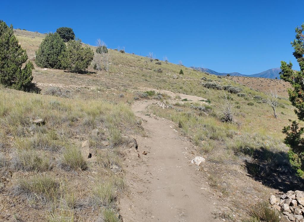
Cowley's is more exposed than the lower trails. The terrain
is mostly grass with scattered sage brush. While there are occasional
groves of trees, this
part of the hill will be toasty in the afternoon.
On the downhill side, you'll pass the entry to two downhill trails, Viking Run and Tufa. These
rejoin Cowley's a little lower on the mountain. Save these for your second
lap around.
There are also a couple of short alternate lines that are slightly more technical. All of these
intersections are well marked with carsonite posts.

Short tricky spot as the trail hits some nasty rocks in a stand of large oak.
 turns 180 d...")
Looking south as we reach the Fault Line fork. Cowley's (on the left) turns 180 degrees here. The Fault Line outgoing trail is just a few feet downhill from the returning trail.
The Fault Line loop forks away from Cowley's Curse as the
loop turns north just below the Bench Road. It rejoins just 20 feet
uphill. This meander is 0.7 miles long. You'll descend about 50 vertical
feet as you head south, then climb back to rejoin Cowley's.
Near the south end of Fault Line, there's a connection to the Bench Road. Use this route if
you're heading for the
Grove Creek
trailhead area, for example to ride the
Bonneville Shoreline Trail
or the
Mahogany Mountain
trail.
A loop that includes Soft Rock, Rose, Gambel, Cowley's, and Fault Line (starting from the Murdock
trailhead and bypassing the DH options) will be 5.1 miles with 500 vertical
feet of overall
climbing. See the GPX track link below.

Back northbound on Fault Line.

View southwest at the top of Viking Run.
Two meanders downhill from the top of Cowley's Curse, the Viking Run DH option forks to the right downhill. It bypasses a bit of
Cowley's, rejoining it further downhill. Although labeled as an expert
route, it's more of an upper-intermediate. At least, in September 2016.
Viking Run is only 1/10th mile long, dropping 50 vertical feet. After the initial plunge, there
are some speed turns, then a traverse to rejoin Cowley's.

Some dippity-turns as Viking Run drops away from an old quarry.

Tufa swoops and curves as we look back uphill to the northeast.
The Tufa downhill route starts just 1/10th mile downhill
from the bottom of Viking Run, as a right fork off Cowley's. This option is also signed as expert but is
more of an experienced intermediate ride. There are a couple of plunges,
but they're not that steep and not very long.
The Tufa trail is 0.3 miles long, dropping about 80 vertical feet before rejoining Cowley's
Curse. It bypasses a 0.6-mile meander of Cowley's loop.

The Rocky Mountain rests on a chunk of Tufa, just before Tufa rejoins Cowley's Curse.

View south as Molly's leaves the Bench Road from Cedar Hills.
Molly's trail runs high on the hillside parallel to the old Bench Road
north of the main Valley Vista trails. It's one mile long, with only
trivial elevation change. Molly's is an easy trail, suitable for
beginners.
Molly's trail can be hard to find if you don't know exactly where it
is. And if you don't find Molly's, you also won't find the top of Cowley's
Cure. To reach Molly's you MUST go onto the Bench Road.
From Cedar Hills: Get on the Bench Road and pedal
south. Just after you pass the last home, veer to the right onto the
singletrack. Keep uphill as the Hard Rock loop forks away downhhill to
your right.
Upper Bench Road: Follow the road downhill 0.4 miles from the top
of Cowley's Curse, around the gully and up the hill. Find Molly's on your
left.
From Cowley's Curse: Stay on Cowley's Curse as it touches
the Bench Road and descend 1.1 miles from the Bench Road through a few
long meanders (past Viking Run and Tufa). As you enter a 180-degree turn,
note the connecting spur to the Bench Road on your right. Go to the road,
keeping straight, and pedal around the gully and up the little hill. At
the top, Molly's forks away to your left.

Typical terrain on Molly's. Not as pretty.

Looking south over the intersection between Molly's and Cowley's Cure.
When northbound on Molly's (coming from Cowley's Curse in the main Valley Vista loop system),
the trail fork for Cowley's Cure is 1/4 mile north of the spot where Molly's
forked away from
the Bench Road. Turn to the left downhill to begin Cowley's Cure.
If you keep to the right, Molly's will take you north and join the Bench Road for a cruise
to Cedar Hills.
Cowley's Cure is an expert-level one-way downhill trail, 1.1
miles long with 150 feet of elevation change. The top is on Molly's Trail
north of the main loop system. (See the instructions above! You won't find
Cowley's Cure unless you know exactly how to get to Molly's.)

Noah hits a bump as we roll into Cowley's Cure. There are a few of these "speed bumps" at the first of the trail -- some of them basically rockpiles -- which serve notice that you're not on a beginner trail any more.

Bruce rolls out of the final corner on the multi-S-turns.
Cowley's Cure descends gently northbound for a bit, rolling over a couple of rockpiles and
bumps. At mile 0.2 from Molly's, Cowley's Cure hits a a series of hugely
banked S turns. There
are even some air opportunities. Some fun here! Cowley's loses most of
its elevation just in
this one short section.
Cowley's Cure now begins a long gently-descending traverse southbound on the hillside. You'll
probably need to pedal occasionally to keep your speed up.
Cowley's Cure ends on the second-to-last turn of the north (downhill) side of Gambel. Keep
right as you join Gambel, and descend down to the Gambel-Rose intersection
to decide on your
next move.

View to the west over Utah Lake and Lake Mountain from upper Cowley's Cure.

Beginning the climb counter-clockwise up Hard Rock as we reach the loop from the connector trail at the bottom.
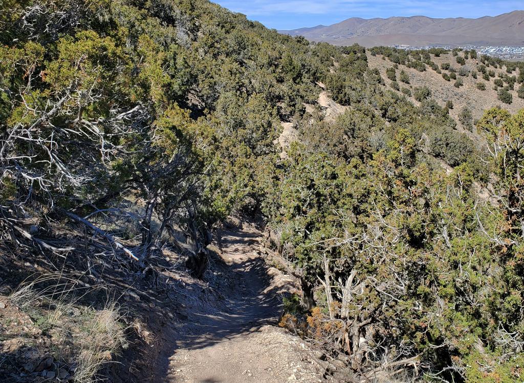
The Hard Rock loop lies at the far north end of the Valley Vista
riding area, sitting between The Pit loop and the Bench Road. Hard Rock is
a directional trail, ridden counterclockwise. You climb the southern side
and descend on the north. It's 0.8 miles around the loop. (Most riders
arrive at Hard Rock via Molly's. If you're climbing The Pit to reach Hard
Rock, it might make more sense to read that section first. The description
of The Pit is just below.)
Hard Rock uses a portion of Molly's trail as the upper
traverse of the loop. After descending from Molly's -- on the
northern side of bottom traverse -- there's a short connector downhill to
The Pit loop. This is your route to the bottom and the Murdock Canal
trail.
Another connecting trail brings uphill traffic from the southern side
of The Pit loop into Hard Rock. You'll use this trail in coming up The Pit
to reach Hard Rock. (See the map.)

Bruce dips through an armored creek-crossing in one of the rare groves of large trees on Hard Rock.

View southwest at Utah Lake in the middle of the climb up Hard Rock.
Hard Rock is an easier-intermediate trail. There's around 100 vertical feet of climbing as
you ascend the 0.3 miles of southern side of the loop between the connector
and Molly's. The
terrain is mostly grass and sage, with a couple of groves of trees. There
are views of the
valley to the west as you climb. As you reach Molly's trail, turn left
onto Molly's to continue
the loop. If you're heading for Cowley's Cure or the stacked loops of
the main Valley Vista
riding area, go to the right on Molly's.
You'll ride north on Molly's for 0.2 miles as you traverse the hillside just below the gravel
Bench Road. As you're approaching the homes of Cedar Hills, Hard Rock
forks away downhill on
your left. (Molly's joins the Bench Road about 50 feet later. This is
your connection to the
trails uphill on Forest Service land.)

Reaching the trail fork at the north end. Here Molly's continues to the Bench Road on the right, while Hard Rock forks to the left downhill.

Bruce rolls the turns on the downhill section of Hard Rock. Pretty smooth stuff, but a little steep for a beginner.
The highest point on Hard Rock is just over 5100 feet elevation. From here you'll drop through
banked turns for about 1/10th mile. As you descend southbound above the
old open-pit mine,
a connector to The Pit forks away on your right. Keep left to continue
the loop.
At the loop's lowest elevation, the connector trail from The Pit will join you on the right.
Remember these are directional trails. There's no turning around or heading
back downhill now.
If your target is The Pit and the Murdock Canal trail, you'll need to
ride almost all the way
around the loop again before you hit the one-way trip to the bottom.

Looking west as we descend Hard Rock.

The Pit singletrack forks away from the common trail (shared with hikers and horsemen) just uphill from the start of the loop.
The Pit is the lower of two stacked loops, lying between
the Murdock Canal trail and the Hard Rock loop. From the Murdock Canal
trail, it's reached via a gravel doubletrack. As the doubletrack hits the
slope, keep to the right. The singletrack on the left is the one-way
return route from The Pit. For a short distance, The Pit shares a common
doubletrack trail with the Hoof and Boot (non-biking) trail. Veer to the
right when the trails split.
The Pit is 0.9 miles around the loop, with 150 vertical feet of climbing on the southern side
of the loop as you ride counter-clockwise. The rate of climb is fairly
mellow, with an occasional
downhill coast in the middle of climbing. The surface is smooth and suitable
for experienced
beginners.

Climbing west through a grove of gambel oak.

There are several spots where you'll lose a tiny bit of elevation during the climb.
The climbing portion of The Pit is 0.5 miles. At mile 0.4, a connector trail to the Hard Rock
loop forks away to the right. (See above for a description of Hard Rock.)
After this point,
if you head left on The Pit you're committed to completing the loop. You'll
need to go all
the way around the loop and climb back uphill if you intend to hit Hard
Rock.
At the trail fork at mile 0.4, keep left and climb on above the old open-pit mine. Near the
ride's highest point at mile 0.5, a one-way connector from uphill joins
on the right. Keep
straight and drop into the mine area.

Looking southwest downhill from a meander in the climb. Most turns are adequately wide and easy to roll, but there are a couple that might be tricky for beginners.

Bruce cruises past an outcrop of tufa -- a sedimentary rock laid down in old Lake Bonneville.
There are two alternate lines within the mine, marked by carsonite posts. Each of these short
alternates rejoins after around 200 feet. The alternates are designed
to be a little more difficult
than the main route, but there's nothing spooky or tricky here.
The mine was a source of clay during pioneer times, used for construction in the valley below.
At the bottom of the loop, keep left to head back uphill, or veer right onto the doubletrack
to head down to the Murdock Canal trail.

Heading down into the Pit. The post in the middle of the photo marks an alternate line that drops to a table jump.

Closeup of tufa. This rock formed at the bottom of prehistoric Lake Bonneville. It's a mash-up of mud, lime, and bits of critters. Note the worm burrows.

Valley Vista main trail system (phase 1)
Map shows phase 1 trails (2016) onlyGetting there:
From the Canyon Road (100 East Street) in Pleasant Grove, turn east --
towards the mountains -- on 1100 North. When you pass 600 East, watch for
the entry to the Wade Spring Murdock Canal
Trailhead on your left, just before the paved trail crosses the road. To
start the ride, you can exit the parking area on the north by the big
white pipe.
GPS Track files (right-click and "Save as..."):
Loop ride hitting all five main loops:
Download
track
Area file, with each trail as individual track:
Download
Print maps:
Open
this map in new window
Open
map below
Bathroom: Wade Spring trailhead
Water: All Murdock trailheads
Camping: No
Bike services: UtahMountainBiking
in Lehi.
Phase 2 (2019 expansion) trails!The Foothill trail is easily found. It starts at the main trail kiosk.
As you approach the kiosk from the Murdock Canal trail, keep to the left
and northbound and you're on Foothill.
The north end of Foothill can be reached directly via the Murdock Canal
Trail. When riding from the north, it's on the left (uphill) side 0.9
miles from the Murdock Canal Canal Road (highway 146) trailhead. To reach the north end of Foothill from
Wade Springs via Murdock, go one mile north on the paved trail.
Molly's trail is reached via the gravel bench road. You can take the
bench road south from Cedar Hills and veer right onto Molly's as you pass the
last home. Or, from the Grove Creek trailhead, you can take the bench road
north. Pass the Cowley's Curse entry at mile 0.5. Now keep left downhill
as the road splits and descends. A spur joins on your left, going to
Cowley's Curse, but stay on the road. Go around the ravine and climb
uphill. At the top, Molly's forks away to the right.Cowley's Cure is 1/4
mile north on Molly's. (See above for information on connecting to Molly's
within the trail system.)
 trails")
Expanded middle Valley Vista (phase 2) trails
 Valley Vista trails")
Phase 3 (northern) Valley Vista trails
Valley Vista Phase 3 trails (2021)The access trail to the Pit Loop and Hard Rock Loop is located 1/4 mile
southeast of the Murdock Canal Canyon Road trailhead. Take the broad
doubletrack gravel trail that leaves the paved path to the left, then
after 1/10th mile turn left uphill. At the base of the hill, keep right to
enter the one-way loop trail The Pit.
To reach these trails from the main Valley Vista area, climb to the top
of Cowley's Curse, then catch the Bench Road northbound. Divert onto
Molly's singletrack after going around the big gulch. Pass Cowley's Cure
by keeping right and uphill. When Hard Rock joins on the left, stay on
Molly's (Hard Rock is one-way), then when you reach the north end of the
Hard Rock loop, drop downhill to the left just before Molly's ends on the
Bench Road.


 turns 180 d...")


 trails")
 Valley Vista trails")