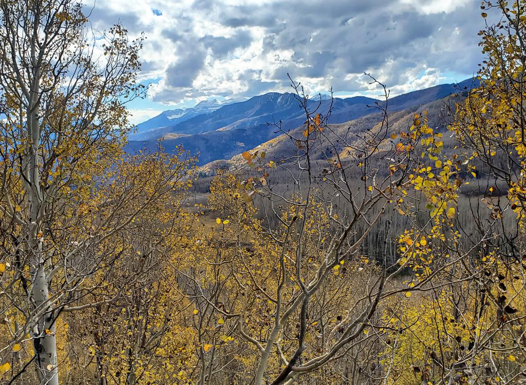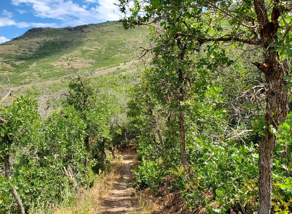
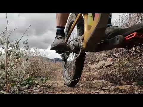
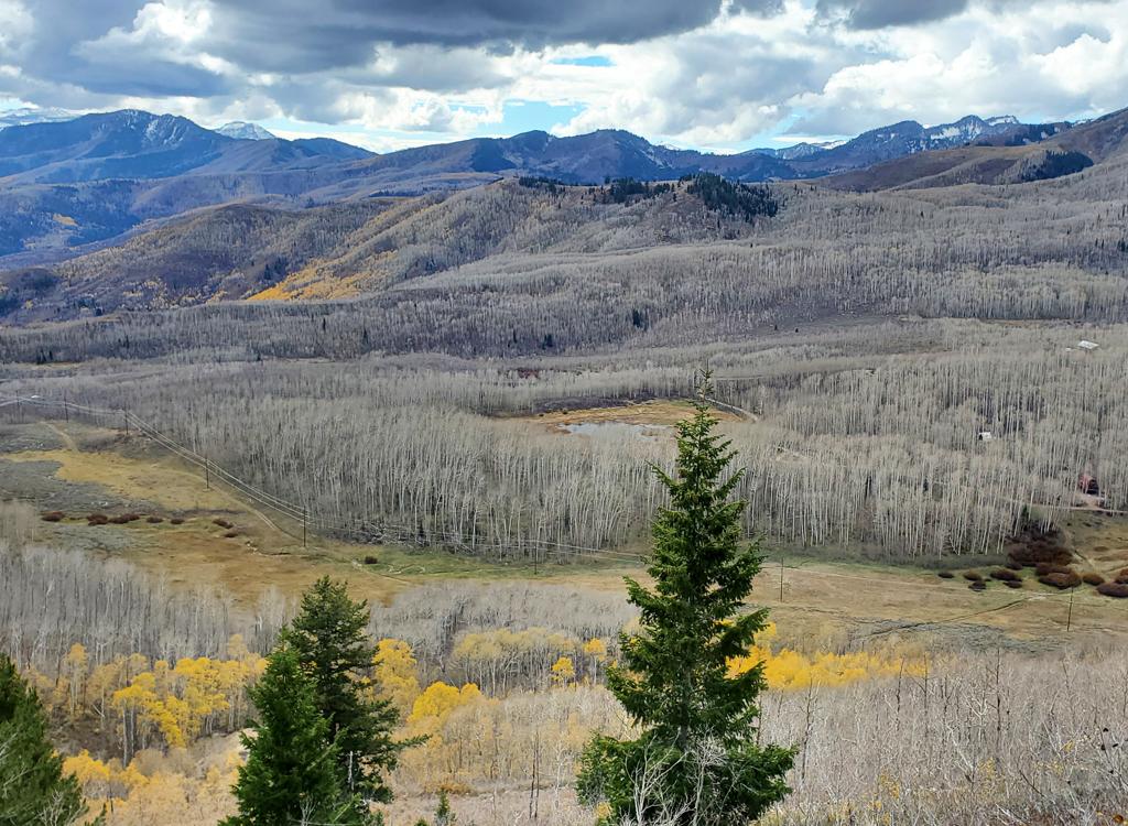
View of Pine Canyon from the trail.
Tricky Pickle and Tug of War

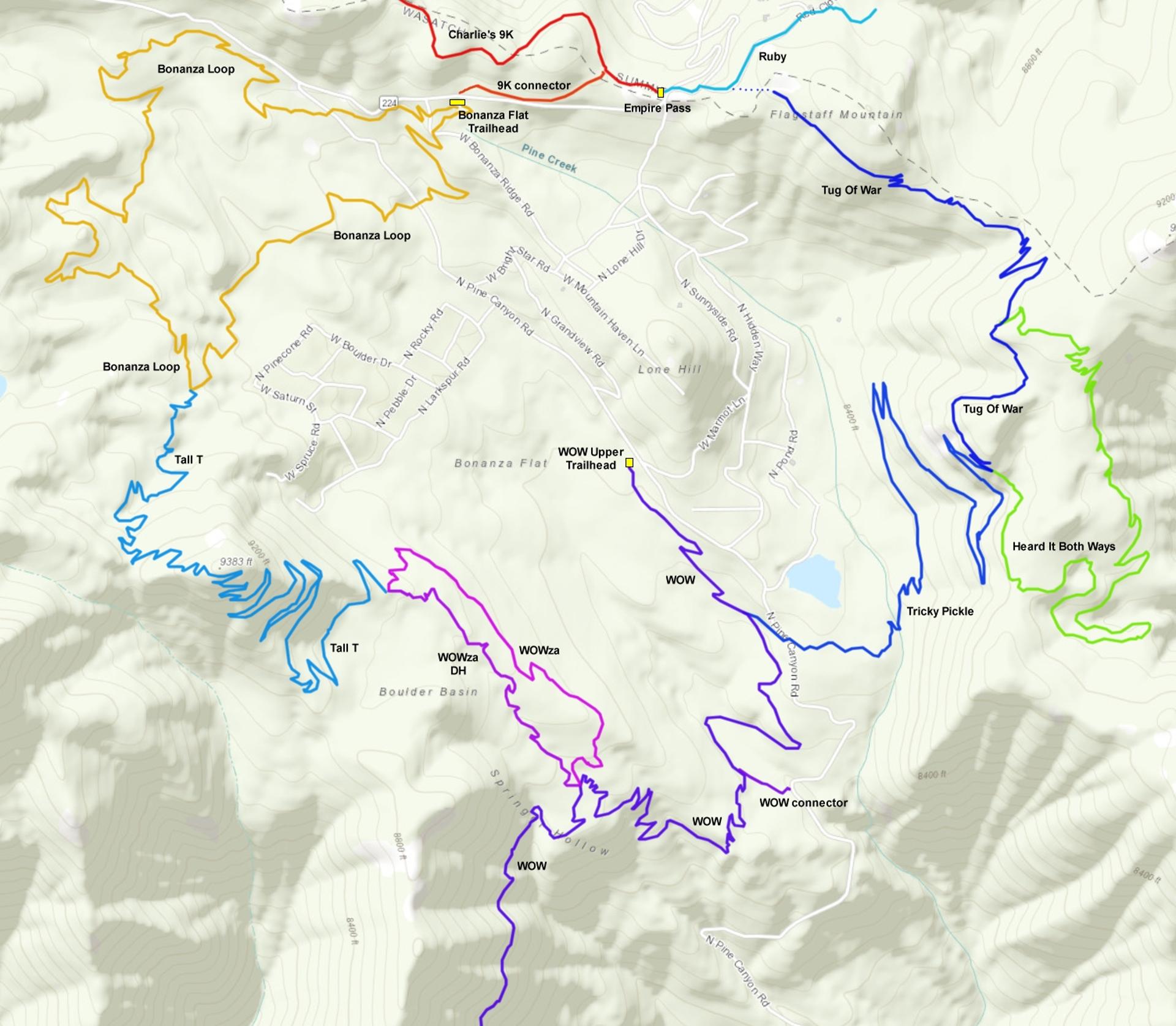
Tricky Pickle and Tug of War lie on the eastern side of upper Pine Canyon (above Midway and across from Park City, east of Guardsman Pass). When taken together, they form a route from the WOW trail to Empire Pass. These trails can be used for loop rides in either direction, and are also nice as out-and-backs.

At the time of this review (October 20, 2026), Tricky Pickle has been re-opened after a summer closure, with two new bridges in place. The Heard It Both Ways trail has been closed for two seasons due to resort expansion and construction, and its future status is unclear. I will mention it only briefly here to describe the trail forks.

The top elevation of this route is 9050 feet on Tug of War, with a low of 8200 where the bottom of Tricky Pickle reaches WOW. The expected riding season will be from late June or early July through mid-October. In planning your ride, remember that the Bonanza Flat conservation area (west of the Pine Canyon road)  is closed to bikes after September 30 and does not re-open until July 1.

The loop ride described below uses BLT east of the Pine Canyon road, as this section of the Bonanza Loop does not close.
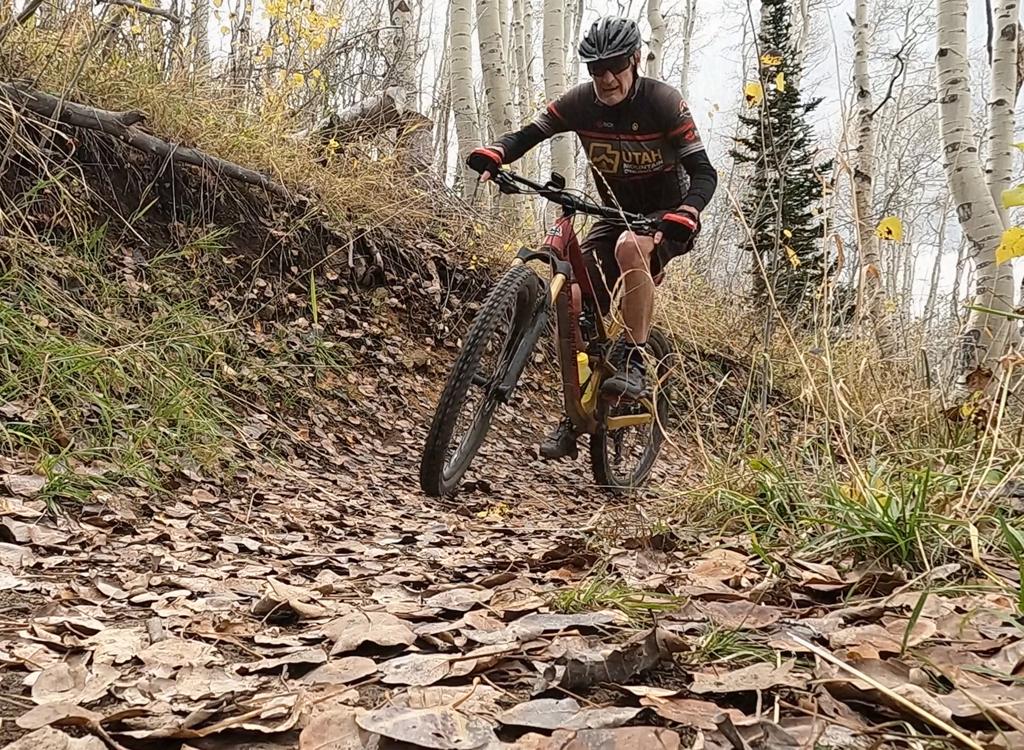
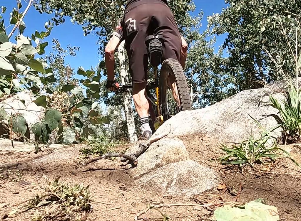
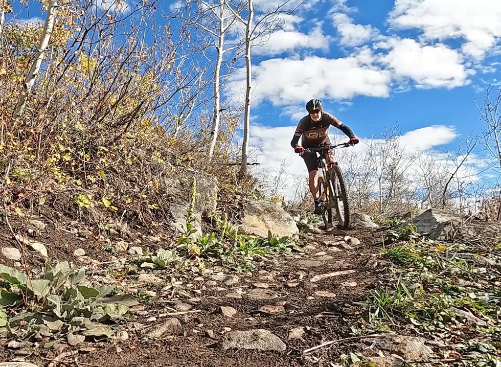
Bruce rolls a climbing turn on Tug of War.
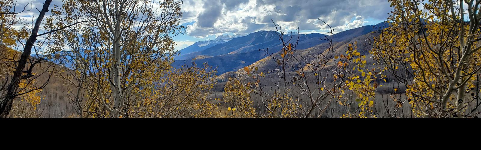
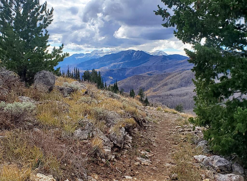
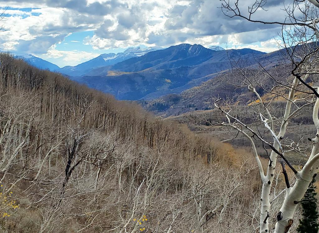
Looking south toward Timpanogos from Tug of War.
Many riders will use these trails as a climbing route to Empire Pass, followed by a ride around Bonanza then a trip over Tall T and back to the upper WOW trailhead. This is an epic and beautiful ride.

Hero climbers who've come up WOW may fork off onto Tricky Pickle for the last part of the climb to Empire Pass, as it's a more direct route than the trip over Tall T. 

The trails ride well in either direction, although the turns on Tricky Pickle feel better in the uphill direction.

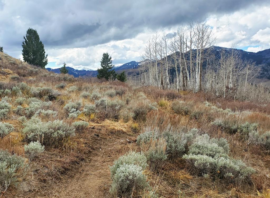
The terrain alternates between rolling sage flats, aspen groves, and mature fir forest. Of the two trails, Tug of War offers more interesting and variable terrain. Tug of War also features a modest amount of climbing as well as descending in either direction.

In contrast, Tricky Pickle mostly consists of mildly down-sloping traverses between tight turns, hugging a steep hillside as it zigzags down to the bottom of the valley above Pine Creek. Both trails offer some incredible views of the surrounding mountains.
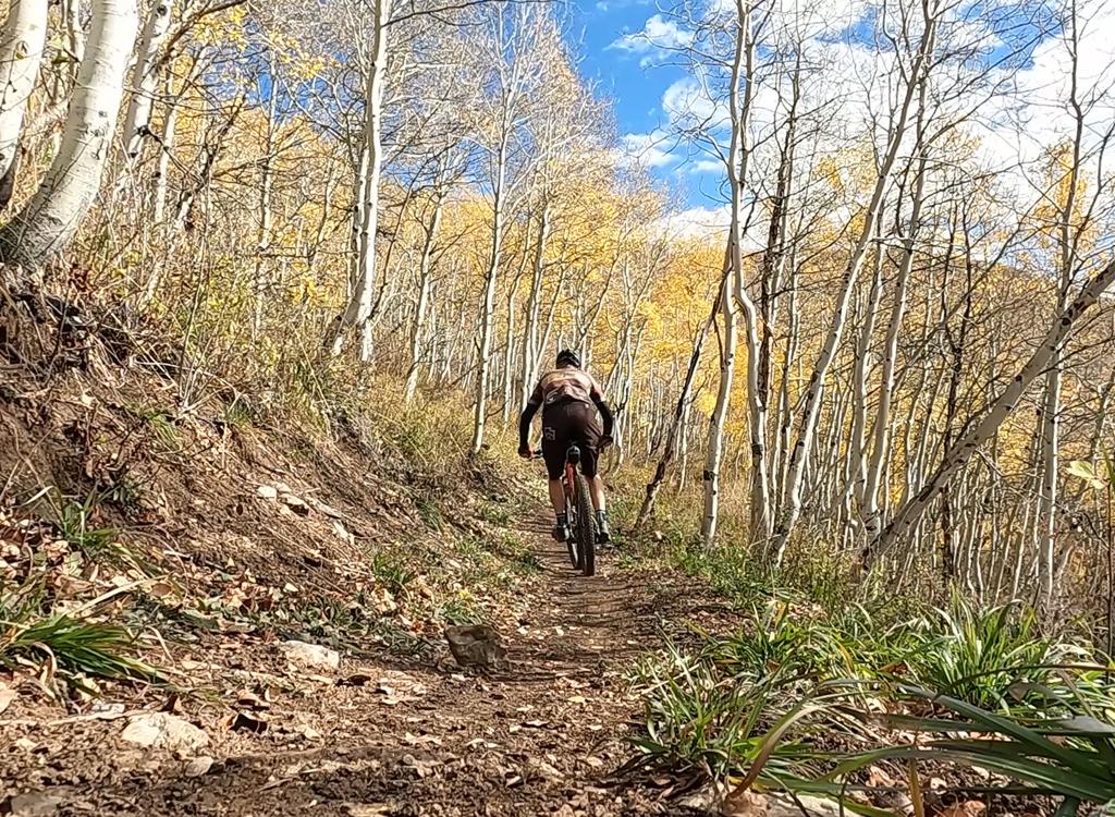
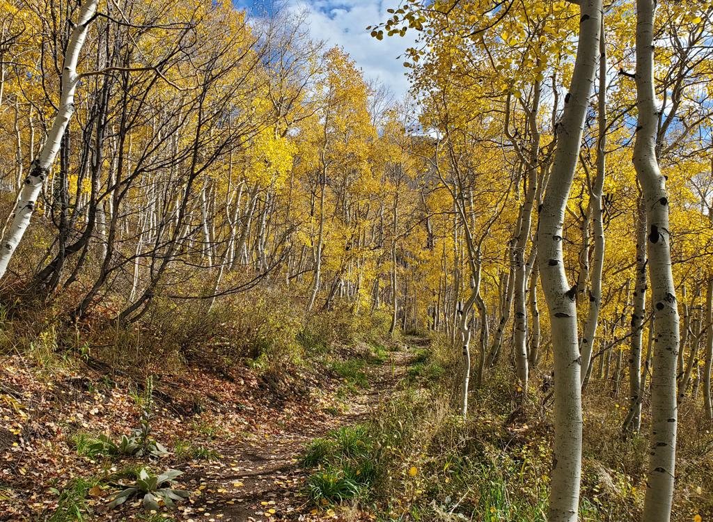
Bruce descends Tricky Pickle, finding aspen leaves       still on the trees at this lower elevation.
Bruce descends Tricky Pickle, finding aspen leaves still on the trees at this lower elevation.
Trailheads
View uphill, seen as you'd begin a clockwise loop       ride (descending both trails).
View uphill, seen as you'd begin a clockwise loop ride (descending both trails).
Upper WOW (SR 222) trailhead
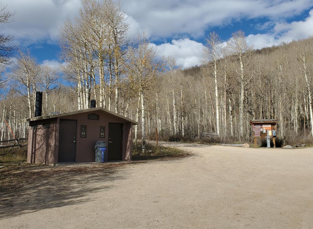
Drive to Pine Canyon (see below) then continue 5 miles past the lower trailhead and turn left at the sign. The upper WOW trailhead is the closest parking to Tall T, with 2.7 miles of singletrack to reach the bottom of Wowza and another 1.2 to Tall T. This large parking area is five miles up the Pine Canyon Road from the lower WOW parking (see below). It includes a toilet building.

For those who want go southbound through Bonanza and Tall T to Wowza, it's around 1.3 miles by pavement from this parking lot to where the upper side of the Bonanza Loop crosses the Pine Canyon Road.

Note that this trailhead requires you to pay the Wasatch Mountain State Park entry fee or have a Utah state parks pass. The entry to WOW is on the downhill side of the parking area, at a break in the log fence.
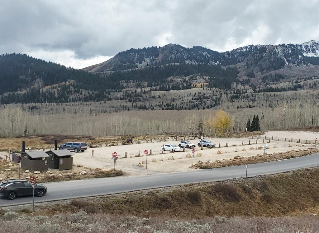
View of Bonanza Flat parking from the connector       trail. Plenty of room here, but it will cost you.
View of Bonanza Flat parking from the connector trail. Plenty of room here, but it will cost you.
Bonanza Flat trailhead
Most riders will start at the Bonanza Flat trailhead on Guardsman Road, 1/2 mile west of Empire Pass and 0.4 miles west of the Pine Canyon road intersection with the Guardsman Road. From here, you can go to the connector trail (uphill across the road) and go to Empire Pass. See the navigation instructions to Tug of War (below).

In 2026, there's now a ridiculously expensive charge to park at this trailhead. It's $5 per hour on weekdays and $8 per hour weekends. So unless you have a full carload of bikers to share the cost, find someplace else to park and pedal into the area. Or take the shuttle bus.

Note! If this trailhead is full, do NOT park along the road. You'll likely get a ticket. Find another trailhead and pedal to the loop.

Heading out from the Empire Pass parking area on the       westbound doubletrack (counterclockwise ride).
Heading out from the Empire Pass parking area on the westbound doubletrack (counterclockwise ride).
Empire Pass
The trail can be reached through the Empire Pass parking area. This is a very small trailhead, and will usually be full on weekends. (And in late 2026, there's ongoing construction that prevents parking here.) To reach Tug of War, cross the highway veering slightly to the right and follow the doubletrack behind the gate.

There's also parking one mile downhill where the Midmountain Trail crosses the Empire Pass road. You can climb Corvair, Tour des Suds, or Boulder to Empire Pass, then descend the 9K connector to Bonanza Flat.
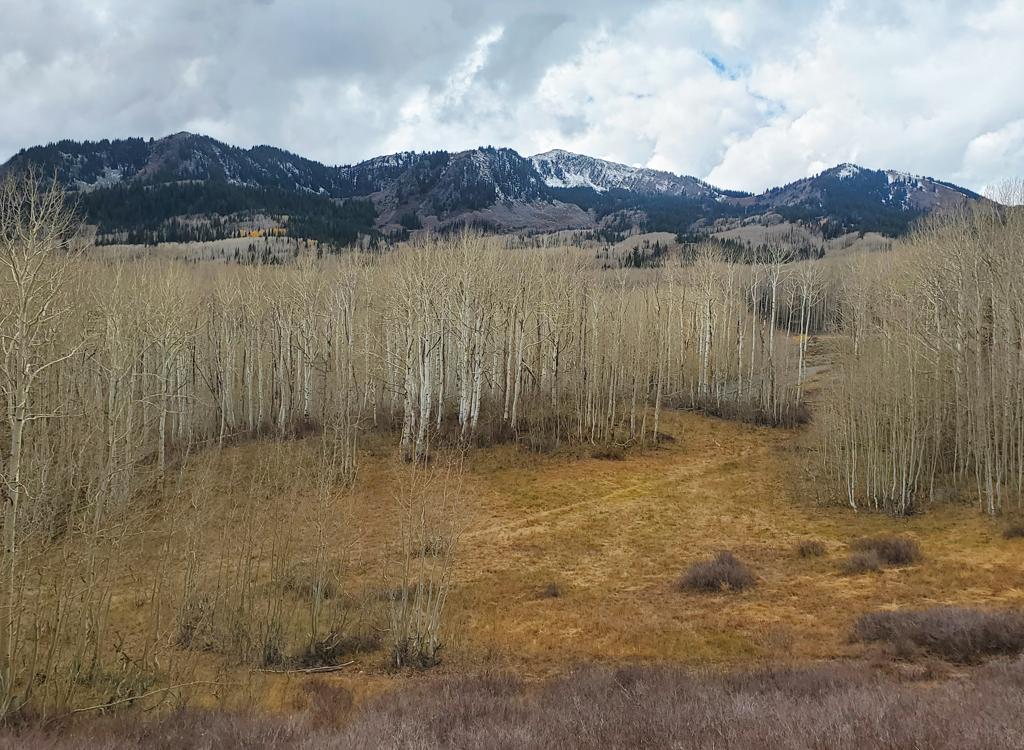
Directions, Clockwise Loop Route to the top of Tug of War
View to the west on a clockwise ride.
A climb up Tricky Pickle and Tug of War requires little explanation. Just ride WOW 0.6 miles from the upper trailhead then fork uphill on Tricky Pickle. Done. But to do a loop ride that descends these trails requires a bit of explanation. So here goes.

Park in the upper WOW lot. Exit the parking area on the entry road and turn left uphill on the highway. Pedal 0.7 miles, and just after the border sign for the wildlife management area, turn right on BLT. (BLT is considered part of the Bonanza Loop, but the wildlife conservation zone is WEST of the road. So BLT is open to riding at any time.)

Climb BLT gently uphill for 0.7 miles. (Yes you could just ride the Pine Canyon road up to the Guardsman road, then east to Empire Pass. But why on earth would you want to do that?) As you reach the Bonanza trailhead, curve around to the right and find the singletrack next to the toilet. Pedal up to the road and cross it.

On the far side of the road, take the singletrack up to the broad gravel path and take a sharp right turn to head east. Follow this trail past the forks for Charlie's 9K and Corvair. Pass through the parking zone and cross the road, veering slightly to the right toward the gate and gravel road.
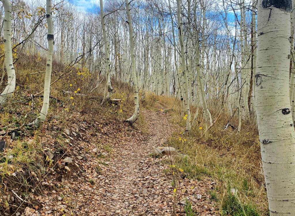
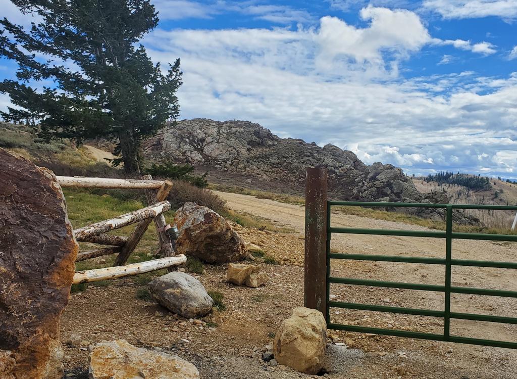
Trail view on BLT, clockwise loop.
Here's the bike-around path at the metal gate at       Empire Pass. This is the place.
Here's the bike-around path at the metal gate at Empire Pass. This is the place.
Ignore the road that forks downhill immediately past the gate and pedal uphill east for 0.2 miles.

Also stay away from the construction zone to the left.

As the larger road turns a bit to the right, there's a doubletrack on the left. That's your target. (There are no markers in fall 2026).

Pedal uphill for around 1/10th mile. Just past the trees, there's an unmarked singletrack on your right. That's the top of Tug of War.

From here, just stay on the main trail, which will turn into Tricky Pickle, until you hit the Pine Canyon road. Cross and drop down to WOW, and keep right to climb back to the upper WOW trailhead.
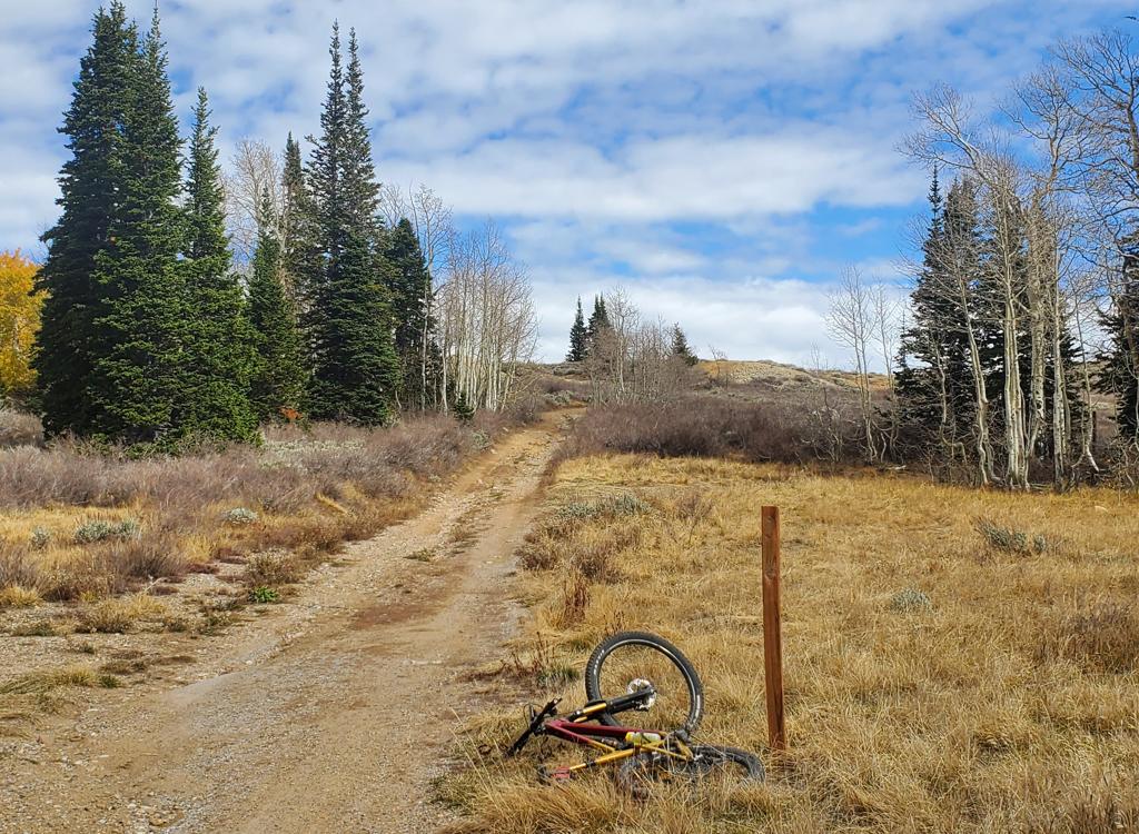
Here's the final stretch of doubletrack as it appears       in 2026. (The signpost is empty.)
Here's the final stretch of doubletrack as it appears in 2026. (The signpost is empty.)
Trail details!
Tricky Pickle
View looking southwest from Tricky Pickle.
Tricky Pickle is 2.5 miles in length, with 700 feet of elevation change. The top elevation is 8900 feet where the top of Tricky Pickle meets the bottom of Tug of War. The bottom is on WOW, 0.6 miles down-canyon from the upper WOW trailhead.

In 2026, Tricky Pickle is not labeled on any trail-post. At the highway, posts on Tricky Pickle say "WOW" as you see them from uphill. So keep in mind that Tricky Pickle is marked with the confusing tradition of "destination you're headed toward" rather than "the trail you're currently riding." (Appeal to trail-post people: Please, please never post a "destination" unless you also label the sign with the name of the current trail. And always include an arrow next to the "destination" sticker. Seriously. This type of trail sign messes people up. /rant)
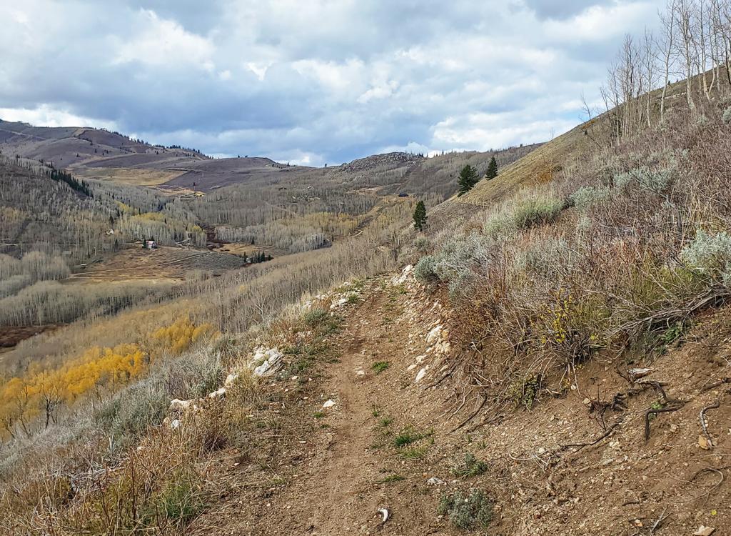
When done as a climbing route, Tricky Pickle forks away from WOW 0.6 miles below the upper trailhead, with the trail fork favoring riders who are descending down-canyon as they arrive. The cruising quickly becomes a steep and somewhat rocky climb as it approaches the road 1/10th mile later. Pop across the road, and the trail settles into a mellow and smooth path. You're already past the "technical" spot.
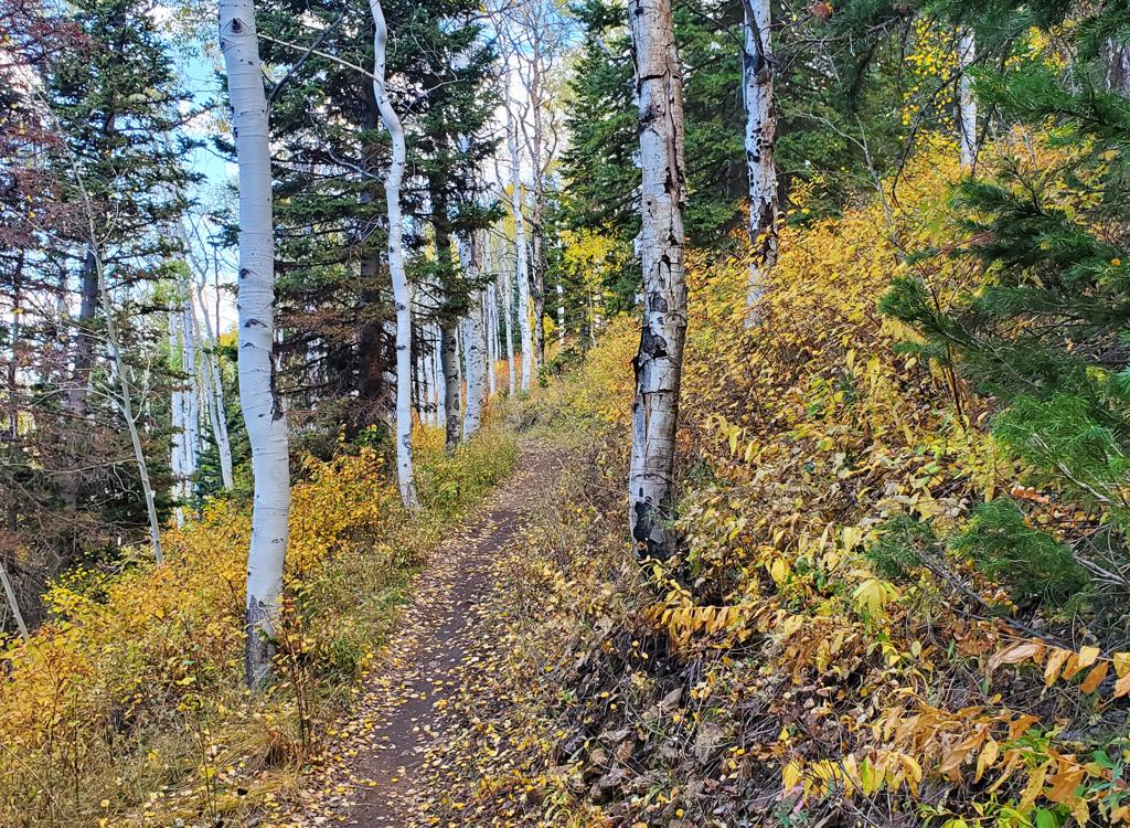
View northwest on upper Tricky Pickle, between the       fir grove and the aspens.
View northwest on upper Tricky Pickle, between the fir grove and the aspens.
Tricky Pickle passes through a glorious grove of fall       aspens.
Tricky Pickle passes through a glorious grove of fall aspens.
The Midway Reservoir lies to your left at this point in the climb, but you won't see it through the trees. (You'll be able to spot it once you get further up the hill.)

Tricky Pickle will descend a little until you cross the bridge over Pine Creek. At this point, the climb will settle into a back-and-forth rhythm, with easy gentle slightly-uphill traverses separated by tight turns.

As you enter a large fir forest heading east, you'll see a trail branching to the right. This is Heard It Both Ways, and in 2026 it's closed. Keep left and uphill, and you're now continuing the climb on Tug of War.
In the downhill direction, you'll hit Tricky Pickle after descending Tug of War. The transition occurs at mile 2 from the doubletrack at Empire Pass, just after Tug of War makes a few zigzags through a fir forest on a modestly steep side-slope. To your left downhill, you'll see a trail coming in to join. This spot is where Tug of War becomes Tricky Pickle. (Again, the trail on the left is Heard It Both Ways. Note that, in 2026, it is closed for construction and its future status is unclear.)
Looking toward Timpanogos and Cascade Mountain, with       Provo Canyon between them.
Looking toward Timpanogos and Cascade Mountain, with Provo Canyon between them.
Bruce drops away from the highway on a downhill ride       of Tricky Pickle.
Bruce drops away from the highway on a downhill ride of Tricky Pickle.
When you hit the Pine Canyon road, cross over to the descending trail, marked with a carsonite post labeled "WOW." No, you're not on WOW, you're just headed that way. Now you'll drop through the most-technical section of the entire ride for about 50 feet. But unless you're a rank beginner, it's still easy and very short.

As the trail reaches WOW 1/10th mile from the road, just keep right and uphill. The parking lot is 0.6 miles away.
Tug Of War
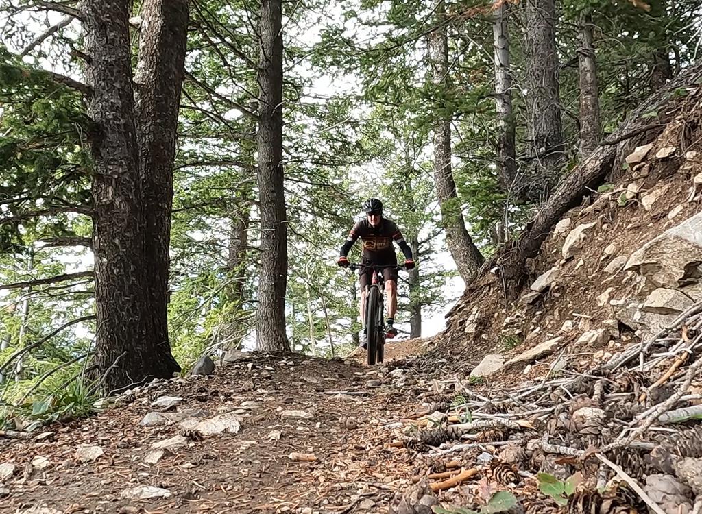
Bruce rolls through the fir forest at the bottom end       of Tug of War.
Bruce rolls through the fir forest at the bottom end of Tug of War.
Tug of War is the uphill half of the route. It's 2.0 miles in length. There's a hill in the middle of the trail (whether riding Tug of War uphill or down). So in the downhill direction, you'll descend 350 vertical but also climb 200 feet.

The surface is generally smooth, with no significant technical challenges. The pitch is gentle whether climbing or descending. There are no technical spots.

Finding the top of Tug of War requires carefully following navigation instructions -- or using a GPS-enabled navigation app to blunder your way through. Further complicating navigation is the construction just north of the route you'll ride. It may affect your path in the future.

First, arrive at Empire Pass as above. From the parking area (currently filled with construction machinery), go a bit to the right as you cross the paved road, aiming for the metal gate at the gravel road. Go around the gate and go east. (Ignore the road branching to the right downhill just after the gate.)
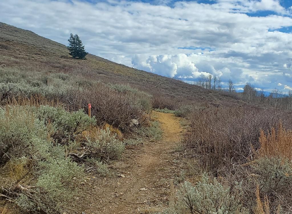
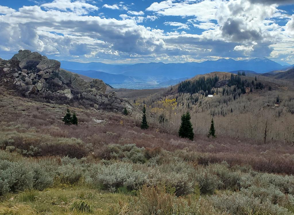
In the downhill direction, Tug of War begins with a       long traverse through low brush and sage.
In the downhill direction, Tug of War begins with a long traverse through low brush and sage.
Looking south from the gravel road. Nice views.
The gravel road will aim gently uphill. At mile 0.2, it will begin a slight turn to the right, and you'll see a smaller doubletrack on the left. This is the way. In 2026, there was a post here, but nothing on it. Go about 100 yards uphill and find singletrack (unmarked) on your right. This is Tug of War.
In the downhill direction, Tug of War starts out with a rolling traverse through sage and low brush. You'll make some turns through an aspen grove then you're back in the scrub slopes. You'll see signs of construction from time to time, as Tug of War skirts the work area.

At mile 0.8, as the trail drops into a shallow valley, you'll enter a thick aspen forest. Here you'll find (surprise!) that a zigzag uphill begins. After a series of turns, you're back above 9000 feet elevation and are treated to some impressive views.
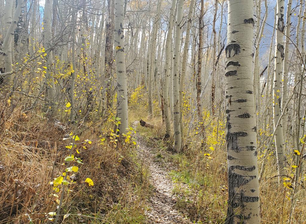
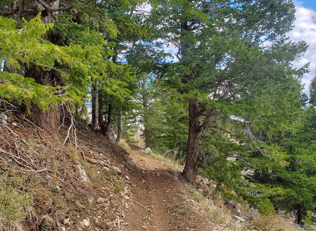
We've hit the grove of aspen and will now climb       through a few turns.
We've hit the grove of aspen and will now climb through a few turns.
After another traverse in sage and low scrub, we're       descending through fir forest.
After another traverse in sage and low scrub, we're descending through fir forest.
Tug of War drops into a fir forest around mile 1.8, where you'll make 4 traverses separated by tight turns. At the edge of the forest, you'll notice a trail joining on your left downhill. In 2026 it's marked closed, with a rockpile to keep you away. This is Heard It Both Ways. At this point, you continue downhill on Tricky Pickle.
Heard It Both Ways
Trail view on the upper end of Heard It Both Ways.
Heard It Both Ways has been closed by construction, and it's unclear to me whether it will re-open. Most of the trail runs through an open area that's fairly flat (compared to surrounding terrain) and is served by a long-standing dirt road, so this stretch was an obvious target for development.
The top of Heard It Both Ways is at mile 1.4 from the top of Tug of War (as measured from the spot where the singletrack forks away from doubletrack). You're passing through a sage meadow, with a big lodge under construction to the north.

The bottom of Heard It Both Ways is at the spot where Tug of War turns into Tricky Pickle. When climbing Tricky Pickle, it will the right fork at mile 2.5 from WOW.
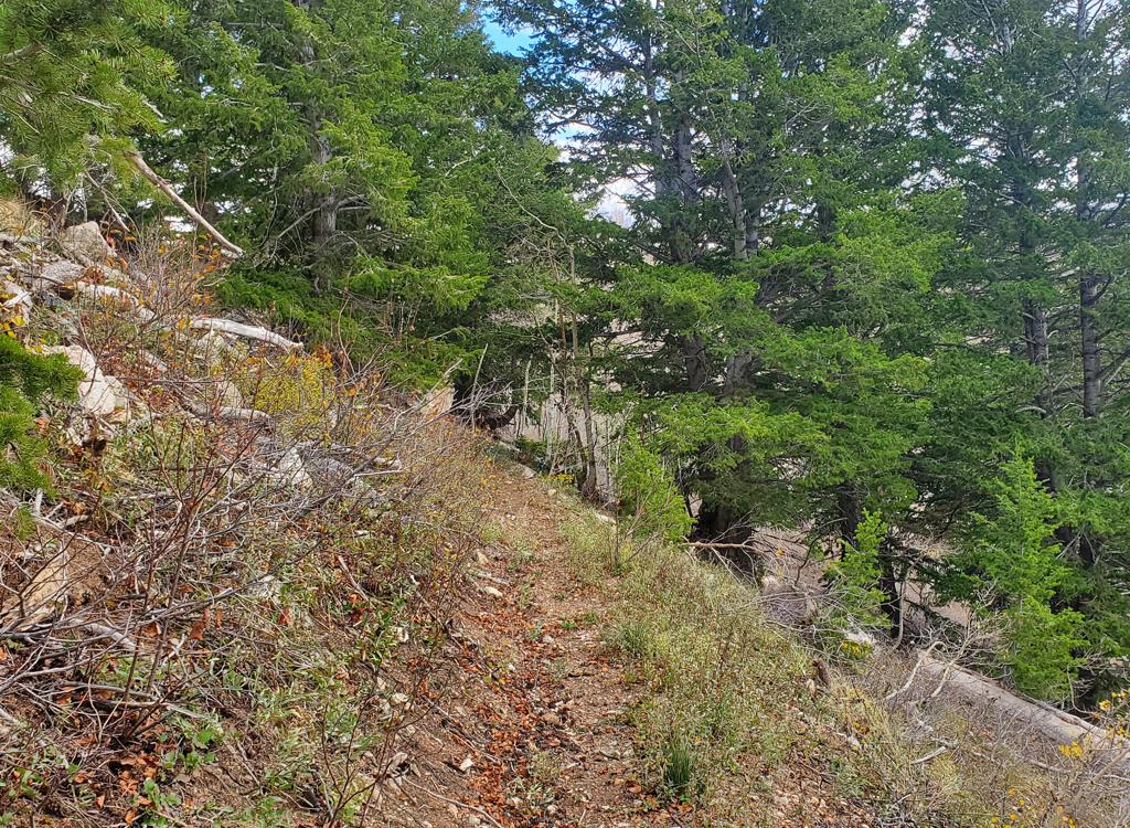
Lower side of the trail, littered with signs of non-use.

Downhill on Tug of War and Tricky Pickle

[Back to video list ]
Bottom Line
Tug       of War has many areas of sage slopes. Consider them "opportunities       for epic views."
Tug of War has many areas of sage slopes. Consider them "opportunities for epic views."
This route combining Tricky Pickle and Tug of War has become quickly popular, and for good reason. It opens up new loop ride opportunities in both directions, with no significant technical challenges and non-exhausting riding (for most of us). The views are impressive, and the elevation keeps temperatures pleasant.

Invalid block structure or missing enabled_block_type.