

Tilted Mesa
Tilted Mesa lies 10 miles east of Kanab. The BLM is partnering with Kanab's Cycling Club to develop around 16 miles of trail here. Most of the trails are now complete and well-marked, and a formal trailhead has been finished.
Tilted Mesa has three connected mesas. From east to west, these are called First, Second, Third Mesa. The trails are on the First and Second Mesas. Each mesa offers its own loops and options, with interconnections between them.


Trail signs have been completed as each trail has come on-line. So once you understand the system, navigation isn't complicated. At the time of my latest ride (April 2, 2023), the Chocolate Canyon loop was not finished but I walked it to get the GPS track.
Getting to the trails

Take US-89 eastbound from Kanab. Drive 9.3 miles from the traffic light where US-89 and US-89A split apart. Pass the paved Johnson Canyon Road on your left. Now go another 0.7 miles, cross Johnson Wash, and add another 1/10th mile. At exactly mile 10.1, turn to the right on a dirt road. Drive south for one mile and turn to the left at the dirt road fork. 100 yards after the turn, turn uphill to the right on a small dirt road. Cross the cattleguard to a large fenced parking circle.

To the left as you enter the parking circle is a bathroom. The entry to the Morning Glory trail is at the far left as it climb the hill behind the bathroom.

The entry to the Western Legend trail is on the right as you enter the parking lot from the road, just past the cattleguard.
The Wash Trail entry is a step-over at the far end of the parking lot.
General trail information

The elevation of the trailhead is 5100 feet, with the top of the loops at 5450. The usual riding season will be late April through November. Although there's a lot of rock surface, portions of the trails will pass over dirt and clay. So if the trailhead area is muddy, do not ride.
The only kid- and beginner-level trail here is the Wash Trail (an old doubletrack found at the far end of the parking circle). The riding ranges from easier-intermediate (western Morning Glory) to expert (Western Legend) to high-expert (The Matrix). Most trails here require at least an advanced-intermediate skill set and good riding strength.


The "tilt" of Tilted Mesa follows the Shinarump conglomerate layer of the Chinle Formation, which tends to resist erosion. Below the Shinarump are colorful clays of the Chinle and Moenkopi formations, for example in Chocolate Canyon. Because some trails lie in the clay layer, there's a good variety of riding experiences and surfaces. Note that the clay in Chocolate Canyon doesn't dry quickly, so riding the Chocolate Canyon and upper Middle Earth trails would be unwise after rainstorms or in early spring.
All the rock layers tilt gradually upward from north to south. We're on the edge of the regional geologic uplift for the Grand Canyon. (The Grand Canyon did not "dig a hole." Instead, the ground rose up while the river stayed in place.) The Kiabab Limestone, which lies under Fredonia at 5000 feet elevation, has been uplifted to 8000 feet at the edge of the Grand Canyon. You're riding on the slope of that uplift.


For those who ride the mesa trails around Hurricane (Gooseberry, Guacamole, Little Creek, Wire Mesa), the terrain will seem very familiar. The trails wind through a forest of juniper, pinion, and gooseberry. Pebbles and petrified wood erode out of the Shinarump conglomerate and lie strewn around the surface.
The main difference from the mesa trails to the west is that Tilted Mesa is, well, tilted. So instead of rolling up and down, you climb when you're headed south, and descend when you're going north.
The Shinarump conglomerate marks the division between the Triassic Era and the Jurassic. It was deposited around 220 million years ago. While southern Utah was under the ocean, the Kiabab Limestone formed. On top of this are the clay deposits of the Moenkopi formation, laid down when the region was a huge mud-flat. The Chinle formation is a transition, with alternating mud and sandstone deposits as western Utah began to rise up. The Shinarump layer formed from sand and pebbles washing down from those mountains to the west. The presence of petrified wood tells us that the area had forests. Meantime, mammal-like reptiles gave way to dinosaurs after the Triassic extinction.

First Mesa
Morning Glory, Middle Earth, Chocolate Canyon, Low Road
Morning Glory Loop

The Morning Glory Loop is a lariat ride of 3 miles on First Mesa. The common stem is 1/4 mile long, and the loop is 2.5 miles around. The loop has 400 vertical feet of climbing. Morning Glory one of the easier rides in the area, ranked intermediate in skill requirement. If you're not a particularly strong intermediate rider, you might find that Morning Glory rides easiest in the counterclockwise direction (up Morning Glory West and down Morning Glory East).
Morning Glory West has connections to the top and bottom of the Middle Earth trail (as an alternate more-technical descent bypassing most of Morning Glory West). Near the top of the Morning Glory Loop, the Low Road trail offers a connection to Western Legend on Second Mesa.
The ride begins at the toilet area. The trail is to the left as you face the bathroom, circling around the hillside behind.


When the singletrack joins an old jeep road at mile 0.2, continue uphill for 100 yards. The trail will then split into the loop. The right-hand selection (Morning Glory West, counterclockwise loop) is a bit easier. The western side also offers the quickest connections to other trails (Middle Earth to Chocolate Canyon and Western Legend).
On the eastern side of Morning Glory, there's a short alternate expert line called Morning "Gory."
When making a clockwise ride, as you descend on Morning Glory West, the first trail fork 150 yards from the top is "Low Road" and is your connection to Western Legend. Turn right to stay on Morning Glory. The next fork at mile 0.2 is Middle Earth. Again stay right. Middle Earth will rejoin western Morning Glory just before it joins eastern Morning Glory at the stem of the loop.

Middle Earth

Middle Earth is 1.2 miles long. It has a very different "feel" from the mesa loops. There's 0.7 miles of brown mudstone and clay from upper Morning Glory West to the Chocolate Canyon fork. This is followed by 1/2 mile of yellow rock and sandy soil down to lower Morning Glory West.
Middle Earth is expert-level riding both uphill and down. Most riders will choose to descend it. There's 200 feet of elevation change over the 0.7 miles of upper Middle Earth, with a bit of up-and-down riding.
From its origin on upper Morning Glory West, Middle Earth descends into brown clay layers on the east side of the ravine called Chocolate Canyon. Here the eastern side of the Chocolate Canyon loop will join on your left at mile 0.2. At 0.3 the trail turns hard to the right, while the Chocolate DH trail keeps straight and drops down to the Chocolate Canyon trail.
Middle Earth then connects to the bottom of the Chocolate Canyon trail at mile 0.7 downhill from Morning Glory West. Make a hard right turn here if you're continuing on Middle Earth.


Middle Earth continues 1/2 mile downhill from the Chocolate Canyon trail fork, joining Morning Glory West about 1/10th mile above the loop trail fork. If your objective is to complete another loop, you can head uphill on Morning Glory West by forking to the right, or you can fork left to continue downhill to the Morning Glory loop fork and the trailhead.
Chocolate Canyon

Chocolate Canyon separates the shinarump caprock of the First and Second Mesas of Tilted Mesa. You can pass between these two mesas on Western Legend, or via the Chocolate Canyon loop.
The bottom of Chocolate Canyon is on Middle Earth, 0.7 miles from the top. It extends 0.6 miles to the ridgeline, where if creates a 4-way intersection with Western Legend, Low Road, and the Chocolate Connector back to Middle Earth.
Chocolate Canyon forms a full loop when you include that short (400 foot) portion of Middle Earth. The loop is exactly one mile. At the top of the loop on the saddle between First and Second Mesas, Chocolate Canyon meets the eastern end of Western Legend and the western end of Low Road.
The Chocolate Canyon DH runs between Middle Earth and lower Chocolate Canyon. This DH is 0.3 miles long, dropping 100 vertical feet.

Second Mesa
Western Legend, Oh My Heck, Shinabump, Boom Chicken, The Matrix
Western Legend

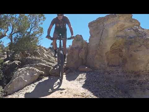
Western Legend is an expert-level trail on the western edge of Tilted Mesa. It extends from bottom of the mesa to the far southern side above Chocolate Canyon. Then across the saddle eastbound to reach Morning Glory.
To ride Western Legend, pedal up the doubletrack from temporary parking and fork to the right. Cross the sagebrush flat to the western side of Tilted Mesa.
From the parking lot to the top of Oh My Heck on Western Legend is 1.5 miles with 400 feet of climbing. With Oh My Heck, Western Legend can be done as a lariat loop in either direction. At this time, it appears that most riders are using Western Legend as the climb, creating a counterclockwise loop.


Although Western Legend is rated as an expert trail, most of the hard stuff falls within the 1/3 mile just above the lower Oh My Heck trail fork. A strong upper-intermediate rider can do this trail by walking a few spots.
At mile 0.5 of Western Legend (0.2 miles above the Oh My Heck fork), an expert alternate line called "Bump up the Jam" forks to the left. It rejoins after 1/10th mile. It's do-able either direction.
As Western Legend reaches the southern cliffs, the Shinabump and Oh My Heck will fork away on the left at mile 1.5 from the parking area. The left trail is Shinabump, the right Oh My Heck. But if you continue straight and keep right, Western Legend will take you over to the saddle, where you can link to Chocolate Canyon or climb up Low Road to Morning Glory on the First Mesa.

Oh My Heck

Oh My Heck is a fun trail that begins and ends on Western Legend. Except for one short spot of expert rock at the bottom, it's an intermediate-level ride. The trail is 0.9 miles long with 200 feet of elevation change.
Oh My Heck runs along the western edge of Chocolate Canyon on the tilted layer of Shinarump conglomerate. It can be done either direction.


Most riders will ride Oh My Heck as part of a lariat loop ride that includes Western Legend.
An alternate descending path is to fork left off Oh My Heck onto Boom Chicken -- about half-way down -- then join the lower part of Shinabump. Lower Shinabump descends back to Oh My Heck just above its end on Western Legend.
Shinabump

The Shinabump trail runs from upper Western Legend down to lower Oh My Heck. Shinabump is exactly one mile long, with the same 200 vertical feet of elevation change as Oh My Heck. The trail is two-way, and can be used as a climbing route.
Upper Shinabump is pretty mellow cruising, while the bottom half is bumpy riding on Shinarump rock. When descending, there's a trail fork at mile 0.6. A left turn will take you 100 yards to Western Legend. Here you can fork left for the uphill direction or right to head for the trailhead.


If you keep right at the 0.6-mile fork on Shinabump, you'll meander through some fun rock for another 0.4 miles. Shinabump will then end on Oh My Heck just above its fork with Western Legend.
The Matrix and Boom Chicken

The Matrix consists of three short double-black DH routes accessed via the White Rabbit trail. The top of White Rabbit forks away from Oh My Heck at mile 0.4 from the top -- 0.5 from the bottom.
White Rabbit is the longest of the DH routes at 1/10th mile long. As you begin downhill on White Rabbit, you'll see first Red Pill then Blue Pill forking away on your left. The drops on White Rabbit come just before it ties back into Oh My Heck.
All three of the DH routes end on Oh My Heck, which serves as your climbing route for doing laps. See the zoomed-in map of The Matrix at the bottom of the page.


Red Pill is 250 feet long, with a single set of technical drops in the middle. All three of the DH options are fairly straightforward -- just aim your bike downhill and recover once you reach the bottom.
Blue Pill, the second DH off White Rabbit, is just short of 250 feet. It also has intermediate riding leading to a set of high-expert drops in the middle of the downhill.


Boom Chicken is a two-way trail that connects Oh My Heck to lower Shinabump. It forks from Oh My Heck just uphill from the end of Red Pill. Boom Chicken can serve as quick access to The Matrix from below, or as a "quitting time" exit. Boom Chicken is 0.2 miles long and is easier-intermediate in tech requirement.

Trail system notes, fall 2023:
1. A new trail running down First Mesa between Morning Glory West and Morning Glory East is planned.
2. The anticipated trail extending west to Third Mesa (Cloud Walker and Third Mesa Loop) shown on previous maps will apparently NOT be constructed.

Bottom Line!
Excellent trail system for experienced riders. Fun and scenic; fair amount of variety. This trail system is certainly worth the trip to Kanab. Add Tilted Mesa to your plans.

Getting there:
Take US-89 eastbound from Kanab. Drive 9.3 miles from the traffic light
where US-89 and US-89A split apart. Pass the paved Johnson Canyon Road on
your left. Now go another 0.7 miles, cross Johnson Wash, and add another
1/10th mile. At exactly mile 10.1, turn to the right on a dirt road. Drive
south for one mile and turn left at the dirt road fork. 100 yards after
that turn, turn to the right on a smaller dirt road and immediately look for a parking opportunity.
Until the formal trailhead is built, you'll need to pedal up the sandy
doubletrack 200 feet to reach Morning
Glory on the left or Western Legend on the right 30 feet further up the
road.
Zoomed view of The Matrix area. Oh My Heck will be your uphill trail if you're doing laps. From the uphill end, White Rabbit is the access to all three DH routes.
Riding
Resources:
GPS tracks (R-click and Save as...):
Tracks
for Tilted Mesa
Multi-track
Kanab area file


