View up the trail early in the ride. Photos September 30, 2008 by Bruce. Update ...
View up the trail early in the ride. Photos September 30, 2008 by Bruce. Update and video July 18, 2018.
Stump Hollow

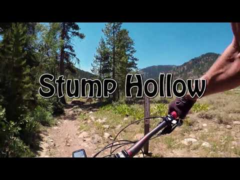
This is a beautiful forested ride on pristine singletrack, near the top of Logan Canyon. As an out-and-back, it's 5.3 miles each way, with about 1600 vertical feet of climbing. It can also be done as a shuttled ride, or as a big 16.5-mile loop. It's an easy technical ride overall, rating an early-intermediate for skills, and the climbing rate is pleasant. Stump Hollow is part of the GWT (Great Western Trail).

The singletrack meanders uphill through aspen and fir. On the lower mile there are some stunt opportunities such as jumping berms and a nice log drop. Eyeball them on the way up so you're ready on the way down. There are cheater routes around the stunts.

Most riders simply ride the lower portion of Stump Hollow as an out-and-back, sometimes doing a couple of runs over the jump area.

Heading uphill in the aspens of the lower trail.
Heading downhill. The lower mile has many jumps. If youre not into air, you can ...
Heading downhill. The lower mile has many jumps. If you're not into air, you can slow down and simply roll over them.
There are three other ways to do this ride:
(1) Shuttle. Drive to Bear Lake Summit at the tip-top of Logan Canyon, then navigate the gravel roads to where the Stump Hollow (GWT) forks off the road above Peter Sinks. Note that the wooden trail sign is well off the road, so GPS is suggested if you don't have a local guide.
(2) Summit Loop. Start up the trail, then at mile 0.3 exit the trees to your right and find an old road heading east through the sage flat (the connector to this road is very faint). Follow this DT until it joins the highway across from the Swan Flat road. Ride along the highway to the Bear Lake Summit, then turn L onto the dirt road and navigate to the trailhead.
Taking a break at Peter Sinks.
Traversing a side-slope as the sun nears the mountain tops in the west, to our l...
Traversing a side-slope as the sun nears the mountain tops in the west, to our left. This photo is on the way down.
(3) Little Bear Creek. Haven't done this, but there's a DT behind the USU research station (east side of US-89 just downhill from the Tony Grove Lake turnoff) that turns into ST heading up Little Bear Creek . My topo map shows that if you stay on the main trail along the creek, you'll turn L on DT about 1-1/2 mile from Stump Hollow's upper end.
Most of the ride is in deep forest, so there are only occasional views over the nearby mountains. Many riders turn around at the ridgetop at mile 4.5, but I think the rock-slab riding in Peter Sinks is a fun addition. As you climb the east side of Peter Sinks, watch for the big rock monuments that mark the trail. The slab rock makes the trail harder to see.
Typical riding view higher on the mountain, where large firs alternate with aspe...
Typical riding view higher on the mountain, where large firs alternate with aspens and occasional brush meadows.
View across the valley as we peek between the fir trees that line the trail.
Bottom Line!

This is a great ride that I can recommend highly. It will accommodate (and satisfy) a wide variety of skill levels. The altitude and shade keeps it fairly cool on a summer's day, but it's a great ride for close-up inspection of fall colors. My suggestion is the out-and-back.

A ride out and back on Stump Hollow...

[Back to video list ]
Out-and-back riding notes:
0.0   Start singletrack, south side US-89
        N41 57.744 W111 31.924
0.3   Fork L at ST fork  N41 57.585 W111 31.823
        [loop ride, find path in sage flat on left]
1.0   Fork L  N41 57.065 W111 31.769
4.5   Highest point 8400 ft N41 55.208 W111 31.079
        [old loop connector near here]
4.8   Peter Sinks, trail hard to follow, aim for rockpiles
5.3   At doubletrack, turn around  N41 54.644 W111 31.083
Peter Sinks. Look for the next big monument as on the left here, and youll find ...
Peter Sinks. Look for the next big "monument" as on the left here, and you'll find the trail up to the TH at the road.
Stump Hollow map
Stump Hollow map
Notes for loop access or shuttle to top:
0.3   Find eastbound path on L in sage flat
        N41 57.585 W111 31.823
0.5   Fork, keep eastbound
2.7   Join US-89 at Swan Flats Rd
5.2   Bear Lake Summit, R on dirt road
        [auto shuttle - turn here!]
        N41 55.560 W111 28.453
6.9   Straight  N41 54.298 W111 28.753
8.0   Fork R  N41 53.384 W111 29.135
10.1 Fork R  N41 54.292 W111 30.767
10.6 Fork L (old route R, then down valley)
        N41 54.677 W111 30.551
11.1 Faint singletrack on R, sign away from road
        N41 54.644 W111 31.083

Getting there:  In Logan, turn east at 400 North on US-89 towards Logan Canyon (about 2 miles). After you enter the canyon, drive 24.5 miles, almost to the top. Turn left toward Beaver Mountain Ski Area and bike trails, then immediately turn right into a parking area. There's a bathroom north of the parking. From the parking lot, go south across US-89 to the south side of the road. From the spot where the Beaver Mountain road forks off US-89, ride 100 feet down the canyon and you'll spot the singletrack heading off into the brush on your left. To shuttle the ride, drive another five miles up US-89 to the Bear Lake Summit and turn right on gravel road. (Driving directions above.)

Riding resources for this trail:
Single-page riding guide
GPS track files and route (right-click and "Save as..."):
    GPX track file
High-res topo (800 KB):  View
Lodging, camping, shops: Links to Logan area resources