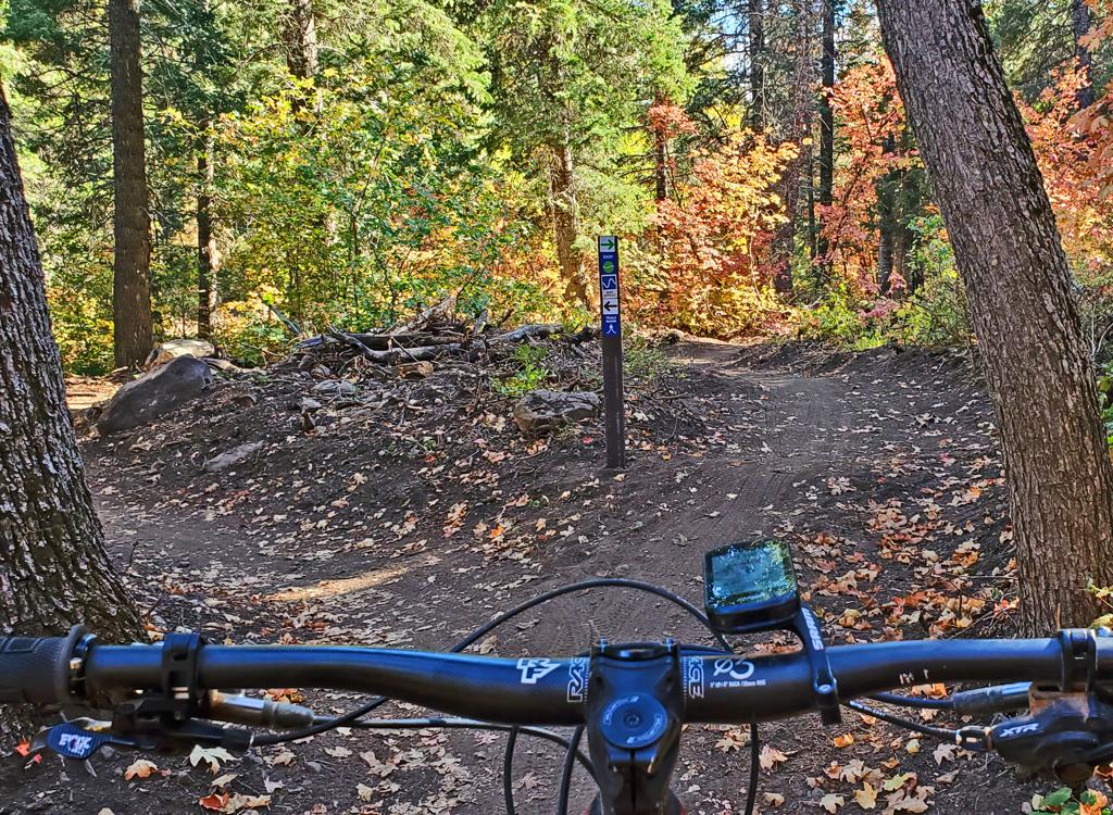
Looking northeast as Bruce rides the trail. Review on October 14, 2022.
Spork Trail

The Spork Trail lies within North Fork Park at the northwest corner of Ogden Valley. This 5.1 mile directional lariat loop trail was added in 2022. Spork is an easier-intermediate ride available year-round (when conditions permit) with grooming for fat biking in the winter.

The Spork trail is for bikes only. It's an engineered trailcut with swoops and twists, created for a fun riding experience. Spork is not a "destination" or a view trail -- it's simply fun and satisfying riding.

Spork starts on the 365 trail as a two-way, then after 0.3 miles becomes a one-way loop trail. The direction of riding will change day-by-day. Reached via 0.7 miles of the 365 trail, the minimum ride to complete this loop from the south gate trailhead is 6.6 miles.

Riding a turn with the slopes of Ben Lomond in the background.
A final rock-drop as an alternate line rejoins the main trail, designed to be ri...
A final rock-drop as an alternate line rejoins the main trail, designed to be ridden on days when the riding will go counterclockwise.
The trail starts at 5550 feet elevation and lies in dense oak forest. The top elevation is just over 5800. The expected riding season will be late May through October. The trail can be done by strong beginning riders, but given the power-turns and rollers I'd recommend the trail for intermediates or better.
Getting to the trail
South gate trailhead, looking at the entry to the 365 Trail.
365 (North Fork South Entry) Trailhead

The main trailhead for bikes is right at the south entry gate to North Fork Park. See below for driving instructions. The gravel parking area is to your left as you approach the park gates. The 365 Trail will take you to Spork. The 365 trail is found on the southern side of parking at the kiosk.

Riding a patch of maple forest in North Fork.
From Ben Lomond or Mules Ear area

From Mules Ear or The Cinch , you can connect to either Pipeline or Traily McTrailface (yes, really) to ride south to the 365 trail. Turn to the right on 365 and follow it down to the trail fork with Spork.

The Spork Trail
Rolling downhill in a grove of aspens on Spork.
The Spork Trail has a 0.3 mile stem, then a loop of 4.5 miles. The loop is one-way riding, but with alternating direction based on the day. Starting at 5550 feet elevation, it will climb to 5800, an elevation change of only 250 feet. But because of constant up-and-down riding, your actual climbing total will be closer to 400 vertical feet as you ride the loop.
Spork lies in a rolling foothill area at the base of Ben Lomond Peak. It's heavily forested. Most of the forest is mature gambel oak, but there are plenty of maples, aspen, and an occasional fir. The bottom of Spork is found on the 365 trail, 0.7 miles from the entry gate trailhead.
View of Ben Lomond from the Spork Trail, looking west.
Note the hump, the dip, and the quick turning climb. The trail is almost always ...
Note the hump, the dip, and the quick turning climb. The trail is almost always in motion.
Spork is a higly-engineered bench-cut trail. Overall there's a mellow rate of climbing or descent, but the trail has swoops that may require a bit of attack in the uphill direction. The path is constantly twisting. It's obvious that it was built to give riders a fun experience in either direction.
Spork has alternate riding lines for experts. As you ride along, there will be an occasional opportunity to launch off a rock at trailside. There are a couple of log balance rides and the occasional rock rollover challenge.

There are two short drop lines, one for each direction. An easy riding path is provided as an alternative. The alternate lines are plainly marked.

Riding clockwise: the right fork is a twisting descent, while the left path desc...
Riding clockwise: the right fork is a twisting descent, while the left path descends more steeply through two mandatory log drops.
Approaching a two foot log drop on the alternate line.
Clockwise, there's a twisty path with two log drops. The second (bigger) drop is around 24 inches.

In the other direction, you're offered a short alternate trail with three rock drops, a bit bigger with each one. The final rock is about 2 feet.

There's a lot of well-built fun stuff here! Riding clockwise, here are two chall...
There's a lot of well-built fun stuff here! Riding clockwise, here are two challenges, a long split-log balance ride
And a dipping twisting line of rock on an alternate line. Yes, I cleaned the roc...
And a dipping twisting line of rock on an alternate line. Yes, I cleaned the rock line on the first try! Video proof below.
Turns are nicely banked and roll well either in the uphill or downhill direction. The finish work -- fine tuning -- on this trail is excellent.

With the 0.7 miles on 365 to reach Spork, a full ride from the trailhead at the gate will be 6.6 miles with 500 vertical feet of climbing overall.

Powering up and around a turn.
View southeast into Ogden Valley as the trail hugs an oak-covered slope.
Because of the dense forest, there will be only an occasional brief spot where you'll be able to see Ben Lomond or the valley. So while those views are pretty, this is a trail you'll ride for the joy of riding.
Two spots on the trail to show the changing "feel" of the Spork loop as you ride...
Two spots on the trail to show the changing "feel" of the Spork loop as you ride. Here is the initial climb in aspen and fir forest.
This photo is while descending through a dense grove of mature maple trees.
Bottom Line!

Excellent trail. Well built and fun to ride. One of the best new trails I've ridden, which is saying a lot. Destined to be a favorite for many riders! Once you've done this loop, continue on the 365 loop around and down Pipeline. You won't be disappointed!

Descending...
Descending...

 Clockwise fall ride on Spork...

[Back to video list ]
North Fork map showing Spork.
Getting there:  Go up Ogden Canyon. (From the north on I-15, take the 12th South Ogden exit and head east on Highway 39. From the south, exit I-15 on US 89. Pass I-84 and climb up the hill, then turn right on Harrison Blvd. Continue on Harrison until you hit U-39 and turn R toward Ogden Canyon.) Turn left across the dam at Pineview Reservoir. At the stop sign in Eden, turn left. Turn left at the stop sign in Liberty. After about 1/4 mile, take the next right. Just after you cross the river, veer left toward North Fork Park. Turn left again at the Ben Lomond Trailhead - North Fork Park sign. As you approach the campground entry gate, turn left into the 365 Trail trailhead and park. The 365 Trail is at the southwest corner of the parking lot. The Spork Trail begins on your left at 0.7 miles down 365.

Camping in formal campground in North Fork. Bathroom at trailhead.

Riding resources for this trail:
GPS track files (right-click, "Save as..."):
    Multi-track GPX area file
Lodging, camping, shops: Links to Ogden area resources