
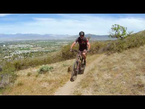
Looking southeast as we climb Sneaky Shiz. This review by Bruce on April 25, 2022.
Sneaky Shiz must be reached via other trails at both the bottom and the top. So while Sneaky
Shiz is only 2.1 miles long, a minimum up-and-back down ride would be
around 8 miles. The top
elevation is at 5850 feet, for a riding season of mid-April through mid-November.
Thunderdome is a more-difficult ride that continues uphill from the top of Sneaky Shiz. There's
450 vertical feet of climbing over 0.9 miles. The viewpoint at the top
of Thunderdome is the
target destination for many who climb Sneaky Shiz. But it dramatically
increases the work you'll
do.

As we look northeast over Utah Valley, Bruce climbs around a turn on Sneaky Shiz.

Looking south in the Canyon Road Murdock trailhead.
Canyon Road TH Murdock Canal Trail (Cedar Hills)The Canyon Road trailhead is located on the uphill
side of Canyon Road where the
Murdock
Canal Trail
passes
under Highway 146. The connector to The Pit trail of
Valley
Vista
is about 1/4 mile south
of the trailhead, on the left side of the Murdock Canal trail.
Get onto the doubletrack just uphill from the paved trail. After about 100 yards on the gravel
doubletrack fork uphill and ride toward the mountain. At the base of the
slope, turn right
(the left-hand trail is the one-way return of The Pit).
Climb The Pit, then Hard Rock, keeping to the right at all trail intersections. Once you're
on Molly's trail, watch for a connector to the Bench Road on your left
about 100 yards later.

Heading south on Hard Rock after climbing The Pit. Next comes Molly's trail, then the Bench Road.

Fork in the road when coming from the top of Hard Rock and Molly's in Valley Vista (looking south). Go to the left and climb to the higher level.
Get onto the Bench Road southbound, then veer left uphill at the fork. Climb 0.2 miles. Doesn't
matter whether you take the wide old doubletrack or hit the singletrack
alongside. They'll
rejoin. At the top, take a hard left on the BST.
Sneaky Shiz begins on the uphill side of the Bonneville Shoreline Trail (BST), about 0.4 miles
north of where you turned 180 degrees from the connector onto the BST/upper
Bench Road. So
start pedaling north. After 0.4 miles, fork right on singletrack and you're
on Sneaky Shiz.

One of several critical non-marked forks. Here the BST is on the right, while the upper PG Bench Road heads north downhill to rejoin the lower (big) Bench Road. The BST is relatively undeveloped in this area, still having zero trail markers in April 2022. (They're coming.)

Wade Springs trailhead in Pleasant Grove, looking north.
Wade Springs TH Murdock Canal Trail (Pleasant Grove)The Wade Spring trailhead is located on 1100
North at approximately 650 East. The
Valley
Vista
trail system is reached by pedaling
0.2 miles north on the
Murdock
Canal Trail
. Veer right and gently uphill
on a gravel doubletrack. A bit over 100 yards uphill, the entry to the
first singletrack loop Soft Rock is on your right.
Head uphill, keeping to the right at the trail intersections until you reach Fault Line. (All
lower loops are counter-clockwise, so staying to the right will keep you
on the uphill side
of the loops.) At Fault Line, go left and left so you skip this loop and
stay on Cowley's.
Once you reach the Bench Road, stay on it and head north.
At 0.2 miles on Bench Road, fork to the right uphill on the (smaller) upper Bench Road, which
will become the BST. Around mile 0.4, it will narrow so it seems less
like road and more like
trail. At mile 0.5, veer right on the BST as you leave the old upper Bench
Road.

Climbing uphill through Valley Vista, aiming for the Pleasant Grove Bench Road.

Here's the Bench Road at Grove Creek, which can take you north to Sneaky Shiz.
Pleasant Grove Bench Road via Grove Creek THIn Pleasant Grove, drive uphill on 500 North until it becomes Grove Creek Drive. Follow it
up to the paved Grove Creek trail parking area. On your bike, coast downhill
to the steel gate
just below the paved Grove Creek parking lot.
On the north side of the street, find the Canal Road (aka Bench Road) north. Now pedal a mile
north until the Bench Road splits. Take the right (uphill) fork, which
will narrow to trail
after 1/4 mile. In another 0.2 miles, the BST forks away on your right,
then the Sneaky Shiz
trail forks to the right after another 0.4 miles on the BST.

This is the BST as viewed looking east from the Bench Road in Cedar Hills.
From the Bench Road in Cedar HillsWhen riding south on the Cedar Hills Bench Road, the BST forks uphill on your left. (No trail
markings as of April 2022.) This occurs while you're still riding past
homes, 0.2 miles from
the northern end of the Valley Vista Molly's Trail. (There's a second
alternate about half-way
between.) If you reach Valley Vista, you missed the BST.
After 0.5 miles climbing the BST, Sneaky Shiz forks left uphill. If you don't know the area,
you may need a navigation app to find your way. The trail forks are not
marked!
Most riders use Sneaky Shiz as a climbing route. Combined with a climb up through Valley Vista,
it's probably the most pleasant way to reach the fabulous views on Mahogany
Mountain. The overall
climbing on Sneaky Shiz is around 700 vertical feet.
The trail surface is non-technical. But the many turns tend to be a bit steep and loose, so
I recommend this ride for intermediates or better.

Northbound on the lower slopes of Sneaky Shiz.

Looking northwest as a smooth curve of trail traverses the hillside.
The terrain is mostly grass with bits of sage and scattered groves of scrub oak. There are
no rock outcrops or tech challenges on Sneaky Shiz. The area is very sun-exposed
and will be
hot on summer afternoons.
Sneaky Shiz is a narrow hand-dug bench-cut, rather than being simply a co-opted game trail.
But there are no turning banks to hold your tires on the downhill, so
you'll find yourself
checking your speed to roll around. On the way down, particularly as you
near the bottom, you'll
notice a few older paths heading more steeply downhill. Do Not ride these.
If your target is the viewpoint at the top of Thunderdome (a popular target for this ride),
your ride will require 1700 vertical feet of overall climbing. The shortest
route would use
The Pit and Hard Rock of Valley Vista to the Bench Road for the connection
to Sneaky Shiz,
and would be a bit under 10 miles for the out-and-back. See the
Valley Vista
and
Mahogany Mountain
pages for climbing options.

Views are constant. We're looking southwest at Utah Lake as we climb.

The trail is smooth with occasional humps where old flood channels or 4x4 digger trails cross.
If you're using Sneaky Shiz as a climbing route, I recommend conserving your energy on the
lower turns. While most sections of the trail are easy cruising, there
are a lot of turns on
the trail, and those turns are often long and steep. If you put too much
leg into powering
around those turns, you won't have much left when you hit the steeper
slopes of Thunderdome.
At the top of Sneaky Shiz, you'll hit a flat viewpoint area and a T intersection with Mahogany
Mountain. A left turn takes you to the Mahogany Mountain downhill route
and later the (unrideable)
steep slope up to the viewpoint. If the upper viewpoint is your goal,
turn RIGHT (away from
the viewpoint) on Mahogany Mountain, then turn left onto Thunderdome just
75 yards later.
The most common descending route is Rojo and the Rojo Connector down to the BST. If that's
your goal, turn right on Mahogany Mountain and find the trail fork on
your right after 0.2
miles.

Looking south as we approach the final viewpoint where Sneaky Shiz ends on the Mahogany Mountain trail.

We're on Mahogany Mountain southbound. The trail on the left is Thunderdome. Thunderdome starts out southbound, but will soon turn back to the north and begin climbing.
Thunderdome is 0.9 miles long, with 450 vertical feet of climbing. It extends from the Mahogany
Mountain trail (just 75 yards south of where Sneaky Shiz ends) to the
viewpoint at 6250 feet
elevation.
While the trail does have some smooth sections, it's more narrow, more steep, and more technical
than Sneaky Shiz. The gambel oak sections are tighter and are more likely
to scratch if you
bobble. Some embedded limestone boulders require dodging and pedal cautions.

Northbound on a smooth stretch of trail. Note that the baseline climbing pitch has increased.

Looking back south on Thunderdome.
While the main trail from Mahogany Mountain to the viewpoint goes almost straight up the slope,
Thunderdome approaches the viewpoint through a series of traverses to
slow the rate of climb.
Once you hit the ridgeline at the top, stop and take in the views. From here, the trail simply
heads 50 yards toward the mountain and joins up with the main trail. (This
trail continues
uphill, should you have the leg to go further.)

An e-biker heads out on Thunderdome from the viewpoint.

View northwest. The pink smear on the mountains at right is the Bingham Canyon mine tailings.
So is it worth the extra climbing to add Thunderdome to your ride on Sneaky Shiz?
I think so. Yes, Thunderdome will seem tougher than all the other climbing you'll do on this
ride combined, but the views at the top are extraordinary. And a little
challenge to your legs
and your bike-handling will do you good.
Popular loop return route: Rojo Rolling and
Mahogany Bench Connector to BST

Bruce rockets down Rojo southbound.
Most riders are riding a clockwise loop. After climbing Sneaky Shiz the pedal 0.1 miles south
and drop onto Rojo Rolling. This trail dumps onto the Mahogany Bench Connector.
At mile 0.7,
the trail hits the Bonneville Shoreline Trail, where you can connect north
or south.
Most riders who climbed Sneaky Shiz will opt for the northbound return. It drops you onto the
Bench Road around 1/4 mile from the top of Hard Rock in the
Valley Vista
trail system.

Once you're hit the high point on the northbound BST, the downhill is constant until you hit the old upper Bench Road. Looking northwest over Utah Valley.
Alternate return route: Mahogany Mountain downhill
trail

Here's the trail fork where Mahogany Mountain turns to descend. The main trail here is the steeper route to the viewpoint (and to points higher on the hill).
If you're in a hurry to get back to the valley, you can take the steep main trail down to Mahogany
Mountain. It's very steep and loose for about 0.2 miles. At 0.4 miles
after leaving the viewpoint
on the ridge, the Mahogany Mountain downhill section will start on your
right. It's marked
by a rockpile.
Note that you can also choose to descend Mahogany Mountain if you return via Thunderdome. Just
backtrack onto the main Mahogany Mountain trail, but ride past the entry
to Sneaky Shiz. After
0.3 miles, the downhill trail will fork away on your left.

Looking uphill on Mahogany Mountain. I don't recommend climbing this route. It's steep and unrelenting.

Heading downhill to the northwest. You can see that the trail continues straight.
Compared to Sneaky Sniz, downhill Mahogany Mountain is fairly straight and significantly steeper.
It's often a little trenched, but it's not horrible. All-out chunder descenders
may enjoy this
way down. I'd only do it again if a thunderstorm were chasing me. After
only 0.9 miles the
singletrack dumps onto a gravel road, where you can work your way down
to the Bench Road in
Cedar Hills.
Bottom Line!One of the better climbs in the Utah County foothills. Great views but not for beginners or
the out-of-shape rider.
See the
Valley Vista
trail pages for
details on navigating those trails.
See the
Mahogany Mountain
trail page for trails
east of Sneaky Shiz.

Looking south from the viewpoint at the top of Thunderdome. The Thunderdome trail crosses the hill just below us.
 Note about the map! There are other singletrack trails that are not are shown
here, and some that are shown will be "retired" by the Forest Service as they develop the trails in this area.
Note about the map! There are other singletrack trails that are not are shown
here, and some that are shown will be "retired" by the Forest Service as they develop the trails in this area.
Getting there:Canyon Road TH Murdock Canal Trail (Cedar Hills): The Canyon Road trailhead
is located on the uphill
side of Canyon Road where the Murdock
Canal Trail passes
under Highway 146. The connector to The Pit trail of Valley
Vista is about 1/4 mile south
of the trailhead, on the left side of the Murdock Canal trail.
Wade Springs TH Murdock Canal Trail (Pleasant Grove): The Wade
Spring trailhead is located on 1100
North at approximately 650 East. The Valley
Vista trail system is reached by pedaling
0.2 miles north on the Murdock
Canal Trail. Veer right and gently uphill
on a gravel doubletrack.
Grove Creek TH to Pleasant Grove Bench Road: In Pleasant Grove,
drive uphill on 500 North until it becomes
Grove Creek Drive. Follow it up to the paved Grove Creek trail parking area.
On your bike, coast downhill to the steel gate just below the paved Grove
Creek parking lot. On the north side of the street, find the Canal Road (aka Bench Road) north.
Bathrooms and water at all trailheads above.


 Note about the map! There are other singletrack trails that are not are shown
here, and some that are shown will be "retired" by the Forest Service as they develop the trails in this area.
Note about the map! There are other singletrack trails that are not are shown
here, and some that are shown will be "retired" by the Forest Service as they develop the trails in this area.


