
Skidder 1
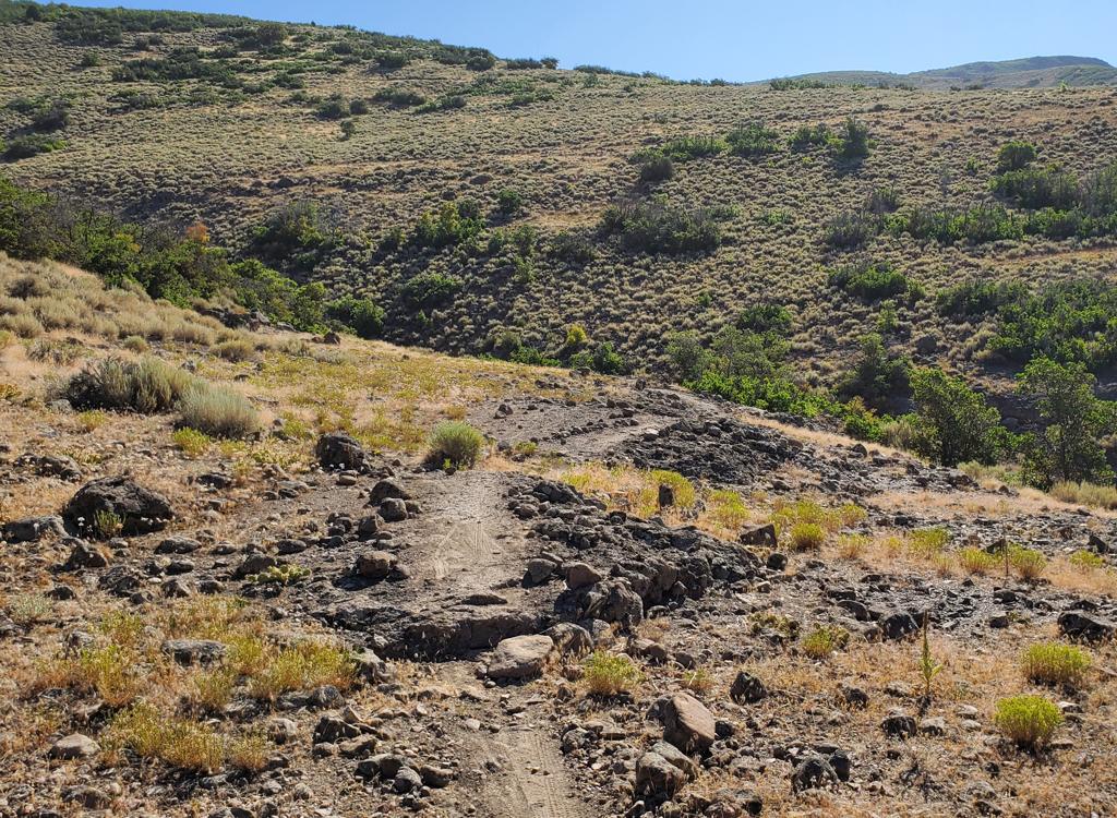
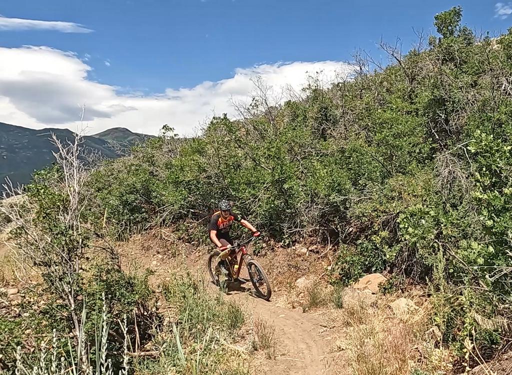
Skidder 1 is a double-black downhill-only trail in the Coyote (Riverview) trail system north of Heber. The trail is very steep and often loose, plunging down a ridgeline from the Smaug Loop to the bottom of Upper Potatoes. It crosses Upper Riverview on the way. The trail is mostly narrow hand-built fall-line singletrack through areas of volcanic rubble. In the areas with actual soil, banked turns offer respite from the plunge.
In 0.6 miles, Skidder 1 drops 550 vertical feet. That's 920 feet per mile AVERAGE, an 18% slope. In the volcanic areas, I found a lot of loose boulders and marbles in the trail surface. A touch of brake could make the tire hang on a loose rock.
Skidder 1 is a trail that's dangerous to ride fast, and almost impossible to ride slow. This is not a trail for casual riders, and will be enjoyable to very few. The top of the trail is at 6500 feet elevation, for an expected riding season of mid-May through October.


Most riders get to the Riverview area west-side trails from the UVU Wasatch Campus trailhead. This is found on the far north end of Heber on Highway 40, one mile south of the Highway 32 junction. At the UVU campus entry, turn east (toward the mountain). Go to the uppermost level of parking behind the UVU buildings. Look for the duck-under and kiosk.


South Coyote Trailhead (Construction closure!)
You can get to Skidder 1 from the Coyote
Lane area in the south. Connect to
Middle Earth for the northbound trip and continue to the Upper
Potatoes/Lower Potatoes trail fork. Climb Upper Potatoes to Upper
Riverview and turn right. Pedal 0.3 miles to Lonely Mountain and climb one
mile to the Smaug Loop.
Or, connect to Upper Riverview early in your trip north, then turn uphill on Chop'd Coyote. Climb up Chop'd Coyote to the top of Lonely Mountain, turn left, and descend Lonely Mountain to the Smaug Loop.

From US-40 just south of the Jordanelle reservoir, turn east at the traffic light onto Highwat 32 (at mile 14.2 from I-80 if you're coming from the north). On Highway 32, climb 1.1 miles. When you see the second entry into Riverview on your left and a road under construction to your right, the Riverview Connector trail starts on the uphill side of that road just after it leaves Highway 32. (In 2025, there's no longer protected parking here. It's unclear whether the trailhead will be restored when construction is complete.)
Get onto the Riverview Connector trail. Climb 0.3 miles up the connector, then turn south on Riverview for 1.5 miles to Lonely Mountain and climb to the Smaug Loop.

The Skidder 1 trail is reached by taking the Lonely Mountain trail to the Smaug Loop. The trail entry to Skidder 1 is built to flow naturally from a clockwise path on Smaug (taking the southern side of the loop 0.3 miles from Lonely Mountain).
Lonely Mountain can be reached via Chop'd Coyote, An Unexpected Journey, or Upper Riverview. Any of these routes would be a satisfying ride. The climb from Upper Riverview is the easiest.


There are quite a few rock rollovers and rock drops. Some have "helper rocks" placed, but the line that will take you gently down the helper rocks is often hard to see until you're passing it. Be prepared to change plans and take some air.
As a brand-new trail, Skidder 1 is still seeing some ongoing tweaks. No doubt it will be "dumbed down" a bit to make some spots less dangerous to over-their-head riders.


When the trail enters an area with deeper dirt, the rate of descent slows through banked turns. These spots are a welcome rest -- where you can stop baby-fingering the brakes and let the bike roll.
The trail ends at the junction of Middle Earth, Lower Potatoes, and Upper Potatoes. To continue your descent, keep straight and downhill on Lower Potatoes. To head for the top to try it again, fork to the right uphill and climb Upper Potatoes to Upper Riverview and turn right to head for Lonely Mountain.


Bottom Line
A trail that few riders will love. Almost 20% average slope. Slippery with loose rock. Rock drops, often with sight-line issues. A bit of a challenge for this 73 year old rider, but I'm sure YOU will do just fine.

Getting there via UVU Wasatch Campus Trailhead:
One mile south of the junction of
Highway 40 and 32 (a couple of miles north of Heber), turn east (toward the mountain) at the UVU campus.
Go to the uppermost level of parking behind the UVU buildings. Look for the
duck-under and kiosk N40 32.798 W111 24.735. A singletrack trail climbs 1.5 miles to the
Riverview Trail. Stay on the UVU Connector trail. Watch the trail signs, as there are multiple trail forks.
Trailhead options!
UVU Wasatch Campus Trailhead: One mile south of the junction of Highway 40 and 32 (a couple of miles north of Heber), turn east (toward the mountain) at the UVU campus. Go to the uppermost level of parking behind the UVU buildings. Look for the duck-under and kiosk. A singletrack trail climbs 1.5 miles to the Riverview Trail.
Wile E Canyon trailhead: The Wile E Canyon trailhead is located on the southern side of Highway 32, just over 4 miles from US-40. It's 1/10th mile east of the old Cutthroat trailhead (see below). There's room for about 8 cars here. From the parking lot, a connector trail takes you 120 yards uphill to the Wile E Canyon loop. To get to Beep Beep (or the Coyote Switchbacks or East Riverview), turn right at the trail fork, keep right at the next fork, then turn left onto the Coyote Riverview Connector trail as you approach the gravel road.
Coyote Riverview Connector trail (old Cutthroat): You can still connect through the old Cutthroat trailhead, although there's no longer a parking area here. For example, if the crowds have forced you to park where construction workers leave their vehicles along Highway 32, you can pedal to the gravel road to the new golf course leaves the highway, four miles east of US-40 and just east of the big rock-wall road-cut.
Puddy Tat parking: On Highway 3 around three miles from US-40, watch for a dirt road turning to the right in a huge sage meadow. There are a couple of buildings across Highway 32 at this spot. The parking spot is just through the fence, with a connection to Puddy Tat on the eastern side of parking. (This spot was still being worked on at the time of my review.)
Riverview trailhead: From US-40 just south of the Jordanelle reservoir, turn east at the traffic light onto Highwat 32 (at mile 14.2 from I-80 if you're coming from the north). On Highway 32, climb 1.1 miles. When you see the second entry into Riverview on your left and a road under construction to your right, the Riverview Connector trail starts on the uphill side of that road just after it leaves Highway 32. (In 2025, there's no longer protected parking here. It's unclear whether the trailhead will be restored when construction is complete.)Coyote Trailhead: The southern Coyote trailhead has been lost to subdivision construction. Access to the southern side the trail system is in limbo, but some riders find their way through the construction zone by pedaling up the gravel Coyote Canyon road.
Canal DT trailhead: Just uphill from the light on highway 32, watch for the canal crossing. Park along the road. Start riding south on the doubletrack just uphill from the canal.