
View northeast just after hitting the singletrack. Photos and review by Bruce on June 22, 2015.
The Rocky Top trail starts on Highway 32 just east of the Jordanelle Reservoir. It climbs 900
feet over four miles to a viewpoint on the rocky hilltop. The trail is easier-intermediate
in overall technical requirement, and moderate in aerobic strenuousness.
The parking lot for the trail is on the north side of Highway 32. The entry to parking is on
the road to the Rock Cliff Nature Center and Jordanelle State Park, just a few feet after that
road leaves Highway 32. Although it's just outside the fee station for the state park, there's
no fee to park or ride here. (The nearby
Jordanelle
Perimeter Trail
is 1.2 miles down the road, at the west end of the park area, and does require a day-fee to
ride.)

On reaching the first ridgeline above the cliffs, we're looking west at an arm of the Jordanelle Reservoir. The Jordanelle Perimeter Trail is about a mile away, to the right of the water. You might see a piece of it.

Looking east along the cliff line. The Provo River peeks through the trees in the valley
From the trailhead parking, go back to the Rock Cliff road, go to the right around the culvert,
then turn right on the gravel road. Go through the smaller side gate (close it behind you).
About 100 feet up the thistle-infested gravel road -- just when you're thinking "this can't
be the right trail" -- nice smooth narrow singletrack forks uphill to the left..
Climb uphill through two switchbacks, and you're at the top of the cliffs. The trail will work
generally northeast. You'll have periodic views of the Provo River and surrounding hills. In
season, there may be flowers.

Sample prickly pear. There were reds, purples, pinks, salmons, yellows and greens.

Getting a little higher on the mountain.
For most of the year, this will be a very dry and warm hillside. An early morning start works
best.
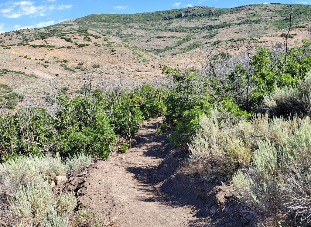
The terrain is mostly sage brush with occasional small stands of scrub oak. You'll pass through
some areas of open igneous rock. In the higher elevation there's a bit of elderberry, chokecherry,
and wild currant.
Navigation is easy. There are no trail forks. The trail is crossed once by a dirt road, but
it's obvious that you just continue straight.
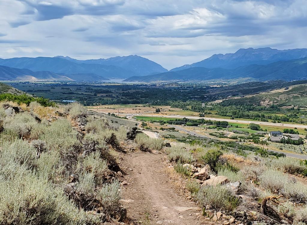
As you reach the ridge, you might think you're there. Nope. Another half mile. But pause to
look at the views over the little town of Francis to the east.

Looking east after reaching the ridge. Francis lies just in front; Woodland is along the hills in the distant right.

The Superfly rests at the top.
The trail will now drop to the east side of the ridge, traverse north, then climb up to the
Rocky Top. Suddenly there's a lot of greenery. Here the trail dead-ends in a group of granite
boulders.
Kamas is the larger town to the northeast, on the far side of the valley. The letters on the
hillside are for South Summit High School, if I recall my rock and roll musician days correctly.

View northeast toward Kamas.

Looking southwest. You can see bits of the river in the trees just above the highway.
You'll need to scramble a bit to get a view south into the valley. That's the Provo River down
there just before it enters the Jordanelle Reservoir.
The downhill is fast and scenic. Beginners may find the turns a bit tight. But there aren't
that many of them, so if you're having trouble rolling through, just put your feet down, swing
the bike around, and continue on.The round trip is 7.9 miles and your total climbing will be 900 vertical feet.

Ready for some "scrunch" as the trail crosses broken granite and tuff.

Go to US-40 north of Heber, via Provo Canyon from Utah County or I-80 up Parleys from Salt
Lake. Just south of the Jordanelle dam, turn east onto State Highway 32 at the traffic light.
Climb up and past the south side of the reservoir's east arm. When the road crosses the Provo
River, turn left toward Rock Cliff Nature Center and Jordanelle State Park. Immediately as
you swing off of Highway 32, turn to the right into the gravel trailhead parking lot. The ride
starts at the gate on the gravel path just north across the creek from parking.Map kiosk, but no other services at trailhead. Water, toilets, and camping at Jordanelle State
Park (fee area). Nearest bike services in Heber (Slim and Knobby's).
Riding resources:
GPS track files (right-click and "Save as..."):
GPX track file for
Rocky Top
Maps for printing:
H-Res
topo
map
Lodging, camping, shops:
Links to area resources