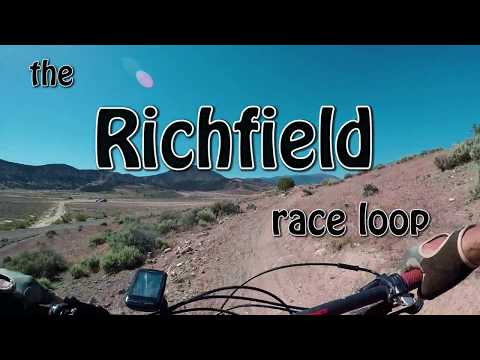
Heading north along the edge of the loop. Photos, track, and ride description by Bruce on June 1, 2018. Latest update to this page October 2021.
The Glenwood Hills riding area lies on a bench area above Glenwood about 6 miles east of Richfield. There's a five-mile race loop, plus optional trails such as the Twist and Hot Lava. The riding is easier-intermediate, with brief mild climbs and fast descents. There are some nice views and the trail is fun to ride.
The riding season is late April through November. There's some clay that will get sticky after
heavy rains. There's no shade on the trail, so it will be hot on summer afternoons. The race
loop trail was designed to be done counter-clockwise, completed in 2018.
The Hot Lava trail is discussed after the Race Loop on this page. The Twist trail is described on a separate page.

Just starting out. Riding clockwise, I've just climbed away from the parking area.

Typical riding for much of the loop -- sage and occasional rock in rolling terrain.
The trailhead is at the Glenwood Hills OHV area, reached via Highway 119 eastbound from Richfield.
There's a 0.8 mile all-weather gravel road extending north from 119 to the trailhead and race
staging area. (It's right outside the northwest fence corner of the motor sports park.) As
of October 2021 there's no kiosk or other markers at the trailhead.
The trail was a lot of wiggles, humps, and turns. Climbs are mellow and usually short. The
loop can be done in either direction. My ride video goes clockwise, which is easier to navigate
if there are no flags or other markers east of the trailhead.Occasionally a doubletrack, game trail, or older social trail will fork away from the race
loop in a way that could fool you. Now that the trail is mature and ridden regularly, this
is unlikely. Just follow the carsonite posts.

Looking northwest. The cliffs in the distance lie just west of I-70 between Salina and Richfield.

Rolling the edge. Richfield is at far left.
There will be some nice views over the Richfield valley as the trail reaches its highest point
on northwest side of the loop. The red and white badlands to the west are home to the
Twist trail
-- a very nice loop ride but with some navigation challenges.
The loop was built to ride counter-clockwise. You're allowed to ride either direction, but
all the trail signs are placed to be seen by a rider going counter-clockwise.From parking, head northeast on doubletrack. Cross another doubletrack and continue all the
way to the edge of the badlands. Here the singletrack begins.

On the doubletrack when riding away from the staging (parking) area, we've arrived at the badlands. Here the trail will veer to the left and enter singletrack as it hits the junipers.

Back on doubletrack for another climb.
At mile 1.2 of the race loop, you'll join a dirt road uphill northbound for another shakeout
climb of 0.4 miles. Then you'll veer to the left onto singletrack (where you'll stay for the
remainder of the loop).
The race loop has seen a lot of improvement since my first ride in 2018. Almost every turn
now has a nice berm. Riding lines are fun and flow nicely.Of note in 2021 is that there's a second loop to the south called Hot Lava. It forks off the
race loop to the right as the trail approaches the parking area at mile 4.6. See the description
below.

Rockin' through badlands on the east side of the loop.

Making the turn at the northern corner of the loop. The drone camera is looking south.
Very nice trail! With the other riding in the area (
Twist
and Hot Lava) it's worth a visit when you're in Richfield.
Hot Lava Loop

Heading south on the loop, as boulders of lava surround the trail. Mormon Mountain shows some fall colors in the distance.
The Hot Lava loop is 3.7 miles in length. It forks away from the Race Loop, then rejoins only
0.1 miles from where it left. While the loop can be done in either direction, my description
will assume you're riding it counterclockwise after completing most of the main Race Loop.
The western end of the loop is at mile 4.6 of the counterclockwise race loop. The trail fork
is unmarked as of October 1, 2021. Veer to the right to begin Hot Lava.(If your target is a quick ride clockwise, just ride the race loop backwards for 0.3 miles,
then veer to the left when you hit the eastern end of Hot Lava.)

Riding the Race Loop counterclockwise, this is the fork to Hot Lava. Expect trail markers to appear soon.

On the initial climb from the Race Loop, we're looking west. Note the nicely-banked climbing turn.
The Hot Lava trail is nicely built, with generous banked turns that ride well in either direction.
The tracks indicate that most riders are taking it counterclockwise (west to east) as an add-on
to the Race Loop.
The trail climbs up to the top of several hills. So although the area looks flat on a topo
map, you'll do around 400 vertical feet of climbing over the course of the loop, 100 feet at
a time. At each hill there will be nice views in all directions.

Up to the top of a small hill to enjoy the views. You'll repeat this a few times.

View to the north at Rocky Ford Reservoir.

View over Glenwood at the southern end of the loop.

Looking east as the trail passes through a pile of volcanic boulders.
The name "Hot Lava" is appropriate. The trail is often surrounded by boulders of lava. And
it's built to ride hot -- fast both uphill and down.There are a few bumps and ledge drops to hit when riding in the counterclockwise direction.
At the end of the loop, Hot Lava rejoins the Race Loop just 1/10th mile from where it forked
away. Keep right to begin the descent down to the parking area.

Northbound toward the Race Loop on the counterclockwise ride.

On Main Street in Richfield, turn east on 300 North. This is Utah Highway 118, old US Highway
89. After 0.9 miles, Highway 118 turns north. Keep straight to the single lane that becomes
Highway 119. Continue straight east and in about 4 miles the road will veer a bit right and
climb up the hill. At mile 6.4, begin watching for a gravel road on your left. It will be just
before the Glenwood Hills OHV sign. Turn left and drive 0.8 miles. Turn right toward the fenced
area and park outside the gate. To begin the Race Loop, look for the carsonite post with the
arrow pointing northeast. Take the doubletrack it points toward (not the dirt road along the
fence of the motor sports area).Water: none Bathrooms: none
Riding resources for this trail:
Single-page riding guide
GPS track files and route (right-click and "Save as..."):
GPX Race Loop track
Multi-track
area file
Maps for printing:
Area
aerial view with roads
Lodging, camping, shops:
Links to
Cedar City area resources
Bryce
area
Updated 2021