Redford Run and Lone Peak Wilderness Trails
This page describes two routes along the east side of Alpine that feed into Lambert Park. Most likely, only locals will find these trails of interest. Redford Run goes down a corridor between homes, crossing a few streets. Meanwhile, the Lone Peak Wilderness trail (LPWT), commonly called the Lambert Access Trail, runs higher on the hill. (An act of Congress in late 2022 has redrawn the Lone Peak Wilderness borders, so the LPWT is now LEGAL for bikes!)

The Redford Run trail is a very easy, almost flat trail that runs along the High Bench Ditch irrigation canal in Alpine. It's only 1.1 miles long, but is important to local riders because it provides a dirt route into the southern end of Lambert Park . All of Redford Run lies within Alpine City boundaries.
There's parking at the end of Bald Mountain Drive at the south end of Lambert Park. But there's no trail parking for Redford Run to the south. Locals pedal or hike to the trail.


Along the way north from Moon Lane, the trail will dump onto Preston Circle. Go out to Preston Drive, turn right uphill, and pedal about 150 yards to find the tiny, hard-to-spot singletrack on the left. The road you'll cross is Lone Peak Drive.
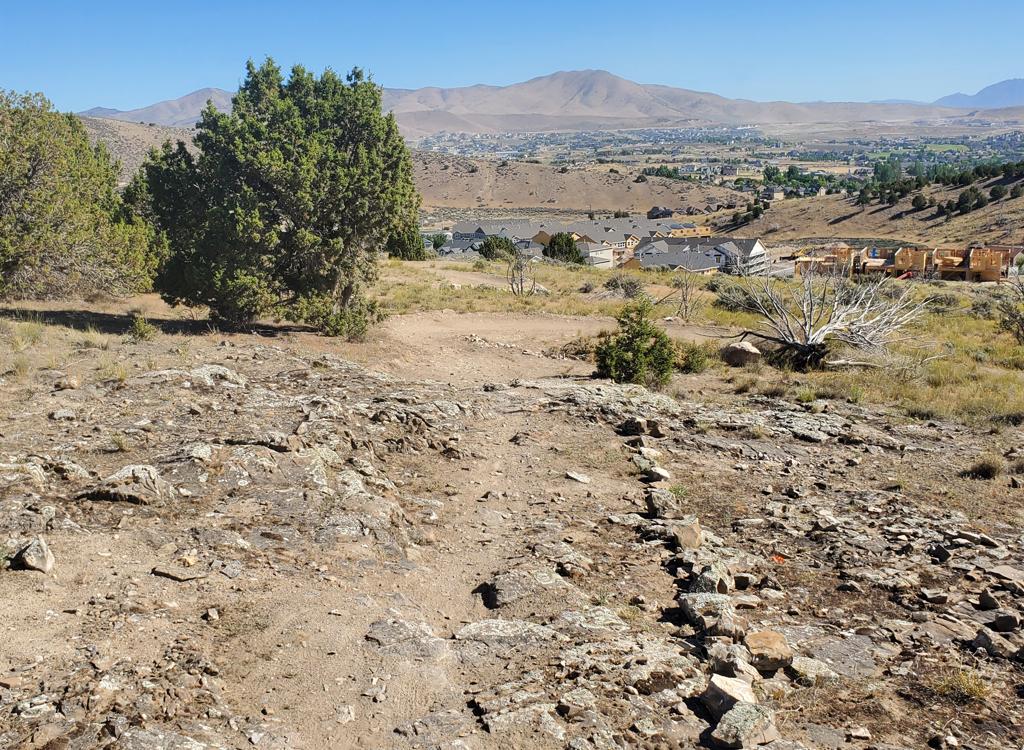
The next road is Bald Mountain Drive. Cross to the far side to continue north. (Bald Mountain is the road to the parking area at the south end of Lambert Park.)


If you continue north on Redford Run, you'll hit the broad parking zone. Look for the hole in the cement barrier. From there, follow the flat doubletrack north to the High Bench trailhead area.


AF Canyon to Highland, 0.5 miles. Infrequently used but has a big parking lot for non-residents. Note that most trail users don't actually start at the American Fork Canyon parking lot, but will catch a connector within Highland or Alpine.
Highland's Shoreline Drive to Alpine's Preston Drive, 1.4 miles. Fairly plush trail, easier intermediate overall.
Preston Drive to Lambert Park, 0.9 miles. Steep side-slopes, occasional steep spots, some tech challenges. Upper-intermediate with a few short expert sections.
Head east toward the canyon from the parking lot, then find the trail turning north (left) and climbing steeply up the hill. You'll pass between the water tank and the gravel pit in a relatively torn-up area before reaching the wilderness border fence at mile 0.4. Coast 1/10th mile down to the fence along the homes and start the next segment.


A paved trail runs from Shoreline Drive at its easternmost turn. If you started in the subdivision, drop down off the pavement and go through the fence. Turn left (north).
In 0.2 miles, there's a trail fork. What appears to be the main trail straight ahead just goes to local homes. It looks like the main trail because so many riders go down it (and back) by accident. Instead, fork to the right uphill.
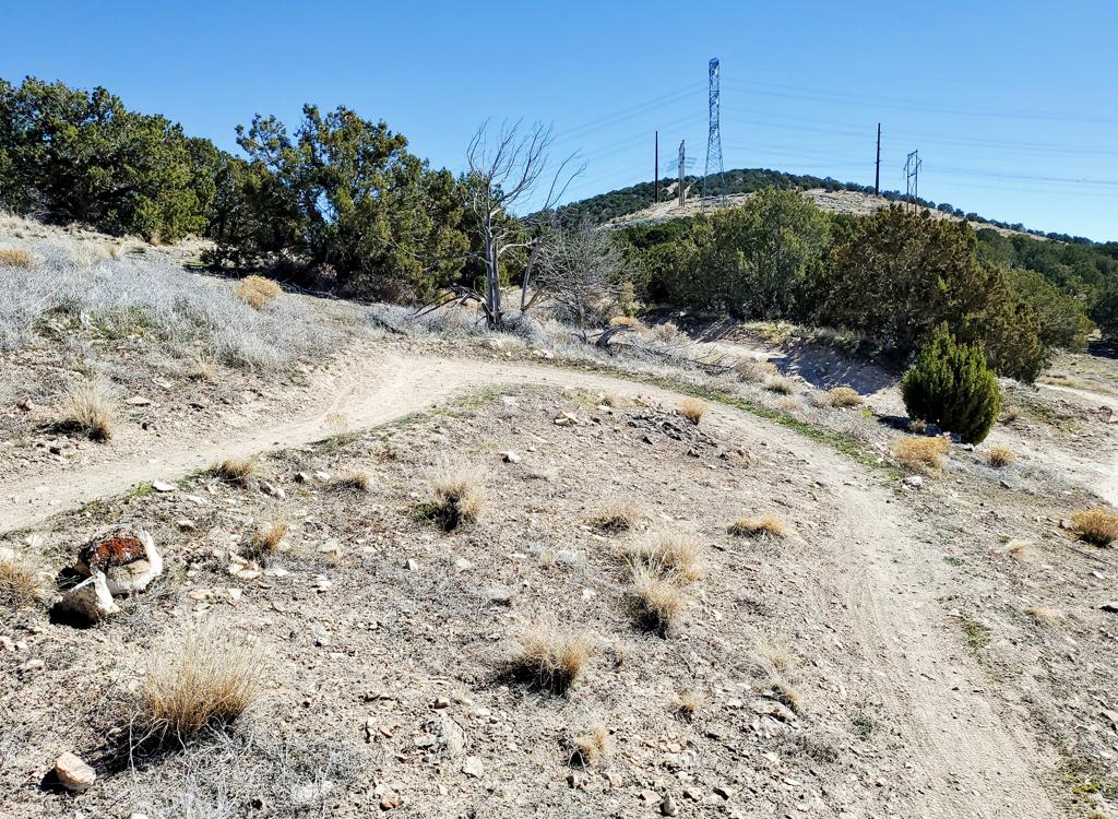
Then at mile 1.0, keep right and uphill. The trail heading downhill to the left joins Redford Run at Preston Circle. (Many riders choose this option, dropping down to Redford Run to avoid the more-techy northern end of the trail.) A bit uphill from the Redford Run connector, keep left and level as the trail from Preston Circle leaves the LPWT to climb uphill.


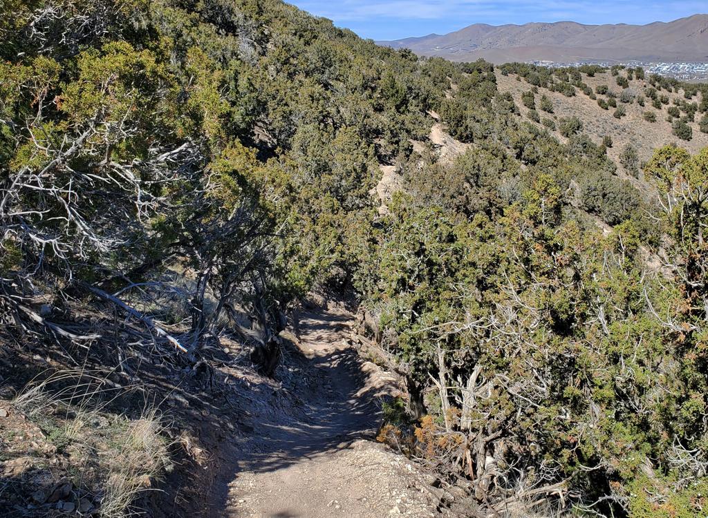
This northern mile of LPWT is more technical. There are two rough steep canyons you'll drop through. I'd rate it as upper-intermediate overall, with some walkable sections for non-experts. The side-slope here is often steep, and the tread is narrow with occasional pedal-banging rocks and stumps.


Note that these are not considered "destination" trails. They're primarily used by locals to pedal to Lambert Park. But you're welcome to explore them.
Redford Run: There's parking at the north end at the Bald Mountain
parking area. As you drive into Alpine, turn onto 100 South in Alpine. Drive east until
you're forced to turn at Country Manor Lane. Go left. At 300 North, turn
right, then take the next left on Bald Mountain Drive. Go to the end of
the road and park.
There are no bathrooms at the Bald Mountain trailhead; nearest bathroom at High Bench trailhead
(see Lambert Park page.)
Lone Peak Wilderness Trail: If you're coming from the far
south end, you can use the American Fork Canyon parking lot on SR-92 -- to
your left right before you enter the canyon. From here, find a trail
heading steeply uphill to the north, skirt the gravel pit area, and find
the break in the fence before descending north. There's a bathroom at this
trailhead.
You can also access the southern end via paved trail off Shoreline Drive
in Highland, above the gravel pit. There's no trailhead here. It's a
pedal-in access for locals.
There's a tiny parking spot for two cars high on Preston Drive in Alpine.
This is approximately at the trail's midpoint. It's on the left side of
the street with the northbound trail just uphill, southbound trail
opposite.
The north end of the trail is high on the mountain in Lambert Park. You
can reach it from upper Ziggy, near the start of Lambert Park's downhill
flow trails.
For connections to south-end trails at Lambert Park, see the Lambert south trails page.
Riding resources:
Trail maps...
Launch
map in separate window for printing
GPS track files (right-click a file and select
"save as..."):
Redford
Run track
LPWT
track
Multi-track
area file
Lodging, camping, shops:
Links to northern county resources