
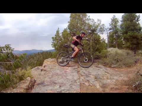

Red Canyon Rim is a 4.8 mile trail on the south rim of Red Canyon at Flaming Gorge. It's usually done as a 9.6-mile out-and-back, but can also be done as a one-way shuttled ride or as a loop with a road return. The riding is fairly easy aerobically despite the altitude of 7400 feet. In some short areas the surface is technical due to rock ledges and loose rock.


There are viewpoints looking out over Red Canyon about every 1/4 mile for the first two miles. Ignore the trails branching right -- these are spurs to picnic areas and campgrounds. At mile 1.3, you'll pass the return path from the lodge (you'll be coming back along this path, so keep left).
At mile 2.5, note this trail intersection. When you come back, you'll fork south here, rather than repeating the same trail section. For now, continue on straight through the gate.
. This is the cr...")

Remember to turn left at the first trail fork past the gate. You'll hit a short section of uphill tricky ledges and rough rock that's a bit of challenge, then smooth trail at the top.


0.0 Find trail on your right at the start of paved loop
N40 53.494 W109 33.619
Keep straight past the toilet.
0.2 Keep L (R = spur from Red Canyon picnic area)
N40 53.374 W109 33.510
1.0 Keep L (R = spur from Canyon Rim CG) N40 53.120 W109 32.815
1.3 Keep L (R = return path, from lodge area) N40 53.028 W109 32.673
1.8 Trail veers away from rim
2.5 Keep L (R = to lodge, return path)
N40 52.578 W109 32.000 Go through gate
2.9 Keep straight (R = Skull Creek CG) N40 52.401 W109 31.561
(continued...)
(riding notes continued...)
4.7 At scenic overlook N40 52.341 W109 29.801
Consider adding Swett Ranch Loop
Backtrack
6.5 Straight past Skull Creek spur
7.0 Left toward lodge and campgrounds N40 52.579 W109 32.000
7.3 Keep R (L=Greens Lake CG) N40 52.404 W109 32.149
7.6 Keep straight N40 52.657 W109 32.359
7.9 Fork R (L = to lodge) N40 52.631 W109 32.505
8.7 Keep L (rejoin outgoing trail) N40 53.028 W109 32.673
Backtrack to visitors center
9.6 Back at car


Via Manila: From I-80, take Wyoming Highway 414 through Mountain View to Utah 43, or take Wyoming 530 from Green River to Utah 43. From Manila Drive east on highway 44. Turn left on the Red Canyon visitor center road. Drive 2.5 miles to the visitors center and park. The trail is next to the toilet, just as you enter the loop in front of the visitors center N40 53.494 W109 33.619. Alternative east TH: drive another 2.5 miles past the Red Canyon road to a scenic pullout on your left. Park N40 52.341 W109 29.801. The trail is the singletrack on the far left.
Via Vernal: On Utah Highway 44/US 191, drive north over the Uinta Mountains. Stay on 44 at the junction with U-260/US 191. At 1.1 miles past the junction, there's a scenic overlook on your right. This is the east trailhead. For the west trailhead, drive another couple of miles and turn right on the Red Canyon visitor center road. Find the trail next to the toilet as above.
Single-page riding guide
GPS track files (right-click and "Save as..."):
GPX Red Canyon Rim
Large-format area topo map: View map
Lodging, camping, shops: Links to Vernal area resources
Bathroom: At visitors center trailhead. BR at campgrounds. None at eastern TH at scenic overlook.
Water: Water at campgrounds and visitors center.
Bike services, maps, trail conditions:
Altitude Cycle, 580 East Main, Vernal. 435-781-2595


