![Red Canyon View of the canyon walls from the trail. The red rock is Claron Formation Limest...](http://cdn1.utahmountainbiking.com/trails/images/pics-trails/RedCanyon01.jpg)
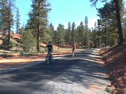
The Red Canyon Trail is a 5.5 mile paved trail through one of Utah's most scenic canyons. Slope is fairly gentle, with only 1000 feet of altitude change (200 feet per mile). But not all youngsters are capable of riding up from the bottom. Consider a shuttle ride, coasting the trail downhill, if you're out of shape or have young children.
![Typical trail terrain: long-leaf pine, pinion, and red dirt. Typical trail terrain: long-leaf pine, pinion, and red dirt.](http://cdn1.utahmountainbiking.com/trails/images/pics-trails/RedCanyon03.jpg)
![Approaching Highway 63 and the end of the trail. Approaching Highway 63 and the end of the trail.](http://cdn1.utahmountainbiking.com/trails/images/pics-trails/RedCanyon04.jpg)
The full length of the paved trail is 11.3 miles one-way, a worthy out-and-back ride. But all the good stuff is in Red Canyon.
![Vincent Bria leads the charge downhill, followed by Kristen (Bruces daughter), V... Vincent Bria leads the charge downhill, followed by Kristen (Bruces daughter), V...](http://cdn1.utahmountainbiking.com/trails/images/pics-trails/b-redcn2.jpg)
![Jessica pauses to admire the scenery. Jessica pauses to admire the scenery.](http://cdn1.utahmountainbiking.com/trails/images/pics-trails/b-redcn3.jpg)
At 7000 feet, the summer temperature is usually nice. But in early afternoon the trail can get a little warm for climbing.
![The trail crosses the (usually dry) creek. The trail crosses the (usually dry) creek.](http://cdn1.utahmountainbiking.com/trails/images/pics-trails/RedCanyon02.jpg)
![Jessica is followed by her mom Diane, while Jackie serves as official pace-dog. Jessica is followed by her mom Diane, while Jackie serves as official pace-dog.](http://cdn1.utahmountainbiking.com/trails/images/pics-trails/b-redcn5.jpg)
Upper Trailhead: Drive about 8 miles south of Panguitch on US-89, then turn east on U-12. Go all the way up Red Canyon on U-12 until the road levels out in a steppe area at the top (about 8 miles from US-89). Watch for a gravel road GPS N 37° 43.169' W 112° 15.322' (on both the right and left sides of the road) about 1/2 mile after reaching the top of the hill. The road is labeled "Fremont ATV Trail." Turn right into the parking area. There is a bathroom at this trailhead.
Note that both the upper and lower trailheads are used by shuttle services that take paying riders to the top of Red Canyon.
![A ride well done. L to R: Vince, Jessie, Alex, Kristen, Savannah. A ride well done. L to R: Vince, Jessie, Alex, Kristen, Savannah.](http://cdn1.utahmountainbiking.com/trails/images/pics-trails/b-redcn6.jpg)
![Red Canyon runs along the highway to Bryce Canyon Red Canyon runs along the highway to Bryce Canyon](http://cdn1.utahmountainbiking.com/trails/images/pics-trails/m-redcan.gif)
GPS track file (right-click and "Save as..."):
GPX multi-track file
(file
includes Thunder Mountain)
High-res topo for printing:
View
Lodging, camping, shops:
Links to Red Canyon area resources