Raptor Route
Eagle Eye, Hawks Glide, Falcon Flow, Kestrel Run
The Raptor Route is a series of trails in the Sand Flats area east of Moab. While they're technically two-way trails, everybody rides them in the downhill direction, and you should too. Falcon Flow was completed in 2020, Eagle Eye in 2021, Hawks Glide in 2022, and Kestrel Run in 2023. This forms a 12-mile section of downhill singletrack. Running from 7300 feet elevation to 4950, the usual riding season will be late March through early November.
The four trails can be done individually, or as a continuous ride. The gravel Sand Flats Road is used for the uphill portion of any loop ride, or as the path for the shuttle vehicle, as each trail begins and ends on the Sand Flats Road.
Eagle Eye has a connector at the top to receive riders from the Lower Porcupine Singletrack, and a connector at the bottom for riders who want to drop off the Raptor Route to Porcupine Rim. This adds to the ride possibilities.


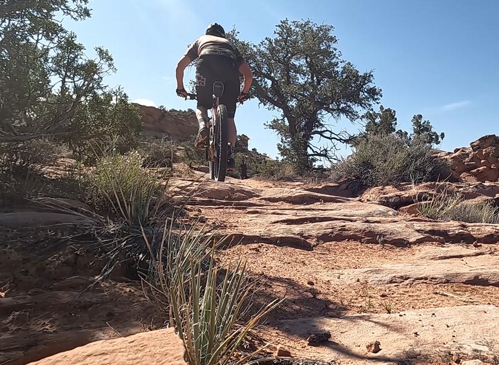
All four trails are intermediate-level singletrack with a mixture of narrow desert ribbon and sandstone. Unlike nearby Slickrock and Porcupine Rim the trails can be hammered out quickly and do not require expert skills. But while intermediate overall, there are several spots on each trail that offer a technical challenge.
For riders who want to turn it into a longer adventure, the nearby Fins 'n Things can be added to your loop or shuttled downhill.
Getting to the trails
")
Bottom of Kestrel Run
At mile 2.8 from the Sand Flats entry station at the Hawk Campground,
you can find lower Kestrel Run up the doubletrack on your right.
Falcon Flow parking
The parking area for the bottom of Falcon Flow is on the Sand Flats Road,
0.3 miles uphill from where lower Falcon Flow returns to the road. This is
a good spot to start cranking uphill for your loop.
Porcupine Rim parking
The Porcupine Rim parking area is on your left at mile 6.9 from the entry station,
around 1/10th mile beyond the top of Falcon Flow. Hawk's Glide ends here.
Shuttle Drop-offs
There's a shuttle drop on Sand Flats Road at the bottom of Eagle Eye
(where it becomes Hawk's Glide) and at the top of Eagle Eye. There are no
parking lots above Porcupine.
Eagle Eye

Eagle Eye begins on the Lower Porcupine Singletrack (LPS) 0.7 miles downhill from the Upper Porcupine Singletrack (UPS). When riding the Whole Enchilada the LPS connector forks to the left away from the cliffs. Just before the connector hits Sand Flats Road, Eagle Eye forks right.
Eagle Eye is officially 2.4 miles long, descending 750 vertical feet with very little climbing. But it has a 0.2-mile connector on each end, and if you count those as part of Eagle Eye, the trail is 2.8 miles from the LPS to the Porcupine Rim trail. Eagle Eye runs parallel to Sand Flats Road, which lies just to the south. The trail is a mix of red dirt singletrack and rock challenges.


At mile 2.4 from the LPS connector (or the Sand Flats Road entry at the uphill end of Eagle Eye), you reach a trail crossing. You can continue descending the Raptor Route on Hawk's Glide by keeping straight for 100 yards then veering left and finding the singletrack entry. Or you can descend 0.2 miles down to the Porcupine Rim trail on the connector by keeping to the right. Or go out to Sand Flats Road by turning left.
Hawks Glide

Hawks Glide begins when Eagle Eye reaches the connector between Sand Flats Road and Porcupine Rim. The terrain and riding area very similar to what you've been doing so far.
Hawks Glide is 2.0 miles long, with 700 vertical feet of descending. There's only a tiny bit of climbing, but it comes in short difficult technical bursts. Hawks Glide runs along the ridgeline between Sand Flats Road and the Porcupine Rim trail.
At mile 1.8 Hawks Glide descends off the ridgeline through a series of turns. This is a highly technical descent. It's expertly constructed, but needs expert skills and confidence to ride cleanly. Hawks Glide rolls into the Porcupine Rim parking area between the Sand Flats Road and the Porcupine Rim trail. To continue downhill on Falcon Flow, go 1/10th mile west on the gravel road.

Falcon Flow

Falcon Flow lies at an elevation that allows early-spring and late-fall riding. At 5.4 miles, Falcon Flow is longer than Eagle Eye and Hawk's Glide put together. When descending top-to-bottom, you'll still put in about 450 vertical feet of climbing, most of it on the lower half of the trail. With the up-and-down riding, tackling the trail in the uphill direction will require around 1150 feet of climbing.
Falcon Flow is now one-way downhill. There's a climbing singletrack called Updraft or Falcon Climb that starts at the lower trailhead and gets you about 2/3 of the way uphill, where you'll divert onto the Sand Flats Road if you're riding a loop of Falcon Flow -- rather than the entire Raptor Route.
The upper end of the trail is about 0.1 miles west of the Porcupine Rim trailhead (toward Moab).
Elevation is 5800 feet at the top. The lower end of the trail is at 5100 feet elevation. If you decide to ride the trail as a loop using the Sand Flats Road as your uphill, it's 700 vertical feet of climbing over 2.7 miles.


There aren't a lot of parking spaces at either of the Falcon Flow trailheads. On weekends, this can be a problem. Get there early.
Falcon Flow links to Kestrel Run for a continuing downhill route. Kestrel Run forks away from Falcon Flow at mile 5.2 from the top, or 0.2 miles uphill from the parking area. (If you're doing the Raptor Route as a continuous ride, you won't enter the parking area.)
Kestrel Run

Kestrel Run is the fourth segment of the Raptor Route, spanning between lower Falcon Flow and the entry to Fins & Things along Sand Flats Road. It's exactly 2 miles long, with one mile from the Falcon Flow trail to Sand Flats Road, and one mile in a narrow sandstone canyon downhill from the road.
Kestrel Run has one upper mile that's suitable for experienced beginners and early-intermediates. This portion ends as Kestrel Run crosses the Sand Flats Road. The trail is almost entirely desert dirt ribbon with a few deviations to cross open rock.
If you continue across Sand Flats Road, there will be an expert-level plunge into the sandstone canyon. This lower half of the trail rolls down to the Fins & Things at the Hawk Campground entry.


When Kestrel Run ends on Fins & Things, you can turn left to continue west using Fins & Things, or you can turn right to descend 100 yards to the Sand Flats Road to continue downhill or to head back up the road for a loop. You can ride uphill on Kestrel Run for an out-and-back, but expect a slippery steep push-a-bike at the plunge.
Trailheads

Kestrel Run at Hawk Campground:
At 2.6 miles uphill from the entry station on Sand Flats Road, spot the
sign for the Hawk Campground on your right. There's parking
for around 5
vehicles between the road the picnic tables, but these will fill up
quickly in the morning and probably should be reserved for campers anyway.
Fork to the right and go up the dirt road 100 yards, where there's a wide
area as the Fins & Things ATV route joins. The trail entry is straight
ahead slightly to the left. There's a composting toilet at the campground.

Lower Falcon Flow parking:
From the entry station at Sand Flats, drive exactly 4 miles up Sand Flats
Road and spot the trailhead on your left. The lower end of Falcon Flow
(which is a two-way trail) is on the downhill side of parking. For a loop
ride, begin pedaling up the road. About 1.4 mile uphill on the left,
there's a second parking area with longer stalls, used by RVs and vehicles
with trailers. In 2023, there's a port-a-potty at the parking area.

Upper Falcon Flow (Porcupine Rim) parking:
The upper parking area is 7.0 miles uphill from the Sand Flats entry gate,
on your right. There's a pit toilet here. The entry to Porcupine is the
broad trail to the left of the road. The singletrack dropping off the
steep hill to the east is Hawks Glide. (If you ride it uphill, you'll
literally climb the cliffs of the hill in front of you. Which is why east
to west is the recommended direction.) The entry to Falcon Flow is 0.1
miles back west. For a loop ride of the upper Raptor Route trails, pedal east on the Sand Flats Road.

Climbing the Sand Flats Road:
Many riders use Sand Flats to create a non-shuttled loop ride. From the lower Falcon Flow parking, it's 2.7 miles to the top of Falcon
Flow, then 0.1 mile to the upper parking (which is shared with Porcupine
Rim). At mile 2.1 from upper parking, the
Porcupine Rim entry is on your
left. This is the route to Hawks Glide. To reach Eagle Eye, continue on
Sand Flats Road to mile 4.0 (6.8 from lower Falcon Flow).
There's a cattleguard across the road with
the LPS connector on your left. 50 feet down that connector, Eagle Eye
forks left. The overall climbing on the Sand Flats Road will be 1400 from
the upper trailhead; 2300 from the lower Falcon Flow trailhead.
Bottom Line:
Compared to Porcupine Rim and Slickrock, the Raptor Route is fun and quick. A good "intermediate rider's sampler" of Moab riding.
The trail sections can be done as quick loop rides, for an awesome "add-on" to a day's riding.


Getting there: Head uphill on the Sand Flats Road, reached by turning left off Moab's main drag onto 300 South. Go right when 300 South ends on 400 East, then second left onto Millcreek Drive. Keep left as the Sand Flats Road separates from Millcreek. Pay your entry fee at the station. From the entry gate, drive 4 miles, then watch for the lower entry to Falcon Flow on your left. Temporary parking is 0.3 miles uphill, also on the left. The upper trail will be on your left at mile 6.8 from the entry station (just as the road drops down to the Porcupine Rim parking area). The Porcupine trailhead is 0.1 miles uphill from the top of Falcon Flow. The bottom of Hawk's Glide is across the road from the parking strip.
Bathroom: Porcupine Rim TH, lower Falcon Flow TH
Water: none
Camping: only in designated campgrounds, throughout the Sand Flats area
The Raptor Route consists of:
Eagle Eye 2.4 miles from Sand Flats Road to Hawks
Glide, 2.8 miles from the middle of the LPS to the Porcupine Rim trail
Hawks Glide length 2.0 miles, from lower Eagle Eye to
Porcupine Rim parking area
Falcon Flow 5.4 miles, from the entry west of the Porcupine
Rim TH to Sand Flats Road parking
Kestrel Run 2.0 miles, from lower Falcon Flow to Fins n Things