
(West Lakeside Trail)
The Quail Creek Trail (West Lakeside Trail) is an advanced-technical singletrack trail, 2.8 miles in length. An optional fork connects to the road and state park near the north end. It's located along SR 318 near Quail Creek reservoir north of Highway 9 west of Hurricane, sharing a trailhead with Rhythm and Blues and Rock and Roll.
If you're looking for information on the "scout trails" east of the dam, see the Quail Overlook trail page .


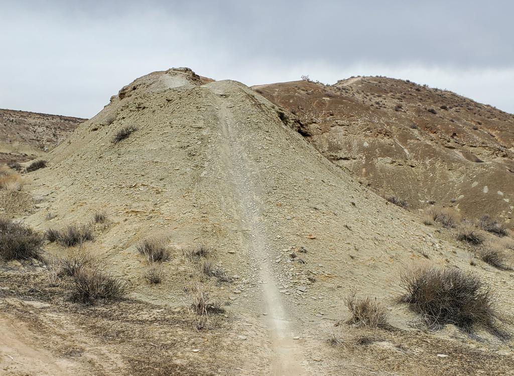
Most of the trail is in white clays of the Moenkopi Formation, specifically the Shnabkaib Member. In the early Triassic Period (around 230 million years ago, before the age of the dinosaurs) this was a broad tidal flat on the ocean's edge.


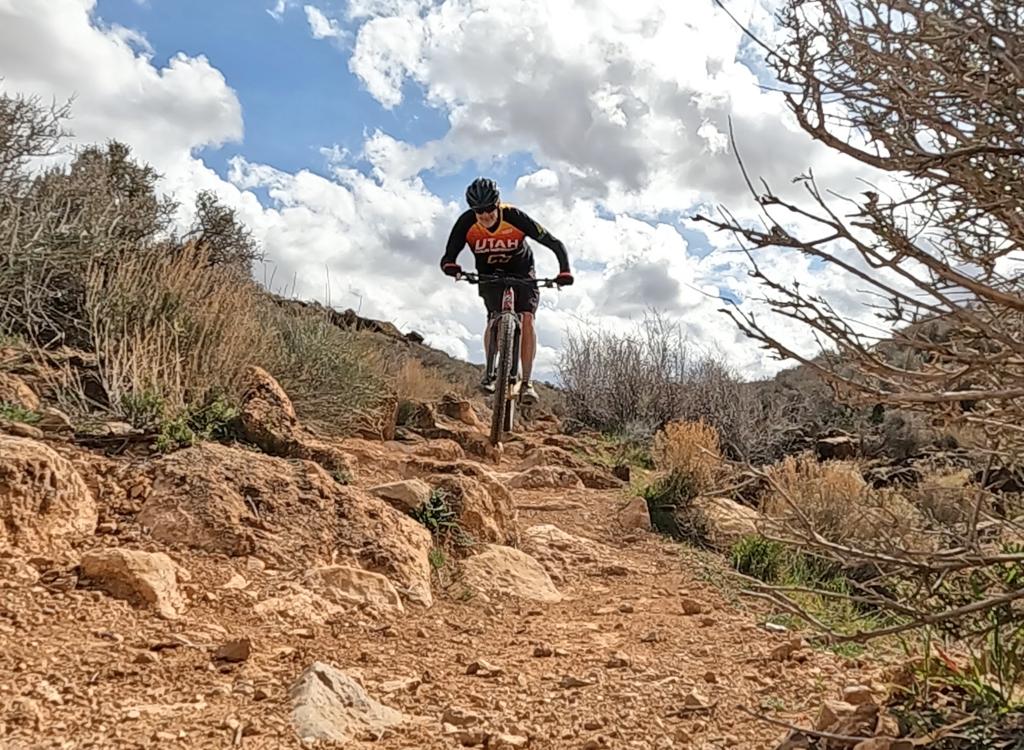
I don't recommend this trail for early intermediates. In addition to skill and strength, you need the experienced eye and confident flow that comes with lots of riding. Intermediates will find the "frustration to riding-my-bike ratio" to be very high.


But whatever you do, do NOT take a cheater trail down the mountain to the road! There are NO trail forks on this route. After you pass the dam, you'll notice some trails between the road and the lake. Don't go there. Stay on legal trail!


The trail now begins another switchback descent to the road. You can take the pavement 1.9 miles back to the trailhead. But real mountain bikers will now do the entire trail in reverse.
Very fun riding for experts, but can be managed by experienced intermediates with a few walkovers and oops-restarts. Great views. It's a quick ride that can be done as you arrive in town in the afternoon, or for a morning quickie on your way out.


Rhythm and Blues trailhead: On I-15 about 10 miles north of St. George, take the Hurricane (US-9) exit eastbound. Drive 2.6 miles. After descending part-way down the hill, turn left toward Quail Creek at the light (onto State Road 318). Drive another 0.5 miles north and find the broad gravel parking area on the left side of the road. The trail starts on the north (right) side of the parking area.
State Park connector: To start at the state park area, go another 1.3 miles up SR 318. Watch for the trail on your left just before you reach the main entry to the state park (roadside parking here is tight and requires an SUV). The trail climbs uphill from the road at N37 11.308 W113 23.682.
North end: Go two miles north of the Rhythm and Blues trailhead. Watch for the trail on your left. Find a roadside pullout for parking. The trail isn't all that obvious as you drive by -- you'll see it climbing uphill on the west side of the road at N37 11.777 W113 23.534.
Water: State Park, none at trailhead
Picnic and Camping: Quail Creek State Park (fee area)
Bathrooms: State Park, none at trailhead
GPS track files (right-click and "Save as..."):
GPX Quail Creek Trail
GPX Rhythm and Blues course file
Area trail links:
Quail Overlook trail page
Rhythm and Blues trail page
Area topo map for printing: View Rhythm and Blues/Quail Trail area
Lodging, camping, shops: Links to St. George area resources