![Princess Di Trail View northbound a few miles into the ride. Youll spot a few huge homes on the hi...](http://cdn1.utahmountainbiking.com/trails/images/pics-trails/PrincessDi07.jpg)
Reached by paved Three Mile Canyon Trail,
with return via Rail Trail
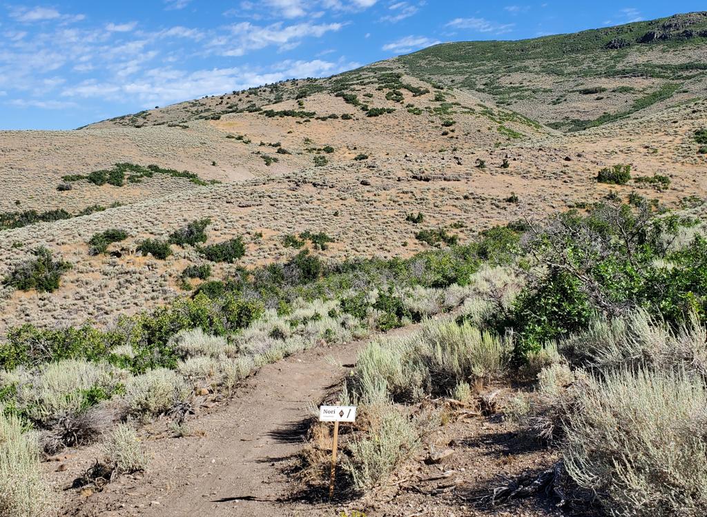
The Princess Di trail is a singletrack trail that hugs the hillside east of Promontory. The track is narrow, with some areas of loose volcanic rock that create tricky traction on the many tight switchback turns. This makes the trail "expert" in technical requirement, although intermediates can ride it by dismounting on most of the turns.
![Just getting started. The Three Mile Canyon paved trail has a gentle slope, clim... Just getting started. The Three Mile Canyon paved trail has a gentle slope, clim...](http://cdn1.utahmountainbiking.com/trails/images/pics-trails/PrincessDi01.jpg)
![From the Three Mile Canyon Trail, there are views west to Parleys Summit and sou... From the Three Mile Canyon Trail, there are views west to Parleys Summit and sou...](http://cdn1.utahmountainbiking.com/trails/images/pics-trails/PrincessDi02.jpg)
Trailhead parking is at 6500 feet elevation. Top altitude is 7300 at the ridgeline 10 miles into the ride, bottom 6300 at the Rail Trail. You'll gain, lose, and regain altitude for about 1800 total feet of climbing.
![Heading downhill after crossing the ridge. The Princess Di trail is just a coupl... Heading downhill after crossing the ridge. The Princess Di trail is just a coupl...](http://cdn1.utahmountainbiking.com/trails/images/pics-trails/PrincessDi03.jpg)
![Entry into Princess Di. The trail is very well marked with carsonite signposts. ... Entry into Princess Di. The trail is very well marked with carsonite signposts. ...](http://cdn1.utahmountainbiking.com/trails/images/pics-trails/PrincessDi04.jpg)
![The trail skirts an outcrop of volcanic rock, a mix of pumice and ash. The trail skirts an outcrop of volcanic rock, a mix of pumice and ash.](http://cdn1.utahmountainbiking.com/trails/images/pics-trails/PrincessDi05.jpg)
![View east toward Rockport Reservoir. View east toward Rockport Reservoir.](http://cdn1.utahmountainbiking.com/trails/images/pics-trails/PrincessDi09.jpg)
The last long climb on the singletrack gains 400 feet over about 1.5 miles, putting you on top of the ridge at 7300 feet. To the west are views over Park City and Jeremy Ranch. To the east, Rockport Reservoir sits in front of the Uintah Mountain foothills.
![Typical trail section on a north-facing slope. Thick low shrubs such as potentil... Typical trail section on a north-facing slope. Thick low shrubs such as potentil...](http://cdn1.utahmountainbiking.com/trails/images/pics-trails/PrincessDi08.jpg)
![View west from the top. The light stripe at mid-left is the end of the subdivisi... View west from the top. The light stripe at mid-left is the end of the subdivisi...](http://cdn1.utahmountainbiking.com/trails/images/pics-trails/PrincessDi11.jpg)
Near the bottom, there's a long straight downhill as you and the Promontory Road follow a small creek down toward I-80.
![One of the few groves of larger trees, as the trail becomes cool and shady under... One of the few groves of larger trees, as the trail becomes cool and shady under...](http://cdn1.utahmountainbiking.com/trails/images/pics-trails/PrincessDi10.jpg)
![I-80, with the Rail Trail between the lanes. I-80, with the Rail Trail between the lanes.](http://cdn1.utahmountainbiking.com/trails/images/pics-trails/PrincessDi12.jpg)
Turn right and cross I-80. Notice the little tree-lined pit to your right. Hike down into the creek (dry in August), turn right, and go through the tunnel under the southbound lane. In between freeway lanes, you'll find the Rail Trail. Turn right and ride uphill 4 miles back to the trailhead.
0.0 Back to road N40 43.475 W111 28.309
Cross road, L on paved trail
Begin Three Mile Canyon paved trail
0.3 Keep straight on paved trail at all crossings
N40 43.449 W111 28.082
(R = to South Canyon Trail)
2.4 Top of ridge, begin to descend
3.0 L on singletrack (end of pavement 2010)
N40 44.537 W111 26.103
Begin Princess Di singletrack
7.2 Top of ridge, angle L across road to ST
N40 46.140 W111 26.772
![Clattering through the tunnel under the freeway, with a bridge on the Rail Trail... Clattering through the tunnel under the freeway, with a bridge on the Rail Trail...](http://cdn1.utahmountainbiking.com/trails/images/pics-trails/PrincessDi13.jpg)
![On the Rail Trail southbound, between the lanes of I-80. Not as obnoxiously nois... On the Rail Trail southbound, between the lanes of I-80. Not as obnoxiously nois...](http://cdn1.utahmountainbiking.com/trails/images/pics-trails/PrincessDi14.jpg)
9.4 Drop R on ST as you hit clearing with bldg
N40 46.684 W111 27.391
10.5 Plunge down to road, turn R and go over I-80
N40 46.512 W111 28.066
Immediately after freeway, drop R into "hole"
N40 46.530 W111 28.161
R into drain tunnel, go under southbound land
R on Rail Trail in between lanes of freeway
14.5 L into parking area
Bathroom: Outhouse at trailhead.
Water: None at trailhead. Convenience store 1/2 mile away.
Camping: None in immediate area. Nearby at Rockport, Echo, or
Jordanelle Reservoirs.
Bike Services: Multiple shops with rentals and repairs in Park
City.
![Princess Di map Princess Di map](http://cdn1.utahmountainbiking.com/trails/maps/PrincessDi-LRes.jpg)
Single-page riding guide: View to print
GPS track files (right-click and "Save as..."):
GPX course for loop
GPX area trails
Large-format area topo map (900K): View
Lodging, camping, shops: Links to area resources