

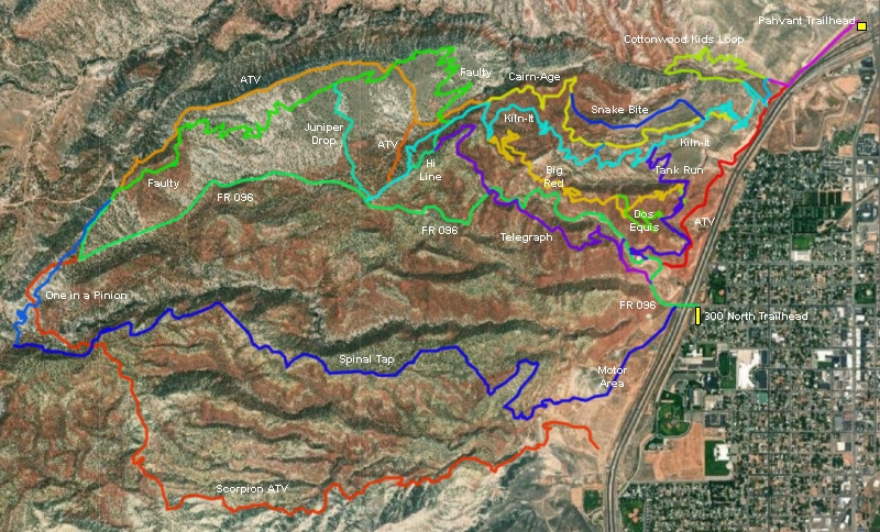
The Cottonwood Kids Loop was added to the lower Pahvant trail system in 2021. The loop itself is 1.7 miles long, plus 1/2 mile of flat riding each way from the Pahvant northern trailhead. The trail is intended for true beginning riders and kids who are ready for real dirt. The expected riding season is May through October.


Ninety degrees to the right, a smaller gravel road angles uphill. (Note that many locals skip the half-mile from the formal trailhead and instead park at the roadside near this fork. There's room for perhaps four or five cars. This is an option if your kids don't have the leg for the full 2.7-mile ride.)
First pass the Kiln-It Connector singletrack forking away on your left 100 yards past the road fork. After another 100 yards, turn to the right uphill on singletrack to start the loop.

 forks away from Kiln-It.")
Once you find the Kiln-It singletrack heading west, follow it 1/10th mile uphill, then keep right to start the southern limb of the Cottonwood Kids Loop. It's 0.3 miles from the gravel road fork to the beginning of the Cottonwood loop trail on Kiln-It .


300 North (FR 096) parking: From Richfield's Main Street, turn west on 300 North. As you approach the freeway, turn left into the ATV parking lot. Pedal under I-70 to head uphill on FR096. (FR096 is used to shuttle to the upper Pahvant trails.)
GPS track files and route (right-click and "Save as..."):
Multi-track area file
Map to save or for printing in new window: 2021 map
Lodging, camping, shops:
Links to Cedar City area resources
Bryce area


