Old 191 Paved Trail - Moab Canyon Pathway
Plus Highway 128 paved path
By request, here's the dope on this paved bike route. Old 191 is the former path of Highway 191, and is now also called the Moab Canyon Pathway. Over the years, the old highway degenerated into a broken dirt path with a few bits of remaining asphalt. It has now been rehabilitated and extended so it forms a nice paved bike path from the north end of Moab to Highway 313. Connecting to this trail at the Colorado is the new seven-million dollar paved path along State Route 128.
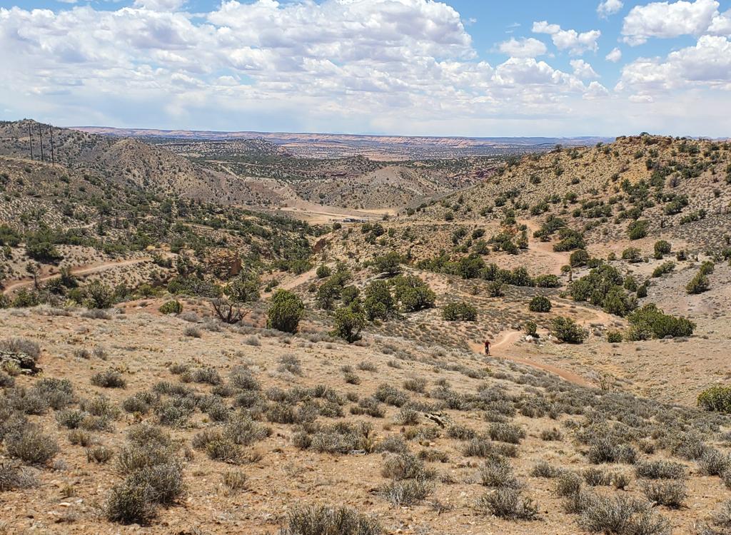
You'll see a lot of bikes on Old 191, both roadies and mountain. Many mountain bikers like to start their bike rides directly from Moab. The Moab Canyon Pathway quickly puts you at the Brand Trails, Gemini Bridges, or Highway 313.

 at ...")
There's a new trail hub (as of May 2014) where the paved path ducks under Route 128. This on the southern bank of the Colorado River. There's a bathroom, plenty of parking, and "wait for my ride" shaded benches. On the other side of Route 128 is the bike bridge across the Colorado, plus the new paved bike path eastbound along the river.
From the trail hub, the pathway continues south about two miles into the north end of Moab. When combined with the State Highway 128 pathway, this gives a mostly traffic-free biking return to your motel from the Porcupine Rim ride.


Northbound from the Colorado, Old 191 follows the east side of Highway 191 for 7 miles, then crosses under 191 to the west side until it reaches Highway 313. Roadies will take Old 191 all the way to its end on 313, then continue their climb up towards Canyonlands. This route is very scenic and has both satisfying distance and reasonable vertical climbing.
To find Old 191, go to the north end of Moab. When you see a bike path along the east side of the road, you're there. At the Colorado River, there's a new trailhead for the paved trails with a bathroom. It's at the southeast corner of the intersection of Highway 128 (the road that follows the Colorado River northeast of Moab) with 191.


Old 191 has connections under Highway 191 on both sides of the river. You can enter the bike path north of the river while southbound on 191, and after passing under 191, over the bridge, and under 191 again, you can exit the bike path on the right side of 191 southbound into Moab.
When using Old 191 as your downhill path, remember that the speed limit for bikes is 20 mph.
You'll overtake wrong-lane cyclists with ipods in their ears and Chatty Cathies walking three abreast. So pass with care.


Distances from Highway 128 parking area:
Parking pullout on 191 - 1.1 miles
End of 279 (Potash Road) - 1.9 miles
Entry to Arches National Park - 3.0
Sidewinder Bar M - 4.9, 5.2, 5.8, and 6.0
Deadman's Ridge Trail - 5.5
Rusty Spur 6.1, 6.2
Bar M Trail - 6.2
Brand Trails Kiosk, pass-under 191 - 7.2
Gemini Bridges Road - 8.0
Highway 313 - 9.1 (ENDS)
Bottom of 7-Up on 313 - 13.2
Highway 128 Paved Path

At the north side of State Route 128, Old 191 connects to paved path eastbound between Route 128 and the Colorado River. As of May 2014, the trail rejoins Route 128 after two miles, ending just below the Grandstaff trailhead. (This trail head is the endpoint for the Porcupine Rim ride, or for hiking Grandstaff Canyon. This will be shown as Negro Bill Canyon on maps prior to 2017. The canyon is named after William Grandstaff, a black cowboy who ran cattle in this area in the 1870s.) If you're planning to ride further up the canyon with small children, you will be dodging cars now.
Because of the narrowness of the canyon, the trail is often supported on pylons above the river bank. That's why this bike path was so expensive. But it does a nice job of keeping motorists and cyclists separated, so you can enjoy the scenery in safety.


The pathway passes the Goose Island campground, providing bicycle-connections from your tent to the business district of Moab.
Once cyclists returning from Porcupine Rim have dodged 1/4 mile of traffic, the rest of the cruise back to town is worry-free.
And if you're just riding the Moab Canyon Pathway (Old 191), a detour up this paved path is 4 very easy and scenic miles round trip.
Getting there:
Colorado parking, east side of Highway 191 on State
Route 128.
Turn into 128 eastbound and immediately turn right into the
parking area.
191 Tailings-area pullout. Turn into the pullout on the east
side of 191 just a mile north of the Colorado River.
Bar M parking. On 191 a mile south of 313 (7 miles north of
the Colorado), turn east onto gravel road. Turn 90-degrees right and
either park at the south end of the parking and pedal 1/2 mile on the dirt
Bar M to Old 191, or drive the route at park at the kiosk near the
underpass.
Gemini Bridges. Across the road from Bar M. Private area, fee
required.
Highway 313. Parking on the north side of 313 across from the end
of the bike path.
Track files for download:
Old 191 GPS track file
Route 128 paved trail track