Bruce rolls down the DH on his checkout ride of June       3, 2025.
Bruce rolls down the DH on his checkout ride of June 3, 2025.
Mueller DH 304 and 305

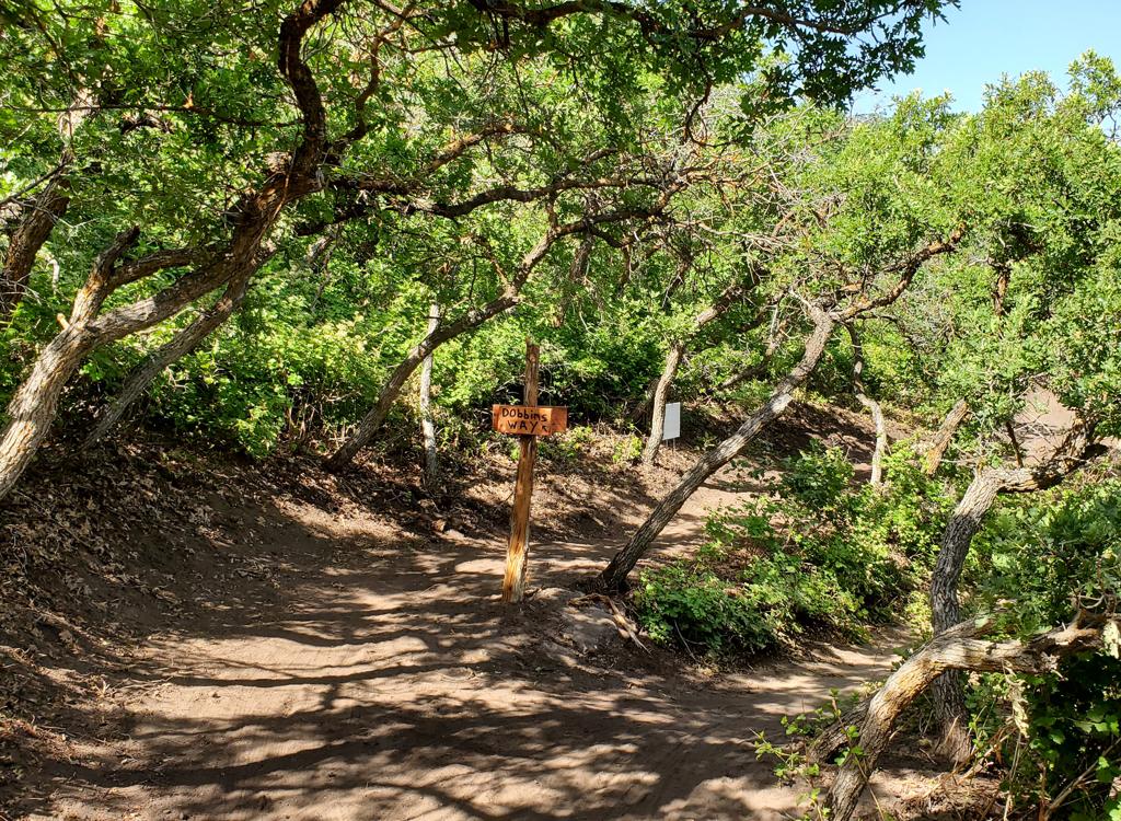
The DH trail at Mueller Park is open for riding in 2025. This one-way trail does not yet have a formal name, but is signed with the forest service segment numbers. It runs downhill from the intersection of the Mueller Park trail with the top of Peregrine at 6500 feet elevation. The DH ends when the route becomes the two-way Hornet trail at the bridge over Mill Creek.

The DH is 2.4 miles long with 900 vertical feet of elevation loss. The downhill is intermediate in tech requirement, with no obligatory jumps, gaps, or tables. It's just a fast way downhill.

In 2025, the trail has firmed up nicely over the winter, with early-season riders packing it into a hardened highway. So even though it's a new trail, the route is already "mature" with established well-packed riding lines.

Handlebar view while riding a traverse area. The       wiggles and dips help the trail shed water.
Handlebar view while riding a traverse area. The wiggles and dips help the trail shed water.
The trail runs through a mixed forest of maple and       fir, with an occasional chokecherry, aspen, and oak.
The trail runs through a mixed forest of maple and fir, with an occasional chokecherry, aspen, and oak.
The trail crosses the Mueller Park trail after 0.9 miles, right at the turn where the spur to Elephant Rock leaves Mueller. Fortunately, there are trail markers at each option of this 5-way intersection. This allows for "laps" on the upper DH via Mueller, or to ride just the lower portion of the DH as a loop with Mueller, Hornet, and the BST Connector.
The trail is a wide engineered bench-cut. Turns are highly banked. On straight sections, the trail wiggles to shed water.

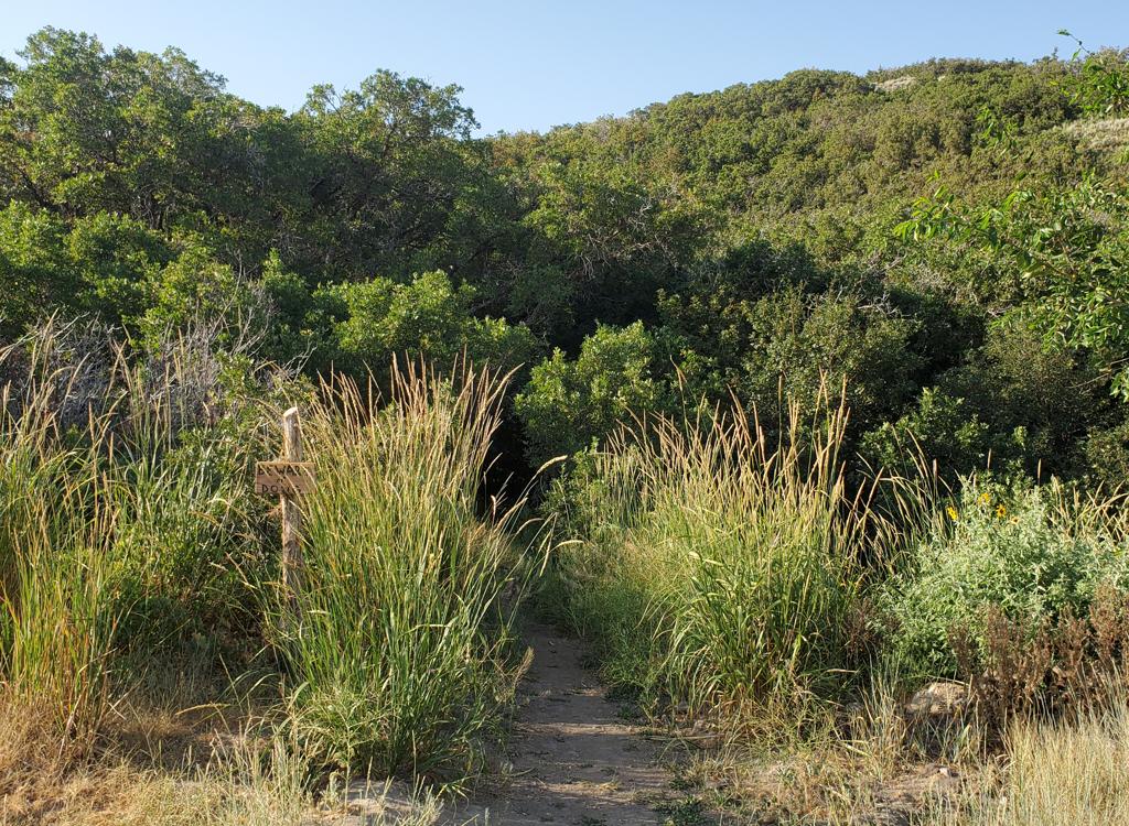
The DH runs through mixed forest and is heavily shaded. At the top it's a mix of fir and mature maple, yielding to tall gambel oak and maple on the lower elevations.

Plenty of riding room on the bench-cut.
Getting to the DH trail
Arriving at the top of Peregrine. We'll now descend       to the X intersection, where we'll cross Mueller to the DH.
Arriving at the top of Peregrine. We'll now descend to the X intersection, where we'll cross Mueller to the DH.
Via Peregrine

From the Mueller Park trailhead, pedal up the paved road 1/10th mile. About 50 feet after you pass the Kenny Creek trail, turn left onto the BST Connector singletrack and climb 250 vertical feet through a series of turns. At mile 0.4 from the road, fork left uphill on Hornet. After 0.5 miles on Hornet, turn left at the next trail fork onto Maple Syrup. Ride another 1.4 miles then fork right onto Peregrine. Pedal 2.8 miles around Mill Canyon until you hit the Mueller Park trail. Cross over to descend the DH at mile 5.2 from the Mueller Park trailhead.

The Mueller Park trail is the shortest route to the       top of the DH, and is the only connection to the DH's midpoint.
The Mueller Park trail is the shortest route to the top of the DH, and is the only connection to the DH's midpoint.
Via Mueller Park

Cross the bridge at the Mueller Park trailhead and begin climbing. Cross the Bonneville Shoreline Trail at mile 1.3. At mile 3.3, you have the option of descending the lower DH by turning hard left downhill. (The Elephant Rock connector trail is straight ahead, and the do-not-enter DH is the trail on far right.) To keep climbing, turn to the right on the continuation of Mueller. At mile 4.2, veer to the right at the intersection to enter the DH.

Looking uphill in oak brush       near the top of North Canyon.
Looking uphill in oak brush near the top of North Canyon.
Via North Canyon

Hitting the DH from North Canyon is more simple than you'd think. Just climb North Canyon up and over Rudy's Flat, 3.6 miles from the end of pavement, then descend 2.3 miles on Mueller to the top of the DH. At the bottom of the DH, take Hornet down to the BST Connector, but turn to the left (away from the Mueller trailhead). Cross over to the Bonneville Shoreline Trail and take it back to North Canyon.

Notes on the DH trail
My Rocky Mountain, leaning against a tree, with the       DH on the right and the continuing climb up Mueller Park at far left.
My Rocky Mountain, leaning against a tree, with the DH on the right and the continuing climb up Mueller Park at far left.
The DH 304 trail begins at an X crossover at 6500 feet elevation. If you're climbing via Mueller Park, just veer to the right and you're on your way downhill. If you arrived via Peregrine, cross Mueller Park.

If you're on your way down from Rudy's Flat, it's a hard left turn. The trail is marked with a carsonite post containing the trail number and its DH-only status.

This highly-engineered trail consists of down-sloped traverses separated by tight, highly banked turns. The riding has no technical features, just bumps and turns. The bumps are easily rolled, but can be used to launch if you have enough speed. Occasionally, bumps will line up so a rider can do a double. Unskilled riders could easily manage this trail, but because of the speeds involved the trail is rated for intermediate-skilled bikers.
Rolling into a typical turn. Highly banked and fast!
The trail is easily managed by an early-intermediate       rider.
The trail is easily managed by an early-intermediate rider.
There were a couple of trailside alternate lines on the way down where an intermediate rider could get the wheels off the ground. But 99% of the time it's just speedy flow.
As you approach the cross-over near Elephant Rock at mile 0.9, slow way down and look around. This 5-way intersection will have hikers, trail runners, and riders coming from 4 of the 5 trails. (Up Mueller, back from Elephant Rock, down Mueller, and behind you on the DH.) Proceed across. This is the longer 305 DH segment, with no other trail connections until you hit Hornet down at the creek.
Looking north at the crossover at the Elephant Rock       spur.
Looking north at the crossover at the Elephant Rock spur.
Lots of nice flow here.
The lower section is significantly longer at 1.5 miles, but has about the same rate of overall descent and the same technical rating. The forest continues to be a mix of big mature maples and fir, with occasional oak.
At the bottom of the DH, you'll go through a small dip and bang your way up a short rocky slope. Now turn left onto the bridge, and you're on Hornet. Climb 1/2 mile to the Maple Syrup trail fork. Either go up Maple Syrup for another lap, or turn left downhill for more descending. When you hit the BST Connnector, you can turn left to catch the BST to climb up to Mueller for a lap. Or you can keep to the right for the descent down to the trailhead.
Bridge at the bottom. From here, you'll gently climb       to the Hornet-Maple Syrup trail fork.
Bridge at the bottom. From here, you'll gently climb to the Hornet-Maple Syrup trail fork.

Descending the DH

[Back to video list ]
The dip at the end of the DH.
Bottom Line!

Very nice and plush one-way route. Fun riding! The DH will attract a lot of riders to this already-popular biking destination. But it's not likely to attract the true gravity crowd because (1) you have to work to get to the top, and (2) it's a fairly non-technical flow trail without deliberate jumping features.

Getting there:

Mueller Park: On I-15, take the 2600 south Bountiful/Woods Cross exit. Go east towards the mountains. The road will turn north and be renamed Orchard Drive. While heading north, turn right (east) on 1800 south. This street takes you to the trailhead about 2 miles later, where you'll see parking places on the right side of the road. Go across the stream on the bridge to begin the ride up Mueller Park. To reach the BST Connector (with connections to Hornet, Maple Syrup, and Peregrine), pedal up the road into the park itself. Pass the Kenny Creek trail on your left, then take the next singletrack on your left.

North Canyon: On I-15, take the 2600 south Bountiful/Woods Cross exit. Go east towards the mountains. The road will turn north and be renamed Orchard Drive. While heading north, turn right (east) on 1800 south. Just as you reach the bottom of a steep hill, turn right at the intersection. (This is about 0.6 miles before the Mueller Park trailhead. If you arrive there, backtrack.) After 1.7 miles, turn left on Canyon Creek and go uphill 0.7 miles to the end of the pavement. Start your ride by heading east (uphill) on the dirt road.