Looking toward the San Rafael Reef, with Interstate       70 in the mid-ground. Review by Bruce on May 8, 2025.
Looking toward the San Rafael Reef, with Interstate 70 in the mid-ground. Review by Bruce on May 8, 2025.
Mine Tour

The Mine Tour trail is a doubletrack route near the eastern edge of the San Rafael reef, just north of I-70 at the Highway 24 exit. It combines pieces of old mine access pathways to create a continuous five-mile ride through a historic uranium mining area.

The riding is considerably less technical than the nearby Miner's Run route, but there are some steep pitches. Plus boggy San Rafael dirt and a few sand pits.

There are two nice spurs off the Mine Tour loop that lead to viewpoints to the west. The southern spur overlooks I-70's entrance into the San Rafael Reef. The northern spur is above the San Rafael river and looks toward Black Dragon Canyon.

The route as shown in the map below (and on Trailforks) combines multiple segments of doubletrack. There will be over a dozen unmarked forks. An on-bike navigation app is a must. The old mine routes follow the Salt Wash sandstone member of the Morrison Formation (deposited around 150 million years ago) as it tilts upward toward the San Rafael Swell.

Where "littering" and       "archeology" intersect: mining debris older than 50 years is       considered a "protected historical resource" and will not be       "cleaned up."
Where "littering" and "archeology" intersect: mining debris older than 50 years is considered a "protected historical resource" and will not be "cleaned up."
Looking over the San Rafael River toward the Swell.
There are no bathrooms, campgrounds, water, or cell phone service in this area. It gets blazing hot in the summer. When it rains, roads may become impassible.

The Mine Tour (and Miner's Run) should be considered an "adventure ride." You're on your own. Only idiots like me will venture into this area alone.

There are several good reasons why many mountain bikers would NOT enjoy this trail. Let's talk about that.

First, the doubletracks are constantly branching. There are no signs, cairns, ribbons, or other indicators of the correct trail fork. During the uranium prospecting boom, every little hotspot on the geiger-counter quickly resulted in a mini-road to haul in mining equipment. You won't find your way through without a navigation app. And I suggest that your device be handlebar-mounted! Otherwise you'll be constantly stopping to fish the cell phone out of your pocket to check Trailforks.

An electrical generator maybe? Look but don't touch!
An old mining building on a spur just off the main       path.
An old mining building on a spur just off the main path.
Second, while there are plenty of slickrock ramps and more-interesting stretches of riding, 90% of the ride will be on dirt double-track. If you're looking for a more-technical "real" mountain bike experience, go to Miner's Run which is just a couple of miles to the north.

Third, there's a steep climb in the middle of the Mine Tour (as ridden south to north) that was torn up fairly recently by a bulldozer. The surface was soft and loose with a pitch of 20% (100 vertical feet in 0.1 mile). For me, this was a push-a-bike climb. And no, the doubletrack to your left at the base of the hill is not an alternative. It drops to a lower line above the San Rafael river and proceeds north without reconnecting to the many branching doubletracks in the mining area.

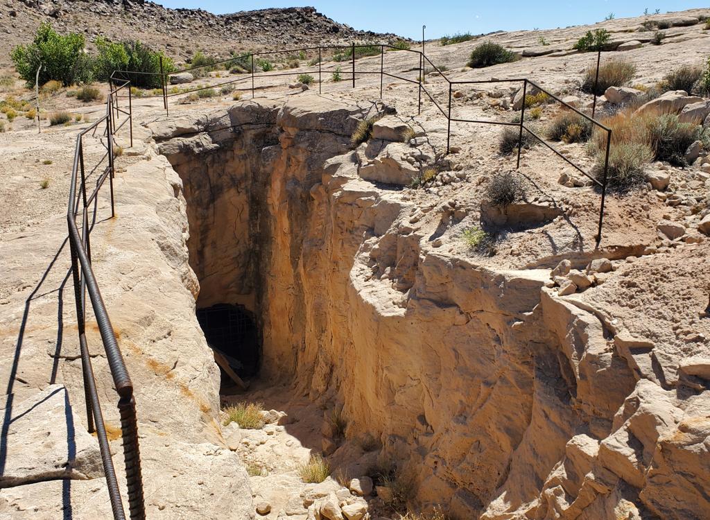
Fourth, the mines are probably not what the typical city-boy would expect. Yes, if you look around, they're everywhere. But usually it's just a shallow hole in a sandstone face with a nearby rubble pile and a rusted fuel drum or two. Most of the deeper excavations have been deliberately closed off. If you do find a mine where it's physically possible to enter, well, don't. Inside you'll find several horrible ways to die: rodent droppings with hantavirus, bats with rabies, radon gas, uranium ore dust, and rattlesnake dens.

So if you're a bike-park follow-your-buddies type of Saturday rider, this is not your trail.

Looking north on the descending side of the Mine Tour       loop.
Looking north on the descending side of the Mine Tour loop.
Petrol barrel, rock debris. Signs of a mine.
Who WILL like this ride?

For the right person, this is a nice outing. There are great views. It's a chance for us nerdish types to look at Utah's wildcat mining history. And if you want some more-techy sandstone riding, it's just up the road at Miner's Run, which is easily added to the Mine Tour. (Or, you can just turn off the doubletrack in the middle of the Mine Tour and play on the slickrock for a while.)

I had a good time watching for the signs of nearby mines and hiking over to check things out.

A loop ride of Mine Tour including up-and-backs to the I-70 and the San Rafael viewpoints, and returning via the Four Corners Mine Road, and will be 10.5 miles long with 1000 vertical feet of climbing. If you add Miner's Run, which I recommend for stronger riders, your day will be around 20 miles with 2000 feet of climbing.
Looking southwest from the ride's highest elevation.
Trailhead and connections
Looking west in the parking area. The doubletrack on       the left is the way to the viewpoints or the Mine Tour.
Looking west in the parking area. The doubletrack on the left is the way to the viewpoints or the Mine Tour.
Highway 24 access

On I-70 east of Green River, drive west from the US-6 junction for 8.5 miles. Exit I-70 at the SR-24 turnoff. Instead of proceeding to Highway 24, turn right (north). Within 100 yards the pavement will turn to gravel, and you'll cross a cattleguard onto the Four Corners Mine Road. Now turn left into a wide primitive parking zone. (In 2025, there was a map kiosk in the middle.) The trail begins as a doubletrack on the western edge of the parking area. This is the route to the Mine Tour and to both viewpoints.

A view from Miner's Run, which features much more       interesting riding.
A view from Miner's Run, which features much more interesting riding.
From Miner's Run trail

The north entry to Mine Tour is a doubletrack that forks westbound from Four Corners Mine Road, 0.4 miles from the southern end of Miner's Run where the route climbs up to the west from the road. See the Miner's Run trail page. (This is 1.3 miles from the parking spot described in the Miner's Run page.)

It's 2.9 miles on Four Corners Mine Road from the south end of Miner's Run to the parking area off Highway 24.

I-70 Overlook spur
Side canyon in the Salt Wash sandstone as we approach       the uplifted area.
Side canyon in the Salt Wash sandstone as we approach the uplifted area.
Head west from the parking zone on the (boring-looking) dirt doubletrack. Pass a spur to a canyon overlook at mile 0.6 (keep right). The I-70 overlook route branches to the left off the Mine Tour loop at mile 0.9 from the Highway 24 parking area.

Note that on Trailforks, this first mile of the Mine Tour loop is shown as part of the I-70 Overlook trail and not part of Mine Tour trail. My GPS track in the downloadable multi-track file follows this precedent.

Shortly after the fork at mile 0.9, you'll begin climbing the slope of the Salt Wash sandstone. Stay on what appears to be the main route. There are a couple of alternate doubletracks, and they both rejoin the main route. So don't sweat the navigation. Just keep heading west uphill.
Heading toward the Swell. The darker sandstone upper       mid-photo is Black Dragon Canyon, a nice doubletrack ride.
Heading toward the Swell. The darker sandstone upper mid-photo is Black Dragon Canyon, a nice doubletrack ride.
Old wood can be seen here and there. My guess is, this is       probably a "tipple" where ore in a wheelbarrow was dropped into       a vehicle to transport it away.
Old wood can be seen here and there. My guess is, this is probably a "tipple" where ore in a wheelbarrow was dropped into a vehicle to transport it away.
Any hump of clay that looks out of place, or a disordered       pile of rocks, is likely due to mining activity. This appears to be a ramp       where uranium ore was loaded onto a truck.
Any hump of clay that looks out of place, or a disordered pile of rocks, is likely due to mining activity. This appears to be a ramp where uranium ore was loaded onto a truck.
View from the end of the trail, looking west.
At mile 1.2 from parking, keep left at the DT fork and descend a bit onto an area of flat sandstone. At mile 1.3, you're at the overlook.

To continue your ride, backtrack down to the trail fork at mile 0.9 from parking. Turn left. In 100 feet, the DT splits again. The trail to the left takes you up to the San Rafael overlook. The fork on the right is the Mine Tour.

San Rafael Reef Overlook spur
The route is a combination of dirt road and open       rock.
The route is a combination of dirt road and open rock.
At the trail fork at mile 0.9 of the Mine Tour loop, take the northern DT. This will be a hard left if you're descending from the I-70 overlook, or a gentle right if you're pedaling from the parking zone. Next take a left in 100 feet. (The trail on the right is Mine Tour.) Quickly begin climbing the slope through the sandstone.
This route will have a little more sandstone riding than the freeway overlook route. It's a more-interesting ride, bike-wise. Again, there will be alternate routes. Stay on what appears to be the main path to keep heading west and uphill. Most alternates will rejoin as you get further uphill.
A long slickrock ramp, heading west.
Looking west and down over the gooseneck bends in the       San Rafael River.
Looking west and down over the gooseneck bends in the San Rafael River.
As you approach the cliffs, you can pedal your way over the rolling sandstone for a preliminary view. Then return to the DT. Continue north until the path makes a loop on the cliff edge. This is the San Rafael viewpoint. You're at mile 0.7 from the trail fork where you left the Mine Tour loop.

Now backtrack downhill to the trail fork with Mine Tour and fork hard left. Ride northbound.
Mine Tour Loop
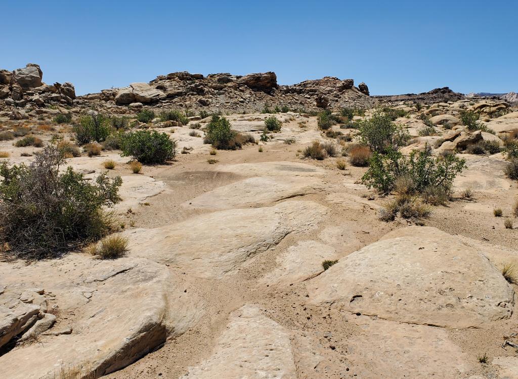
A stretch of DT with domes of Salt Wash sandstone to       make the riding more interesting.
A stretch of DT with domes of Salt Wash sandstone to make the riding more interesting.
If you're coming back from the San Rafael viewpoint, fork hard left as you reach the Mine Tour doubletrack. If you're coming directly from parking, it's a right turn at mile 0.9, then another right turn in 100 feet. You're now officially on the Mine Tour.
At mile 0.4 from the viewpoint fork, turn left. There was a rockpile here along the DT, which is the one and only "navigation aid" I saw.

At mile 0.8, keep straight onto a climbing slickrock ramp while the main road forks to the left. (I went the wrong way here and had to backtrack.)

Critical fork where the route takes you up this       sandstone ramp, instead of the more-obvious DT crossing the valley to your       left.
Critical fork where the route takes you up this sandstone ramp, instead of the more-obvious DT crossing the valley to your left.
Rusting truck at a mine site. The truck model tells       you the age of the mining activity here.
Rusting truck at a mine site. The truck model tells you the age of the mining activity here.
Around mile 0.9, keep to the right at two trail forks.

At mile 1.1, stay left. Then at mile 1.2 fork 90 degrees left.

When you spot signs of mining activity, hop off your bike and explore. But again, there are hazards here. Don't crawl into any holes!

Where did the uranium in these little mini-mines come from? The Salt Wash sandstone was laid down in a meandering river delta area. Organic matter -- like leaves and logs -- accumulated on the river bottom in spots. Later, deep underground, hot ground-water carrying uranium permeated the rock. Uranium ions replaced the carbon in the organic material.

I found several beautiful specimens of petrified wood on my ride, but I didn't collect anything. Because, radioactive. Probably low-grade radioactivity and not very dangerous, but do I want my grandkids playing with those fossils?

Blast holes on a rock face are all that remains of       this mine.
Blast holes on a rock face are all that remains of this mine.
All that remains of a house or mining shed.
Stay to the right at mile 1.4 and begin a loose steep climb up to the top of the hill. (The attractive DT to the left looks nice but it will take you off into the boonies.) This climb was a hike for me. I found it too steep and too loose to ride.

Note that the San Rafael dirt compacts poorly, even on ATV routes. Often it feels like you're riding in glue.

At mile 1.7 you'll reach a cabin, then a trail fork. Straight ahead and uphill is a shortcut to the continuing trail. The "official" route forks right, where it will descend around the hill. At the lowest point on the far side, fork left uphill. Pedal back up to a ridgeline above the cabin and turn right. This is the ride's highest point. It's pretty much all downhill from here.
Cabin at the top of the climb.
Riding through broken sandstone as we roll around the       hill.
Riding through broken sandstone as we roll around the hill.
There will be a couple of small branching DTs during the descent. Stay on the main route.

At mile 3.3, your skinny DT will end on a broader dirt road. This is NOT the mine road you're looking for. There are signposts for ATV routes here. Fork to the left, then in 100 feet, fork left again onto a smaller DT. You'll be climbing the rock ramp up and around the hill to the west.

Keep right at mile 3.5 and climb over the hill.

As the DT becomes sandy at mile 3.8, consider jumping over to the slickrock on your left that parallels the ATV track. Here you'll find a couple of mines, including one mine tunnel guarded by a gate with a tempting person-sized hole near the top. Again, stay out!
It was a different age. Nobody was expected to       "clean up after themselves."
It was a different age. Nobody was expected to "clean up after themselves."
Fuel drums and mounds of clay are the hint       that mining occurred here.
Fuel drums and mounds of clay are the hint that mining occurred here.
Another small mine that went nowhere.
Photo-op mine ear the north end of the Tour.
Do not, do not, go inside. Take your selfie       and leave.
Do not, do not, go inside. Take your selfie and leave.
Another mine building, maybe residence or maybe       equipment storage, in the act of returning to nature.
Another mine building, maybe residence or maybe equipment storage, in the act of returning to nature.
From here, keep generally to the right at several DT intersections as you work your way east to the Four Corners Mine Road. Turn right here to return to parking.
On the dirt Four Corners Mine road, it's a quick 2.5 flat miles back to parking.

If you're heading for Miner's Run, turn left on the road and pedal 0.4 miles north until you spot the ramp on your left that takes you up the sandstone to the west.

Bottom Line!
Not anybody's first choice for a ride in the Moab area, but satisfying and educational if you have appropriate expectations. Nice views, beautiful in an ugly sort of way.

Looking south on the Four Corners Mine Road as we       head back to parking.
Looking south on the Four Corners Mine Road as we head back to parking.
aerial map
aerial map
Getting there, Interstate 70 to Highway 24 access

On I-70 east of Green River, drive west from the US-6 junction for 8.5 miles. Exit I-70 at the SR-24 turnoff. Instead of proceeding to Highway 24, turn right (north). Within 100 yards the pavement will turn to gravel, and you'll cross a cattleguard onto the Four Corners Mine Road. Now turn left into a wide primitive parking zone. (In 2025, there was a map kiosk in the middle.) The trail begins as a doubletrack on the western edge of the parking area. This is the route to the Mine Tour and to both viewpoints.

Primitive camping allowed
No water
No toilets
No cell phone reception