. Review by Bruce on July 21, 2024.")
Mayors Trail is a higher-elevation route at the western ridgeline of Traverse Mountain. It has created some nice new loop riding options through its connections to Lolo's Loop, Traverse Traverse, the Lehi's Dream DH, and a doubletrack connection to Beware of Doug and across the ridge to the upper Maple Hollow trailhead.
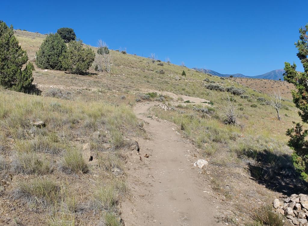
The top elevation of Mayors is 6400 feet. Much of the Mayors trail lies on a north-facing slope, so the expected riding season will be late May through October.


The water tank trailhead on the southwest corner of Sensei is also affected. At the time of this trail review, it was not possible to get onto the trail system there. You'd need to use a neighborhood connector such as Broadband. But there's no dedicated public parking for Broadband or Dial-up.
For now, you should use the plush paved trailhead at the top of the Fox Canyon road.

The main access point for those who drive to the Traverse Mountain trails is the new paved trailhead in Fox Canyon. Turn onto the Fox Canyon road and drive to the top of the pavement. There's parking for around 20 vehicles, with a toilet and other amenities planned. The trail entry is on the northern wing of the parking complex. At the northwest corner, find a paved strip leading uphill to a dirt doubletrack (which then turns to the right uphill). Follow the dirt road 100 yards uphill to where the Sensei trail crosses. Depending on your ride plan, you can reach Mayors trail in either direction by connecting north via Sensei then Mo-mentum and Traverse Traverse, or south via Sensei to Lolo's.

You can take Mo-mentum either direction to reach Traverse Traverse, which will then take you to Mayors trail. Both put you at the bottom (north) end of Mayors trail for a clockwise loop.
(1) Western route (clockwise on Mo-mentum): On the dirt road above the Fox Canyon trailhead, turn left on the singletrack Sensei trail. When you reach Mo-mentum at mile 1.2, turn right. At the next trail fork at 1.8, keep left uphill on Traverse Traverse and pedal 2.1 miles. Turn right on Mayors at 3.9 miles from the trailhead.
(2) Eastern route (counterclockwise on Mo-mentum): Climb the dirt road from the Fox Canyon trailhead, but turn right on Sensei. After 0.1 mile, turn left uphill on Mo-mentum. Climb 1.8 miles, then make a hard right turn onto Traverse Traverse heading east. Go another 2.1 miles to Mayors trail at the ridgeline.

You can reach the southern end of Mayors trail by riding Lolo's in either direction. From the Fox Canyon trailhead, turn to the right from the doubletrack on Sensei. Climb 1.3 miles, then make a hard left onto Lolo's eastern end. Continue the climb for another 1.4 miles to Lolo's highest point, then make another hard left turn onto Mayors trail.
To climb up on the western half of Lolo's, continue another 0.2 miles west on Sensei then fork left uphill on Lolo's. This side of Lolo's has 1.3 miles from Sensei to Mayors trail.

ST route: On western Ann's trail above Draper, go to the trail fork for Traverse Traverse. This is found 1.2 miles above the western (bottom) end of Ann's, or 0.9 miles west of the fork between Ann's and the Maple Hollow TH connector trail. (If you started at the Maple Hollow trailhead, it's 2.0 miles to Traverse Traverse.
Turn uphill and ride the "wiggles" uphill then continue to the top of the ridge. At mile 1.3 from the trail fork, you'll reach a doubletrack on a ridgeline. Cross over, then turn left onto Mayors trail.
Road and DT route: A second option is to connect via paved and dirt road from the Maple Hollow trailhead. From Elk Glenn, go back out to Deer Ridge drive and go west uphill. At the saddle, turn right on a dirt road, which will take you up to Mayors trail. The connection is at mile 0.6 from the southern end of Mayors trail.

It's a two-way trail, although I suspect most riders will want to do it in the south-to-north direction for a counterclockwise loop.

You will, of course, need to use at least two other trails to get uphill from the Fox Canyon trailhead to Mayors Trail. (See the access instructions above.) So your minimum loop ride will be 9.5 miles. While technically easy, the length and amount of uphill riding will be too much for unconditioned beginning riders.

(There are actually three doubletracks to the right of Mayors Trail at this spot. The route to Beware of Doug is just a bit to the right -- almost straight ahead as you arrive at the trail fork area. The DT heading hard right uphill to the west goes to a viewpoint, while the DT 90 degrees to the right that drops downhill through the trees to the south descends Dry Canyon to the Bonneville Shoreline Trail.)


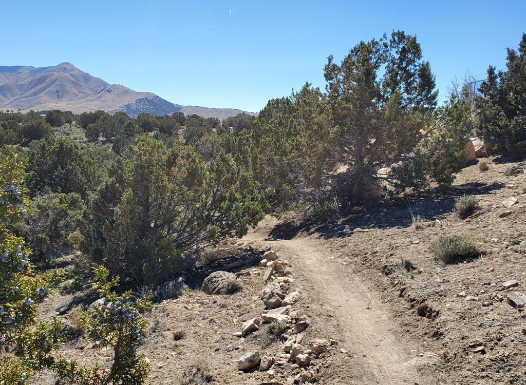
After passing the entry to Lehi's Dream DH trail on the left at mile 0.6 -- and the DT connector to Beware of Doug (and to the Maple Hollow trailhead) on your right -- Mayors trail descends steadily, with only a tiny bit of gentle climbing. You'll roll through a series of banked turns in the oak brush as you drop down a north-facing slope.


Mayors Trail is a great addition to the Traverse Mountain system. Well-constructed and fun to ride. Opens up some very nice longer loop options for both Traverse Mountain and Draper riders. The route I rode was about as short a loop as you can make, at 9.5 miles and just under 1000 feet of overall climbing. Good views.


Fox Canyon trailhead. The main access point for those who drive to the Traverse Mountain trails is the new paved trailhead in Fox Canyon. There's parking for around 20 vehicles, with a toilet and other amenities planned. The trail entry is on the northern wing of the parking complex. At the northwest corner, find a paved strip leading uphill to a dirt doubletrack (which then turns to the right uphill). Follow the dirt road 100 yards uphill to where the Sensei trail crosses. Depending on your ride plan, you can reach Mayors trail in either direction. For the northern end, take Sensei to wither end of Mo-mentum climb to Traverse Traverse. For the southern end of the Mayors trail, take Sensei south and westbound to Lolo's. Climb Lolo's to the Mayors trail.
Maple Hollow or Deer Ridge trailheads: At the stop sign in Suncrest, get on Deer Ridge Drive (right turn from SLC, straight from Utah Co). Go 0.9 miles. For the Deer Ridge trailhead, continue straight into the parking strip at the end of Deer Ridge Drive. For Maple Hollow, turn right onto Elk Glen Drive and after 1/10th mile turn left to park in the semicircle at the small picnic area. Get on Ann's Connector for 1.1 miles, keep left on Ann's trail, then turn left uphill when you reach Traverse Traverse. Climb to the top of the ridge and fork left on Mayors trail.