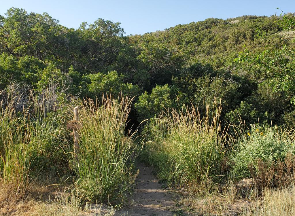
Looking south on Flying Squirrel.
Lodestone Regional Park

Lodestone Park, located in Kearns just off the Mountain View Corridor on 6200 South, has a set of bike trails on a slope above the main park. The trails have recently been revised to offer more-varied riding options, with the addition of a skills area, and have now re-opened to the public in May 2025.

Note that in a "bike park" area, trails and features may change fairly often. This description is current as of summer 2025.

There are 3.5 miles of trail here, stuffed into an area that's only 200 yards on each side. These trails should be considered more of a "training opportunity" rather than an exciting destination ride. In general, everything here is suitable for beginning and early-intermediate riders.

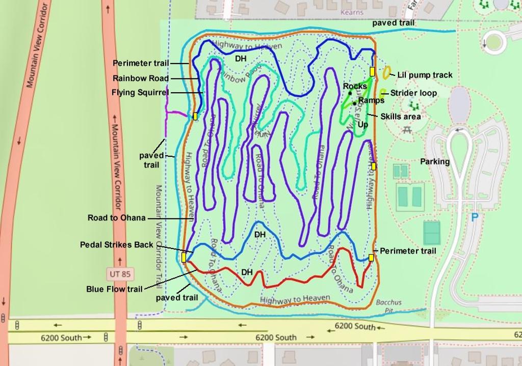
Trails are well-marked. There's an area map on the lower Perimeter Trail at the skills area.
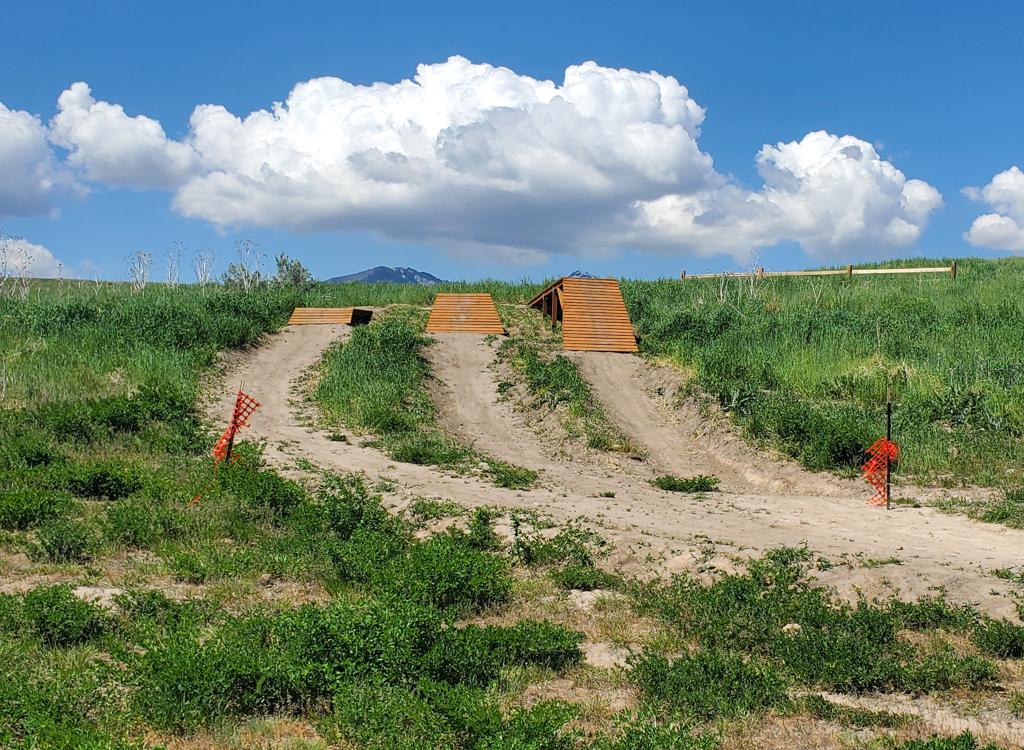
View of three ramp options in the skills area.
A receiving corral, designed to check speeds before       downhill riders merge onto the perimeter trail.
A receiving corral, designed to check speeds before downhill riders merge onto the perimeter trail.

There are some optional trailside stunts, such as rock roll-overs and balance beams. But for the most part they're beginner-level easy.

"Corrals" have been added to the start and end of the downhill routes to provide safe staging areas at the top and receiving pens at the bottom to prevent collisions from high-speed merging. And the pens make a nice spot to group up for a downhill, or to wait and watch while the rest of your group filters down the trail.

The trails are contained within a two-way singletrack Perimeter trail. This narrow singletrack is, itself, contained within a paved loop. There are three downhill-only trails: Rainbow Road (easy) on the north end and Pedal Strikes Black (difficult) and Blue Flow (intermediate) on the south. Road to Ohana is a two-way longer easy trail. Flying Squirrel is intermediate two-way, joining Road to Ohana half-way down.

Because the paved trails see heavy use, I'm going to suggest that you climb ride the singletrack to access the DH routes and NOT use the paved perimeter trail that will be filled with kids, strollers, and dogs.

Looking at two rock-rumble descents in the skills       area.
Looking at two rock-rumble descents in the skills area.
Looking at a rock roll-over on Pedal Strikes Back       from the (easy) bypass trail alongside.
Looking at a rock roll-over on Pedal Strikes Back from the (easy) bypass trail alongside.
Because the paved trails see heavy use, I'm going to suggest that you ride the singletrack to access the DH routes and NOT use the paved trail that will be filled with kids, strollers, and dogs.
Trailhead
Parking area, looking west.
On 6200 South in Kearns, turn north into the Lodestone Regional Park. Find a spot to park, then take the sidewalk west to the slope and hike across a bit of grass to the Perimeter Trail.

There's a bathroom with running water in the play area east of the bike trails.

Perimeter Trail
Looking south on lower Perimeter Trail.

The Perimeter Trail forms a loop around the downhill trails. It is two-way.

As mentioned, there's a paved trail just outside of the singletrack. Especially on weekends, I'd suggest you leave the paved trail to those who are on foot.
Climbing the northern limb of Perimeter Trail.
A mellow rock roll-over as an optional line on upper Perimeter Trail.

There are some practice stunts as alternate lines on Perimeter Trail. For example, there's a rollover ramp, a rock roll-over, a rock rumble strip, and a couple of balance beams.

Skills area
The climbing trail is the narrower trail on the left.

Near the northern end of Perimeter Trail, there's a receiving corral. On the southern side of the fence, there are two trails. the smaller one on the left is the climbing trail. It will meander around to the top of the wooden ramps you see above you. There are three options, all quite easy. It gets bigger from right to left.

Just past the wooden ramps, there are two rock rumble descents. Both are relatively non-threatening, but the bumps are bigger on the left option.
Practice controlling the bike during a bouncing       descent.
Practice controlling the bike during a bouncing descent.

"Lil Pump Track" located just outside the Perimeter Trail       loop on the northeastern end.
"Lil Pump Track" located just outside the Perimeter Trail loop on the northeastern end.

Across Perimeter Trail from the ramps, there's a small pump track. The bumps seemed pretty tiny on my all-mountain 29er. So I guess it's designed for smaller people on smaller bikes.

Located just south of the pump track is a loop with wooden ramps. Seems designed for smaller people, testing their handling skills. This is called the Strider Loop.

Kiddie bike-handling loop.
Rainbow Road
Entry to Rainbow Road from the corral off Perimeter Trail.

The northernmost DH trail is Rainbow Road. It's 0.3 miles long with only around 80 vertical feet of descent. The trail begins on the northeast corner of a staging corral just off Perimeter Trail.

It's a relatively easy ride. The trail ends in a receiving corral on lower Perimeter Trail.

A long whoop on the way down.
Flying Squirrel
Climbing a bit as the trail turns south.

Flying Squirrel begins on the southwest corner of the north staging corral on upper Perimeter Trail. It runs 0.5 miles, then joins with Road to Ohana for the final 0.5 miles of the downhill.

Flying Squirrel is not a continuous downhill. It often angles back uphill to add distance. It's ranked intermediate in difficulty. There are occasional embedded rocks, and the width of the trail is narrower.

Road to Ohana
A rumble strip with variable difficulty near the       bottom of Road to Ohana.
A rumble strip with variable difficulty near the bottom of Road to Ohana.

Road to Ohana is the longest trail of the system. With the 2025 revisions, it has been shortened to 1.6 miles. Like Flying Squirrel, Road to Ohana is a two-way trail that meanders around the slope.

The top of Road to Ohana trail begins in the southern staging corral on upper Perimeter Trail. At the bottom, you'll find it at the middle staging corral on the lower Perimeter Trail.
Road to Ohana wanders back and forth forever.
Pedal Strikes Back DH trail
Entry to Pedal Strikes Back on the left. These DH routes are fairly fast and direct.

Near the southern end of upper Perimeter Trail, two DH routes leave the southeast corner of a staging corral. Each is 1/4 mile long with around 75 feet of elevation loss.

The trail to the left is an expert-level descent called Pedal Strikes Back.

Pedal Strikes Back features a rock garden near the top.

There are a few linked flow turns near the bottom, and a couple of tables where you can catch air if you've got enough speed.

Running the rock garden.
Approaching the top rock roll-over.
There are two rock rollovers. The first has a "helper" ramp to get you up. The second is steeper and shorter. It's pure rock.

Both of the rock stunts have ride-arounds.

Pedal Strikes Back ends at the south receiving corral on lower Perimeter Trail.

Blue Flow DH trail
The only real "tech" feature on Blue Flow       is this curved ramp leading to a little rock drop. Note the scouting trail       that bypasses it.
The only real "tech" feature on Blue Flow is this curved ramp leading to a little rock drop. Note the scouting trail that bypasses it.
The southernmost trail (closest to the Perimeter Trail) is called Blue Flow. It's ranked intermediate in skill requirement. 

There's one curved ramp leading to a rock drop of around 12 inches. It looks intimidating at first but is pretty easy. If you keep to the inside at moderate speed, you can actually roll it. And there's a ride-around to the side.

Blue Flow has some turns and bumps. Most of the trail would actually rank as easy. It only becomes intermediate if you're hitting it with speed. Fingers off the brakes when you dare.
Typical banked turn on Blue Flow.
A low table. You have to really *want* to jump it.
Blue Flow also has a couple of spots you can launch if you want. 

Blue Flow joins Pedal Strikes Back at the receiving corral on lower Perimeter Trail.

Trail names are temporary.
Getting there:
On 6200 South and around 6250 West in Kearns (just off the Mountain View Corridor highway) turn north into the Lodestone Regional Park. Find a spot to park, then take the sidewalk west to the slope and hike across a bit of grass to the Perimeter Trail.