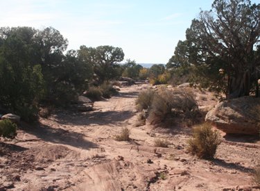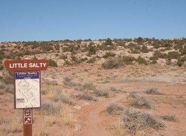
Little Salty is part of the Klondike Bluffs area trail complex . It's a 1.7 mile up-down route. Altitude is 5000 feet at the ridge. At the top, it begins on Baby Steps on a saddle of the ridge. The EKG Trail transects it about 0.7 miles from the bottom, where it ends on the Copper Ridge Road.


Once you get out of the flood area and onto the slanted sandstone, it gets very nice. The trail is well-marked with stripes of yellow paint.
A trail called UFO hits Little Salty from the left at around mile 0.3 to 0.4 from the top.


0.0 East across cattle guard
N38 46.417 W109 42.735
0.8 Veer L on Copper Ridge Rd
N38 46.997 W109 43.072
1.7 R uphill on Baby Steps
N38 47.545 W109 43.603
Follow rock cairns up slickrock
2.1 Straight uphill (L = EKG)
N38 47.741 W109 43.285
2.6 Trail veers R N38 48.02 W109 42.88
3.5 Fork L (R= to Klondike) N38 47.958 W109 42.584
3.9 L on ST N38 48.28 W109 42.69
5.1 Back at DT, fork L N38 48.41 W109 42.77
6.1 Fork L to join Klondike trail
N38 48.578 W109 42.373
6.6 Keep R and descend
N38 48.817 W109 42.085
6.8 Fork L in valley N38 48.811 W109 41.871
8.2 Fork L and climb hill N38 49.310 W109 43.045
8.8 Top of hill, L on ST Little Salty
N38 49.102 W109 43.371
9.0 Future UFO Trail, keep L if fork
9.8 R on EKG Trail N38 48.589 W109 43.922
11.5 R downhill on Baby Steps South
N38 47.741 W109 43.285
11.9 L on Copper Ridge Rd
N38 47.548 W109 43.605
12.9 Keep R at road fork
13.6 Back at parking

Note: Trails are color-coded to show individual named trails. The Baby Steps route in red does not correspond to the loop ride above.
Single-page riding guide
GPS track files (right-click and "Save as..."):
GPX Klondike area trails
Little Salty only
Baby Salty Loop
High-res topo for printing: View Klondike area
Lodging, camping, shops: Links to Moab area resources


