


Lambert Park has four routes that run from north to south on the west side of the park. They are have a gentle downhill slope from north to south, connecting the steeper hillside trails in the northern riding block and south riding block. These four routes are, from west to east, the High Bench trail, the River trail with a combined segment of High Bench, the Middle trail, and a combination of a bit of Spring, upper Luge, upper Poppy, and lower Ziggy.
Note that the western-most trail is a broad hiking-only loop trail. On the north, it skirts the outside edge of the park just west of the High Bench trail, then crosses High Bench, River, Middle as it turns uphill before looping back to the north.


The riding is dryer and hotter as you progress south or east up-slope.
The best trailhead for these trails is the Lambert South Trailhead. This is also known as the High Bench or church trailhead. It lies at Lambert Park's southwest end , with a large parking area, covered picnic tables, and a bathroom with running water.
You can catch the middle of High Bench or River at the Moyle Drive trailhead.
The Bowery trailhead in the north section also allows quick access by coasting down and across Box Elder Drive. On the far south, Alpine's Bald Mountain Drive ends at the bottom of Corkscrew, and there's room for parking here.


Length: 1.1 mi.
Elevation change: 150 ft
Tech: intermediate
Westernmost trail. South half is easy technically; north intermediate
South (lower) end High Bench trailhead N40 27.885 W111 45.348
River trail fork m 0.2 N40 28.006 W111 45.471
River trail rejoins m 1.05 N40 28.536 W111 45.423
North end on Middle trail N40 28.529 W111 45.389
The trail starts at the South Trailhead (often called the High Bench trailhead or church trailhead) at the southwest corner of the park.


The trail ends at the Middle Trail. Here a left turn takes you to Rodeo Up, straight ahead takes you to the Spring trail, and a right turn sends you downhill on the Middle Trail.


Length: 1.0 mi.
Elevation change: 150 ft
Tech: easier-intermediate, a bit more techy than River or High Bench
Upper end Box Elder Drive N40 28.540 W111 45.393
4-way Spring (L), High Bench/River (R) 100 ft
Spring Trail origin L m 0.3 N40 28.374 W111 45.432
Lambert Luge crosses m 0.4 N40 28.296 W111 45.406
Ruin joins L m 0.8 N40 28.025 W111 45.430
Poppy joins L m 0.9 N40 27.995 W111 45.385
Zag Ziggy join L m 1.0 N40 27.973 W111 45.358
Bottom end High Bench Road and water tank road N40 27.959 W111 45.339
The Middle Trail is the most reliably packed trail for snow riding in winter, as an out-and-back or as a loop with High Bench.


From the south, it's a bit more complicated. There are two "Middle trail" options as you cross the bridge from the kiosk at the High Bench trailhead. Right then left takes you to the gravel road intersection, and you'll head east to the trail. Right then straight across the gravel High Bench Road take you to the curving trail, where you'll cross the water tank road northbound.
The Middle trail alternates between sage and small groves of gambel oak, with occasional taller trees. It's a fairly open ride compared to High Bench. It dries quickly and is usually reliably good to ride.


Length: 0.5 mi. One-way from the Poppy connector downhill
Elevation change: 110 ft
Tech: upper-intermediate
North (upper) end Spring Trail N40 28.460 W111 45.323
R downhill at Poppy connector m 0.2 N40 28.304 W111 45.331
Luge becomes ONE WAY here
Cross Middle m 0.3 N40 28.297 W111 45.406
Cross River m 0.5 N40 28.223 W111 45.529
West (bottom) High Bench, cross then join southbound N40 28.216 W111 45.548


Length: 0.7 mi.
Elevation change: 130 ft
Tech: easier-intermediate
North end at Middle near Box Elder Drive N40 28.530 W111 45.389
High Bench R, River L m 0.05 N40 28.536 W111 45.423
R after bridge, L is alternate m 0.1 N40 28.517 W111 45.448
Alternate crosses at road m 0.2 N40 28.437 W111 45.501
Alternate rejoins m 0.3 N40 28.394 W111 45.531
Keep R at Middle connector m 0.6 N40 28.079 W111 45.478
South end on High Bench N40 28.003 W111 45.461
River is a fairly open trail, with a long stretch through the park's central sage brush plain. It doesn't spend much time in oak groves, tending to pass nearby rather than through.


The River trail is the least likely of the north-south trails to be packed down in winter, and usually can't be done in January or February.

Length: 0.2 mi.
Elevation change: 30 ft
Tech: intermediate
Whooping in a ravine
Upper end at near the bridge on upper River N40 28.520 W111 45.441
Cross river and dirt road m 0.1 N40 28.437 W111 45.501
Lower end on River N40 28.394 W111 45.529


Length: 2.0 mi, 0.5 of it in the western section
Elevation change: 300 ft
Tech: easier-intermediate
Southwest end at Middle N40 28.379 W111 45.437
Passes north origin of Luge m 0.3 N40 28.463 W111 45.321
Crosses Box Elder Drive m 0.5 N40 28.463 W111 45.321
(See Northern trail page for northern Spring trail details)
Circles then ends on Rodeo Up N40 28.681 W111 45.204
The Bowery trailhead on Spring is just north of Box Elder, and is often used by riders who are heading for the western trails on the other side of the road. For more details about the Spring trail, see the northern section page .


Length: 0.4 mi.
Elevation change: 120 ft
Tech: easy
Famous poppies mid to late May
Upper end at upper Ruin and Luge connect N40 28.286 W111 45.328
Homestead N40 28.217 W111 45.281
Fork R, L to Ziggy N40 28.143 W111 45.281
Lower end on Middle N40 28.002 W111 45.388


It's worth taking a break from the bike to investigate the old Lambert Homestead. Much of this area was farm and orchard that went feral, and the poppies originally grew around the farmstead home.

Length: 0.4 mi.
Elevation change: 110 ft
Tech: intermediate
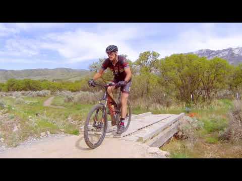
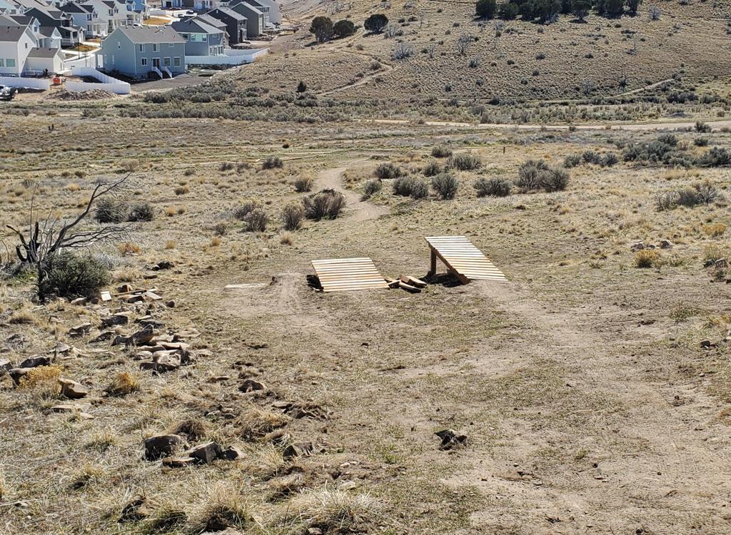
Series of small ramp jumps when done top to bottom
Upper end at Poppy and Luge connect N40 28.286 W111 45.329
Bottom end on Middle N40 28.027 W111 45.434
Most of the jumps are in a line near the top of the Ruin trail, but there's half a dozen more scattered along the trail as you descend.


The Ruin trail ends on Middle, with the curve of the trail tending to send you southbound. The Poppy trail, which climbs back to the top of Ruin, is just 100 yards south of the trail junction.

0.0 R downhill on Spring from TH N40 28.587 W111 45.216
0.1 Cross Box Elder Drive N40 28.549 W111 45.324
100 feet, keep L (R=to Middle or High Bench)
N40 28.541 W111 45.340
0.3 Straight (L) on Luge N40 28.460 W111 45.322
0.5 L on connector N40 28.304 W111 45.334
40 feet then L on Poppy (R = Ruin)
0.6 Homestead on R N40 28.223 W111 45.284
0.7 L onto ZPC (R = Poppy) N40 28.143 W111 45.281
0.75 Keep R (L = Ziggy up) N40 28.108 W111 45.279
0.9 Keep straight, join Middle N40 27.974 W111 45.359
0.95 Cross road to ST N40 27.959 W111 45.339
1.0 Keep R and cross main road N40 27.925 W111 45.332
Pass behind bathroom, straight to High Bench
N40 27.917 W111 45.357
1.2 Fork L (R = River) N40 28.004 W111 45.461
2.1 Cross road and join River N40 28.532 W111 45.424
2.15 Cross Middle to connector N40 28.529 W111 45.391
2.2 R on Spring N40 28.541 W111 45.340, cross road
2.3 Back at TH

Take I-15 to the Alpine/Highland exit, just south of Point-of-the-Mountain. Drive straight east 5 miles towards the mountains, turning left at the stoplight in Highland (where you see the grocery store and gas station). Drive 2 miles north into Alpine to the 4-way stop at 200 North. Turn right. At the next stop sign, turn left. You'll be on 200 East, which becomes Grove Drive. Continue northeast on Grove for two miles. The road will turn 90 degrees to the right. Pass two streets on your left, then arrive at a T in the road. Turn right, across the river. At the fork in the road, go right for the Bowery parking area, left for the Rodeo grounds.
Rodeo grounds trailhead: Keep left at the fork and drive 0.25 mile on pavement, then turn right onto a dirt road and drive 0.25 mile. The trailhead is on the right side of the road, where you'll see a parking strip and a bathroom just before the rodeo arena. (Toilet.)
Bowery trailhead: Keep right at the fork as you cross the river on the paved road. Pass the High Bench dirt road on your right. About 300 feet further up the paved road, keep straight as the main road turns right, entering a smaller road. 500 feet up the dirt road,, the Bowery pavilion is on the left, with a parking lot on the right. (Toilet, pavilion, water.)
South (aka High Bench or "church") trailhead: About 1.5 miles up Grove Drive (as above), turn right on Alpine Boulevard. Go 1/2 mile until the road turns from east to south in front of a big church. After you pass the church, fork left toward the mountains. Immediately after the church's back fence turn left onto a narrow paved road and proceed to the trailhead. (Toilet, shaded picnic, water.)
Moyle Drive: On Alpine Blvd, turn left onto Moyle and drive to the end. The High Bench trail crosses the road just east of parking. The trail that crosses the parking area is a hiking trail (Judy's).
Bald Mountain Drive: Turn onto 100 South in Alpine. Drive east until you're forced to turn at Country Manor Lane. Go left. At 300 North, turn right, then take the next left on Bald Mountain Drive. Go to the end of the road and park.
Map in new window: Topo map
Other Lambert Park pages...
Lambert Park overview
North Trails
South Trails
GPS track files (right-click a file and select "save as..."):
Loop ride Spring to Luge, Poppy, Ziggy, High Bench
Multi-track area file
Lodging, camping, shops: Links to northern county resources


