
Kestrel Run
Kestrel Run is a two-way singletrack trail in the Sand Flats Recreation Area. It's the fourth segment of the Raptor Route, spanning between lower Falcon Flow and the entry to Fins & Things along Sand Flats Road. It's exactly 2 miles long, with one mile from the Falcon Flow trail to Sand Flats Road, and one mile in a narrow sandstone canyon downhill from the road.
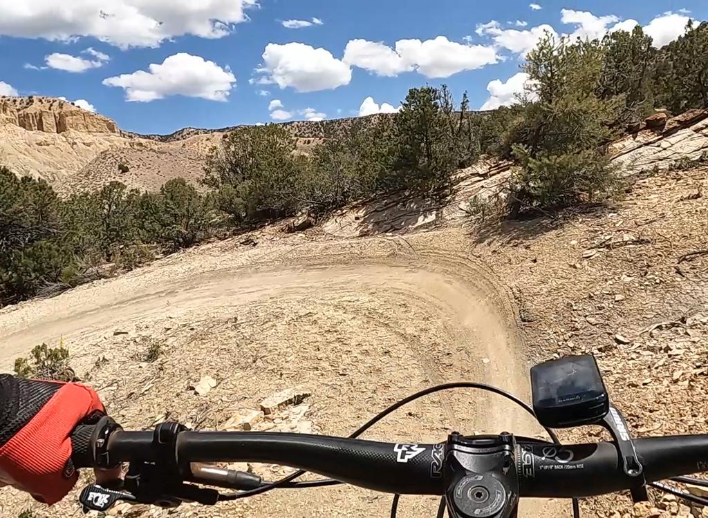
The Kestrel Run trail is very easy to ride -- except for a steep slippery plunge down into a sandstone canyon in the second half of the descent. There's a tricky juke S turn in the middle of that descent.
Parents of younger kids: While this steep spot is only 100 feet, the initial drop-in is so steep (and dust-covered) that it's very hard to keep your footing if you try to hike your bike. And I found it impossible to ride in the uphill direction, with the unplanned dismount being absolutely treacherous.


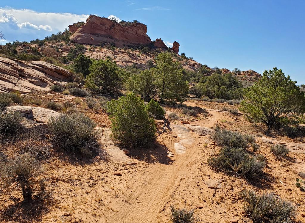
The trail is 99% dirt singletrack, with only occasional outcrops of open rock to ride across. On the top half, there are views across the ridges of rock for miles to the west and of the La Sal Mountains to the east as you wind through juniper and pinion.
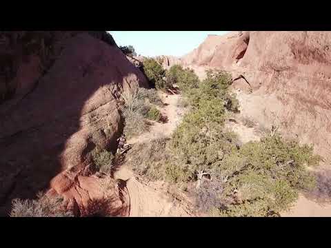
The mile of undulating singletrack in the canyon is scenic and fun to ride. As it twists below sandstone cliffs in a narrow canyon, this trail section has a different feel from other rides in Moab. A down-and-back on Kestrel Run from the lower Falcon Flow trailhead will be 4.2 miles with 450 feet of overall climbing.
Trailheads and Connections

Lower Falcon Flow parking (top of Kestrel Run):
From the entry station at Sand Flats, drive exactly 4 miles up Sand Flats
Road and spot the trailhead on your left. The lower end of Falcon Flow
(which is a two-way trail) is on the downhill side of parking. This is
your route to the top of Kestrel Run. Pedal 0.2 miles up Falcon Flow and
turn right at the sign for Kestrel Run.
In 2023, there's a port-a-potty at the parking area. About 1.4 mile further uphill on the Sand Flats Road, there's a second parking area with longer stalls, used by RVs and vehicles with trailers.

Kestrel Run at Hawk Campground:
At 2.6 miles uphill from the entry station on Sand Flats Road, spot the
sign for the Hawk Campground on your right. There's parking for around 5
vehicles between the road the picnic tables, but these will fill up
quickly in the morning and probably should be reserved for campers anyway.
Fork to the right and go up the dirt road 100 yards, where there's a wide
area as the Fins & Things ATV route joins. The trail entry is straight
ahead slightly to the left. There's a composting toilet at the campground.

Upper Falcon Flow (Porcupine Rim) parking:
The upper parking area is 7.0 miles uphill from the Sand Flats entry gate,
on your right. There's a pit toilet here. The entry to Porcupine is the
broad trail to the left of the road. The singletrack dropping off the
steep hill to the east is Hawks Glide. (If you ride it uphill, you'll
literally climb the cliffs of the hill in front of you. Which is why east
to west is the recommended direction.) The entry to Falcon Flow is 0.1
miles back west. For a loop ride of the upper Raptor Route trails, pedal east on the Sand Flats Road.

Climbing the Sand Flats Road:
From the Sand Flats entry station, it's 4 miles to lower Falcon low
parking, 6.7 miles to the top of Falcon Flow plus 0.1 mile to the upper parking (which is shared with Porcupine
Rim). At mile 8.8, there's a "sneak" doubletrack
Porcupine Rim entry on your
left. (This is also the route to Hawks Glide. Pedal through the fence opening,
turn left and descend the doubletrack 0.1 miles, then veer left to the extruder
gate.) For Eagle Eye, continue on Sand
Flats Road to mile 10.8 where a cattleguard crosses the road.
The overall climbing on the Sand Flats Road will be 2800 from
the bottom of Kestrel Run to the top of Eagle Eye.

Entry via Lower Porcupine Singletrack:
The Eagle Eye trail begins on the LPS connector, just a few feet from the Sand Flats
Road. When climbing Sand Flats Road, the LPS connector is obvious. Fork left just before the cattleguard, and then turn left onto Eagle Eye 50 feet later.
When descending Upper Porcupine Singletrack, continue west on LPS. At mile
0.8 from the Porcupine Overlook, turn hard left (south) as LPS continues
west. Pedal 0.2 miles then fork to the right in the sage meadow just
before Sand Flats Road.
The Kestrel Run trail

The upper end of Kestrel Run forks off the lower Falcon Flow singletrack, 0.2 miles uphill from the lower parking area. At this spot there are two separate connectors turning left to Kestrel Run. The trail intersection is well marked, with two separate forks -- one optimized for riders coming up from the parking area, and the other for downhill riders who are descending Falcon Flow. Take the first one you come to.
If you're descending Falcon Flow, you'll fork to the right at mile 5.2 from the upper end.
The upper mile of Kestrel Run is suitable for experienced beginners and early-intermediates. The trail is almost entirely desert dirt ribbon with a few deviations to cross open rock. On the day of my ride, riders were lapping this upper segment by turning uphill when they hit the Sand Flats Road and climbing back to lower Falcon Flow.


You'll cross the Fins & Things 4x4 route twice on this upper segment. There's a ATV-extruder walk-through on each side of Fins & Things, and the trail crossings are well-marked. You'll hit Sand Flats Road at mile 1.0 where you'll cross to another extruder gate.
Immediately after crossing Sand Flats Road, there will be two trail forks with a hiking trail. These are well-marked by signs and control gates. Keep straight on Kestrel Run. 1/4 mile after the road, you'll reach the plunge into the sandstone canyon, marked by a warning sign. Drop 50 feet, quick turn-turn, and drop another 50 and you're at the canyon bottom westbound.


The ride down the canyon has a gentle slope as the trail wiggles up and down and side to side. I thought this stretch of trail was a lot of fun both downhill and back up. (And yes, I had to get off and push my bike up the last section of the "plunge.")
At mile 2.0, you'll reach an extruder gate leading to a wide gravel area near the Hawk Campground. To reach Sand Flats Road, keep relatively straight and coast north downhill for 100 yards.
If you want to check out Fins & Things, to your left at the extruder gate is the westbound Fins & Things. Hard right is the uphill path of Fins & Things, which will join Sand Flats Road a bit uphill.


Getting there:
On Main Street (Highway 191) in Moab go to 3rd South and turn east. Turn
to the right when the 3rd South ends on 4th East, then take the second
left onto the Sand Flats Road. Drive to the entry gate and pay your
entrance fee. Drive past Slickrock. The entry to lower Kestrel Run is at
mile 2.6 from the entry station at the Hawk Campground. The connection via lower
Falcon Flow is at the parking at mile 4.0 from the fee station.
Bathrooms: Hawk Campground, Upper and Lower Falcon Flow parking.
Water: none
Camping: multiple sites along Sand Flats Road.