View down an undulating section of Lava Flow. Photos and trail reviews by Bruce ...
View down an undulating section of Lava Flow. Photos and trail reviews by Bruce starting December 5, 2015. Latest update July 2019.
Lichen It, Iron Giant, and Lava Flow
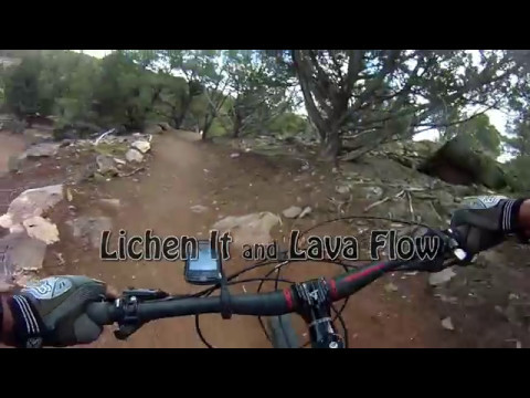
Iron Hills Trail System in Cedar City

Work on the Iron Hills Trail System began in 2015. Fifty miles of trails are planned on the mountain slopes east of Cedar City. This page will discuss the lower trails: Lichen It (climbing), plus Lava Flow and Iron Giant (descending). The starting altitude is 6050 feet. (See the separate trail page for information on the Green Hollow trail , an extension from the top of Lichen It uphill to the Greens Lake drive trailhead, and Turnpike , an easier contour out-and-back trail.)

Lichen It
The typical terrain is a mix of juniper and pinion, with lichen-covered boulders...
The typical terrain is a mix of juniper and pinion, with lichen-covered boulders alongside the trail.
Lichen It is a broad smooth trail with a gentle rate of climb. It's suitable for beginning riders. The trail was formerly two-way traffic for bikes, but is now a climbing-only trail. (Hikers may continue to go both directions.)

Note: You'll note some snow and frozen mud in a few of these photos. During the late fall and winter months, only ride early in the morning after a hard freeze. To be off the mountain before things get muddy, start by 8 to 9 a.m. (depending on your riding speed).

The trail surface has firmed up nicely to form a broad and forgiving riding surface. When climbing, the trail feels like a highway. The trail is very forgiving, and with the exception of a few rock rollovers near the top, it's a very easy trail for beginners to tackle.
View near the bottom of Lichen It in the crisp pre-sun hours. Typical trail view...
View near the bottom of Lichen It in the crisp pre-sun hours. Typical trail view shows a smooth trail of red dirt with surrounding juniper, cedar, and pinion.
Lichen covers the exposed boulders along the trail as we continue climbing.
Start on the paved Southview trail. After you cross the bridge, the first trail on your right is Turnpike Next, Lava Flow joins on your right, then Iron Giant. Stay on the wide paved path. (Note that Lava Flow and Iron Giant are one-direction downhill flow trails. Do not enter from downhill.)

Around 200 feet from the bridge, fork to the right off the paved path onto Lichen It. Lichen it will be your path to upper-mountain riding.

Lichen It will meander back and forth across the face of the mountain as it climbs the west-facing slope. The rate of climb is consistently easy. The first fork is labeled "Junior Giant" with a short connector over to the Iron Giant downhill trail. Stay left to climb. The next fork, Jolly Giant, also joins Iron Giant part-way down. Again, stay left to climb.

The surface is 100% dirt with no tricky stuff. The juniper trees are spaced widely enough to allow frequent views to the west.

View northwest. The little sawtooth mountains in the middle distance are the Thr...
View northwest. The little sawtooth mountains in the middle distance are the Three Peaks. Nice bike trails there.
Getting near the top of Lichen It. The climbing rate is very pleasant, with undu...
Getting near the top of Lichen It. The climbing rate is very pleasant, with undulating trail to keep the riding interesting.
At mile 2.8 from the trailhead, at an altitude of 6550 feet, Lichen It officially ends. To loop back to the trailhead, you have the option of the advanced-level Lava Flow trail (straight ahead), or the easier Iron Giant trail. Kids and beginners should definitely choose Iron Giant.

At the Lichen It - Lava Flow junction, the Green Hollow trail forks uphill to the left. This trail is harder than Lichen It if you want to climb higher. I'd rate it intermediate in difficulty. It climbs another 500 vertical feet to the Greens Lake trailhead on the gravel road, with connection further uphill via the Highlands trail to the C Trail .

A video of a climb up Lichen It and downhill via Lava Flow...

[Back to video list ]
Iron Giant   (includes Junior Giant)
Bruce descends Iron Giant in April 2019.
Iron Giant is a downhill-only flow trail that starts at the top of Lichen It. It is an easier ride, early-intermediate in technical requirement. Beginners who are strong enough to make it up Lichen It will do fine on Iron Giant.

Iron Giant is 2 miles long, descending from an elevation of 6450 feet to the trailhead at 6000. Lower on the mountain, there are two connectors from Lichen It to Iron Giant that allow for a shorter ride.

Iron Giant can be reached by climbing Lichen It from the Southview trailhead, or by descending the Green Hollow trail from the upper mountain.

When climbing Lichen It, there will be a connector called "Junior Giant" at mile 1.3 from the origin of Lichen It on the doubletrack. This connector is only 1/10th mile long, delivering you to the middle of Iron Giant, 1 mile from the bottom. Keep left and uphill if you're headed for the top.

Handlebar view of the trail fork for Junior Giant. If you fork to the right onto...
Handlebar view of the trail fork for Junior Giant. If you fork to the right onto Junior Giant, you can't go back up. Everything is downhill-only once you enter Junior Giant.
The 4-way trail intersection. On the left (straight ahead from Lichen It) is Lav...
The 4-way trail intersection. On the left (straight ahead from Lichen It) is Lava Flow. To the right is Iron Giant.
A second connector called "Jolly Giant" is at mile 1.7. A loop of Iron Giant lies right alongside Lichen It, with a short connector. If you elect to fork onto Iron Giant here, your descent will be 1.2 miles.

The top of Iron Giant is at the intersection where Lichen It ends, and Lava Flow begins. (Green Hollow is uphill to your left if you're climbing higher.) Drop down to your right into the first turn and begin your descent.

Turns are highly banked with a generous turning radius. While there are some more-technical alternate lines alongside the main trail, the trail itself is smooth and wide, with very little that's scary.
Typical banked turn.
Descending. This a rare spot where theres actually a view. For most of the desce...
Descending. This a rare spot where there's actually a view. For most of the descent, you're in tall trees.
Iron Giant is a one-way downhill trail. Your only option to NOT go all the way to the bottom is to hook over onto Lichen It at the Jolly Giant connector, one mile from the top. (Junior Giant is also a one-way downhill path. If you pass Jolly giant, you're destined to wind up back at the trailhead.)

The descent down Iron Giant from Lichen It...

[Back to video list ]
Lava Flow
A roll-over shortly after the beginning of Lava Flow in the early-morning hours ...
A roll-over shortly after the beginning of Lava Flow in the early-morning hours before the thaw. Not tough; but quite different than the butter-smooth dirt we climbed to get here.
The Lava Flow downhill trail is a direct straight-ahead continuation from Lichen It at N37 38.342 W113 04.626, 2.8 miles uphill from the trailhead. (To your left is Green Hollow, and to the right is the Iron Giant downhill trail.) Two miles long, Lava Flow will return you to the bottom of Lichen It.

The beginning of Lava Flow is marked by a sign and a rock rollover that alerts you to tech stuff coming up. The trail surface immediately becomes more technical with rock slabs of sandstone, basalt, and granite.

There's still a bit of climbing during the first part of Lava Flow. You'll notice the pitches are a bit more taxing than Lichen It, but still not too tough. After a quarter mile, the trail will reach a top altitude of 6550 feet before turning downhill.

About 0.4 miles onto Lava Flow, the new Boulder Dash trail will join on your left. This is a highly technical downhill-only trail, reached via Green Hollow . Do not enter. Slightly to the left is Lava Link , which extends a couple of miles south to the top of Elevate and Black Ops . To stay on Lava Flow, keep right.

Most of Lava Flow is broad smooth trail with a wide riding line. Periodically, t...
Most of Lava Flow is broad smooth trail with a wide riding line. Periodically, there are areas of embedded boulders that give a bit of challenge.
A rolling and slightly twisty descent through the rocks, followed by a tiny clim...
A rolling and slightly twisty descent through the rocks, followed by a tiny climb.
Lava Flow will now drop 500 vertical feet in 1.8 miles. The pitch is never spooky. There's a bit of bouncy rock here and there, but much of the descent is on smooth dirt. Although rated as an advanced trail, tech sections are short and seem very do-able by an experienced intermediate rider.
After the first half-mile bound southwest, Lava Flow turns to the northwest and descends fairly directly without much winding back and forth. The trail has a bit of gentle undulation, some of which has been put to use for tabletop jumps. (For those who don't know, tabletops are broad bumps with a flat top, and are easily rolled over by lower-speed riders.)
Bare dirt on a south-facing slope, with rollers inviting a bit of air.
Nicely bermed turn as we look south.
Turns have a high berm for fast riding. Depending on the weather and riders, many of the berms will have loose dirt and chunks. Not a problem if you know what to expect. For out-of-towners, realize that the trail and its turns are not as "grippy" as the downhill flow trails you'll find in brown-dirt regions of Utah.
There are some A/B lines on the descent. Most are easily scout-able on the fly as you approach them from uphill. None of the stunts required going airborne, although you could if you wanted.
The tech line to the left looks like its going to be a monster rock-drop, but it...
The tech line to the left looks like it's going to be a monster rock-drop, but it's actually just a playful rollover. If you decide to launch it, note the quick right turn just downhill.
A center-squeeze riding line versus a rock-garden line on the right. Right is wa...
A center-squeeze riding line versus a rock-garden line on the right. Right is way more fun!
Bottom Line!
Lichen It is an easy trail suitable for kids and beginners. Iron Giant is a very fun and non-terrifying downhill, well-planned and well-built. Lava Flow is a big harder, but with a few walk-overs, is easy enough. Definitely worth a visit. Do a couple of laps.

If you're into downhilling, the combination of the upper C trail , Highland trail, Green Hollow and Lava Flow makes great riding that you can reach with a shuttle.

Riding notes, clockwise loop:
0.0  Straight from road through gate
       N37 38.699 W113 04.894
       Left on Lichen It
0.1  Keep L (R = return route)
       N37 38.677 W113 04.811
2.8  End Lichen It, start Lava Flow
       (Pass entry to Greens Lake on L)
       N37 38.342 W113 04.626
4.7  At fork, L to TH
       N37 38.677 W113 04.811
4.8  Back at parking
Map of the Iron Hills riding area
Getting there:
At the southern I-15 Cedar City exit (Exit 57 to Cross Hollow Road and Highway 130), turn east onto Highway 130. Immediately turn right (south) from 130 onto Old Highway 91. Drive 0.3 miles. Watch for the sign for Southview Trailhead and turn left on Shurtz Canyon Drive. Now stay on Shurtz Canyon Drive to the trailhead and find a spot to park. Start out on the paved Southview trail. After the bridge, go past the Turnpike trail and the one-way return trails from Lava Flow and Iron Giant. Turn right onto Lichen It at N37 38.699 W113 04.894.

For a map that shows the relationship of these trails to the C trail and the Highland trail, click the topo map link below.

Bathrooms:  Southview Trailhead
Repair stand at trailhead
Water:  Sink in bathroom
Camping:  None at trailhead (recommend Three Peaks)

One-page printable trail guide
GPS track files (right-click and "Save as..."):
     GPX of loop ride
     Multi-track area files
Topo map for printing:    View high-res area topo
Lodging, camping, shops:     Links to Cedar City area resources