
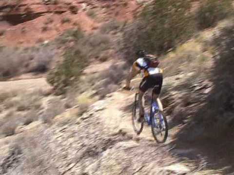

The Hurricane Rim trail climbs to the cliffs over the Virgin River near Hurricane. From its origin just above the town of Hurricane at the Hurricane Hill trailhead, it follows the deep canyon of the Virgin River east before ending on the JEM trail. The trail is 7.5 miles long with moderate climbing in either direction. Because there are sections with very rough surface, it's recommended for strong skilled riders.
The Hurricane Rim trail is joined by the Chinatown Wash trail and the Cryptobionic trail. These trails create some shorter loop options by slicing Hurricane Rim into pieces.


Connections for shorter loop rides!
Two trails fork east away from the Hurricane Rim trail. These are Cryptobionic and Chinatown Wash. Both connect to the middle of JEM, and Cryptobionic continues to the Sheep Bridge Road trailhead and further east to Goosebumps.
Cryptobionic is found as Hurricane Rim passes through the Virgin Dam trailhead at mile 1.8 from lower JEM, 2.8 miles from Chinatown Wash, and 5.6 miles from the Hurricane Hill trailhead. Cryptobionic forms the shortest and easiest loops using the Hurricane Rim trail.
Chinatown Wash is the second connector from Hurricane Rim to JEM. It has some technical rock, so it's a tougher option. If you climbed Hurricane Rim from the lower trailhead, you'll reach Chinatown Wash at mile 2.7. To climb the wash, go to the right up the wash as Hurricane Rim drops down to cross it.
If you're heading west, Chinatown Wash is 4.6 miles from the turnoff of Hurricane Rim from lower JEM. (From the Virgin Dam trailhead, or lower Cryptobionic, it's 2.8 miles westbound to Chinatown Wash.) Go left up the wash.


This trailhead serves the Hurricane
Rim and Gould's trails. Other trails in the system are reached via these
trails. In Hurricane, turn south on US-59 (towards the Grand Canyon).
Follow the road uphill 0.9 miles, then turn left into the trailhead
parking near the cell phone towers. The Hurricane Rim trail exits the east (uphill)
side of parking for a clockwise loop ride. The dirt road 0.2 miles back down U-59
takes you to Gould's for a counterclockwise Hurricane Loop ride.
Option, Gould's Wash corral: As you head uphill on Highway 59, pass
gravel Sheep Bridge road on your left (about half-way between Hurricane
Hill and the JEM trailhead). Now watch for a dirt road on your right. It
will take you to the corral. If you're heading for the rim, go directly
west from the corral for 1/2 mile.

Hurricane City to Gould's Connector Trail
On Highway 9 eastbound in Hurricane, turn right at the Highway 59 sign. Go
four blocks south to 400 South and turn left (east). Turn right on the
narrow 60 East Street to go south again. Continue on cinders as the
pavement ends. My GPS trail track starts at the dead-end, but you can also
short-cut across a break in the old canal about 100 yards before the end
of the road.

In Hurricane, turn south on US-59 (towards the Grand Canyon). Drive exactly 5 miles uphill. Turn left on cindered doubletrack right as you approach the base of Gooseberry Mesa. Drive another 0.3 miles to the parking area. Cross the cattle guard at the gate, then immediately turn right on singletrack. This section of JEM is one-way only.

This trailhead with bathroom and bike stand is found
half-way along the gravel Sheep Bridge Road, which connects US-9 to US-59. Drive toward
the upper JEM trailhead on Highway 59 as above. But at mile 3.3 (while
still on the flat area), turn left on gravel Sheep Bridge road. Drive 2.9 miles on Sheep Bridge
road to a fenced parking area with a bathroom. Cryptobionic and
northern Dead Ringer can be found here.
Option, roadside
parking off US-59: If you turned onto Sheep Bridge Road from Highway
59, immediately park on the
right, just inside the fence. Pedal 0.4 miles northeast to where the JEM
singletrack crosses.

From Highway 9 in Virgin, turn south onto Sheep Bridge Road. Drive 1.7 miles. As the gravel road drops into a dip, there are two paths on your right. The ridgeline road is the race staging area. There's a connector to Carne Asada in about 100 feet on your right. The second dirt road, around 50 feet downhill, is the primitive camping and trailhead area. JEM crosses this road at the bottom of the camping zone, and Carne Asada is found to your right on JEM downhill from the road.

My favorite riding direction is east to west. That is, start at the JEM Sheep Bridge Road trail off SR-59, then turn west to Hurricane Rim after a mile and a half. On a shuttled ride, this saves you 300 vertical of climbing. (On the counterclockwise loop, you'll continue to Gould's from the lower trailhead.)


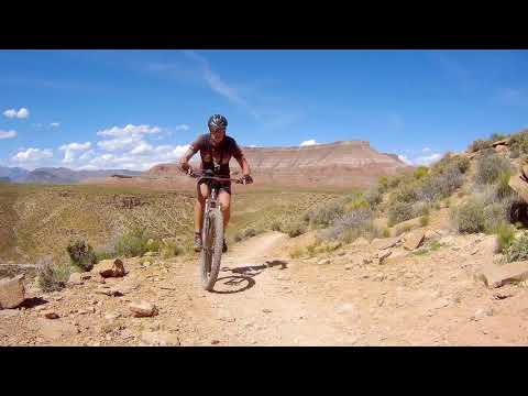
For the west to east ride from the Hurricane Hill trailhead, you'll climb 300 vertical feet in a bit under a mile. After the initial climb to Panorama Point, the trail follows the Virgin River gorge eastward. As it veers south away form the gorge, it ends on the JEM trail after seven miles.


Riding notes, Hurricane Rim eastbound:
0.0 Northeast on ST along fence
0.7 Panorama Point
N 37 11.169' W 113 16.179' Alt=3850'
1.9 Keep R (L = Virgin Dam trail)
2.8 Cross wash, then L
(R = Chinatown Wash trail)
3.5 Gooseberry Lookout
5.5 Dam trail rejoins on L (toilet)
5.7 Virgin Dam trailhead (toilet)
Keep L on ST
(R = Cryptobionic trail)
7.5 JEM trail, fork L
N 37 11.261' W 113 13.862' Alt=3650'
9.0 JEM lower trailhead
Start from parking area on US-59 above Hurricane
0.0 R (downhill) on US-59
0.2 L uphill on DT
1.8 Top of DT climb
2.3 R off DT onto ST
N 37 09.606 W 113 16.330 Alt=4000'
5.4 Trailhead, L on DT, head NE
N 37 08.142 W 113 16.280
6.2 At corral, find ST rear on R
N 37 08.310 W 113 15.649
8.0 ST comes in from R
8.3 US-59. For Big Loop, cross to DT
N 37 08.096 W 113 14.564 Alt=4350'
For small loop, head downhill on road
8.6 JEM Trailhead, cross cattleguard
N 37 08.329 W 113 14.527
Immediate R onto ST
9.0 Cross DT, descend toward cliffs
9.3 Keep R (L=More Cowbell)
N37 08.863 W113 14.661
Drop off ledge on switchback
N37 09.119 W113 15.103
10.8 Keep R (L = China Wash)
N37 10.541 W113 15.154
11.0 Cross Dead Ringer
Cross Sheep Bridge gravel road
11.1 Cross Cryptobionic
N37 10.798 W113 14.354
14.0 Fork L to Hurricane Rim
N 37 11.261 W 113 13.862 Alt=3650'
15.8 Virgin Dam trailhead
N 37 11.781 W 113 14.109
(Cryptobionic start on L)
16.0 Keep L (R=Virgin Dam trail)
18.7 R across Chinatown Wash
Straight = Chinatown Wash trail
19.6 Dam trail rejoins on R
20.2 Panorama Point
N 37 11.169 W 113 16.179 Alt=3850'
21.5 Back at parking

From US-9 (no mountain biking trailhead): At the junction of US-9 with UT-17, turn east towards Zion. 4.8 miles after the turnoff, turn right (south) on a gravel road signed "Sheep Bridge Rd." Descend toward the bridge across the Virgin River and find a parking spot along the road. Start pedaling. Just past the bridge, but before the cattle guard, there's a dirt road to the right. This will take you to the bottom of JEM and Carne Asada. (The parking directly at the bottom of JEM is reserved for the nature conservancy.) Pedal up Carne Asada and find the Hurricane Rim trail where Carne Asada joins JEM.
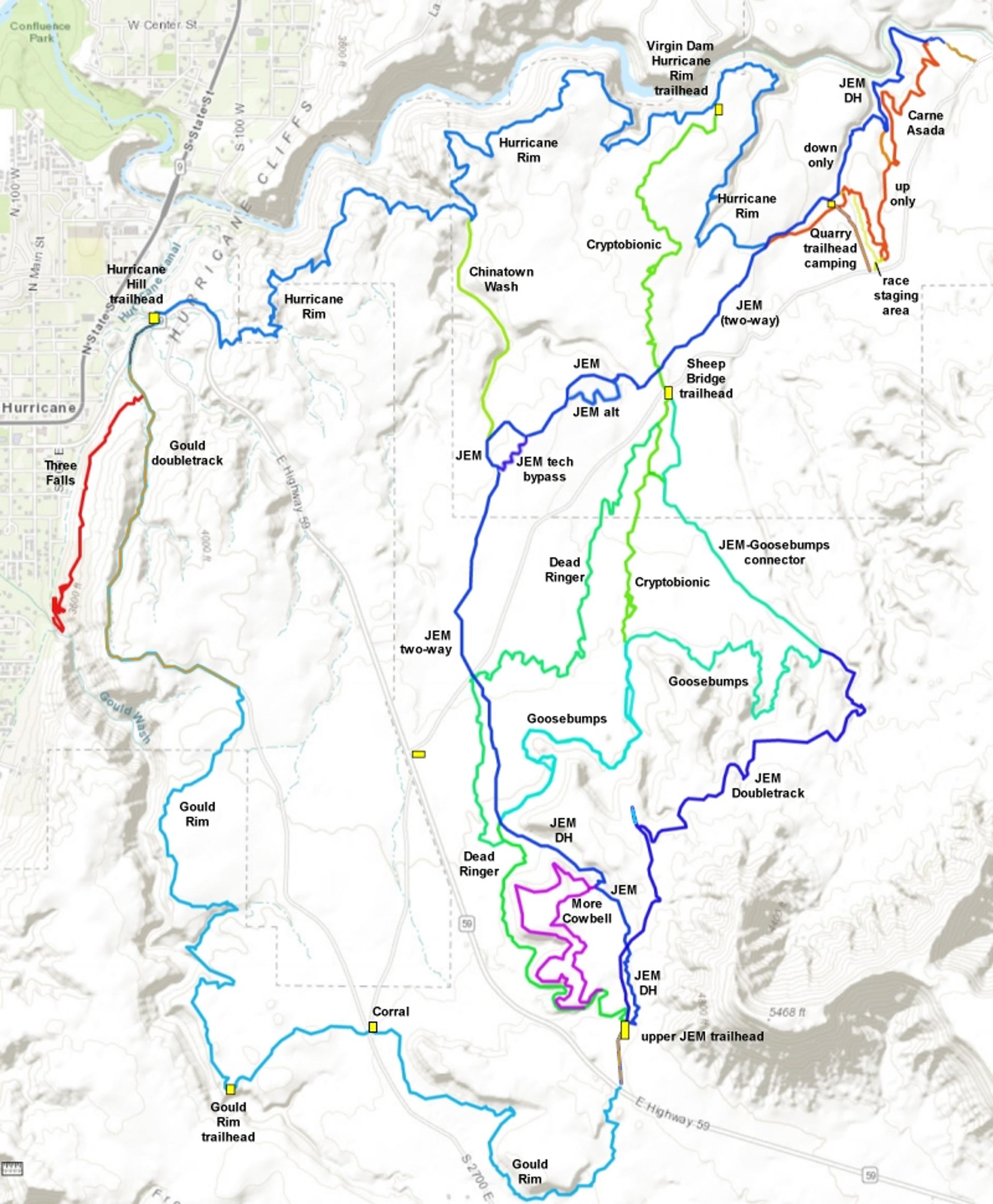
Other Resources for the Hurricane Rim Trail:
Links to other pages:
Single-page riding
guide to Hurricane Rim
Hurricane Cliffs Trail
Summary page
Carne
Asada
JEM Trail
Gould's Rim Trail
Goosebumps/Cryptobionic
JEM DT
More Cowbell
Dead Ringer
Gould's
Connector
GPS track files (right-click and "Save target as..."):
GPX master file of area
trails
Loop ride Gould-JEM-Hurricane
Hurricane Rim only
Alternate maps (download to print):
Large-format
topo map of trail system
Satellite view w elevation profile
Lodging, camping, shops:
Links to St.
George area resources


