
Hawks Glide
Hawks Glide is a singletrack trail that runs parallel to the Sand Flats Road just above the Porcupine Rim trail. Hawks Glide is the second segment of the Raptor Route downhill ride, following Eagle Eye as you descend.
Although technically Hawks Glide is a two-way trail, I strongly suggest doing it east to west (downhill). For details on the entire Raptor Route, please see the Raptor Route overview page.
The trail can be ridden as a shuttled ride of the Raptor Route, with a drop-off either on the La Sal Loop road or the Sand Flats Road at the LPS connector. It can also be done as a loop by climbing the Sand Flats Road from the upper Falcon Flow (Porcupine Rim) trailhead.


I recommend this ride for intermediates or better. Non-experts (and tired riders) will have to walk a few sections. Hawks Glide starts mellow and will fool you, then throw some very difficult techy stuff at you during the second half.
Trailheads and Connections

Lower Falcon Flow parking:
From the entry station at Sand Flats, drive exactly 4 miles up Sand Flats
Road and spot the trailhead on your left. The lower end of Falcon Flow
(which is a two-way trail) is on the downhill side of parking. For a loop
ride, begin pedaling up the road. About 1.4 mile uphill on the left,
there's a second parking area with longer stalls, used by RVs and vehicles
with trailers. In 2023, there's a port-a-potty at the parking area.

Upper Falcon Flow (Porcupine Rim) parking:
The upper parking area is 7.0 miles uphill from the Sand Flats entry gate,
on your right. There's a pit toilet here. The entry to Porcupine is the
broad trail to the left of the road. The singletrack dropping off the
steep hill to the east is Hawks Glide. (If you ride it uphill, you'll
literally climb the cliffs of the hill in front of you. Which is why east
to west is the recommended direction.) The entry to Falcon Flow is 0.1
miles back west. For a loop ride of the upper Raptor Route trails, pedal east on the Sand Flats Road.

Climbing the Sand Flats Road:
From the lower Falcon Flow parking, it's 2.7 miles to the top of Falcon
Flow, then 0.1 mile to the upper parking (which is shared with Porcupine
Rim). At mile 2.1 from upper parking, the
Porcupine Rim entry is on your
left. This is the route to Hawks Glide. Pedal through the fence opening,
turn left and descend the doubletrack 0.1 miles, then veer left to the extruder
gate. If you want to reach Hawks Glide via Eagle Eye, continue on Sand
Flats Road to mile 4.0 (6.8 from lower Falcon Flow).
There's a cattleguard across the road with
the LPS connector on your left. 50 feet down that connector, Eagle Eye
forks left. The overall climbing on the Sand Flats Road will be 1400 from
the upper trailhead; 2300 from the lower Falcon Flow trailhead.

Entry via Lower Porcupine Singletrack:
The trail begins on the LPS connector, just a few feet from the Sand Flats
Road. When climbing Sand Flats, the LPS connector is obvious.
When descending Upper Porcupine Singletrack, continue west on LPS. At mile
0.8 from the Porcupine Overlook, turn hard left (south) as LPS continues
west. Pedal 0.2 miles then fork to the right in the sage meadow just
before Sand Flats Road.
The Hawks Glide Trail
 take you to Porcupine Rim.")
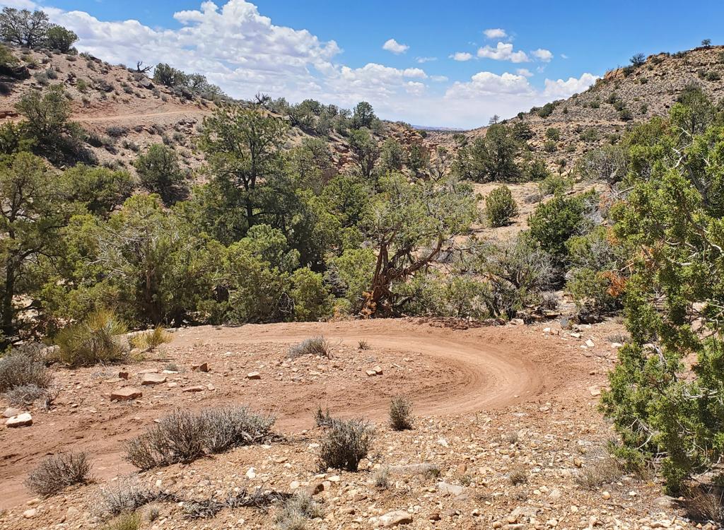
Hawks Glide begins as the continuation of Eagle Eye, but with around 100 yards of doubletrack Porcupine Connector trail linking the two. You can also enter the trail at the top by turning away from the Sand Flats Road onto the connector trail.
The Hawks Glide trail is 1.9 miles in length, 2.0 if you count the link-up through the Porcupine connector doubletrack. The total descending will be 600 vertical feet, but 100 feet of that drop comes in a series of turns in the last 1/10th mile as you drop toward the trailhead.
There are some quick and sharp uphill spots along the trail that add 100 vertical feet to your climbing total, but 99% of the trail is downhill. A couple of these are climbing turns with facing ledges, where only aggressive experts will arrive at the top.


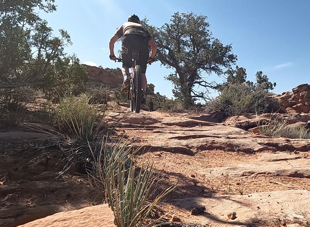
The trail has winding dirt singletrack among pinion and juniper, with occasional domes of sandstone that you'll ride over. Overall, the trail is intermediate with sections requiring expert skills -- or hiking. The trail tend to run straight west -- rather than winding back and forth like Eagle Eye -- so it's shorter than the road climb to get there.
The trail often has rough broken rock to bounce over. And for a while it hugs the edge of the canyon, where a fall has significant injury potential.
This is a scenic ride. There will be occasional views when the pinion and juniper thin out.


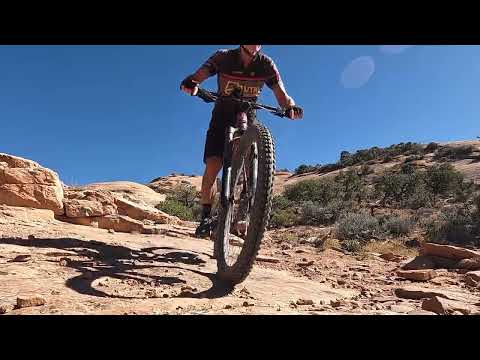
The top of the descent is marked with a sign and a pole fence. This is an expert-level drop, but aggressive upper-intermediates can clean most of it. This stretch of trail has significant injury potential, so walk if you're uncertain.
The trail will roll through several tight turns, with rock slabs forming the trail surface. Some areas are covered with skidding dirt and you'll just need to roll them because your tires won't hold. The rockwork here is excellent -- the trail-builders did a great job of making an impossible slope merely scary.
As you reach the road, you can continue past the parking area and slightly up the hill 100 yards to the top of the Falcon Flow trail to continue the Raptor Route.


Bottom Line!
Nice riding with some sudden challenges; hard even for experts to ride the full length of this trail cleanly. Expect some nice views -- usually in spots that make you nervous.
Getting there:
On Main Street (Highway 191) in Moab go to 3rd South and turn east. Turn to the right when the 3rd South ends on 4th East, then take the second left onto the Sand Flats Road. Drive to the entry gate and pay your entrance fee. Drive past Slickrock. The first trailhead is the lower Falcon Flow parking at mile 4.0 from the fee station.
Bathrooms: Upper and Lower Falcon Flow parking.
Water: none
Camping: multiple sites along Sand Flats Road.

Map of the Raptor Route area as of 2026