The trails twists and turns are hard to see here, but its a fun ride. First phot...
The trail's twists and turns are hard to see here, but it's a fun ride. First photos and review by Bruce on November 19, 2016. Updated May 3, 2017.
Green Hollow and Highlands Trails

The Green Hollow trail (also known as Greens Lake, 310 East, or Lichen It Extension) joins the top of Licken It and Lava Flow to a trailhead on the gravel road Greens Lake Drive. The Highlands trail runs from the Greens Lake trailhead to the C Trail . See below for the Highlands trail. 

Green Hollow

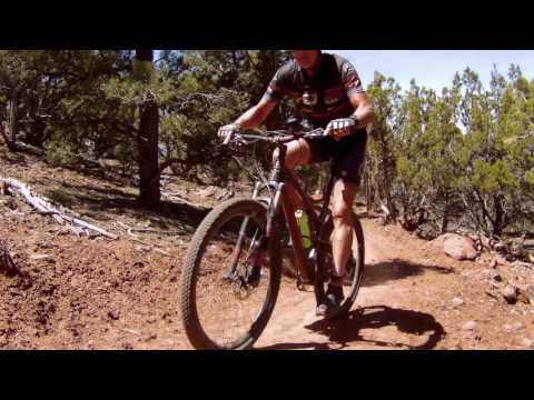
Green Hollow was completed in November 2016 as an addition to the Iron Hills trail system. It extends from the top of Lichen It to the Greens Lake trailhead further uphill. This section is 2.5 miles long and early-intermediate in technical difficulty. Green Hollow will gain about 500 feet of elevation before ending at the Greens Lake trailhead.

Improved and fenced Southview trailhead parking area at the end of Shurtz Canyon...
Improved and fenced Southview trailhead parking area at the end of Shurtz Canyon Drive. There's now a bathroom here (closed in winter).
My Rocky Mountain Blizzard fat bike, leaning against the gatepost at the singlet...
My Rocky Mountain Blizzard fat bike, leaning against the gatepost at the singletrack entry at the top of the trail. I climbed the trail. In the snow. No shuttle for this guy.
To climb Green Hollow, you'll first need to climb Lichen It On Lichen It you'll climb from 5950 feet elevation to 6450 on fairly easy but fun singletrack. Start at the Southview trailhead in south Cedar City. At the top of Lichen It, fork left uphill when you see the entry to Lava Flow (In May 2017, there isn't a trail sign yet, and the turn to Green Hollow -- through a rock garden -- is anything but obvious.) Just know, if you're about to roll over the rocks into Lava Flow, Green Hollow is about 20 feet behind you.
If you're a shuttle monkey DHer, you can start at the top -- either the big DH via the C Trail and Highlands, or from the Greens Lake trailhead. Greens Lake Drive forks off Old 91 just before Shurtz Canyon Drive (the street that takes you to the trailhead). The pavement will turn to a gravel road and climb up toward some homes on the hill. About two miles uphill, turn into the Greens Lake trailhead. The trail starts as doubletrack on the east side of parking, going south 100 yards. The gate through the fence straight ahead is the start of the singletrack.

The new Boulder Dash trail is on your left at mile 1.7 from the top, 0.8 miles uphill from the junction of Green Hollow with Lichen It . Boulder Dash shortcuts to Lava Flow for a one-way trip to the bottom. Boulder Dash is highly technical and for true experts only.

Bruce rails a turn in May 2017.
The trail has almost constant shallow dips. There are a couple of S-turn descent...
The trail has almost constant shallow dips. There are a couple of S-turn descents into washes.
For climbers, Green Hollow is significantly more strenuous than lower Lichen It. While a lot of the trail is mellow and flattish, the climbs following the little dips are steeper. Turns are a bit tighter. I didn't notice any tricky rock stuff.

You'll lose some elevation on downhills, then have to grunt to get it back. The singletrack ends at almost 7000 feet elevation at a corral just off the gravel Greens Lake road. The whole climb from Southview trailhead to the trail's end yielded 1100 total vertical feet of climbing, with a total distance of 5.2 miles.

At the top of Green Hollow, you can continue uphill on the gravel Greens Lake Drive to reach the top of the C Trail After a DH run on the C Trail, you can catch the paved East Bench Trail back to Old 91 near the freeway. From here, it's a short pedal to retrace your car's path to the trailhead parking.
Looking west.
Looking west.
Were about a half-mile from the top. The terrain has flattened and the trees hav...
We're about a half-mile from the top. The terrain has flattened and the trees have thinned out.
Views are rare, but occasionally there will be a break in the trees allowing you to see the Cedar City area to the west. Not high-voltage views by Utah standards.

The terrain is a mixture of pinion pine and juniper. The understory is mostly bare dirt and rock cobble with an occasional manzanita or pitiful weed.

As a downhill, Green Hollow is a lot of fun. But it's not all down. You'll need to climb a few steepish pitches and a couple of S-turns when you plunge through ravines.

Similar to Licken It, this trail could make a good snow ride. But don't count on riders from Cedar to pack it down for you. For local residents, there's dry dirt in winter just down the freeway. I made the first tracks on the trail's announced Grand Opening day, a Saturday, two days after the snowstorm. I saw no one, uphill or down.

A turn in the snow.
A turn in the snow.
Looking north near the top of the ride.
Bottom Line!
Good stuff. In the six months since this trail was finished, I've done it three times. And not just to get some non-snow photos. It's a good uphill ride and a riot to ride downhill.

Green Hollow Trail as an uphill...

[Back to video list ]
Highlands Trail (C Trail Connector)

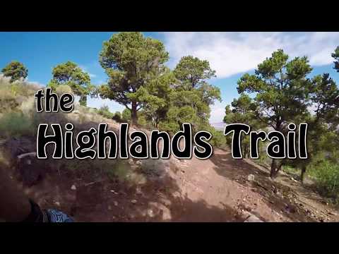
The Highlands Trail opened July 2017 connecting the C Trail to the Greens Lake (Green Hollow) trailhead. With the completion of this trail, there's a continuous singletrack route from the C Overlook down to the Southview Trailhead. The Highlands trail can be used as a climber or a downhill.

Climbing east on the Highlands trail, with about 1/4 mile to go before reaching ...
Climbing east on the Highlands trail, with about 1/4 mile to go before reaching the C Trail.
Layout of the Greens Lake trailhead, looking east. Either the singletrack or the...
Layout of the Greens Lake trailhead, looking east. Either the singletrack or the gravel road will take you to the Highlands trail where it crosses Greens Lake Drive.
The Highlands trail begins as singletrack on the east side of the Greens Lake trailhead. After crossing Greens Lake road, it climbs 1.6 miles to join the C Trail at N37 38.702 W113 02.777. This junction is 1.8 miles downhill from the origin of the C Trail at the Overlook.
As a downhill route from the C Trail, Highlands and Green Hollow will have less foot traffic than the lower C Trail. It also rides better.

To climb to the C Overlook, take Lichen It uphill, then Green Hollow to the Greens Lake trailhead, then Highlands to C for the last bit of uphill to 8200 feet elevation at the C Overlook. (Although the C Trail has a reputation as a downhiller trail, it rides pretty well in the uphill direction.)

At mile 1.8 from the C Overlook, keep left for Highlands.
Rolling through pinion pine and rabbitbrush just downhill from the C Trail fork....
Rolling through pinion pine and rabbitbrush just downhill from the C Trail fork.
The Highlands trail creates loop options using the C Trail. The loop rides either direction. The loop consists of either Lichen It or Lava Flow (depending on which direction you ride), Green Hollow, Highlands, C Trail, and the East Bench paved trail, a bit of road and ATV track and Southview paved trail. (The East Bench trail ends on Old 91 just north of Greens Lake Drive, about 1/3 mile from the Southview trailhead. See the Cedar City Paved Trails page for details on making the connection to Southview.)
It's possible to drop to the C trail from the northwest corner of the Highlands subdivision. This 80-foot hike-a-bike connector is not officially marked. To reach it, fork to the left after entering the Highlands subdivision from below and left again at the next road fork to N37 38.680 W113 02.804. The connector drops steeply from the gravel road down to the C trail about 100 yards uphill from the Highlands trail fork.
Looking northwest as the trail passes a rock outcrop.
Turns are generous in radius and flow well either uphill or downhill.
Bottom Line!
Great addition to the Iron Hills trail system, offering a long downhill, a scenic and fun climbing route, and new loop options.

Highlands Trail as a downhill...

[Back to video list ]
Riding notes, climb to the C Overlook:
0.0  Through gate east of parking
       N37 38.699 W113 04.894
       Left on Lichen It
0.1  Keep L (R = Lava Flow)
       N37 38.677 W113 04.811
2.8  Fork L uphill on Greens Lake
      (Straight ahead = Lava Flow)
       N37 38.342 W113 04.626
5.0  Gate, straight ahead to DT
       N37 38.306 W113 03.518
5.1  At Greens Lake trailhead
       N37 38.355 W113 03.524
       Fork R on Highlands
5.2  R uphill on DT, 30 feet, then L on ST
       at N37 38.390 W113 03.479
6.7  Straight onto C Trail
       N37 38.730 W113 02.884
8.5  At C Overlook
       N37 38.544 W113 02.083
map
Map of trail area.
Getting there, Southview:
At the southern I-15 Cedar City exit (Exit 57 to Cross Hollow Road and Highway 130), turn east onto Highway 130. Immediately turn right (south) from 130 onto Old Highway 91. Drive 0.3 miles. Watch for the sign for Southview Trailhead and turn left on Shurtz Canyon Drive. Now stay on Shurtz Canyon Drive to the trailhead and find a spot to park. The Lichen It Trail is to the east (uphill) from where you entered the parking lot. Once you're through the gate, turn left N37 38.699 W113 04.894.
Greens Lake:
On old 91 as above, at mile 0.1 turn left on Greens Lake Drive. Keep going uphill after the road turns to gravel. The trail head is on your right, about 2.3 miles uphill from 91.

Bathrooms:  Southview Trailhead
Water:  None at trailhead
Camping:  None at trailhead (recommend Three Peaks)

One-page printable trail guide
GPS track files (right-click and "Save as..."):
     GPX LichenIt/GreensLake climb
     Greens Lake only
     Highlands Trail only
     Multi-track area files Topo map for printing:    View high-res topo
Lodging, camping, shops:     Links to Cedar City area resources