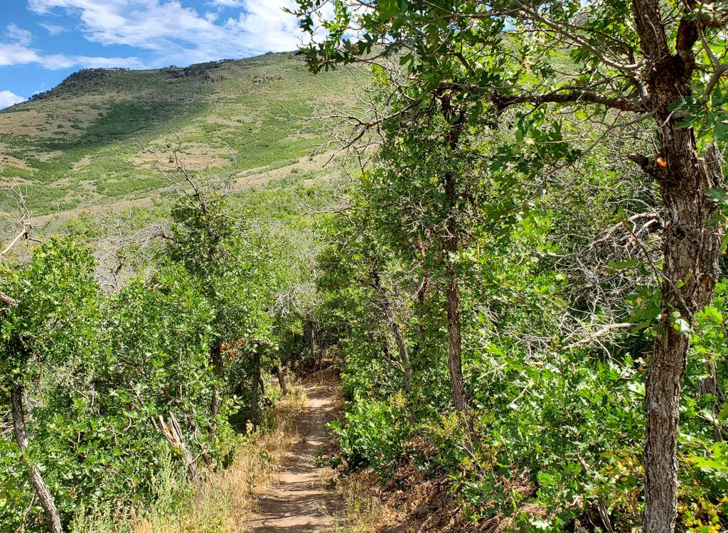
Looking at the hillside of Fourth Water Ridge as we begin the climb up Fifth Wat...
Looking at the hillside of Fourth Water Ridge as we begin the climb up Fifth Water. Photos and trail description from a ride on September 22, 2009.
Fifth Water Ridge

(Upper Fifth Water 015, Center Trail 009, Fifth Water Ridge 014)
This fabulous loop ride won't stay secret for long. The trail is located on the west side of Strawberry Ridge, a few miles north of Spanish Fork Canyon on Rays Valley Road.

The route I describe here is 12 miles, climbing 1500 feet to a top altitude of 8400 feet. It offers mellow climbing punctuated by an occasional short but tricky steep, incredible views, and a long awesome downhill.

Other options? Tougher riders can make this a 21-mile, 2800-vertical ride by starting at the Three Forks trailhead in Diamond Fork. Less aggressive riders can simply do Fifth Water as a 9-mile-total out-and-back.

After a mellow two-mile climb up Fifth Water from Rays Valley Road, you'll hit the fork for the loop. Clockwise (the route I describe here) is for strong climbers. You'll do 350 vertical in 1/2 mile. It's not a sustained pitch, though. It's stand-and-grunt then spin-and-recover.
View uphill on Fifth Water before the trail fork.
View along the creek as the trail heads through a cottonwood grove.
The advantage to the clockwise route is that it turns the entire upper Fifth Water trail into a 4.5-mile downhill giggle (or 9-mile downhill if you started from Three Forks). And once you get past that tough half-mile on the Center Trail, the rest of the clockwise climb is pretty easy. But it takes good skills and strong legs to get uphill past the many small roots and embedded rocks.
Most intermediate riders will prefer to ride counterclockwise. Climbing all the way up on Fifth Water, there are only a couple of very short steeps over rock outcrops, so the uphill is much easier. But it means you'll hit the steep area on the Center Trail, with its network of aspen roots mixed with embedded rocks, on the downhill. Walk it if you need to.
Clockwise loop!  At mile 2.0, fork left on the Center Trail (009) -- where the right fork would take you through a tiny creek. A bit later, you'll ride through a spot where the trail has captured the creek for about 30 feet. In spring, this could be major water. But it was only a trickle for my ride.
Handlebar view of the trail going through a fork in the creek on the Center Trai...
Handlebar view of the trail going through a fork in the creek on the Center Trail.
At mile 2.4, a faint trail forks right toward the creek, looking inviting. No dice. Go left and begin the granny-gear climb. The trail was trenched about a foot deep here. The trail will level out, then hit another stiff pitch, then level, then climb steeply again. These spots aren't as steep as the first grunt climb, but they're full of roots and big embedded boulders, so it requires aggression and full-body effort. But each steep spot is followed by a rest section.
View on the Center Trail as we climb higher.
At around 2.8 miles, the slope mellows. Then you'll drift down a bit to follow a small (dry in September) creek. Continue a gentle climb, going past a fenced spring. Significant cow-pie minefield here. Stay on what appears to be the main trail, ignoring any branching game or cattle paths.
At mile 4.3, fork right onto the Fifth Water Ridge Trail #014 at a signed trail intersection, leaving the Center Trail 009. (You can complete a larger loop by following the Center Trail, but it's ugly.)
Now you'll be riding up and down for about a mile and a half as you head east along Fifth Water Ridge. Lots of views here.
From the Fifth Water Ridge Trail, were looking northwest.
From the Fifth Water Ridge Trail, we're looking northwest.
Typical trail view on the ridge trail, as forest alternates with grass and low s...
Typical trail view on the ridge trail, as forest alternates with grass and low scrub.
When you reach a log fence and doubletrack, keep straight (right) until you hit the main dirt road and fork right, uphill and southbound.
At the top of the mountain, turn right on the smaller dirt road just before the cattleguard. (Yes, go look at the view of Strawberry, then come back.) Just before the next cattleguard, veer right onto the singletrack Fifth Water 015 Trail.
At mile 9.4, keep straight as the southern part of the Center Trail comes in from the right to join Fifth Water for 1/2 mile. There are a couple of tricky rock areas to roll over. When you reach the original fork, keep straight (left) and downhill.
View south from Fifth Water Ridge.
Turning onto Horse Creek road.
Counter-clockwise!

If you're riding CCwise, when you get to the fork at mile 2.0, head R and through the water. There are a few very short but steep rock areas here that can be a little tricky. Either attack them or walk them.

At mile 2.5, keep straight as the Center Trail 009 comes in from the right. Now just grind on uphill, and at mile 4.5 you'll hit the Strawberry Ridge road. Head left uphill on the dirt road.

A half mile after leaving the Fifth Water trail 015, turn left on the Horse Creek road and head downhill about 3/4 mile. Watch for a carsonite "014" marker next to a doubletrack branching off on your left. (It's around mile 6.1 of the ccwise ride.) Turn left into the DT and connect to the ST at the end.<>br> At mile 7.7, you'll reach the junction with the Center Trail. Fork left (southwest). Now just follow the trail downhill to the original trail fork.
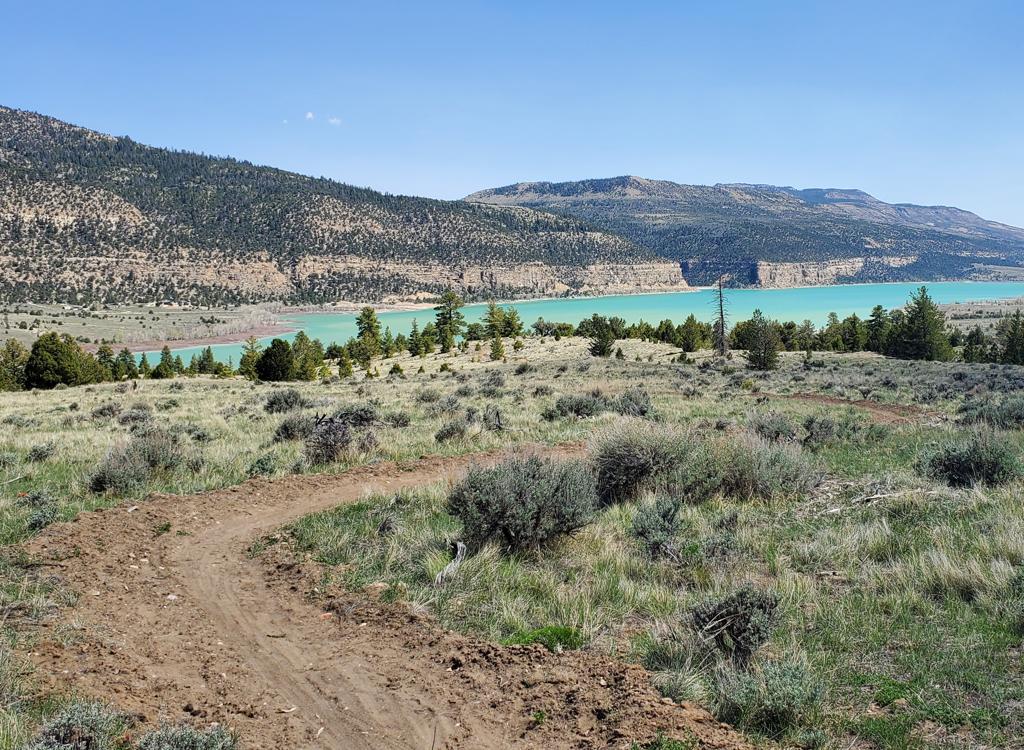
From the rides highest point, looking east over Strawberry Reservoir.
From the ride's highest point, looking east over Strawberry Reservoir.
Descending Fifth Water 015. The trail undulates gently for a super descent.
Bottom Line!
It was a delight to discover this trail. Most of the trail is smooth as butter. The steeper tech spots were short enough that I was rested and ready to attack as I came on them. I rode the loop clockwise, and no, I couldn't make all the climbs on the Center Trail. I had a few start-overs, plus three or four push-a-bikes of about 30 feet each.
So add this trail to your "to do" list. It's a great ride. This loop won't stay unknown for long.
Getting there, via Spanish Fork Canyon:
On I-15, exit on US-6 toward Price. Continue up Spanish Fork Canyon, passing the Manti exit at mile 14. About mile 23, just after exiting the "Red Narrows", turn left on the paved Sheep Creek Road. (It's immediately before the gas station and camping area.) 7 miles up the road, pass the Unicorn Ridge camping area (toilet!) and the Strawberry Ridge Road on your right. Around mile 14, in the bottom of a valley, turn right into the Fifth Water trail parking. The trail starts northeast on the doubletrack.
Another look down the Fifth Water trail, a bit lower in the canyon.
Riding notes, clockwise loop:
0.0   East on DT (Fifth Water Trail)
        N40 06.346 W111 17.454
0.2   Cross rollover cattleguard to ST
2.0   Fork L on 009 (Center Trail)
        N40 07.177 W111 15.530
2.4   Keep L uphill, begin tough climb
        N40 07.516 W111 15.508
2.8   Climb eases
4.0   Springs, fence
4.1   Keep L on main trail N40 08.602 W111 15.486
4.3   Fork R on 014 (Fifth Water Ridge Trail)
        N40 08.733 W111 15.392
5.8   R on DT
5.9   R on dirt road (Horse Creek)
        N40 09.014 W111 14.065
6.6   View of Strawberry N40 08.667 W111 13.559
        R on Ridge Road before cattleguard
7.1   R on ST before cattleguard (Fifth Water Trail)
        N40 08.275 W111 13.444
9.4   Straight (Center Trail 009 on L)
        N40 07.253 W111 14.874
10.0 Through creek and fork L N40 07.177 W111 15.530
12.0 Back at car
map
Map of the loop
Riding resources for this trail:

Single-page riding guide
GPS track files and route (right-click and "Save as..."):
      GPX
High-res topo:   View
Lodging, camping, shops:  Links to area resources

Camping: Unicorn Ridge, Fifth Water
Bathroom: Unicorn Ridge