
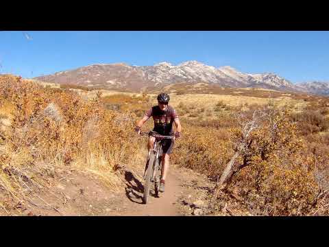

The Fango trail links lower Hog Hollow to lower Mercer Hollow and to Woods Hollow . It's 3.3 miles long and is an easy trail to ride. For this discussion I will divide the trail into two segments: eastern and western. The two sections are different in character and are often done alone. The average elevation is 5300 feet. The expected riding season for this trail will be early May through November.
The eastern end of the trail starts on the old Hog Hollow trail, just 50 feet below the exit from Achtung Baby From the Angel Gate trailhead on the border where Alpine, Highland, and Draper touch, it's 0.4 miles on Hog Hollow to reach Fango.
When riding westbound, the western section begins as Fango splits in two as it approaches the Mercer Hollow doubletrack. The uphill fork crosses Mercer Hollow and climbs around the hill. (The downhill fork descends to the Mercer Hollow trailhead.) Fango crosses Suncrest Drive then continues uphill to Woods Hollow .
To start from the western end, you'd use the South Maple Hollow trailhead and take Woods Hollow to Fango.
. The trail s...")


The western segment forks away from the eastern trail as it approaches the trailhead in Mercer Hollow. From here it climbs steadily, gaining 320 feet in 1.3 miles. It will cross Suncrest Drive and end on the Woods Hollow trail.


On the uphill fork, the trail will steadily climb around the small hill and end on the entry road to the subdivision. Cross Suncrest Drive and go downhill about 100 yards, then turn right onto the continuing singletrack. The trail will continue to climb. When you reach Woods Hollow, you can fork hard right uphill to get to Eagle Crest and the DH trails or keep left downhill to descend to the South Maple Hollow trailhead.
Nice easy addition to Draper's south-side trail system. Will be a major attraction to Alpine and Highland locals because it creates a loop on the south side of the mountain. Also good as an out-and-back for a quick ride.


Angel Gate at Spring Hollow (Hog Hollow side): On Westfield Road, turn uphill (north) on Beacon Hill Blvd. Drive 0.5 miles, then as Beacon Hill turns to the right (east), turn left on Lighthouse Drive to continue straight north uphill. Lighthouse will become Angel Gate. Keep straight until you pass the irrigation facility, then park. At the northeast corner of the fence, a doubletrack descends east across the hollow. Immediately after crossing the creek, turn left on Hog Hollow.
Suncrest Drive (Mercer Hollow side): There's room for 3 or 4 cars at the bottom of the doubletrack portion of Mercer Hollow on Suncrest Drive.
GPS track files for download (Right-click and "Save as..."):
Fango track to Mercer only
Fango Mercer to Woods only
Hog Hollow area multi-track file
Corner Canyon area multi-track file
Higher-res satellite map for printing: View map
Lodging, camping, shops: Links to southern SLC resources
Click for Corner Canyon area trails overview page updated 2020


