
Falcon Flow downhill trail
with Falcon Flow climbing trail
The Raptor Route is a series of trails in the Sand Flats area east of Moab. While most of them are technically two-way trails, everybody rides them in the downhill direction, and you should too. Falcon Flow was completed in 2020 and remains the most popular. (Eagle Eye was added in 2021, and Hawks Glide in 2022, and Kestrel Run in late 2023.) On the Raptor Route, Falcon Flow follows Hawks Glide as you descend.
In 2026, Falcon Flow has been converted to a downhill-only trail. The 2.6-mile Falcon Climb singletrack trail has been added as an uphill-only climbing route from the lower trailhead. The final 0.8 miles of the climb is on the Sand Flats Road.
When descending the Raptor Route, you'll catch Falcon Flow after a short hop on Sand Flats Road. At the bottom of Falcon Flow, you'll divert to your right onto Kestrel Run around 0.1 miles from the main Falcon Flow trailhead.
.")

You can also create a loop ride by climbing the Sand Flats Road on your bike. This is a bit of a grind, and on weekends you'll contend with constant traffic noise and dust. Most riders would use Falcon Climb for most of the uphill.
Falcon Climb is an easier-intermediate climb, but has one set of sharp climbing turns that will be challenging.


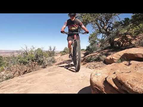
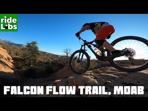
Falcon Flow is intermediate in technical requirement. There's a bit of up-and-down riding on the trail when done east to west (the downhill direction). Overall, you can expect around 300 vertical feet of climbing, mostly on the second half of the descent. So you'll drop only 750 feet of elevation yet your total descending will add up to around 1100.
Trailheads

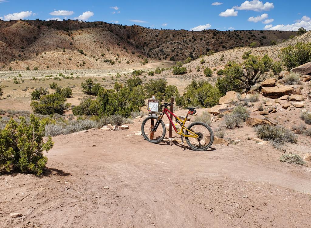
Lower Falcon Flow parking:
From the entry station at Sand Flats, drive exactly 4 miles up Sand Flats Road and spot the trailhead on your left. The lower end of Falcon Flow (which is a two-way trail until you reach the fork for Kestrel Run) is on the downhill side of parking. For a loop ride, enter the bottom of Falcon Flow and immediately fork to the right on Updraft. Or you can crank directly up Sand Flats Road.
About 1.4 mile uphill from the main trailhead, there's a second parking area on the left with longer stalls, used by RVs and vehicles with trailers. In 2023, there's a port-a-potty at the parking area.

Upper Falcon Flow (Porcupine Rim) parking:
The upper parking area is 7.0 miles uphill from the Sand Flats entry gate, on your right. There's a pit toilet here. The entry to Porcupine is the broad trail to the left of the road. The singletrack dropping off the steep hill to the east is Hawks Glide. (If you ride it uphill, you'll literally climb the cliffs of the hill in front of you. Which is why east to west is the recommended direction.) The entry to Falcon Flow is 0.1 miles back west. For a loop ride of the upper Raptor Route trails, pedal east on the Sand Flats Road.

Shuttle Drop-offs
There's a shuttle drop on Sand Flats Road at the bottom of Eagle Eye (where it becomes Hawk's Glide) and at the top of Eagle Eye. There are no formal parking lots above the Porcupine Rim trailhead.
There are a few parking spots on Sand Flats Road at the bottom of Eagle Eye (where it becomes Hawk's Glide) and at the top of Eagle Eye. There are no parking lots above Porcupine, although many riders sneak their car into a wide spot in the road.
You can leave your bottom vehicle at either the Falcon Flow trailhead or further downhill at the Hawk Campground parking at the bottom of Kestrel Run.
Falcon Flow
Falcon Flow is the lowest in elevation of the Raptor Route trails and at 5.4 miles is longer than Eagle Eye and Hawk's Glide put together. It is now a one-way, downhill-only trail. When descending top-to-bottom, you'll still put in about 450 vertical feet of climbing, most of it on the lower half of the trail.


The upper end of the trail is about 0.1 miles west of the Porcupine Rim trailhead (toward Moab). If you're descending from Hawks Glide on the Raptor Route descent, you'll pedal past the trailhead to catch Falcon Flow at the top of the small rise to the west.
Elevation is 5800 feet at the top. The lower end of the trail is at 5100 feet elevation. If you decide to ride the trail as a loop using the Sand Flats Road as your uphill, it's 700 vertical feet of climbing over 2.7 miles.
There's a small parking area located at the downhill end of the Falcon Flow trail. On weekends an early start means you're more likely to find a spot for your car.
At this time, there's a small overflow parking area located 0.3 miles uphill from the downhill entry. The parking zone is tiny, so on weekends an early start means you're more likely to find a spot for your car.


Although the trail is intermediate overall, there a couple of quick challenges that require expert skills (or, at least, a few tries to clean them). There are some thread-the-needle passages where picking the right line gets you past, and a couple of steep drops that less-aggressive intermediates can walk.

Falcon Climb (aka Updraft) begins on the right side of lower Falcon Flow as you leave the parking area. It's 2.6 miles in length, gaining 550 vertical feet of elevation as you pedal east. At mile 0.3, Falcon Climb crosses the Porcupine 4x4 ATV trail.
At the top, Falcon Climb briefly joins a doubletrack loop for the Juniper Mesa hiking trail before ending on Sand Flats Road. From there, keep east and uphill for another 0.8 miles, and you'll find the entry to Falcon Flow on your left.
A reasonable time estimate for a loop up Updraft and Sand Flats Road then down Falcon Flow is 90 minutes riding time for a well-conditioned intermediate rider. Add time for pictures, huddles with fellow riders, and re-tries of the fun stuff.


There's a bit of scenery, such as occasional views of the La Sal Mountains to the east, and of the sandstone humps of the Slickrock area to the west. But you won't notice any of it, because you'll be too busy playing.

Bottom Line:
Compared to other rides in the area, Falcon Flow is fun, non-scary and quick. A good "intermediate rider's sampler" of Moab riding.
An awesome "add-on" to a day's riding for expert groups, or a
destination trail for intermediates. Falcon Climb is a nice uphill cruise
(at least, by Moab standards) that creates a satisfying loop ride for
bikers with intermediate skills and strength.

Getting there: Head uphill on the Sand Flats Road, reached by turning left off Moab's main drag onto 300 South. Go right when 300 South ends on 400 East, then second left onto Millcreek Drive. Keep left as the Sand Flats Road separates from Millcreek. Pay your entry fee at the station. From the entry gate, drive 4 miles, then watch for the lower entry to Falcon Flow and the main parking lot on your left. RV and overflow parking is 0.3 miles uphill, also on the left. The upper trail will be on your left at mile 6.8 from the entry station (just as the road drops down to the Porcupine Rim parking area). The Porcupine trailhead is 0.1 miles uphill from the top of Falcon Flow. The bottom of Hawk's Glide is across the road from the parking strip.

Riding Resources for Falcon Flow:
GPS track files (right-click and "Save as..."):
Falcon
track
Raptor
Route area
tracks
Lodging, camping, shops:
Links to Moab area resources