

Turning the corner on the Megawatt Loop, looking south toward the Brian Head area. Review by Bruce on May 9, 2023.
Evil Water Trails
The Evil Water trail system lies in lower Parowan Canyon. At the time of this review, there are two connected lariat loop trails, Electric Avenue and Megawatt. The trails are fairly short and easy to ride. With only 2.5 miles of singletrack trail, the system will be of most interest to beginner and early-intermediate riders who are looking for a quick ride. I did the trails 3 times in different directions and had a great time.
The Evil Water trail system lies in lower Parowan Canyon. At the time of this review, there are two connected lariat loop trails, Electric Avenue and Megawatt. The trails are fairly short and easy to ride. With only 2.5 miles of singletrack trail, the system will be of most interest to beginner and early-intermediate riders who are looking for a quick ride. I did the trails 3 times in different directions and had a great time.
The trails lie just a mile up Parowan Canyon. At an elevation of 6300 feet, the trail surface
will usually be dry and ready to ride by May, and the riding season will extend through early
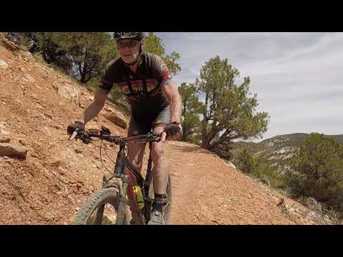
November.The trails are well-built machine bench-cut. There's a wide riding base. Turns are banked,
although they're a bit tight for a fast downhill. I found them to be useful "redirect berms"
for fast climbing. There's one short steeper climb on the Megawatt loop what won't be a problem
for most riders, but beginners may walk 100 feet or so.

Descending Megawatt on the bench-cut trail through orange and white limestones.

Rocking a banked turn during climbing Electric Avenue on a counterclockwise ride.
The trails are in a juniper and pinion forest, on a base of orange and white clays and broken
limestones. Most of the rock and clay was washed down from higher elevations in the fairly
recent geologic past. You'll have a nice view of a mountain of volcanic rock as you enter the
Megawatt loop, and there will be occasional bits of conglomerate.
Trailhead

Evil Water trailhead, looking west. Lots of room.
The Evil Water trailhead is in lower Parowan Canyon, 1.7 miles from Parowan's Main Street on
Highway 143. The entry to the trailhead is a small gravel road on the right as you drive up
the canyon, marked by a "trailhead" road sign. The unpaved trailhead is large and fenced with
plenty of parking, but has no bathroom, water, or bike service stand. You'll share the trailhead
with a disc golf course.
The entry to the mountain bike trail is at the far (southwest) corner. There's a break in the
fence in the middle of the south side, which is for entry to the disc golf course. Consider
bringing your competitive flying discs, and give the golf course a try between your rides.The trailhead and trail system are maintained by the BLM.

Entry to the Electric Avenue connector trail. This is your way to the bike trails.

Found the bridge! Immediately, we'll turn to the right to enter the loop counterclockwise.
Finding your way to the Electric Avenue loop can be confusing, because disc golfers are wandering
through creating their own trails -- and locals often simply take the doubletrack or hop on
a side-trail to arrive more quickly. But however you get there, your target is the bridge that
crosses Parowan Creek, which you'll be able to glimpse as you pedal out from the parking area.Officially, here's the route: 150 feet on ST, cross a DT, hook hard left around a tree and
drop down to a lower DT, then keep straight to cross a flat area with a disc golf goal to arrive
at the bridge. As you leave the bridge, turning right will take you counterclockwise on Electric
Avenue.
Electric Avenue

Climbing away from Parowan Creek as we hit Electric Avenue's loop in the counterclockwise direction.
It's only 0.1 miles from the parking lot to the Electric Avenue loop. Once you arrive at the
loop fork -- on the far side of the bridge over Parowan Creek (see above) -- hook to the right
for a counterclockwise ride.
The trail is bi-directional, but it's easier to navigate if you go counterclockwise. The lower
part of the loop goes onto and off of dirt road, and flirts with disc golf trails that may
look like the right way to go. (If you're going clockwise, a good "rule of thumb" is: unless
there's a trail sign, don't fork away on anything, no matter how "bike-trail-ish" it may appear.)So I suggest doing the loop counterclockwise first so you've seen where the lower side of the
loop goes. Then for a changeup, do your second lap clockwise.

Southbound on the upper side of the Electric Avenue loop. Orange clay has given way to white.

The southern end of the Electric Avenue loop is narrower, with a few opportunities to dodge rocks.
After heading north for a bit through riparian forest along Parowan Creek, the trail turns
uphill and winds through pinion and juniper. At mile 0.4 from the trailhead, you'll arrive
at a large dirt road. Across the road and to your right is the entry to the stem of the Megawatt
loop.To stay on Electric Avenue, veer to the left along the edge of the roadway.
From this point, the Electric Avenue loop winds gently uphill for another 0.2 miles. As it
turns to run parallel to the main canyon, it will follow what appears to be an ancient road-cut.
The riding here will be fairly flat.

Cranking along Electric Avenue in a sparse pinion and juniper forest.

Looking south from the lower limb of the Electric Avenue trail, as we approach the turn on a clockwise ride.

Looking north toward the Parowan valley from the upper side of Electric Avenue when riding clockwise.

Drone shot as I head south on Electric Avenue.
At mile 1.1 from the trailhead, Electric Avenue will turn left downhill, cross a dirt road
to singletrack, then drop gently downhill through riparian forest. After about 1/4 mile, it
will join a narrow dirt road. Watch for the singletrack that will take you toward the bridge.
The trail signs are adequate, but they're not overly abundant considering the disc golf side-trails.
Megawatt

View to the east from Megawatt.
The Megawatt trail is a lariat loop, originating at the far northwest corner of the Electric
Avenue loop. It will circle a tiny hill that's located just behind the "P Hill" on the edge
of Parowan. You'll need to ride a portion of the Electric Avenue loop to reach the "stem" of
the Megawatt lariat loop.At mile 0.4 from the trailhead, while riding Electric Avenue counterclockwise, you'll arrive
at a gravel/dirt road, with a trail sign on your left. Electric Avenue continues to your left.
Megawatt lies just out of sight, uphill and across the roadway. Trust the arrow on the sign
and cross the road.
Megawatt first runs to the west up a side-canyon. The trail flirts with an ATV route, but the
bicycle path is well-marked with carsonite trail signs. The stem of the Megawatt loop is 0.1
miles long. Pass the return trail, which joins sharply on your right, to begin a clockwise
loop.

Southbound around the hill.

Rolling on a bed of clay and limestone.
The trail will turn north for a steeper climb across a saddle, then it will meander into a
sage and oak meadow to descend a bit in elevation before returning to the small hill.
Megawatt will follow a fairly flat path on the north and eastern sides of the hill, then descend
down to the loop fork. For a second lap, keep straight. To return to Electric Avenue, make
a hard 180 to the left onto the stem of the loop.At the doubletrack, veer to the right as you cross, and you'll enter the southbound upper side
of the Electric Avenue loop.

Dropping down to the loop fork on a clockwise ride of Megawatt.
Bottom Line

Drone shot as I circle the small hill on Megawatt. Wide and easy riding surface.
This is a fun little ride, and it's ready for your tires two months before Brian Head's trails.
But Evil Water is largely unknown. And the system won't be expanded unless riders are using
it.Evil Water is a great and quick dirt-fix when you're heading south for the weekend and the
evening is approaching fast. Give it a shot.

Map of the Evil Water trail system
Getting there:
From I-15, take either of the Parowan exits and head into the center of town. Follow the road signs for Parowan Canyon and Brian Head, and turn off Main Street on Highway 143. At mile 1.7 from Main Street, spot a trailhead sign on your right and turn onto a narrow dirt road. Go to the far end of the spacious parking area. The Electric Avenue trail starts at the southwest corner of the log fence, at the trail kiosk. (Note that the trail entry in the middle of the fence is for the disc golf course.)
Bathroom: none
Water: none
Camping at the trailhead: no
Resources:
GPS track files (right-click and "Save as..."):
Evil Water trails, multi-track file


