

Ephraim Canyon Trail System
The Ephraim Canyon trail system lies on US Forest Service land at an elevation of 6800 to 8000 feet. The expected riding season would be June through October. The trails are new in 2020 through 2023.
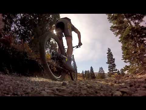
As of October 2023, there are nine connected trails in this system and most are easy to ride, suitable for beginners and older children. (The Keelber trail is rated by the Forest Service as "easy" but I'd give it an intermediate rating for technical requirements and a "stronger rider" requirement for climbing. Gravity and Ponderosa are technically easy but are a bit more steep.)
There are multiple different loop options, short and long. It's also possible to shuttle the trails. Many local families do a drop-off at the top of Mirkwood or Templar and ride the 5 miles downhill by connecting several trails.


There are several small trailheads along the Ephraim Canyon Road where you can access the trails. The main trailhead is just below the bottom of the Gravity trail at 6800 feet elevation, just uphill from the top of the Flume Trail.
The upper end of the trail system lies on the Ephraim Canyon Road just below the two developed campgrounds and the top of the Pioneer Trail.
Trailheads and Access

Main Canyon parking lot
The main trailhead for Ephraim Canyon is on the canyon road, 3.4 miles after the canyon road
turns toward the mountains. This trailhead has a bathroom. The Pinecone
portion of the Pioneer
trail ends on the north side of the road here. The bottom of the Gravity
trail is uphill around
the corner on the right.

Minor Trailheads and Access Points
Most trails have a small parking area where they reach the Ephraim
Canyon road. From bottom to top:
Gravity - small, 1/10th mile uphill from the main parking lot
Gravity/Ponderosa - small, 0.7 miles uphill from main parking
Ponderosa/Stopwatch - large, 1.4 miles from main parking
the bottom of Templar is across the road from
Ponderosa
Stopwatch/Scandinavian - large, 2.1 miles from main parking near FR 051
connector to middle of Templar is across the road
Patriot/east Scandinavian - large, on FR 051 at 1.1 miles from canyon road
Templar - no trailhead at top of Templar, located mile 2.6 on
left
Mirkwood - medium, mile 2.8 on right
Keebler - small, at turnoff to Lake Hill Campground, mile 3.4
Gravity

The lowest-elevation trail in the system is Gravity. This trail is 0.7 miles long with 250 feet of elevation change. This is an easy trail, suitable for beginners.
An out-and-back from Gravity to the top of Mirkwood and back down would be 10 miles with 1300 vertical feet of climbing.
The bottom of the singletrack starts at a small roadside pull-off just 0.1 miles uphill from the main paved parking area. There's only room for one or two cars here, so I suggest you simply pedal uphill from the main parking lot.
Gravity is smooth and easy riding, with no steep pitches. Young children may find the slope a bit more work than they'd like. Like all the trails in this new system, Gravity was machine cut using modern techniques and has been laid out to flow well.


Gravity is a nice ride both uphill and down. From the entry just uphill from the main parking lot, it climbs at a steady pace. Turns are banked for speed; good for climbing and even nicer for descending.
Gravity has more open terrain than the other trails in the system. Most of the trail is surrounded by short oak scrub. There are almost constant views of the mountains and valley.
The top of Gravity is at a small roadside pull-out with room for a couple of cars. The trail then continues uphill as Ponderosa.

Ponderosa

Ponderosa is a trail segment between the Gravity Trail below and the Stopwatch Trail above. It is 0.8 miles long, with 300 feet of elevation change. Ponderosa is an easy trail for all ability levels.
The terrain surrounding Ponderosa is mostly short oak scrub, so you'll continue to enjoy views in every direction. There's a short stretch as Ponderosa starts uphill that's a bit steeper in pitch than you've seen so far.


As you might expect from the name, there are a few stands of long-leaf pine along the trail.
After the initial climb along a bench-cut, Ponderosa has a more cross-country feel. It spends more time meandering -- and has fewer banked turns -- than Gravity.
As Ponderosa returns to the Ephraim Canyon Road, the trail continues uphill as Stopwatch. There's room for several cars at this upper trailhead, and it seems to be a popular target for hikers.

Stopwatch

The Stopwatch Trail begins at a fairly generous parking area off the Ephraim Canyon Road. There's short connector through the log fence to exit Ponderosa, and another opening to enter Stopwatch about 50 feet away.
Stopwatch is 1.3 miles long, with elevation change of 300 feet. It's also an easy trail and is suitable for beginning riders. At the upper end of Stopwatch, the uphill route continues as the Scandinavian trail.
The bottom of Stopwatch seems to be a popular spot for hikers and nature-lovers to enter the trail system. I encountered a few senior citizens (my peer group) strolling slowly with canes.


With Stopwatch, the climb turns from generally eastbound to southbound. There's a bit of up-and-down riding but the general tendency is to climb.
At mile 0.5 uphill, there's trail fork for Badger Run. Stopwatch turns left uphill. The Badger Run trail on the right is a return return route from the lower Patriot trail.


Stopwatch ends on a gravel parking area. As you exit through the log fence, keep straight. Head out of the parking area toward the main road. Pedal 100 yards to the intersection of the parking area road, the paved Ephraim Canyon Road, and the gravel FR 051 road. Look to your right and you'll see the continuing singletrack Scandinavian trail at a break in the log fence across the gravel road FR 051.
Scandinavian

The Scandinavian trail begins alongside the paved road after a very short dirt-road link from Stopwatch. This section is 1.4 miles long, with 150 feet of elevation gain as you go south from the Ephraim Canyon Road. It will end on the gravel Forest Road 051 at the top of the Patriot trail.
The Scandinavian trail contours a small canyon heading south. There's a bit of up-and-down riding as it goes through drainages. Beginning riders would enjoy this trail as an out-and-back, as it has the least climbing of any trail in the system.


The trail runs parallel to Forest Road 051, but on the deeply forested hillside above it. You may catch a rare glimpse of the gravel road from time to time. There are a couple of primitive camping/picnic spots that back onto the trail.
Mirkwood joins Scandinavian 0.1 miles from its end. If you're climbing to the top, make a hard left turn here.
Scandinavian ends as the trail crosses FR 051. The route continues as the Patriot trail, with the option of looping back to Stopwatch.

Mirkwood

At this time, Mirkwood is the highest-elevation trail in this system. The upper end is on the Ephraim Canyon Road at 8050 feet elevation. It descends -- with more than a little up-and-down -- to join the southern end of Scandinavian.
Mirkwood is 1.4 miles in length with 200 feet of overall elevation difference between the north and south ends. It is considered an easy trail, but would require a bit more skill than Scandinavian.
There's a hiking trail forking steeply uphill near the upper trailhead. It extends to the campground just uphill. It's unmarked and I didn't see any bike tracks on it.
As the name implies, a lot of Mirkwood is in deep forest. The longleaf pine has given way to fir and aspen at this elevation. Temperatures were pleasant at mid-day in June while the valley baked in 95-ish heat.


There's a nice view of Ephraim as the trail briefly hugs a hillside. Most of the ride is in deep forest.
Because of the easy vehicle access to the top of Mirkwood, on weekends it's likely you'll encounter oblivious young riders heading downhill as you climb Mirwood. It's OK. Just ride. Nobody hired you as the trail policeman.
Near Mirkwood's southern end, a steep and unmarked motorcycle route crosses. This is the Bovine Trail. This raw trail runs down from the lake at the Lake Hill campground, linking it to FR 051 below, with an ugly steep section that drops 400 feet in about 1/3 mile. I saw no bicycle tracks to indicate that riders are frequently using this route. But I understand some cyclists use Bovine as a downhill route from the campground to the new trail system -- climbing back uphill via the canyon road -- so I've included it on the map below.


The bottom of Mirkwood joins southern Scandinavian about 0.1 miles from Patriot. If you're descending from the upper trailhead, you now have two options for your downhill. A hard right puts you northbound on Scandinavian, while continuing straight takes you to Patriot.
Keebler Trail

The Keebler trail runs from the Lake Hill Campground road to the Mirkwood trail. It's designed to be best when done downhill, but it appears that riding either way is kosher. It runs through a dense fir forest, breaking out into an area of scrub where you can enjoy the views just before it ends on Mirkwood.
The Keebler trail is 0.7 miles in length with 250 feet of elevation change. The high is 8300 feet at the campground road. The entry to the trail is just after the campground road turns away from the Ephraim Canyon road, where there's room for 3 to 4 cars to park.


The trail has a lot of little jumps built into it. Some are baby-gap jumps. Definitely don't try to roll a jumping ramp at low speed. All the jumps have ride-arounds.


At the bottom of Keebler, the trail splits to send you either direction. If you head to the right, it's only 0.2 miles gently downhill to where Mirkwood ends on the canyon road. (From here, go to the right uphill if you're grunting up to the top of Keebler for another run, or go left to descend 0.2 miles to the top of the Templar trail.)

Templar

The Templar trail, new in 2022, has added upper loop options to the Ephraim Canyon trail system. The bottom of Templar is directly across the road from the trailhead where Ponderosa becomes Stopwatch. The upper end of Templar is found on the north side of the Ephraim Canyon Road, about 0.2 miles downhill from the top of Mirkwood.
The Templar trail lies north of the Ephraim Canyon Road. Templar is 2.3 miles long, with 500 feet of elevation change. It's good as a climb or a descent. Like the other trails in the system, Templar is a bench-cut and is a fairly easy ride.


At the time of my ride in October 2022, many of the trail's turns seemed unfinished. Other turns showed obvious signs of significant custom work and TLC to make them flow well. The "unfinished" turns can be flat or off-camber requiring significant shedding of downhill speed. (I'd bet this is already on the "to-do" list for next year's trail work.)
At mile 0.6 mile from the top -- 1.7 from the bottom -- there's a marked trail fork in a grove of long-leaf pine. This trail connects Templar to the canyon road. The connector is a bit over 1/10th mile. It hits the road across from FR 051, where you'll find the top of Stopwatch and the northern end of Scandinavian. This little connector is useful for shorter loop options.


At mile 1.5 miles from the top -- 0.8 from the bottom -- there's a connector to the Pioneer trail. When heading downhill, it's on your right. This connector angles downhill for 0.3 miles to join Pioneer. This connector opens up a very different couple of loop options.
The bottom of Templar is right across the road from the Ponderosa/Stopwatch trailhead. Although it's marked and has a short log fence, it's not immediately obvious and is easily overlooked.

Patriot

The Patriot trail is rated intermediate, but most experienced beginning riders would be able to do this trail in the downhill direction. While it's officially a two-way trail -- default Forest Service policy -- I think few riders will chose to do it uphill. As the trail firms up, it may become a more satisfying climb.
Patriot is 1.4 miles long, descending 400 vertical feet. The downhill flow isn't consistent, though. Once the surface has been packed firmly and the riding lines roll better, it may be possible to blow through the slightly-uphill sections like a true flow trail.


In June 2021, Patriot still has some rough edges. It needs a bit of fine-tuning here and there. But mostly it requires quite a few more bike tires to work-in the lines and compact the trail. It's still a bit loose, and not as satisfying to ride uphill or down as the other trails in the system.
Note that the older trail down this slope, called Maple Syrup by locals, has been closed off.
At 1/4 mile from the bottom of Patriot, a new (in June 2021) trail forks away to the right. This trail heads north and connects to Stopwatch for a loop ride. This is the Badger Run trail.
Patriot continues downhill to end on a dirt road.


The dirt road heads north for just over a mile and joins a larger dirt road, hitting the Ephraim Canyon Road just uphill from the start of the Flume Trail. It's not a horrible ride, but I think most riders would prefer to take the Badger Run trail to Stopwatch and descend from there to reach Flume.
Badger Run

The trail connecting lower Patriot to the middle of Stopwatch is named Badger Run, new in 2021. Badger creates a lower loop option.
At the time of my ride, I had to deal with a culvert awaiting installation and clamber over a barbed-wire fence that wasn't yet been replaced by a ride-over. I'll assume these will no longer be issues for your ride.
This segment is 1.3 miles long. There will be up-and-down riding over the length of the trail without any overall change of elevation. This trail completes a lariat-loop ride of Scandinavian and Patriot when it joins Stopwatch.


Bottom Line!
I'll award this system my highest rating. It's a nice easy trail system, well-constructed and laid out intelligently, with awesome views. It will be a hit with families who ride with pre-teens. The nearby campgrounds make this system a good choice for groups and families.

Getting there: On US-89 in Ephraim, go to 400 south and turn east towards the mountains. At 300 East, turn right. You're now on state road 29, the Ephraim Canyon Road. Drive into the canyon and climb around 3 miles uphill. When you see paved parking on both sides of the road, with a bathroom on your left, that's the main parking area. The entry to the Gravity Trail is 100 yards up the paved road on your right.
There are five small roadside parking spots at points where various trails come to the Ephraim Canyon road. The final entry is just before the Lake Hill Campground turnoff.
Bathroom: Main parking and Lake Hill Campground
Riding resources for this trail:
GPS track files (right-click and "Save as..."):
Ephraim Canyon
trails, multi-track file
Map above for printing:
View
map in new window
Lodging, camping, shops:
Links to south Utah
Co resources


