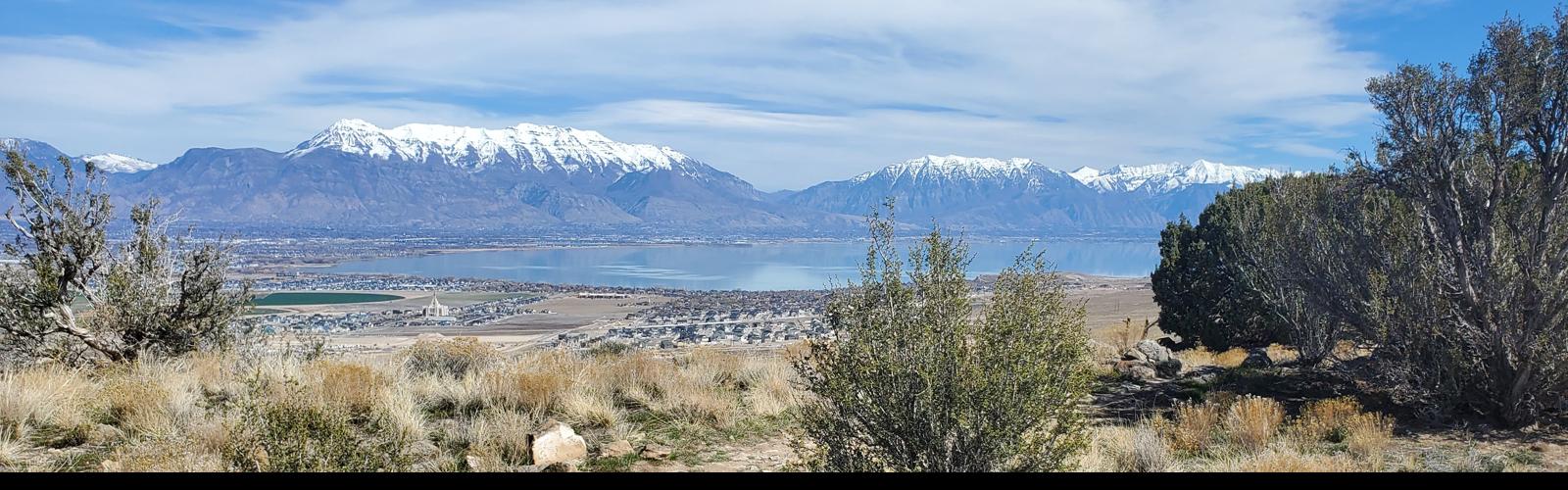
Looking east at Mount Timpanogos, Cascade Mountain, and Utah Lake from La Gringa. Review by Bruce on March 17, 2026.
Lake Mountain Ridgeline Route
La Gringa, southern Bugs Bunny, ApolloThe trails on the eastern side of the Lake Mountain ridgeline are
relatively new additions to the Eagle Mountain trail system. La Gringa,
upper Bugs Bunny, and Apollo are all bi-directional, not strenuous to
ride, and easier-intermediate in technical difficulty. The trails run in
the north-south direction, hugging the hillside just east of the ridge.
La Gringa, upper Bugs Bunny, and Apollo can be linked together.
Although in general the trails aim downhill as you ride north, there's a
bit of mild up-and-down. And while there's a bit of climbing to get to
these ridgeline trails, it's fairly mellow and gradual if you ride in the
counter-clockwise direction (going northbound once you arrive).
The combination of La Gringa, southern (ridgeline) Bugs
Bunny, and Apollo is 2.0 miles. The least complicated ride is a
counterclockwise 6.2 mile loop, using the ridgeline trails northbound.
(See the loop in the GPS window.) A well-rehearsed riding plan and a
GPS-enabled trail app are necessities for newcomers. In spring 2026, many
trails are still waiting for signposts. There are over 100 trail tracks in
my area GPS file. So yes, it's a complex area and it's really easy to get lost.

While much of the ridgeline is grassy scrub, there are stretches of juniper forest that can be muddy in winter and early spring. Looking south.

Riding north on Apollo in mid-March 2026, with a bit of snow on the Oquirrh Mountains ahead.
Each of the three trails can be done individually via the
multiple connecting trails on the western slope of Lake Mountain. For
Apollo, I recommend Rock-a-Billy to Bugs Bunny, then forking left on
Apollo in the rock garden at the ridgeline. For Bugs Bunny, take the same
route but stay on Bugs Bunny for a clockwise ride. And with La Gringa,
climb Crop Duster. Pick your return route when you arrive at the overlook
area.
The terrain is a mixture of juniper forest and grassy
hillside, with occasional sage and low scrub. The trail surface is mostly
dirt. There are a few limestone rock outcrops to roll over -- or bang
across in the uphill direction. A south-to-north ride is definitely
easier, if that makes a difference to you.
There are almost constant views of Utah Lake and the mountains of the
Wasatch Range to the east. The riding here feels different than the rest
of Eagle Mountain's trails, and I highly recommend that you check it out.
See the trail notes sections below for further details!

Just starting uphill on La Gringa from Bugs Bunny when riding north to south. We're facing northeast as La Gringa curves around the torn-up Flintstone overlook area.
Trailheads and connections

Parking lot, looking south. The trail you see behind the bathroom is Old Town Road. The trail at the far corner is the connector to Old Town and Rock-a-Billy.
Hidden HollowThe paved Hidden Hollow trailhead has a bathroom, water, and room for over 40 vehicles.
Westbound on SR-73 from Redwood Road (11600 West) in Lehi or from the
Mountain View Corridor, turn left at the stop light onto The Ranches Parkway.
At Pony Express Parkway, turn right. The road will veer a bit south
(left), then back west (right) as you get one mile from Ranches Parkway.
At the traffic light before Hidden Hollow
Elementary, turn left and drive uphill 0.3 miles. Turn left into the
parking lot.
Connectors to Old Town Road and Rock-a-Billy can be found on the
southeastern corner of the
parking strip. A doubletrack across the road to the west will take you to
the Hickman Hill loops (on your right after 1/4 mile) plus Creed and Brass Monkey
northbound, or to Supersonic, Cracker Jack, and Given-to-Fly southbound
(connectors are on your left starting in 0.2 miles).

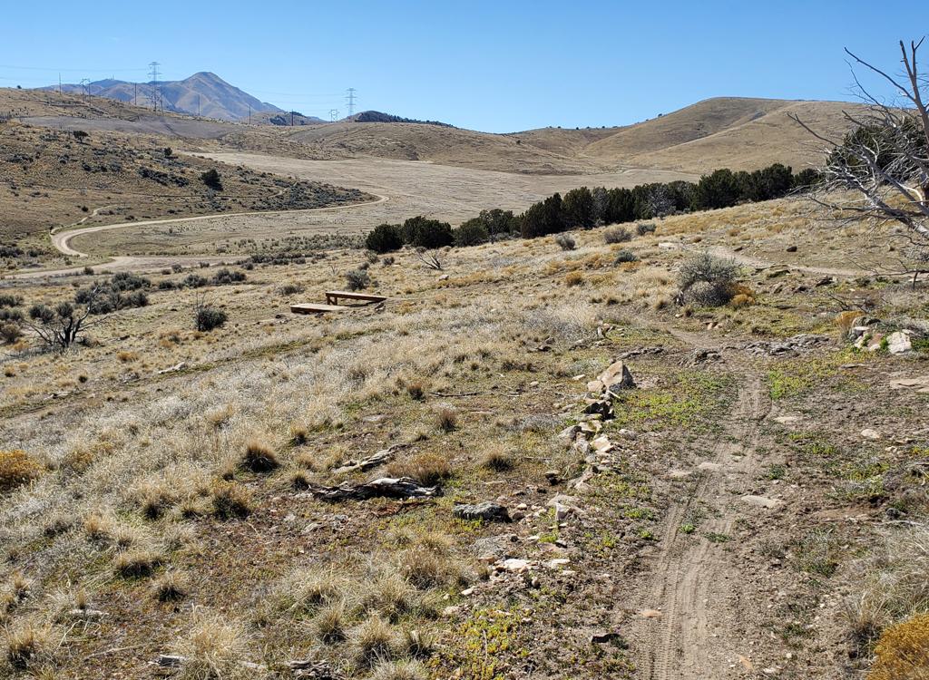
On the day before the big event, a few teams have set up to pre-ride the race loop.
Race Loop (rockpile) Parking: Westbound on
Pony Express Parkway in Eagle Mountain, turn south and drive uphill past Hidden Hollow
Elementary. Pass the main trailhead at 0.3 miles. When the pavement ends, keep as straight as possible
southbound on dirt road through the construction area. Drive a mile up the dirt road.
After you reach the top of a small rise and see another valley in front of
you, there's a big rockpile on the left. The parking is the primitive open
space south of the rockpile.
Deer Tracks is west of the parking area
(across the dirt road), Cow Tracks (to Rock-a-Billy) heads northbound at the northeast
corner where a dirt road leaves the parking area uphill.. Bugs Bunny is
across from Cow Tracks, southbound. Dirt
roads on the east and south connect to other singletrack trails.

Arriving at the top of Crop Duster, we find La Gringa across the ATV road.
Connections for the recommended loop rideFrom the Hidden Hollow trailhead, cross the road and hook up with Given
To Fly. Climb to the ridgeline and turn right onto Backspacer. Descend,
cross the road and dip through the wash. Now turn left onto Crop Duster.
At the top of Crop Duster, cross the doubletrack to La Gringa and you're
on your way.
As you finish Apollo, descend Big Thunder to Hidden Canyon, then at the
5-way trail fork take the middle-left trail Rock-a-Billy (possibly
dropping onto Old Town road later) back to the trailhead.

Heading up toward the doubletrack on Ridgeline to reach the northern end of Apollo.
Clockwise loop rideThe navigation for this route is much more complex, and in spring 2026
the trail forks are NOT marked. From the Hidden Hollow trailhead, catch
one of the connectors to Old Town Road or Rock-a-Billy and go north to a
5-way intersection just above the highway. Take the middle-right trail
climbing uphill, which is Hidden Canyon. At the top of Hidden Canyon,
cross the doubletrack then fork right on Ridgeline. Stay left on
Ridgeline as Cow Tracks forks away and climb to the ridgeline doubletrack.
Cross to Big Thunder and descend about 1/4 mile. Make a hard right onto
Apollo at the spot where Big Thunder and Rocky Balboa are around 20 feet
apart.
As you complete La Gringa at the south end of the ridge, you can cross
over to Gunslinger, or climb the doubletrack to 411. There are multiple
return-loop options. An on-trail navigation app is highly recommended.
Trail notes!
Apollo and Apollo connector

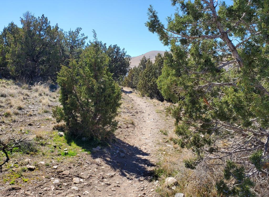
Northbound on Apollo. Much of Apollo is in juniper forest.
Apollo is the northernmost piece of the eastern ridgeline
ride. It's a two-way trail although most riders will prefer to ride
northbound.
Apollo has the most slope of the three ridgeline trails, but drops only
100 vertical feet in 0.7 miles when done south to north. However most of
that slope comes in a short stretch that will be a tough climb when the
trail is dusty. So for both tech difficulty and navigation simplicity, I
suggest riding it from the southern end northbound. Because of these
steeper bits, I rate Apollo as intermediate.
In the spring, Apollo will stay muddy much longer than other
Lake Mountain trails. A significant portion of the trail lies in clay dirt
facing away from the winter sun and shaded by junipers. I expect that in a
routine year, Apollo will be ready by late April or early May.
To the east, there are almost constant views of the Wasatch Range from
Lone Peak down to Loafer Mountain. At the far north, you'll see Traverse
Mountain (and the scar from the gravel mine) and a bit of the Wasatch
above Salt Lake County. When the trail approaches the top of the ridge,
you can see the Oquirrh Mountains. The city of Saratoga Springs and Utah
Lake lie below you in the valley.

Looking across the junipers to Mount Timpanogos and Cascade Mountain and Provo Peak

Origin of Apollo -- to your left -- after climbing up lower Bugs Bunny from the rockpile parking.
At its southern end, Apollo forks off Bugs Bunny in a rocky
area on the ridge, just as Bugs Bunny arrives at the top. The trail fork
is at mile 0.3 of the climb up from the rockpile (race loop) parking area,
on your left, just before Road Runner forks away on the right.
The fork is a little easier to spot when riding Bugs Bunny northbound.
The fork is 0.2 miles from the overlook area. Just watch for a big rock
garden and some trail signposts. (In spring 2026, Apollo is not yet
marked.)
There's also a connector trail, located further south on
Bugs Bunny, that links it to southern Apollo. The connector is 0.2 miles
long. It will be of interest to riders who are linking all three ridgeline
trails.
If you're arriving via southern Bugs Bunny riding northbound, the
connector is 0.5 miles from the Flintstone overlook and 0.1 miles from
where you passed the overlook north of Paintball City.
Northbound, there's a trail crossover at mile 0.3 (0.4 if you came via
the connector) for the expert DH trail Witch King. In spring 2026 the
bottom of the Witch King trail isn't finished yet, so don't divert onto
it.

Looking south from Apollo to show the Apollo connector fork.

Looking north as we approach a couple of short but steepish drops.
The steep spot on Apollo is around the trail's midpoint. The
elevation change is around 50 feet in 0.1 mile, but there are three short
brisk drops -- or dusty slippery grunt climbs if riding southbound. This
is also the area you can expect to be muddy in early spring.
At the northern end of Apollo you'll cross Rocky Balboa,
then merge onto Big Thunder. From here you can descend through the trails
above the bike park, but my suggestion is to descend through three
turns and 0.3 miles on Ridgeline then head west toward the top of the
Hidden Canyon trail. At the 5-way intersection, finish your return trip by
taking the middle-left trail Rock-a-Billy (not marked in spring 2026).
 and Big Thunder (veer right to join it).")
Junction of Apollo with Rocky Balboa (cross it) and Big Thunder (veer right to join it).
Bugs Bunny (ridgeline section)

Bruce approaches the ridgeline on Bugs Bunny after a climb from the rockpile parking.
Bugs Bunny climbs from the rockpile (race staging) parking
area to the ridgeline, then runs just east of the mountain's crest to the
Flintstone overlook area. The trail is 1.0 miles long. The lower Bugs
Bunny trail climbs 0.4 miles and 100 vertical feet to the Lake Mountain
ridgeline, where there's a trail fork with Apollo (left) and Road Runner
(right). Watch for the big rock garden.
The southern 0.6 miles of Bugs Bunny lies east of the
ridgeline. Only this portion of Bugs Bunny is included in our
"ridgeline" ride. In either direction, there's a gentle
down-slope, then a gentle climb. The trail surface is smooth and
non-technical. A stretch of rock garden as Bugs Bunny crosses the ridge of
Lake Mountain raises an otherwise-easy trail to intermediate tech rating.

Southbound on Bugs Bunny, just after passing the overlook at Paintball City.
 and Box Elder (the tall peak on the right). Geneva Rock quarry is the yellow spot at far left.")
Looking northeast toward Saratoga Springs, Lone Peak (middle) and Box Elder (the tall peak on the right). Geneva Rock quarry is the yellow spot at far left.
Southern Bugs Bunny runs mostly through grassy meadows, with
an occasional visit to a juniper grove. You'll pass subtle connecting
trails (listed from south to north) to Hunting Wabbit, Flintstone, the
Paintball City overlook, then the Apollo Connector. If you arrive at a
rock garden with the top of Roadrunner on your left, Apollo is to your
right.
Again, take a minute to enjoy the views! That's why you came
up here.
 and Cascade Mountain (right) across Utah Lake.")
Mount Timpanogos (left) and Cascade Mountain (right) across Utah Lake.

Looking north at Bugs Bunny. The jackrabbit sign indicates Paintball City. Hunting Wabbit branches from the road just past the tree on far left. La Gringa goes east from the lower right corner of this photo.
The junction between the south end of Bugs Bunny and La
Gringa is not marked as of spring 2026. This spot can be confusing, as
Flintstone, Paintball City, Hunting Wabbit, Jackrabbit, and Hog Rider all
originate here as well. From the spot where two wide ATV tracks cross,
look for the singletrack along the road edge that makes a 90-degree turn
right where the roads cross. Bugs Bunny is the singletrack running north
along the doubletrack to Paintball City and Hunting Wabbit. La Gringa is
the eastbound singletrack, lying on the north side of the dirt road to the
overlook.

Running along the ridge on La Gringa, enjoying a view of Utah Valley.
La Gringa is the southernmost of the Lake Mountain ridgeline
trails. It's 0.6 miles long with 100 vertical feet of elevation loss from
south to north. There's a series of limestone rock outcrops near the
southern end that might challenge less-strong riders coming from the
north, but they're do-able. The outcrops raise the overall tech rating for
La Gringa to intermediate, but the rest of the trail is quite easy.
The northern end of La Gringa meets the southern end of Bugs
Bunny at the spot where the Flintstone overlook dirt road crosses the
ridgeline dirt road. La Gringa goes east to curve around the overlook
area, then crosses the Flintstone DH trail. If you're riding south on La
Gringa (from Bugs Bunny toward Gunslinger/Cropduster), a couple of
junipers may block your view of riders flying down Flintstone. Heads up,
OK?
Stay level as you curve around the Flintstone ridge. Don't go up and
don't go down. Stay flat as you cross the main trail and cheater lines.

The Flintstone crossing, heading southbound.
Looking east from the main ridgeline doubletrack. Gunslinger is behind our backs. La Gringa will cross another doubletrack before settling into its northbound singletrack.
On the southern end, La Gringa begins on the ridgeline ATV
road, just across from the uphill ends of Cropduster and Gunslinger.
Hopefully the trail-marking rocks will stay in place to guide you through
the double doubletracks and onto nice trail.
Other than the Flintstone crossover, there's one other spot
that needs a comment. 100 yards from the origin of La Gringa across the
ridge doubletrack from Gunslinger/Cropduster, a trail forks away downhill
to the right. Don't go there. This is Shooting Gallery and it's nasty.
Nasty enough that I don't have a track for you, double-black plus morons
with guns blasting away at the bottom. Keep left and level.

Looking south toward the rest of Lake Mountain from La Gringa.

Northbound on La Gringa.
I highly recommend this route. It offers views that you
won't see on other Eagle Mountain trails. While the riding is intermediate
overall, the relatively mellow climbing and absence of tricky tech make
this ride one that any experienced mountain biker can enjoy. I suggest
going south to north. If you ride Eagle Mountain, you've gotta do this one!