
Eagle Eye
Eagle Eye is a singletrack trail that runs parallel to the Sand Flats Road. It's the upper segment of the Raptor Route downhill ride. While Eagle Eye is a two-way trail, almost everybody does it top to bottom. For details on the entire Raptor Route, please see the Raptor Route overview page.
On the Raptor Route descent, Eagle Eye is followed by Hawks Glide on its downhill end.
The trail can be ridden as an alternate line on the Whole Enchilada ride by linking to it from the Lower Porcupine Singletrack (LPS). It can be a target trail for a shuttled ride, with a drop-off either on the La Sal Loop road or the Sand Flats Road at the LPS connector. It can also be done as a loop by climbing Sand Flats.


Experienced beginners can manage this ride. I'd suggest a loop, climbing up Sand Flats and descending Eagle Eye. For newer riders, I don't suggest continuing down Hawks Glide. It starts mellow, but throws some techy stuff at you on the second half.
Trailheads and Connections

Lower Falcon Flow parking:
From the entry station at Sand Flats, drive exactly 4 miles up Sand Flats
Road and spot the trailhead on your left. The lower end of Falcon Flow
(which is a two-way trail) is on the downhill side of parking. For a loop
ride, begin pedaling up the road. About 1.4 mile uphill on the left,
there's a second parking area with longer stalls, used by RVs and vehicles
with trailers. In 2023, there's a port-a-potty at the parking area.

Upper Falcon Flow (Porcupine Rim) parking:
The upper parking area is 7.0 miles uphill from the Sand Flats entry gate,
on your right. There's a pit toilet here. The entry to Porcupine is the
broad trail to the left of the road. The singletrack dropping off the
steep hill to the east is Hawks Glide. The entry to Falcon Flow is 0.1
miles back west. For a loop ride of the upper Raptor Route trails, pedal
on east on the Sand Flats Road.

Climbing the Sand Flats Road:
From the lower Falcon Flow parking, it's 2.7 miles to the top of Falcon
Flow, then 0.1 mile to the upper parking (which is shared with Porcupine
Rim). The road then has little elevation change for a mile before
beginning to climb more steeply. At mile 2.1 from upper parking, the
Porcupine Rim entry (and access to the top of Hawks Glide) is on your
left. At mile 4.0 (6.8 from lower Falcon Flow) there's a cattleguard, with
the LPS connector on your left. 50 feet down that connector, Eagle Eye
forks left. The overall climbing on the Sand Flats Road will be 1400 from
the upper trailhead; 2300 from the lower Falcon Flow trailhead.

Entry via Lower Porcupine Singletrack:
The trail begins on the LPS connector, just a few feet from the Sand Flats
Road. When climbing Sand Flats, the LPS connector is obvious.
When descending Upper Porcupine Singletrack, continue west on LPS. At mile
0.8 from the Porcupine Overlook, turn hard left (south) as LPS continues
west. Pedal 0.2 miles then fork to the right in the sage meadow just
before Sand Flats Road.
The Eagle Eye Trail

The Eagle Eye trail is 2.4 miles in length, starting at 7300 feet elevation on the LPS connector trail about 50 feet from the Sand Flats Road. (It's just before the cattleguard.) Your total descending over the 2.4 miles will be 750 vertical feet.
Eagle Eye can be done as an alternate to continuing down the Lower Porcupine Singletrack on the Whole Enchilada ride.
There are some mildly uphill areas along the trail that add 100 vertical feet to your climbing total, but 99% of the trail is downhill.


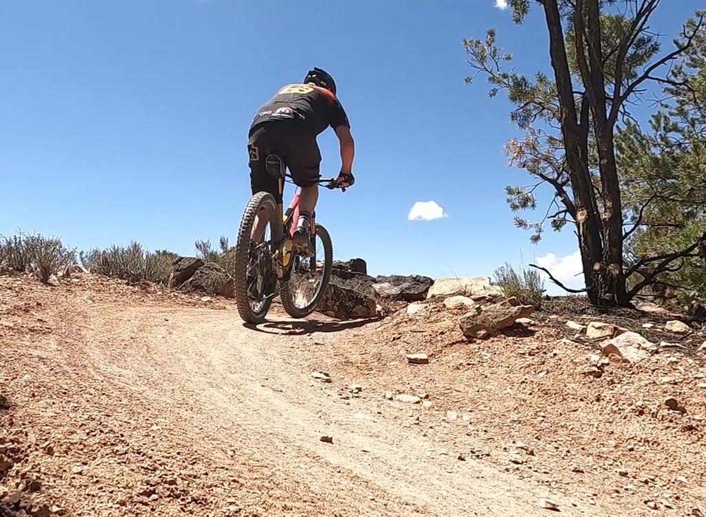
The trail has winding dirt singletrack among pinion and juniper, with occasional domes of sandstone that you'll ride over. Overall, the trail would deserve an easier-intermediate rating.
Occasionally the trail surface is broken chunky rock. You'll be happier riding a plush full suspension, especially if you plan to keep up some speed.


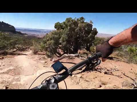
Views are rare at first, then the forest begins to break up, allowing you to see long views to the west.
When you reach the bottom of Eagle Eye, you're on the Porcupine Rim connector trail. Turn 90 degrees east to go out to the Sand Flats Road. If your target is Hawks Glide, continue 0.1 miles down the rough doubletrack then turn to the left when you see the extruder gate for the singletrack.
To connect to Porcupine Rim, keep straight and follow the rocky doubletrack through a series of turns as it descends to Porcupine Rim. Turn to the right to head toward the viewpoint on the Rim.


Bottom Line!
Nice singletrack for early intermediate riders; some stretches are a bit bouncy at faster speeds. No nasty or unexpected challenges. Some nice views.
Getting there:
On Main Street (Highway 191) in Moab go to 3rd South and turn east. Turn to the right when the 3rd South ends on 4th East, then take the second left onto the Sand Flats Road. Drive to the entry gate and pay your entrance fee. Drive past Slickrock. The first trailhead is the lower Falcon Flow parking at mile 4.0 from the fee station.
Bathrooms: Upper and Lower Falcon Flow parking.
Water: none
Camping: multiple sites along Sand Flats Road.

Wide area map of the Raptor Route 2026