On the trail along the south rims Shotgun loop, heading northeast. Thats Lone Pe...
On the trail along the south rim's Shotgun loop, heading northeast. That's Lone Peak straight ahead. Trail mapping and photos by Bruce on September 12, 2016.
Highland Hollow
Dry Creek Gulch Trails

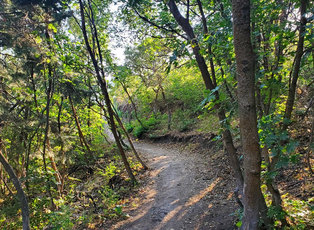
The Highland Hollow trail system in Dry Creek gulch in northwest Highland was built in summer 2016 by the Lone Peak High School mountain biking team with help from Eagle Scout projects. The trails are just downhill from the flood-control dam in "the big dip," along the Murdock Canal Trail

The trails can be reached from a small parking area off Canterbury Drive on the south side of the gulch. Drop down the gravel road. See below.

Or, you can start at a nearby Murdock Canal Trail trailhead and pedal down into Dry Creek. The closest trailhead is on 10400 North at around 6500 West. (There's a bathroom and water here.) From this trailhead, it's 0.8 miles northwest to reach the bottom of the gulch.

Westbound on fresh trailcut on the Adrenaline (northern rim) loop trail, as the ...
Westbound on fresh trailcut on the Adrenaline (northern rim) loop trail, as the trail hugs the side of the gulch.
A reminder that youre not out in the woods. You will see houses along the edge. ...
A reminder that you're not out in the woods. You will see houses along the edge. We're on the smaller beginner loop north of the creek, called Bonzai.
There's currently about 4 miles of trail in the system, which are ridden as tangled loops. It's not a continuous ride, and there will be some duplication if you're trying to do everything.

The riding season will be March through December. The area has a lot of sand, so hopefully it won't be a mud-bog when wet. At this time, the surface on these brand-new trails is very powdery. But I only spun out once and dug-and-died once. So it's good to go.

Trails range from easy to upper-intermediate in tech requirement. The easiest trails are a broad straight track going east-west north of the creek (shown on my map as the south side of the Adrenaline and Machette loops), and the doubletrack south of the creek that crosses the big flat meadow (shown as "DT" on my map, connecting via bridge to the easy trail north of the creek). These are suitable for small kids.
On the Adrenaline trail, weve turned to the northeast, with Lone Peak between th...
On the Adrenaline trail, we've turned to the northeast, with Lone Peak between the stands of gambel oak.

A ride in Highland Hollow...

[Back to video list ]
Were coming back from the far west end on narrow singletrack winding through wil...
We're coming back from the far west end on narrow singletrack winding through willow trees.
There are three spots to grab a trail from the Murdock Canal trail. Assuming you're heading north, the first is the broad doubletrack on your left just before you reach the bridge across the creek. In about 50 feet veer left for a singletrack connector to the north arm of the Shotgun loop, or continue another 50 feet and catch the loop as it crosses the doubletrack.
The next spot is about 100 feet past the bridge. You'll see a broad path on the left. It's not an official entry, because there's no fill between the paved trail and the singletrack. This is the easy wide trail that takes you west to the middle of the riding area, where you can fork right for the Adrenaline trail, or continue straight and very slightly downhill to enter the Machette loop.
The doubletrack south of the creek crosses this bridge before it joins the easy ...
The doubletrack south of the creek crosses this bridge before it joins the easy and broad central trail. Looking west.
Mountains east of Alpine. Thats Box Elder Peak (11,100 feet) on the left.
Mountains east of Alpine. That's Box Elder Peak (11,100 feet) on the left.
The "official" entry is at the huge wooden sign on the left downhill side of the trail 200 feet past the bridge. Expect a trail map to appear here soon. As you drop off pavement, an immediate right turn takes you on Bonzai. The next fork splits Adrenaline off to the right and uphill.

If you go straight south from the official entry (keeping left at the Bonzai fork then crossing two trails), you'll find yourself on Greg's trail along the creek's edge.

The south side of the riding area can be reached either via the doubletrack as it forks off the Murdock Canal Trail south of the bridge, or by crossing the bridge to that doubletrack from the east end of the Machette loop trail. See the map.
A glimpse of the creek from the trail.
South of the creek two alternate lines of bumps occupy the flat area.
Here south of the creek is the Shotgun loop. It wanders through the north side of the meadow and splits in two to offer a choice of two bump lines. As it crosses the doubletrack on either end, it climbs up the south rim of the gulch. I found it a little easier in the counterclockwise direction, but this may change as the trails firm up.
Bonzai and Greg's Trail are easy technically. The broad south side of the Machette loop trail is very easy, while the north side dips and swoops through jungle as an intermediate ride. Adrenaline is also intermediate in tech and leg-strength requirement.

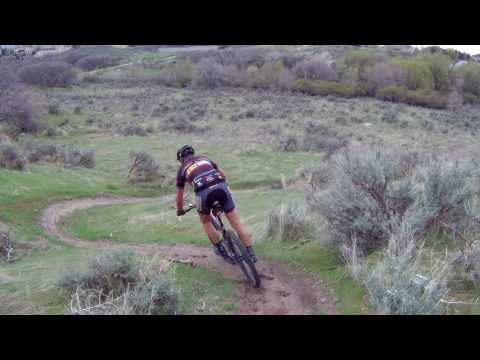
Shotgun is another loop that mixes easy trail with harder trail. The north side (closest to the creek) is easy riding, although the bumps may be tough for kids and their tiny bikes. The south half (on the south rim of the gulch) has some tough turns and would rate upper-intermediate.

Looking northeast on the south rim trail.
Big up-and-over on the western end of the Shotgun loop trail as we return to the...
Big up-and-over on the western end of the Shotgun loop trail as we return to the bridge area. Don't hang a pedal on the top!
Bottom Line!

Great little trail system for a fun ride, especially attractive to groups of mixed ability. It will only get better as the trails are compacted. A good quick ride for locals who crave dirt but don't have time to drive somewhere, but worthy of the trip from SLC or south Utah Valley.

I'm assuming that there will be some fat bike traffic in the winter. At least, I'm planning to try it.

Map of Highland Hollow.
Getting there, south rim parking:  (Note that there's only room for a couple of cars here, and you'll be in a residential neighborhood. For non-local riders I suggest you use the Murdock Canal Trail to reach Highland Hollow.) Exit Timpanogos Highway on 1200 East (the street just west of the big Smith's shopping complex) and go south. Proceed through the dip, and as you reach the top, turn left onto 10400 North. Take the second left, Canterbury Drive. Take the next left to park at the top of the gulch. Descend the gravel path. Either jump on the south rim trail as it crosses, or keep going down to the doubletrack in the flat.

Bathrooms and water:  Murdock Canal Trail rest stops and trailheads.

Getting there via the Murdock Canal Trail:
From the north. 
On Timpanogos Highway in Lehi, turn into the Smith's parking lot. Find a parking spot near the southwest corner. Find the connector to the Murdock Canal Trail and turn left. Go under the road, then descend around two turns to the kiosk.
Alternatively, you can ride a couple of miles from the Bull River trailhead near I-15 on the Timpanogos Highway. See the Murdock Canal Trail page.
From the south. 
Take Timpanogos Highway east to 6400 West (the first road on the right as you climb out of the dip) and turn south. Go to 10400 North. To park near the bathroom, go straight through the intersection, pass the Murdoch trail (which looks a bit like a road), then turn left at 10250 North down to the parking area. This is Mitchell Hollow Park.  (An additional larger parking lot is on the north side of 10400 South at around 6500 West, with quick access to the paved trail.) Get on the paved Murdock Canal Trail and head north 0.9 miles. In the bottom of the dip, you can turn left on DT just before the bridge, or cross the bridge and turn left onto singletrack at the big wooden sign 200 feet later.
Riding resources for this trail:
GPS track files (right-click and "Save as..."):
       GPX multi-track file w individual trails
Aerial map for printing:  View map
Lodging, camping, shops:
    Links to AF Canyon resources
    Links to Provo area resources