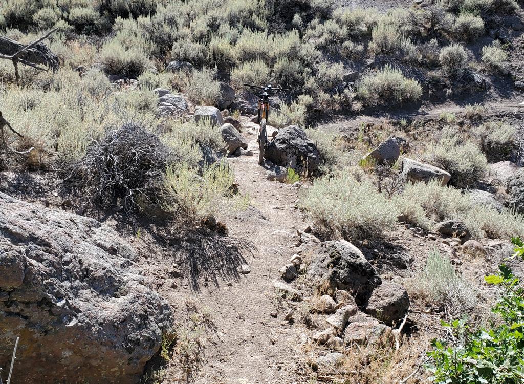


The Coyote Canyon Loop lies northeast of Heber. It's a big ride that's best reserved for conditioned riders. Much of the trail is easier-intermediate technical, but there are many tight turns and a few rock gardens that will challenge skilled riders.

 trail.")
The loop can be ridden in either direction. Locals seem to like the counter-clockwise direction. Variations on the loop can include combinations of the Lower Riverview trails.


You'll also have great views of ewes and their lambs. This is private land grazed by herds of sheep. Spooking them is bad form.


(1) Coyote Trailhead. Located at the south end on Coyote Lane, this is used frequently by locals, but is harder for outsiders to navigate. See the Lower Riverview page for details on the lower mountain southern trails.
(2) UVU Wasatch Campus Trailhead. At the uppermost level of parking behind the UVU buildings, look for the duck-under and kiosk. A singletrack trail climbs 1.5 miles to the Riverview Trail.
(3) Riverview Trailhead. Park along Highway 32, one mile uphill from US-40. 1/4 mile up the Riverview trail is the fork that starts the loop.
(4) 32 Trail. As of 2013, there's no formal trailhead here. You can park along the road and clamber over the fence near the (locked) gate. Ride uphill on doubletrack and find the singletrack on your left about 100 yards uphill. You'll reach the fork that starts the loop 1/2 mile from the highway.
Park on the right side of Highway 32 at the Riverview trailhead. Head uphill and ride 1/4 mile to the trail fork. Stay left and keep climbing. After crossing the ridge on the north end, you'll descend slightly to the Cutthroat trailhead area. Keep straight as Looney Tunes joins. Cross the dirt road at mile 4.5. About 100 yards later, fork right and start climbing uphill. (The left fork takes you down to Highway 32 and to the Wile E Canyon trail.)


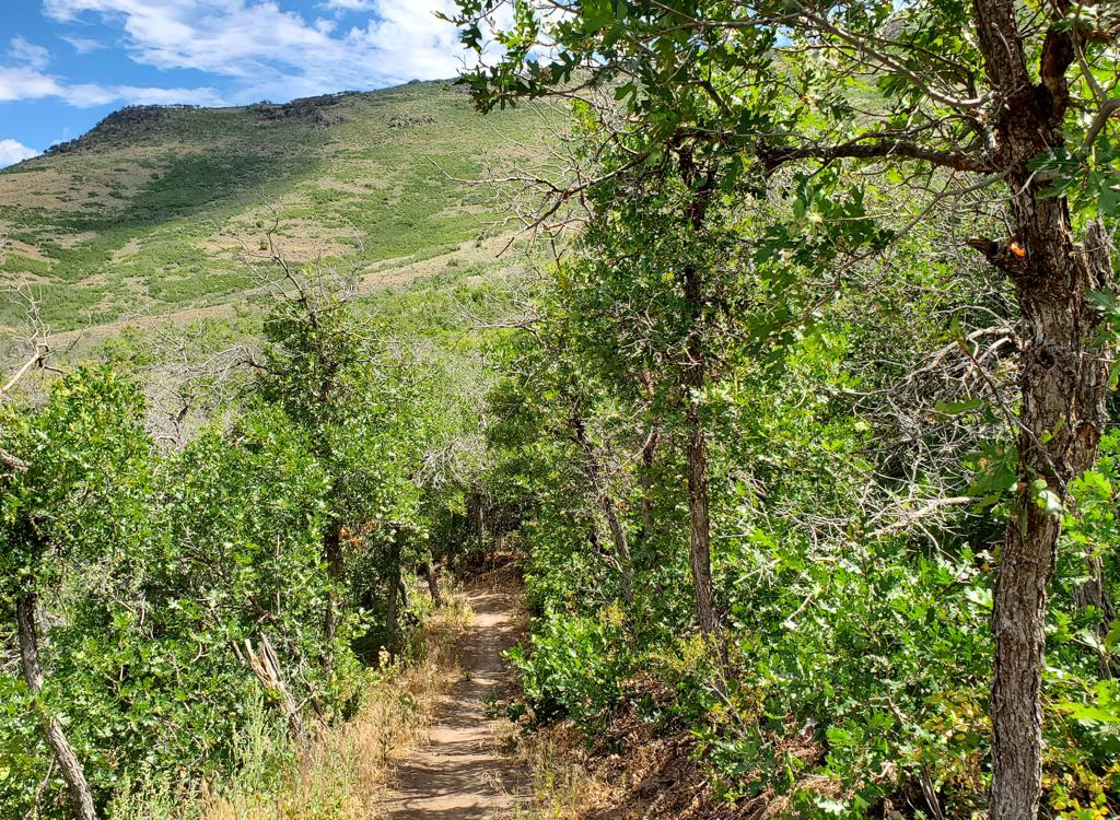
Around mile 9.5, you reach the ride's highest point at 7550 feet. As you descend into a sage-covered saddle, there are views in every direction.
Immediately after the view, you'll begin dropping off the southern end of the mountain. There will be a few rock gardens along the ridge before you begin dropping down the steep side-slope.


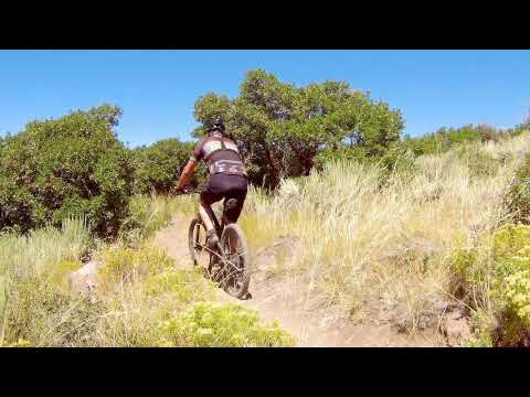
The mountain gets steep here, although the trail is not. Prepare for seemingly endless switchbacks. The hairpin turns seem a bit more hairy here. Many of these turns "go flat" quickly with no run-out. Good handling skills are required.


You'll pass connecting trails such as Hobbiton Hill and Chop'd Coyote. At mile 16.9, keep straight (right) as connector from the UVU campus joins from downhill. A quarter-mile later, keep to the right uphill as Upper Frodo and Doors of Durin fork downhill.
Stay straight and level as you pass forks where Mordor crosses and Lonely Mountain forks uphill. At mile 18.7, keep right as Upper Potatoes leaves on the left. At mile 20.0, you're back at the first trail fork. Turn left and descend to parking.
Bottom Line
This is an epic loop with great riding and great views. You'll want to do this
ride.


Chop'd Coyote used to cut across the Coyote Loop trail to divide Coyote into two smaller loops, which you could ride either direction. The top end of Chop'd Coyote was interrupted by construction in 2022. A mile before the top, you can divert onto Stone Giants, then climb the Coyote Lane Road to catch the middle of the Coyote Loop on the backside of the mountain. This still yields a significantly shorter loop ride. Or, you can use Chop'd Coyote and the full two miles of Stone Giants as an alternate path to southern Riverview and southern Coyote. This variation has similar distance and climbing to the classic loop. See the Chop'd Coyote trail page for details.
At the northeast corner of the Coyote Loop, you can take Looney Tunes to bypass part of the loop. This section you'll skip goes down to the Highway 32 trailhead and climbs back out, so you save a couple of miles (3.6 vs 1.7) and a bit over 250 vertical feet of climbing.
Looney Tunes is 1.7 miles long. The bottom is 1.1 miles from the junction of the trailhead connector with the Coyote Loop, and the top is 2.5 miles uphill from that loop fork. The elevation change on Looney Tunes is 400 feet, with a top elevation of 7330 at the Coyote Loop. (After being interrupted by golf course construction in 2023, Looney Tunes has been hooked back up.)
0.0 Trail at downhill end of parking
N40 34.404 W111 25.215
Take stairs over fence
0.2 Keep L (R = return)
N40 34.430 W111 25.062
4 First ridgeline
4.5 Cross DT N40 35.353 W111 23.617
4.55 Fork R (L = to highway 32)
N40 35.329 W111 23.601
7.6 Unmarked ( R to Chop'd Coyote via DT)
N40 34.366 W111 23.772
9.5 Highest point
14.9 R to Riverview Tr
N40 32.361 W111 23.402
L = descend for longer ride
N40 32.544 W111 23.380
R on ST N40 32.539 W111 23.397
16.5 Keep L (R = Chop'd Coyote)
N40 33.053 W111 24.030
16.9 Stay R uphill (L = to UVU TH)
N40 33.210 W111 24.242
18.7 Fork R (L = view)
N40 33.705 W111 25.007
20.0 Fork L (finish loop)
N40 34.430 W111 25.062
20.2 Back at parking

Trailhead options!
UVU Wasatch Campus Trailhead: One mile south of the junction of Highway 40 and 32 (a couple of miles north of Heber), turn east (toward the mountain) at the UVU campus. Go to the uppermost level of parking behind the UVU buildings. Look for the duck-under and kiosk. A singletrack trail climbs 1.5 miles to the Riverview Trail.
Wile E Canyon trailhead: The Wile E Canyon trailhead is located on the southern side of Highway 32, just over 4 miles from US-40. It's 1/10th mile east of the old Cutthroat trailhead (see below). There's room for about 8 cars here. From the parking lot, a connector trail takes you 120 yards uphill to the Wile E Canyon loop. To get to Beep Beep (or the Coyote Switchbacks or East Riverview), turn right at the trail fork, keep right at the next fork, then turn left onto the Coyote Riverview Connector trail as you approach the gravel road.
Coyote Riverview Connector trail (old Cutthroat): You can still connect through the old Cutthroat trailhead, although there's no longer a parking area here. For example, if the crowds have forced you to park where construction workers leave their vehicles along Highway 32, you can pedal to the gravel road to the new golf course leaves the highway, four miles east of US-40 and just east of the big rock-wall road-cut.
Puddy Tat parking: On Highway 3 around three miles from US-40, watch for a dirt road turning to the right in a huge sage meadow. There are a couple of buildings across Highway 32 at this spot. The parking spot is just through the fence, with a connection to Puddy Tat on the eastern side of parking. (This spot was still being worked on at the time of my review.)
Riverview trailhead: From US-40 just south of the Jordanelle reservoir, turn east at the traffic light onto Highwat 32 (at mile 14.2 from I-80 if you're coming from the north). On Highway 32, climb 1.1 miles. When you see the second entry into Riverview on your left and a road under construction to your right, the Riverview Connector trail starts on the uphill side of that road just after it leaves Highway 32. (In 2025, there's no longer protected parking here. It's unclear whether the trailhead will be restored when construction is complete.)Coyote Trailhead: The southern Coyote trailhead has been lost to subdivision construction. Access to the southern side the trail system is in limbo, but some riders find their way through the construction zone by pedaling up the gravel Coyote Canyon road.
Canal DT trailhead: Just uphill from the light on highway 32, watch for the canal crossing. Park along the road. Start riding south on the doubletrack just uphill from the canal.
Riding resources:
Single-page, printable trail
guide
Short loop from Riverview (20 mi)
Longer loop from UVU (24 mi)
Multi-track GPX area master file
Sorenson only GPX
Riverview to 32 32 to Coyote TH
WB50 track
Maps for printing: Above map in new window
Lodging, camping, shops: Links to area resources
Trail pages:
Riverview Trail
page
Lower Riverview page
Chop'd Coyote page
Isengard/Mordor page
Cutthroat
(Wile E Coyote and Looney Tunes) page
Bathrooms: No public restrooms nearby.
Water: Gas stations in Heber, campgrounds.
Camping: Hailstone campground at Jordanelle on US-40, about 6 miles away.
Bike services: Slim and Knobby's bike shop, Heber Latest update June 2022.