
The trail runs up and over three hills among small outcrops of sandstone. Original review June 21, 2002 by Bruce, with new photos and update December 6, 2017.
City Creek Trail
(plus connectors to Owen's Trail and Rusty Cliffs)
Beginning on Red Hills Parkway (formerly Turtle Road) above the red cliffs north of St. George, the City Creek trail offers some rocky options. While located right on the edge of the city, the rough terrain makes this an upper-intermediate trail in technical requirement.
The City Creek trail can be done as an out-and-back, or as a loop by using the paved Red Hills
Parkway trail. The singletrack is 2.5 miles in length, with 300 vertical
feet of climbing in
either direction.

Step-over gate at the eastern end of the trail. Both ends of the trail are on the paved Red Hills Parkway Trail, just 1.1 miles apart.

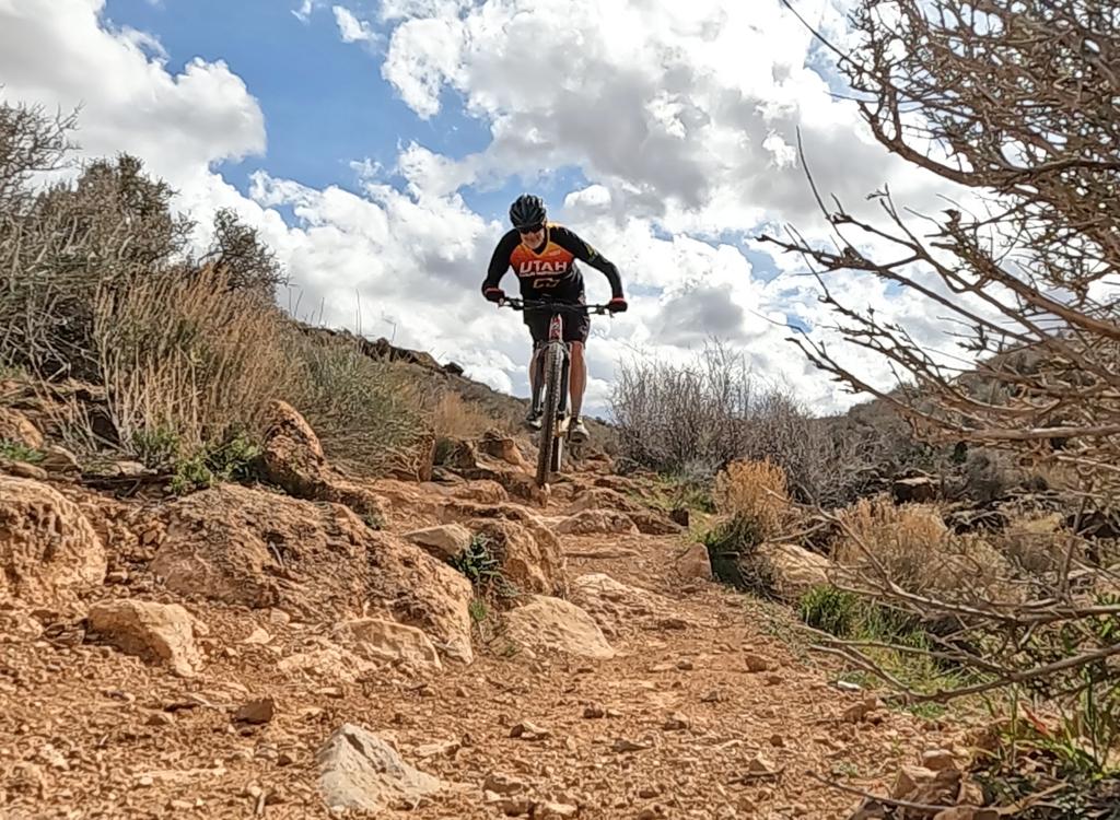
Heading uphill on the first part of a clockwise ride, with the Pine Valley Mountains in the background.
You can reach the trail on the eastern end from the Pioneer Hills trailhead on Red Hills Parkway,
adding 0.3 miles of paved trail to reach the singletrack (see map). Or
you can pedal from town
on the parkway trail to reach the step-over gates on either end of City
Creek.
Most of the trail is intermediate technical, with a smattering of advanced technical rough
rock thrown in. This route is NOT appropriate for beginning riders. There
will be technical
challenges both uphill and down, whichever direction you ride the trail.

One of the City Creek Trail's local residents out for a stroll. Do NOT touch the turtles. This trail is in the Red Cliffs Desert Reserve -- you break the rules, and bike trails will be history.

Climbing the stairs on an east-to-west ride.

Descending more stairs on the other side of the hill.

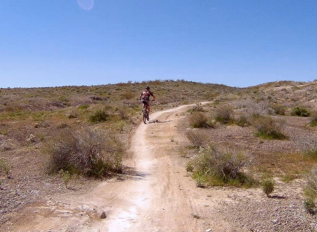
Cruising westbound on a rare stretch of flat trail after climbing the first of three hills.
My favorite ride is a quick four-mile loop ride from the Pioneer Hills trailhead. Right at
the entry to the parking area, a cement pathway parallels the highway
heading downhill and
north. After 100 yards, it turns under the parkway. Turn left (uphill)
as you reach the paved
Red Hills Parkway trail. Pedal uphill just over 0.1 miles, then go to
the step-over gate on
your right.
The initial climb will take you up to the junction with the Owen's Trail connector. On my most
recent ride, this trail fork was not marked. Fork hard right to stay on
City Creek. (If you're
hungry for miles, you can do Owen's, then come back to City Creek.)
After a bit of flat riding, you'll descend on rough trail down to City Creek itself. After riding northeast along the creek, you'll go cross over as you hit the parkway. After you climb away from the creek, there's a connector to the paved trail on your right -- in case you need to bail.
After a bit of flat riding, you'll descend on rough trail down to City Creek itself. After riding northeast along the creek, you'll go cross over as you hit the parkway. After you climb away from the creek, there's a connector to the paved trail on your right -- in case you need to bail.
 creek is in the gully. We...")
Descending toward City Creek. The actual (usually dry) creek is in the gully. We'll go right down to the bank.

Rolling over slickrock.
The trail will now descend slightly to the west and circle a sandstone canyon. It will flirt
with the edge of the golf course.
Next comes a bit of nice Navajo sandstone slickrock. Play for a minute if you're tempted. Unfortunately the slickrock section is short.
Next comes a bit of nice Navajo sandstone slickrock. Play for a minute if you're tempted. Unfortunately the slickrock section is short.
From the slickrock area, the trail climbs to the third and final hill. There are some nice
views from the summit.

Heading up toward the final summit.

Views from the top. We're looking northeast.
From this hill, the trail turns north and descends down to the Red Hills Parkway. Just 1/10th
mile before the parkway trail, there's an (unmarked as of 2022) trail
fork. The left (less
traveled) path is the eastern end of the Rusty Cliffs trail. Keep right
to finish up City Creek.
Step across the gate, turn right, and pedal the pavement back to the underpass
to complete
the loop. Or turn around and do City Creek in the opposite direction for
a 5.6-mile, 650-vertical
out-and-back.
About Rusty Cliffs...
The Rusty Cliffs trail begins 0.1 miles from where City Creek ends on the paved Red Hills Parkway trail. The fork is unmarked. If riding east-to-west, fork to the left on the smaller trail. After 0.2 miles, it will descend steeply to a drainage tunnel and pass under the Red Hills Parkway. Most riders will do only the first 2.5 miles of Rusty Cliffs as an out-and-back from City Creek. (See the Rusty Cliffs trail page for more information.)

View from the Rusty Cliffs trail, as we follow the old pioneer road.

Aerial map of the City Creek area
Getting there, Pioneer Hills trailhead: From St. George Blvd (the
main drag), head north on Main Street (towards the "Dixie"
painted on the big rock above the cliffs). When you reach Hope Street,
turn right, then immediately take the left fork and climb Skyline Drive to
the top of the cliffs. Turn left on Red Hills Parkway (labeled Skyline
Drive on some city maps, and still called Turtle Road by many locals). After the
top of the hill, turn right into the parking area. The trail starts across
the road. Find the paved (cement) trail descending north and crossing
under the parkway. Turn left (back uphill) on the Red Hills Parkway Trail.
After 1/10th mile, look for the
stepover gate.
Western trail entry from town: At the intersection of Red Hills Parkway (where it becomes Snow Canyon Parkway) and Bluff Street, exit the Snow Canyon paved trail to head east uphill on the paved Red Hills Parkway Trail. After 1/4 mile, find the step-over gate to the City Creek trail.
Western trail entry from town: At the intersection of Red Hills Parkway (where it becomes Snow Canyon Parkway) and Bluff Street, exit the Snow Canyon paved trail to head east uphill on the paved Red Hills Parkway Trail. After 1/4 mile, find the step-over gate to the City Creek trail.
Bathrooms: None
Water: None
Riding resources for this trail:
Single-page riding guide
GPS track files (right-click and "Save as..."):
GPX track of loop above
Area multi-track file
Maps of trail system for printing:
Aerial as above
Desert Preserve area topo
Lodging, camping, shops: Links to St. George area resources
Single-page riding guide
GPS track files (right-click and "Save as..."):
GPX track of loop above
Area multi-track file
Maps of trail system for printing:
Aerial as above
Desert Preserve area topo
Lodging, camping, shops: Links to St. George area resources
Original ride 2002. Last updated 2022.