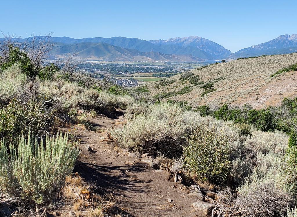
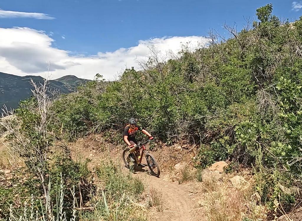
View as we approach the trail fork on the Center Trail in Fourth Water. Ride and...
View as we approach the trail fork on the Center Trail in Fourth Water. Ride and photos by Bruce and Jackie, September 10, 2009.
Center Trail to Strawberry Ridge Loop.
Includes the Second Water and upper Fifth Water Trails.

The Center Trail to Strawberry Ridge Loop is an epic ride for very strong conditioned riders. But there are shorter ride options, so stay tuned. The ride starts at 7400 feet elevation on Rays Valley Road, mid-way between Hobble Creek and Spanish Fork Canyon. The loop has just over 4000 vertical feet of climbing, with a top altitude of 8500 feet. It's 18.3 miles long, but you can make the ride even longer if you want.
The smaller rides create of loop from a piece of the Center Trail plus two of four trails: Second Water, Third Water, Fourth Water, or Fifth Water. My suggestion is to climb either Third or Fourth water to the Center Trail, then circle counter-clockwise before descending Fifth Water. Avoid riding clockwise on the Center Trail from Fifth Water, because it puts some very steep pitches on the uphill. More on these options later.
View east up Second Water at the trailhead.
View from the trail as we climb Second Water along the creek.
For now, we'll assume you want the BIG ride. But if you wuss out, there are three trails that let you bail out and circle back to your car.
Let's get started. Park at the Second Water Trailhead and ride uphill.
Typical trail view in Second Water, as we slowly gain elevation.
Jackie grabs a drink at one of several creek crossings.
View down the canyon in Second Water, just before reaching the Center Trail.
Second Water climbs along the creek, crossing it several times. Keep left when you hit the first fork, just after crossing the creek to the south side and climbing a short steep pitch. (I don't know where the right fork goes -- probably around the ridge to First Water.)
At mile 1.8, the Center Trail 009 forks hard left uphill. This first 1/3 mile is a bit steep with some slabs of loose rock. Fight your way uphill, or get off and push. This is probably the toughest climb of the entire ride. But there'll be lots more uphill yet to come.
View south on the Center Trail. South-facing slopes are mostly brush, and are to...
View south on the Center Trail. South-facing slopes are mostly brush, and are toasty hot to add to your climbing suffering. North slopes are shaded and cool.
Typical view along the Center Trail as we head into fir and aspen forest at the ...
Typical view along the Center Trail as we head into fir and aspen forest at the top of a ridge, then turn eastward and descend into the next canyon.
At the top of the Second Water Ridge, keep straight as an ATV path hits the trail in a meadow. (This path connects to Strawberry Ridge Road.) The trail will now drop down into the next canyon, Third Water. As you reach the creek, the Third Water Trail (signed 236 and 020) forks left. Bail out to Rays Valley Road if you need to. Otherwise, keep right, cross the creek and start climbing again.
After the next ridge, you'll descend to a dry fork of Third Water before climbing again to Third Water Ridge. Again, keep straight as smaller trails join or cross on the ridge top.
Now turn and descend into Fourth Water. Just before the creek, keep right at the trail fork. (Left takes you down the Fourth Water Trail 017 to Rays Valley Road. Again, bail if you need to.)
Time to climb again. Cross another ridge. Now descend a somewhat more-technical section to a fork of Fourth Water. Pass the fenced spring. Now climb to the top of Fourth Water Ridge.
A typical south-facing slope, climbing upward on Third Water Ridge.
View back uphill as we descend into the northern fork of Fourth Water. A few roc...
View back uphill as we descend into the northern fork of Fourth Water. A few rocks and roots here.
After passing through the gate at the top of Fourth Water Ridge, it's time for the descent to the Fifth Water Trail. You'll drop 650 feet in one mile. It isn't technical, but you'll occasionally want to scoot your butt back to control the bike in the steeper sections. (This slope is why I don't recommend riding the Center Trail north-to-south on this section.)
When you cross Fifth Water creek at the bottom of the canyon, fork right, uphill. (Fifth Water offers you another bailout opportunity. It's 2.5 miles downhill to the road, but then you'll have a few uphill road miles to get back to your car.) The Fifth Water Trail will climb at a mellow pitch for one mile, then at moderate steepness for another mile, averaging 400 vertical per mile over the two miles.
When Fifth Water reaches the Strawberry Ridge Road, fork right (southbound). To finish the loop, head south.
If you want more miles, consider the Strawberry Ridge ATV path. You can catch it on your left just past the cattleguard. Or you can simply ride north up the dirt road to the intersection with the Horse Creek road. Go right across the cattleguard, then immediately fork left on the ATV track. Good luck. Jackie wishes I hadn't added that section to my ride -- it extended our day to 26 miles.
A spring is the origin of the north fork of Fourth Water.
Descending toward the Fifth Water trail.
To finish the loop from the top of Fifth Water, ride 6 miles south on the Strawberry Ridge Road to the top of the Second Water trail. No, there aren't any shortcuts now. You'll have 1000 more vertical feet of climbing as the road follows the ridge up and down.
The road will cross a cattleguard as it goes through a fence then descend for about 1/2 mile. As it levels out and approaches another cattleguard, watch carefully for the combined Second Water and Center (009) Trail forking sharply off to your right.
Now fly down the singletrack 0.7 miles to the Center Trail fork, watching out for horses. Retrace your original route on Second Water back to your vehicle.
This is a very taxing ride. There's a lot of up-and-down on the Center Trail and the Strawberry Ridge Road. I'd allow at least four hours, maybe five, for this ride. It's beautiful and fun, but brutal. You hurt.
willView uphill in Fifth Water. Pretty. Mellow climbing.
will View uphill in Fifth Water. Pretty. Mellow climbing.
Getting a little higher in Fifth Water, the creek is dry. Still buff trail.
Easier option: Three Fifths or Four Fifths loop (short rides)
My suggestion for a shorter ride is: park at the Fifth Water trailhead, but ride (southbound) up Rays Valley Road to either the Fourth Water or the Third Water trails. After climbing one of these trails to the Center Trail, ride north on the Center Trail to the Fifth Water Trail and drop down to your car.
map
Area map
Fourth Water to enter loop from Fifth Water trailhead:
1.5 Rays Valley Road + 2.0 Fourth Water + 2.5 NB Center + 2.5 Fifth Water = 8.5 miles
Climb Third Water to enter loop from Fifth Water trailhead:
2.0 Rays Valley Road + 1.6 Third Water + 4.5 NB Center + 2.5 Fifth Water = 10.6 miles

Waypoints for the easier alternate loops (see green arrows on map at left):
Third Water @ Rays Valley Road N40 05.010 W111 16.715
                       @ Center Trail N40 04.768 W111 15.088
Fourth Water @ Rays Valley Road N40 05.411 W111 16.801
                         @ Center Trail N40 05.863 W111 14.751
Fifth Water @ Rays Valley Road N40 06.359 W111 17.437
                      @ Center Tr Northbound N40 07.224 W111 15.528
                      @ Center Tr Southbound N40 07.252 W111 14.869

Distances, alternate trails:
Fifth Water to Center SB 2.5 mi
Fourth Water to Center 2.0
Third Water to Center 1.6

A quite Brutal Option:  The Three Forks to Center Trail loop
Another brutal epic ride is to start in Diamond Fork at the  Three Forks trailhead, climb the Cottonwood Creek Trail, connect to Second Water across Rays Valley Road, then climb to the Center Trail. After reaching Fifth Water via the Center Trail, descend back to the trailhead. In other words, you start out just like the normal Three Forks loop, but instead of connecting across via Rays Valley Road, you climb all the way up to the Center Trail and ride that to Fifth Water.
Option: Strawberry Ridge only, using Rays Valley Road.
An easier and popular riding option is to climb on the Second Water Trail all the way to the Strawberry Ridge Road, ride northbound to the top of Fifth Water, then descend. This cuts out the Center Trail entirely. (Or, do it the other way, clockwise, by climbing Fifth Water.) You'll use Rays Valley Road to connect between the two trailheads.
As we approach the Strawberry Ridge Road on Fifth Water, we have a nice view of ...
As we approach the Strawberry Ridge Road on Fifth Water, we have a nice view of the Wasatch canyons to the north.

Getting there, via Spanish Fork Canyon:  On I-15, exit on US-6 toward Price. Continue up Spanish Fork Canyon, passing the Manti exit at mile 14. About mile 23, just after exiting the "Red Narrows", turn left on the paved Sheep Creek Road. (It's immediately before the gas station and camping area.) 7 miles up the road, pass the Unicorn Ridge camping area (toilet!) and the Strawberry Ridge Road on your right. At 9.3 miles from US-6, you'll pass a corral on your left, then note a dirt road on the right. That dirt road is the parking area for the Second Water Trail.
View on the Strawberry Ridge Road, heading south.
map
Map of the Center Trail area
Riding notes, EPIC Center Trail to Strawberry Ridge loop from Second Water:
0.0    Through fence and uphill from trailhead  N40 03.385 W111 16.754, Alt 7400 ft
1.2    After steep uphill, keep L at fork N40 03.660 W111 15.495
1.8    Hard L and climb sidehill (Center Trail) N40 04.056 W111 14.971
2.3    Top of ridge, keep straight ( R=DT connector to Ridge)
         N40 04.228 W111 15.357, Alt 8450. Descend into Third Water
3.0    Keep R uphill (L=descend Third Water Trail to road)
         N40 04.768 W111 15.088 Alt 7900
3.9    Cross fork of Third Water
4.4    Third Water Ridge, keep straight  N40 05.476 W111 15.469
5.2    Keep R uphill (L=descend Fourth Water Trail to road) N40 05.863 W111 14.751
5.7    Cross ridge, keep straight N40 06.183 W111 14.928
6.1    Cross branch of Fourth Water, climb again
6.5    Through gate top of Fourth Water Ridge  N40 06.658 W111 14.962
7.6    R uphill on Fifth Water Trail N40 07.252 W111 14.869 Alt 7500
9.8    At Strawberry Ridge Road, fork R  N40 08.275 W111 13.441, Alt =8300 ft
         (Option: cross cattleguard then L on ATV trail, continue north over Strawberry Ridge.)
10.6  Keep straight (R) N40 07.637 W111 13.337
15.8  Hard R on ST just before cattleguard at bottom of hill. Descend Second Water
         Pass Center Trail fork N40 04.056 W111 14.971
18.3  Back at parking
Riding resources for this trail:
Single-page riding guide
GPS track files and route (right-click and "Save as..."):
        GPX
High-res topo:   View
   Lodging, camping, shops:     Links to south Utah County resources
Facilities:
Camping: Unicorn Ridge, Fifth Water
Bathroom: Unicorn Ridge