Heading into one of many hairpin banked turns on the machined part of Carpe Diem...
Heading into one of many hairpin banked turns on the machined part of Carpe Diem. Photos and trail review by Bruce on September 19, 2021.
Carpe Diem

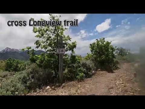
Carpe Diem is a one-way downhill trail on the south side of Draper's trail system, branching off the upper (western) end of the Three Falls trail. The trail is a machine-built flow flow trail that's intermediate in tech requirement. Carpe Diem is just under 3.2 miles in length with just over 900 vertical feet of elevation loss as it drops into Hog Hollow. The lower end of the trail lies at the bottom of the Longview trail as both trails fork away from Hog Hollow .

Original review September 2021. Updated following trail re-working May 30, 2026.

The trail was new in fall 2021 but underwent a substantial "tweak" in late 2025. The upper 0.7 miles was formerly a narrow hand-cut ribbon in the forest. This has been replaced by a straighter machined cut with more consistent downhill tilt. It now matches the lower 2.5 miles in character, where you find machine cut trail with highly banked turns, rock stunts, and table jumps.
The upper end of Carpe Diem is now fairly straight,       wide, and plush compared to the old hand-cut version.
The upper end of Carpe Diem is now fairly straight, wide, and plush compared to the old hand-cut version.
There are a lot of great views on the climb up, and       during the descent. Here we're at the top of Carpe Diem, looking northeast       toward Lone Peak.
There are a lot of great views on the climb up, and during the descent. Here we're at the top of Carpe Diem, looking northeast toward Lone Peak.

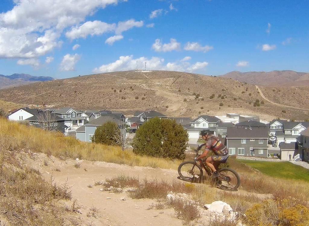
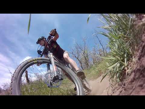
The descent is upper-intermediate in technical difficulty, with a lot of sequential tight turns. It's the longest downhill trails in Draper's system, although not nearly as crowded as those a mile away in South Maple Hollow. The expected riding season is late May through November.

Climbing routes to the top of Carpe Diem!
Via Longview and Peacemaker

Carpe Diem hits Hog Hollow at the same spot where Longview leaves for the uphill climb. This makes for a nice figure-8 ride up Longview and down Carpe Diem. The entry to Longview (and the end of Carpe Diem) is 0.4 miles up Hog Hollow from the Angel Gate trailhead. Longview climbs at a gentle pace for 3.2 miles, gaining 800 vertical feet before ending on Peacemaker.

Entry to Longview from the Hog Hollow trail. Its a 150-degree turn to your right...
Entry to Longview from the Hog Hollow trail. It's a 150-degree turn to your right when climbing Hog Hollow, but a straight shot if you're coming from uphill (from Fango, Achtung Baby, or Carpe Diem).
Looking east from Peacemaker at the trail fork where Longview ends. Make a right...
Looking east from Peacemaker at the trail fork where Longview ends. Make a right turn here.
(An alternative to Peacemaker is Turkey Road. It's a bit steeper, but a faster route to Peak View. Longview hits Turkey Road as it makes a left turn at mile 3.0. Just keep straight onto the doubletrack for this shortcut.)

To ride up to Peak View via Peacemaker, stay on Longview then make a right turn at the top. Pedal 0.7 miles and a bit over 200 vertical feet of climbing on Peacemaker. Turn right again when you hit the Peak View trail. Pass the trail to Jacob's Ladder on your left, then find Carpe Diem on your right just under 1/10th mile later.

Via Hog Hollow and Porcupine

Trom Angel's Gate at the end of Lighthouse Drive, go north and downhill from the parking area. Cross through the creek, then turn left (north) on the Hog Hollow Creek singletrack to join the main Hog Hollow trail. Pedal up the broad Hog Hollow trail until you hit Porcupine at mile 2.8, then make a hard right turn and climb Porcupine.

Hog Hollow has gained new fans with the connections to Porcupine, Two Hollows, a...
Hog Hollow has gained new fans with the connections to Porcupine, Two Hollows, and Achtung Baby.
View south toward Utah Lake as we climb uphill.
As a climbing route, Porcupine ascends the hill at a reasonable pace. At mile 0.7, you can turn right on Peacemaker and pedal one mile to Peak View , where you'll fork right and proceed east to the top of Carpe Diem.
Or, you can stay on Porcupine until it ends at mile 0.9, then make a hard fork to the right onto lower Peak View. From there, you'll climb a bit over a mile to reach Carpe Diem.
From Peak View trailhead

From the Peak View trailhead, it's 1.6 miles to Carpe Diem. Keep left and uphill when you hit the trail for Porcupine at mile 0.7. The trail climbs 400 vertical feet over the first 1.3 miles, then rolls a flat quarter mile further to the Jacob's Ladder trail fork. From there, fork right onto Three Falls and go another 100 yards to the top of Carpe Diem, on your right.

Looking east as Bruce rolls the climbing turns of Peak View.
Bridge at Three Falls in Alpine's Fort Canyon.
From Alpine

Using one of the four climbing trails ( Vista Ridge , Fort Canyon, Bodily Harm, or Forbidden ), pedal to upper Fort Canyon and get onto Three Falls westbound. Now pedal the three miles to Carpe Diem, on your left.

Descending Carpe Diem!
At the rides highest point on Peak View, heading east toward the trail fork with...
At the ride's highest point on Peak View, heading east toward the trail fork with Carpe Diem.
Carpe Diem begins on the upper Three Falls trail, just 400 feet east of Three Falls' fork with the Jacob's Ladder access trail and Peak View. The elevation at the top is 6100 feet. When heading eastbound from Peak View, there will be two chances to turn right off Three Peaks, near the Jacob's Ladder trail fork. Each will take you to Carpe Diem via old four-digger doubletrack.

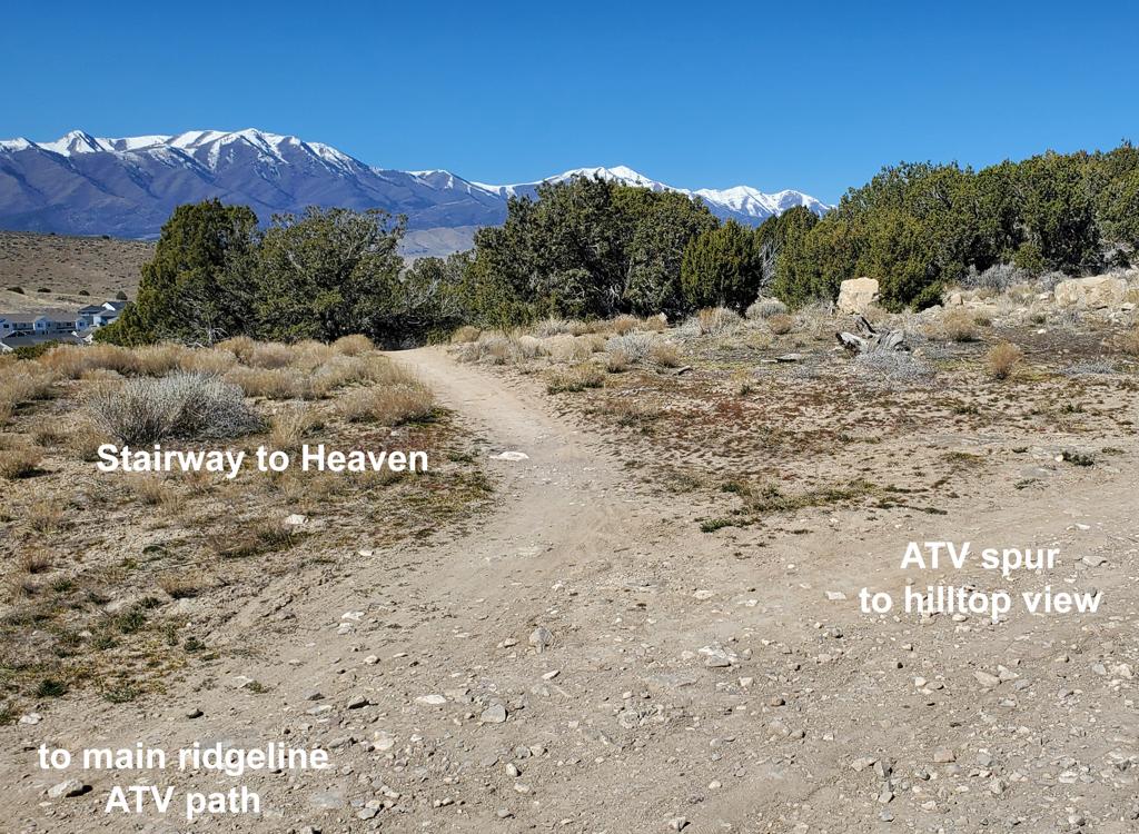
There's a doubletrack to the right off Three Peaks when heading east. From there, it's 150 feet to the trail. If you continued further on Three Peaks, you'll need to make a hard right. After making the 150-degree turn off Three Falls, keep straight to pick up the trail at the signpost across the old mud-road area.

Horses are not allowed on this trail, but hikers and uphill riders are. Control your speed where your sight-line doesn't give you time to stop!

Ready to get serious. The singletrack goes into the trees for the next 0.7 miles...
Ready to get serious. The singletrack goes into the trees for the next 0.7 miles.
A lot of the rebuilt (2025) upper trail is straight       with a gradual slope.
A lot of the rebuilt (2025) upper trail is straight with a gradual slope.

The upper 0.7 miles of Carpe Diem is a fairly straight southbound descent. Most of this section hugs the western side of a ridge, traversing a steep side-slope. This machine-built section has replaced the old tree-dodging tight twisting singletrack.

Turns in the rebuilt section do not reverse direction, but simply herd the trail southwest. Turns are banked, but most of the trail is fairly flat in this upper 0.7 miles.

Rolling into a "readjustment" turn between straight sections.
Looking south on the trail. The trees are       leaning because of the pitch of the slope.
Looking south on the trail. The trees are leaning because of the pitch of the slope.

You'll cross Turkey Road at mile 0.7 from the top.

For anyone who wants to catch the ride at this spot, there IS an option. At the spot where Longview touches Turkey Road (1/4 mile downhill from Peacemaker), hop onto Turkey Road heading south. If you're dropping down Longview from Peacemaker just go south and uphill on the doubletrack when you hit it. It's only 1/4 mile from Longview to where Carpe Diem crosses Turkey Road.

If you're climbing Longview, this is a 150-degree right turn at mile 2.9, then an easy climb on Turkey Road to where Carpe Diem crosses. Turn to the right.

At Turkey Road. This is where the tight hand-cut trail gives way to wider machin...
At Turkey Road. This is where the tight hand-cut trail gives way to wider machined bench-cut. We'll cross Turkey Road several more times on the way down.
Typical view down the trail on a flat section.
So you've just crossed Turkey Road. Now for the first time you can turn it loose -- hikers and uphill cyclists permitting. Here the trail resembles more of the stuff you've been riding elsewhere in Draper's trail system, although a bit more techy. You may be pleased, or disappointed, depending on what type of trail you like.
Almost immediately, you'll break out of the forest for the first time and see so...
Almost immediately, you'll break out of the forest for the first time and see some views. We're looking south at Lehi, American Fork, and Utah Lake.
To the northeast is Lone Peak (shown here) with Timpanogos and Cascade Mountain ...
To the northeast is Lone Peak (shown here) with Timpanogos and Cascade Mountain to the southeast. You may not even notice them unless you're climbing uphill.
There's a very short trail split at mile 1.0, where the left line is for climbing. Keep right. The next short trail split is at mile 1.4, where the left line is expert with a rock rollover at the lip, and the right line is two-way.
Coming up on a table jump, followed by a banked turn.
Lots of turns looking like this. Thats Lone Peak, Rams Horn and Chipman Peak on ...
Lots of turns looking like this. That's Lone Peak, Ram's Horn and Chipman Peak on the skyline. Box Elder is the hump of blue at far right.
There are launching bumps and tables, and too many sharply-banked turns to count. These stretches of trail are a sign of how good this trail will be after it's tweaked and ridden-in.
There are several spots where the flow of the trail is interrupted by a bumpy hand-cut section or an off-camber turn. This will get better quickly as more riders hit the trail.
Heres a rock rollover on a flat section of trail just after crossing Turkey Road...
Here's a rock rollover on a flat section of trail just after crossing Turkey Road yet again.
Heading north into Hog Hollow. The yellow slash at upper left is Two Hollows.
At the south end, Carpe Diem turns northbound and drops into Hog Hollow. Then after turning back to the south again, the trail ends on the Hog Hollow trail. Longview is right there if you want to roll into it to head back to the top!

Carpe Diem from the Peak View (2021)

[Back to video list ]
Bottom Line:

This is a fun trail! Everything about Carpe Diem screams "ride fast." As Draper's longest (3.1 mile, 900-vert) DH trail, it's suitable for intermediate riders who aren't into gaps, jumps, and tech (as found over at South Maple Hollow). The climb up Longview is "kind" with plenty of valley views on the way.

Bottom of the trail. On my ride, I encountered zero riders going uphill. I was p...
Bottom of the trail. On my ride, I encountered zero riders going uphill. I was passed by around 8 downhill riders as I stopped to take pictures. One lone hiker headed up the trail while I was shooting this photo.

2026 Full Carpe Diem DH

[Back to video list ]
map
Map of the Hog Hollow area.
Getting there:

Angel Gate at Spring Hollow (upper Hog Hollow and top of Hog Hollow Creek): On Westfield Road, turn uphill (north) on Beacon Hill Blvd. Drive 0.5 miles, then as Beacon Hill turns to the right (east), turn left on Lighthouse Drive to continue straight north uphill. Lighthouse will become Angel Gate. Pass the horse-trailer parking (to your left). Keep straight until you pass the irrigation facility, then park in the hiker/biker trailhead. At the north end, a road descends east to a subdivision (under construction in 2026). Immediately after crossing the creek, turn left on Hog Hollow. Alternatively, you can descend the singletrack found on the east side of the road where you entered the trailhead. After you cross the creek and turn back south, turn north again and climb up and across the road to the Hog Hollow doubletrack.

No water or restrooms at Angel Gate.

For other nearby trailheads, see the pages for Woods Hollow, Eagle Crest, Peakview, and Fort Canyon.