
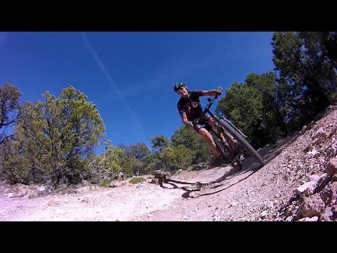

The C Trail is Cedar City's incredible classic downhill romp. (It can also be a climbing trail.) NOT a trail for beginning riders, this is a super-twisty flight straight down Cedar Mountain to the edge of the city. The downhill singletrack is 4.5 miles in length, dropping 2300 vertical feet (peak altitude 8400 ft), and would be rated advanced-intermediate technical. The loop using Greens Lake Drive is 10.5 miles and is very strenuous aerobic.
, ...")

A nice alternative climbing route is to go up Lichen It , then Green Hollow , before making the final bit of grunt climbing on Greens Lake Drive. This loop is just over 15 miles.
 Drive, where t...")


Once you get into the last couple of miles, the trail is plush and ready to rip. Watch for hikers, though, because this is a very popular route for foot soldiers.
At mile 1.8 from the top (N37 38.702 W113 02.777), the new Highlands trail will be the left fork. This trail takes you down to the Green Hollow trailhead (and Green Hollow trail). Opened in July 2017, the Highlands also provides an alternate climbing route to the top of the C Trail, by starting at the Southview Trailhead and climbing Lichen It , Green Hollow, and Highlands .

Leave your car at the parking area near the water tank (see below). Cross the paved trail and find uphill trail to the north of the flood control basin. A trailhead sign is hidden behind the trees about 30 feet up the trail to tell you that you found the right strip of dirt. Now head uphill.Yes, you can ride the C-trail uphill. Yes, it's hard. But the pitches are OK for climbing.


As above, leave your car near the water tank (see map). Climb to the paved trail southbound, then watch for a spot to jump onto the levee to your left and continue south. Cross TWO flood control basins, aiming for the homes just downhill from the second water tank. As you draw near the homes, spot a path between the homes and drop onto a street, still heading south. About 100 yards later at mile 1.35, the street will reach Greens Lake Drive, a paved road heading east uphill. Turn left and start uphill. The road immediately turns to gravel and becomes steep.
On Cedar City's north-south Main
Street, turn east (towards the mountain) on 400 South. Drive to 300 East
and turn right (south). At 820 South, the pavement of 300 East ends near
water tanks and the
paved East Bench trail
.
Continue straight onto dirt road and drive about 100 yards to an unmarked
and unimproved parking zone.
For the shuttle option or road loop, head back north on 300 East to 400
South, then jog east (right) one block, turn north again on 400 East.
At
Center Street, turn right (east towards the mountains) and head up the
canyon. Five miles up the canyon, turn right on the Kolob Reservoir road.
Watch for a tiny sign marking the C Overlook at mile 4.6, just before
a
fence with a cattleguard. Turn right into the parking area of the
overlook.

One-page printable trail
guide
GPS track files (right-click and "Save as..."):
GPX
Topo map for printing:
High-res
view
Lodging, camping, shops:
Links to Cedar City area resources


