View west on Butterknife near the ridge above Butterfield Canyon. Photo and review by Bruce on September 3, 2023.
Bonneville Shoreline Trail Butterknife SectionThe Butterknife trail was completed in 2023, forming a link between Yellow Fork Canyon and Butterfield Canyon. It has been designated as the route for the Bonneville Shoreline Trail (BST). With the lower portion of
Yellow Fork on the south, and the
Butterfield Trailhead system trails at the north, this creates an 8.4-mile route between the two canyons.
This would be considered an intermediate trail because of its length and the amount of climbing required to complete it. But the trail surface is smooth and easy to ride. Strong experienced beginners could do OK here.

Looking south into Yellow Fork Canyon near the southern end of the trail.
Trailhead and Connections

Pedaling west on Galena Gulch, at the Millie trail fork. Millie, Bingham, and Galena Gulch will all take you to Copper Rise, your next uphill trail.
Via Butterfield Park
On Main Street in Herriman, continue west on 13100 South. Just as you're arriving at the Butterfield Canyon Road, turn left into a primitive temporary parking area. To get to the trails, go back to the parking entry and turn right. Pass the gate and continue on a broad path, keeping left and following the signs. As you arrive at a trail fork, you can turn right for Galena Gulch to begin your climb. Follow the directions below to navigate to Butterknife.
Via Yellow Fork
From Bangerter Highway turn onto westbound 126th south. In Herriman, turn left on Main Street, then left again onto Rose Canyon Road. Set odometer. 0.9 mile later, turn right at stop sign, then keep left at 2.3 to continue on Rose Canyon Road. At mile 4.4, pavement ends at the creek. Find a parking spot. The trail begins right along the creek, going uphill. Keep right and straight until you reach the Butterknife fork.

View up the westbound trail as we climb the Yellow Fork trail.

Rolling southeast away from the ridgeline above the Butterfield Park trails.
The Butterknife trail itself is 3.9 miles in length, running over the higher foothill elevations above 6000 feet. It reaches a top elevation of 6400 on the ridge above Yellow Fork. Because the hillside on the northern side of this ridge is steep and shaded, it will not usually not be dry until late May or early June.
The trail is a modern bench-cut, with some up-and-down riding to drain the trail, plus longer stretches of mild climbing and descending as you turn in and out of small canyons. Turns are banked for higher-speed riding. Because of the elevation difference between the Yellow Fork ridge and the ridge at Butterfield Park, the trail rides fast and easy in the northbound direction.

Passing through maple forest on a north-facing slope.

Looking to the east as the trail traverses through an area of grass and sage.
The terrain is mostly cedar and juniper, but there are groves of oak and maple and occasional pinion pine. Between groves of trees is dry hillside of grass and sage.
Looking to the east as the trail traverses through an area of grass and sage.
At the northern end, Butterknife begins on a ridgeline at 6100 feet elevation. To get there, you'll need to climb through the Butterfield Park trail system. The combination of Galena Gulch, western Copper Rise, and Outta Gas will get you there in 3 miles with 700 vertical feet of climbing.

Almost to Yellow Fork. We'll climb those switchbacks to the ridgeline saddle at left.

A smooth banked turn on the north slope switchbacks.
Here are the details for getting to the trail through Butterfield Park. As you enter the trailhead area, keep right onto Galena Gulch westbound. Stay on Galena at the Millie and Bingham trail forks until you've gone 0.8 miles. At the complex multi-trail intersection, keep straight and right onto westbound Copper Rise. Climb up 1.4 miles and onto the ridge, then turn right at the 4-way intersection onto Outta Gas. Climb 0.7 miles then keep straight to cross the gravel area onto Butterknife.
Southbound, the trail will roll up and down, but mainly goes up. It will reach an elevation of 6400 after some climbing turns, then drop over the ridge into Yellow Fork Canyon. Your climbing is now around 1200 vertical feet at mile 3 of Butterknife and mile 6 from the Butterfield Trailhead.

Looking north toward Butterfield Canyon, we can still see the tailings.

View into Yellow Fork Canyon from the 6400 foot ridgeline.
The Butterknife trail descends one mile into Yellow Fork Canyon. It reaches the right fork (main Yellow Fork trail) at 6100 feet elevation. To reach the Rose Canyon trailhead, you'll descend 1.5 miles and 400 vertical feet.
There are some rock outcrops in Yellow Fork. At this time (2023) they're easy to ride, but will become rougher as the trail around them erodes with time.

Descending in Yellow Fork with a banked turn ahead.

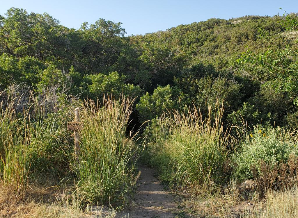
Here's the Butterknife trail, seen from the Yellow Fork trail. It's near a trampled picnic area, so if it weren't for the sign you could easily just ride past.
To climb up Yellow Fork to make the south-to-north run, go to the Rose Canyon trailhead. Go to the right on Yellow Fork. Keep straight and right at mile 0.5 to continue climbing parallel to the doubletrack. Just after mile 1.4, the trail will cross the creek and the doubletrack, and you'll see picnic tables to the right of the trail. Look carefully to the right for a singletrack angling 150 degrees away just before the picnic area. That trail is the Butterknife BST.
Bottom Line:
Very nice trail. One of the better BST routes. Easy technically, but a bit long for most inexperienced riders. You can ride Butterknife BST as a loop using roads -- most riders will prefer to do it as an out-and-back -- if you don't think you're up for the climbing.

Butterknife actually heads a bit uphill toward the end, as it climbs parallel to the Yellow Fork trail to reach the picnic area.

Wide area map of Butterfield and Yellow Fork
Getting there:Via Butterfield Park
On Main Street in Herriman, continue west on 13100 South. Just as you're
arriving at the Butterfield Canyon Road, turn left into a primitive
temporary parking area. To get to the trails, go back to the parking entry
and turn right. Pass the gate and continue on a broad path, keeping left
and following the signs. As you arrive at a trail fork, you can turn right
for Galena to begin your climb. Follow the directions below to navigate to
Butterknife.
Via Yellow Fork
From Bangerter Highway turn onto westbound 126th south. In Herriman, turn left on
Main Street, then left again onto Rose Canyon Road. Set odometer. 0.9 mile
later, turn right at stop sign, then keep left at 2.3 to continue on Rose
Canyon Road. At mile 4.4, pavement ends at the creek. Find a parking spot.
The trail begins right along the creek, going uphill. Keep right and
straight until you reach the Butterknife fork.