Moab Brand Trails
Bar M, Circle O, Rockin A, Bar B
The "Brand Trails" are found a few miles north of Moab, just off Highway 191. The main four trail names are based on cattle brands and spell out M-o-a-b. The easy Bar M trail forms a loop from which the other trails can be reached. Bar M, Rusty Spur, and Lazy-EZ are suitable for pure beginners. For experts, there's Killer B and Longbranch. The other trails require reasonable shifting skill and bike handling ability, but can still be enjoyed by beginning-level riders.
There are 13 named trails in the Brand Trails system. Other trails include Lazy-EZ, Deadman's Ridge, Killer B, Rusty Spur, Sidewinder, Longbranch, and North 40.
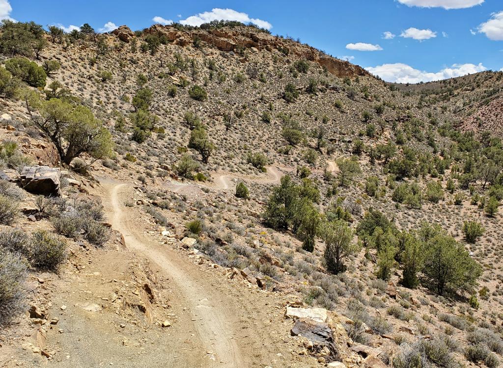
The riding area hugs a shelf between Highway 191 and Courthouse Wash. Except for the routes that drop down to the Old 191 paved trail (like Killer B and Sidewinder), there's little overall elevation change on any given trail, but quite a bit of quick up-and-down riding. The Bar M area has long been a classic destination for new riders and for groups of varying skill.

Individual trails in the Brand Trail system

Bar M Loop
The Bar M Loop is a fairly easy ride technically. Elevation change is modest at about 300 feet. Many families ride this trail, including baby trailers and trail-a-bikes. The loop is 7 miles long. It can be ridden in either direction. Most riders go counterclockwise. This direction also is the optimal direction for riding the more-technical alternate route using Bar B, Rockin A, then Circle O.
[ Bar M trail page ]

Circle O Loop
The Circle O trail is 100% slickrock, on top of Entrada sandstone. The Circle O trail itself is only about 3.5 miles long with only 200 feet absolute elevation change. To ride it as a loop, include 1.3 miles of the Bar M between the two trail ends. But to get there via the Bar M, your minimum riding distance will be about 10 miles. This trail is quick up-and-down riding, with a few upper-level moves to cross tire-traps and ledges. You can ride either direction, but south-to-north is most common.

Rockin A
Rockin A connects the Bar B loop to the slickrock portion of Circle O. The riding is very similar to Circle O -- quick moves on slickrock requiring good shifting, balance control, and stand-and-grunts. It's only 1.7 miles in length, but to loop around via Bar M is 4 miles. Advanced riders use Rockin A as a route between Bar B and Circle O.

Bar B Loop
The Bar B trail starts at the southern end of the Bar M loop. It starts as desert singletrack, then throws in technical rock-rolling singletrack. The return half of the loop is easy doubletrack and slickrock. Ridden counterclockwise, the end of the loop connects to the south end of Rockin A.
[ Bar B trail page ]

Killer B
Killer B is a steep one-mile descent from the south end of Bar B to old highway 191 in the valley below. It drops 500 vertical feet in 0.7 miles. There are a few extreme rock-clearing stunts, and a couple of very steep sandstone sections. Near the bottom, there's a split in the trail. There's a steep switchback bike route on the right versus a 600 foot stair-step hike on the right. From the bottom, use Old 191 to go back to Bar M or head downhill back to Moab.

Lazy - EZ Loop
Lazy-EZ is a lariat loop ride that starts on the "Short Loop" cutoff of the Bar M. The 3-mile loop is easy riding, intended for those who are just getting their wheels on singletrack. But it also gives a more interesting route for experts to reach the more tech trails. At the southern end, the loop connects to Deadman's Ridge.

Deadman's Ridge
Deadman's Ridge starts on the Bar M where the southern tip of Lazy-EZ loop hits the Bar M. Deadman's Ridge connects to the north end of the Bar B trail just after the western half of Bar B loop leaves the south end of Bar M. The continuing trail goes south then curves back north to join Old 191 paved trail.

Rusty Spur
This is a short and very easy dirt singletrack suitable for beginners and children. It starts off the Old 191 paved trail and loops 1.3 miles around with views of the cliffs to the west.

Longbranch
Longbranch is a very technical 1.1 mile trail that forks off Deadman's Ridge (just before the Deadman's Ridge trail descends down to Old 191) and joins the south end of the Bar B loop near its connection to Killer B.

North 40
The 4-mile North 40 is a new addition, opening in late winter 2012. It forms a loop or figure 8 within the northern end of the Bar M loop. The trailhead is just across the doubletrack from the Lazy-EZ trailhead.
O-to-40
This short connector ties the eastern side of the North 40 Loop to Bar M
at the northern connection to Circle 0. It provides a way to create a loop
ride without returning to the North 40 trailhead.
[ North 40 page ]

Maverick
Maverick is a short alternate route on the eastern limb of North 40. It's one-way from north to south. Length is 1/2 mile. Note: if you're planning a loop ride starting on North 40 clockwise, taking this trail downhill will bypass the O-to-40 connector.
[ North 40 page ]

Sidewinder Bar M
1.5-mile trail near the southern end of Rusty Spur, forks off Old 191 and descends to rejoin Old 191 in the lower canyon. Mostly used as a connector (in place of Old 191) to maximize riding on dirt.

Old 191 Paved Trail
Although not considered part of the Brand Trails, Old 191 is a paved bike path, running from Moab to Highway 313, that passes through the Brand Trails. Trails connect to Old 191 and in some cases connect to each other via Old 191.

Getting there:
From the north, exit I-70 at Crescent Junction and drive south on US-191 for 22 miles. From Moab, drive 7 miles north from the Colorado River on 191. When you see the Gemini Bridges parking area, look for a gravel road on the opposite side (east, away from the cliffs). Turn onto the gravel road and immediately go right. Drive past the first parking lot. (This is restaurant parking or fee parking GPS N 38° 39.38' W 109° 40.66'.) As you approach the fence and kiosk at the paved trail, turn left and drive 1/4 mile to the gravel parking lot in the bottom of the valley N38 39.107 W109 40.110. Ride either direction on doubletrack to reach the east or west side of the Bar M loop. For other trails, see the individual trail pages.
Alternate: From Moab, ride the Old Highway 191 paved trail until you reach the Bar M sign.