
Blue Sage Ranch Trails
The Blue Sage trail system is located on the eastern edge of Heber City, just a bit south of the Pole Canyon trails. The trails are new in 2023, with 6 named trails. The trails are beginner to intermediate in technical and aerobic requirements.
The trails are organized into 3 one-way loops, with two way trail leading from the trailhead to the first loop, and another two-way trail connecting the top of the lower loop to the upper loops.
The trails are very well-marked with trail names, "do not enter" signs and directional arrows.


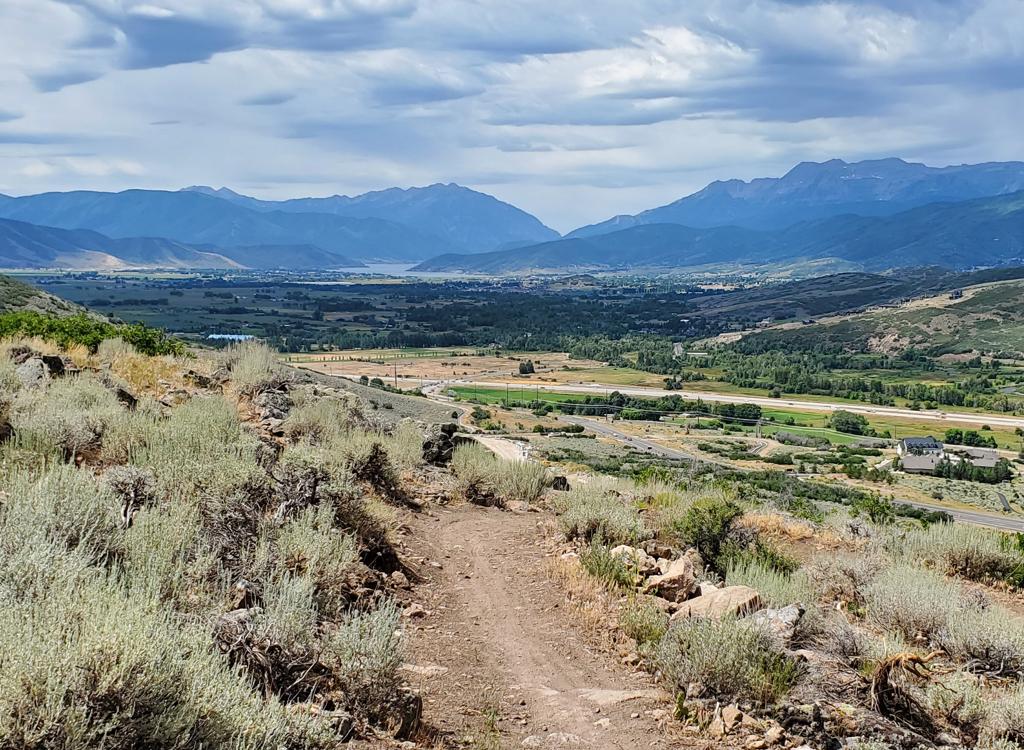
The starting elevation is 6300 feet, with a high of 6700. The expected riding season is late May through early October. The lower trails pass through an area being developed for homes and will cross paved roads. As you might expect from the name, there's plenty of sage brush here.

The trailhead is on the south side of the road (to your right when driving from US 40 or US 189), exactly 5 miles from the US 40-189 intersection. The trailhead is gravel with room for 6 to 8 cars. There's no bathroom or water. The Blue Sage trail is found at the south side of the parking area.

The Blue Sage trail has two-way traffic, connecting the trailhead to the bottom of the Springer Loop. This is probably the most heavily forested section of the ride, with mature oak trees.
Starting at 6300 feet elevation, Blue Sage climbs only a tiny amount over its 0.3 miles. It will cross a paved road before it ends at a trail fork for the Springer loop. You must turn to the right here; Springer is one-way.


The Springer loop starts at the uphill end of Blue Sage. You must turn to the right here. The trail on the left is the one-way downhill side of Springer.
While Springer is considered an easy trail, it becomes steeper near the top of the loop. This section of the trail would be difficult for young children.


Springer will meander around in the sage hillside, gaining a bit less than 100 vertical feet over 0.6 miles. It will cross a couple of streets on the way. The road crossings have slabs of rock for a smooth transition from pavement to dirt, and are marked by painted crosswalks.
At mile 0.6 you'll come to a trail fork. To the right is the Cast trail, which will take you further uphill. (If you continue on uphill, you'll transition from easy to intermediate trail.)
To the left is the continuing Springer Loop. From here, the trail will descend 0.3 miles back to the top of Blue Sage.


The Cast Trail begins at the highest elevation of the Springer Loop. It's considered an intermediate trail because of the climbing rate and tighter turns. Cast is two-way, linking Springer and Rise both uphill and down.
The Cast Trail will also cross paved roads on its way uphill. It meanders around, flirting with the borders of building lots.


Cast will be your exit from the loops on the upper mountain. On the Rise trail, just keep pedaling east until you find Cast on your left.

When climbing from the trailhead, Cast will end as it hits the Rise Trail. The Rise trail is one-way. You must turn to the left.
If you just climbed up via Cast, you'll turn to the left on Rise, and pedal 0.3 miles to the trail fork where Rib Cage and Cow Tummy begin.
Rise actually starts on the far side of the hill, as the continuation of the Cow Tummy trail. After climbing the hill, it will be joined by the Rib Cage (one-way) trail at mile 0.5 from Cow Tummy. The Cast trail merges onto Rise near its eastern end (mile 0.8 from Cow Tummy). Then Rise ends as it divides into two one-way trails, Rib Cage and Cow Tummy. (See the map!)
Together, Rise and Cow Tummy form a one-way loop. Rise is 1.1 miles in length, with 300 feet of elevation gain from the end of Cow Tummy to the start of Cow Tummy.


You can exit the upper loops by turning to the left off of Rise onto the two-way Cast trail.

The Rib Cage trail is one-way. It begins at the end of Rise, turns back to the west, then rejoins Rise after 0.6 miles. The combination of Rib Cage and the eastern half of Rise forms a 1.2-mile one-way loop.
Rib Cage runs gently downhill overall, but will require a bit of pedaling. The trail will take you back to the west, where you'll turn back eastbound as you merge with Rise.


The trail is easier-intermediate, with a few roll-overs and low tables. While you should do the loop while you're up there, it doesn't offer much compared to Cow Tummy.

Most riders will consider Cow Tummy to be the star of the Blue Sage show. This trail is one-way, with 350 feet of descending and 50 feet of climbing between the first and second descents.
The Cow Tummy trail begins at the end of the Rise trail. Keep left and straight as Rib Cage turns to the right. After 100 yards, Cow Tummy will begin its first descent.


Cow Tummy will hit the bottom of a shallow canyon and cross to the other side for a couple of switchbacks worth of climbing. This positions you for the second, and longer, descent.
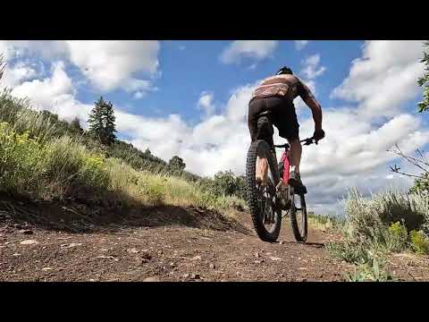
Cow Tummy is a solid intermediate-level downhill, with plenty of twists and turns. There are table jumps and gap jumps, but less-aggressive riders can simply roll over them. It will wind back and forth across the bottom of the ravine.
At the bottom, Cow Tummy crosses the ravine for the final time and turns north uphill. Here, it becomes the Rise trail.


Bottom Line
Very nicely built trail system. Fun to ride. But Blue Sage won't appeal to hard-core riders from outside Wasatch County. Because of glamorous destination trails just a few miles away, Blue Sage will be used mainly by locals. But if you've done the more-famous nearby trails, give this system a try.

Getting there:
In Heber, drive east on 1200 South. (1200 South is straight across from eastbound US 189 where it merges with US 40.) Drive 5.0 miles east from US 40 on 1200 South. As you approach the end of 1200 South at a T intersection, look for a gravel trailhead on your right, about 100 yards before the end of 1200 South.
No bathrooms, water, or bike services at trailhead.