
View down a tangle of roots and fallen trees. You really wanna do this?
Black Forest Trail
If you're new to Park City and looking for fun stuff to ride, stop looking at this page. Go back to the area index. And if you like smooth buff trail, look elsewhere.
Black Forest could be described as an Adventure Ride. If you manage to find it, you'll probably hate it. It's remote, in the sense of "barely a trail." But if you've done it all and you're looking to try new terrain, you might have some fun. Don't yell at me if you don't.
I can't say if my route is the "official ride." I'm using Jenni's and CMG (Crescent Mine Grade)
and Apex as the climbing route because it's a fairly direct and foolproof
way of getting there
from the middle of the city.
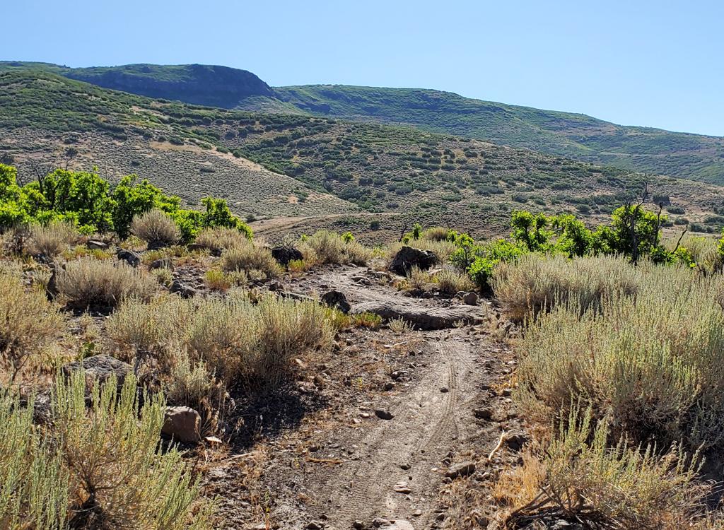
From the south, you can find first 1/4 mile of Black Forest (which is combined with the new Cyn City trail, 2022) by taking the new (in 2019) 9K trail from Empire Pass.

Fork off the road onto singletrack after 0.9 miles of plodding uphill in loose gravel.

Climbing uphill early on CMG. It's an easy climbing route.
This lariat-loop ride is 15 miles, with 2300 vertical feet of climbing. It starts from the
north parking lot of Park City Mountain Resort (PCMR). Top altitude is
around 9000 feet.
From the parking lot, find the entrance to Jenni's and Silver Spur, just downhill from the Crescent Lift. Keep left until you find yourself on Jenni's one-way uphill trail.
From the parking lot, find the entrance to Jenni's and Silver Spur, just downhill from the Crescent Lift. Keep left until you find yourself on Jenni's one-way uphill trail.
At 1 mile, you'll cross doubletrack at an "X" trail crossing. Do a hard right turn to begin
climbing the old CMG. You'll reverse directions and begin climbing north
around the mountain.
(The lower part of CMG is one-way downhill. By taking the first mile on
Jenni's, you're past
the one-way portion and can now climb uphill on CMG.)
At mile 1.9, keep straight as Eagle comes in from the right, just after crossing a doubletrack. Follow an old road-grade uphill. When you hit a dirt road at mile 2.9, go uphill a few feet and veer right off the road onto the Midmountain Trail. (Midmountain and CMG are combined for 0.2 miles.)
At mile 1.9, keep straight as Eagle comes in from the right, just after crossing a doubletrack. Follow an old road-grade uphill. When you hit a dirt road at mile 2.9, go uphill a few feet and veer right off the road onto the Midmountain Trail. (Midmountain and CMG are combined for 0.2 miles.)

CMG would be more popular if it were easier to find. You need to blunder past lifts and bounce castles to find the gravel road.

Looking uphill on CMG just after Eagle joins on our right.
As you reach the far side of a ski slope, fork left uphill on the continuation of CMG. Climb
to mile 4.2 and take a hard left uphill on Thaynes Road. Go 1/2 mile and
turn left on the singletrack
that climbs the ski slope. This is Apex.
At mile 5.2 you'll reach an old roadcut with singletrack in the middle. This is Keystone. Fork
hard left.
Keystone will traverse around the mountain. You'll cross a substantial road on a ski slope at mile 5.7 (Meadow Rd). About 1/10 mile later, the trail will split. Fork right (leave Keystone) to start the Fat Lip. The trail will briefly drop onto Webster Road. Head downhill, and at the hairpin turn, go straight into the faint singletrack at the apex of the turn to continue Fat Lip.
Keystone will traverse around the mountain. You'll cross a substantial road on a ski slope at mile 5.7 (Meadow Rd). About 1/10 mile later, the trail will split. Fork right (leave Keystone) to start the Fat Lip. The trail will briefly drop onto Webster Road. Head downhill, and at the hairpin turn, go straight into the faint singletrack at the apex of the turn to continue Fat Lip.

CMG will join Midmountain for a short distance, then split again to resume climbing up the ski slopes.

After a short jaunt on Thaynes Road, we're climbing uphill on Apex.
The year of this review, Fat Lip hardly seemed like trail. It was overgrown and tight, with bent aspen trunks and roots
to bang over. Grunt on, and things will open up a little. (2023 note:
the newer trails have brought increased traffic, so you'll probably find Fat Lip to be in better shape.) Fat Lip crosses Change Reaction.
The Fat Lip trail will drop to the right onto McConkey Road at a trail fork at mile 6.7. The left fork is Stiff Upper Lip. It will take you to Charlie's 9K. Turn right here, then cross McConkey Road.
If you chose to descend to McConkey Road at the Fat Lip - Stiff Upper Lip trail fork above, go right uphill. After about 150 yards, fork left on singletrack. You've found Black Forest.
You'll gain altitude at about 10% slope. You'll reach the ride's top elevation (9100 feet) and begin
descending to the east. The trail then traverses over to reach McConkey
Road again. Cross the
road to the left (eastbound) trail of two trails. This is the new Cyn
City trail (2022), which is combined with the old Black Forest for the first quarter-mile. The trail to the right is the new (2019)
9K
trail.

Keystone is narrow singletrack that traverses around the mountain through multiple ski slopes.

After Keystone drops onto Webster Road, head onto this narrow band of not-quite-trail to head across to McConkey Road.
Shortly after crossing the McConkey Road, the trail will begin a steep plunge. Over logs, over
roots, etc, on a path that's not exactly ridden-in. You'll drop around
350 vertical within
0.4 miles.
Black Forest will join
TG
Fork left and descend 1/2 mile to the Midmountain Trail. Fork left onto Midmountain. (A cheater
route crosses Midmountain and descends to Link. For this "official" ride,
stay on Midmountain
until you return to CMG.)
Keep straight as Link crosses at mile 8.7 (1/10 mile from the turn onto Midmountain).
Keep straight as Link crosses at mile 8.7 (1/10 mile from the turn onto Midmountain).

Black Forest drops abruptly downhill through aspen and fir forest.

The trail is obvious only in those spots where riders slide out of control and drag the dirt off the roots.
Keep straight again when Empire Link joins Midmountain at mile 9.3.At mile 10, the Midmountain Trail curves to the right, and you'll see mine buildings. Fork
to the left to stay on Midmountain. (An alternate descent is to keep straight,
pass the ski
lift on the R, and head down John's and Sweeney's for a more-technical
descent.)
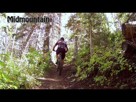
A descent down Black Forest is shown on this vid of 9K, Midmountain and Corvair...
[Back to video list ]
Assuming you stayed on Midmountain, you'll come to another fork 100 yards later. Turn hard
left uphill. After 1/10 mile, fork R to stay on Midmountain. (Straight
head takes you to Steps.
If your intention is to climb uphill to take another run at Black Forest,
go ahead. Meadow
Road at the top of Steps takes you up to Keystone.)

Heading back downhill, we've spotted our car in the PCMR parking lot.

CMG makes for a high-speed but relatively boring downhill. Consider the John's to Sweeny option for your descent.
At mile 12, Midmountain will cross a steep rocky dirt road. Achtung! The CMG is just below
you, but going the opposite direction. Drop to the right 30 feet down
the dirt road, then turn
right onto the singletrack CMG. Retrace your path back to parking.
Riding notes, lariat loop ride:
0.0 Exit parking lot on gravel road south
N40 39.245 W111 30.550
Aim between ski slope and Alpine Slide
0.2 Singletrack on L just below Crescent Lift
Take Jenni's trail uphill
N40 39.019 W111 30.505
1.0 Hard right turn onto CMG
N40 38.599 W111 30.660
1.9 Keep straight N40 39.005 W111 31.292
2.9 Uphill on DT N40 38.259 W111 31.445
Immediate R onto ST (Midmountain)
3.1 L uphill on CMG (leave Midmountain)
N40 38.189 W111 31.511
4.2 L uphill on Thaynes Road (end CMG)
N40 37.816 W111 32.021
4.6 R uphill on Apex singletrack
N40 38.015 W111 31.756
5.2 L on Keystone N40 37.783 W111 31.866
5.7 Cross Meadow Road N40 37.640 W111 31.483
5.8 Fork R on Fat Lip
5.9 Drop onto Webster Road
6.0 Straight onto ST as road turns (Fat Lip)
N40 37.495 W111 31.633
6.7 Join McConkey Rd, go R uphill
N40 37.026 W111 31.732
6.8 R uphill on ST (Black Forest)
N40 36.970 W111 31.735
Switchback climb then descend
7.6 Cross McConkey Rd N40 36.993 W111 31.513
8.4 L on TG N40 37.369 W111 31.028
8.6 L on Midmountain N40 37.516 W111 30.927
8.7 Keep straight as Link crosses
N40 37.495 W111 30.987
9.3 Keep L (R=Empire Link)
N40 37.662 W111 30.893
9.8 Cross gravel road N40 37.787 W111 30.793
10.1 L to stay on Midmountain
N40 37.864 W111 30.895
Alt = straight to John's Trail
10.1 L uphill N40 37.908 W111 30.839
10.2 R to stay on Midmountain
(L=to Steps) N40 37.874 W111 30.914
12.0 Hard R on DT
N40 38.255 W111 31.441
Immediate R on ST (CMG)
15.0 Back at parking

Map of loop ride.
Finding the trail from the south:
Climb to the doubletrack above the top of TG (N40 36.428 W111 30.474 for the top of TG, N40 36.408 W111 30.651 at the upper TG.) Follow the ridgeline. Veer R onto ST at N40 36.565 W111 31.248 when the DT goes L around a hill. (Look ahead. Notice the unusual stripe on the hillside? That's "trail" but it may not seem like trail when you get there. That stripe of altered vegetation is your target.) When you hit the dirt road at N40 36.582 W111 31.506, go uphill. Go around the bend, take the right fork and climb about 100 feet to N40 36.579 W111 31.548. Look for a faint path through the aspens. As you exit the aspens, follow the overgrown trail-cut uphill along the mountainside through hip-high grass. When you hit ski slope, duck left through a cleft in the ridge of dirt and go out to the gravel road at N40 36.846 W111 31.587. Turn downhill. This is McConkey's Road. Go exactly 0.3 miles downhill. Just after you've gone around a corner to the left, the trail will cross. Scout carefully for the trail on the right side of the road at N40 36.984 W111 31.515.PS: If you have an official Park City trail map, ignore it when navigating to this trail. It won't help you find Black Forest, and will only confuse you.
Getting there:
In Park City, head south on Park Avenue. Follow the signs for Park City Mountain Resort. At the traffic light where you see a bike store on both sides, turn right on Empire. Veer right onto Silver King. As you see the first parking area, turn in and park there. CMG starts on the west side of parking, just north of the buildings.
Riding resources:
One-page riding guide
GPS Track File (Right-click and "Save as...")
GPX course file
Black Forest only
Fat Lip only
Park City area file (multi-track)
Topo map for printing: View map
Lodging, camping, shops: Links to Park City area resources
One-page riding guide
GPS Track File (Right-click and "Save as...")
GPX course file
Black Forest only
Fat Lip only
Park City area file (multi-track)
Topo map for printing: View map
Lodging, camping, shops: Links to Park City area resources